Grasmere to Patterdale
This was a day I will long remember. The previous day of our Coast- to-Coast Walk, we took an alternate high route. Instead of walking down through the valley after we reached the col at Greenup Edge, we hiked uphill, crossing a number of interesting peaks ending at Helm Crag, before we descended to Grasmere. Today we planned to do another alternate high route across a peak called Helvellyn and then across Striding Edge. I hadn’t researched it, so I didn’t know what we were in for, but it was pretty spectacular.
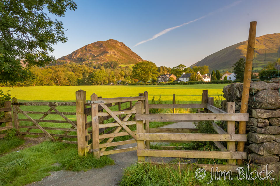
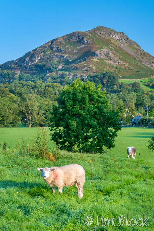
I was up at 6 AM after a good night’s sleep. I showered in the shared bathroom that I don’t think anyone was sharing with me. I had a bit of time before our 8:15 breakfast, so I wandered around outside the wonderful Glenthorne Guest House to talk some photos. Here are two different views of Helm Crag, which culminated our walk the previous day.
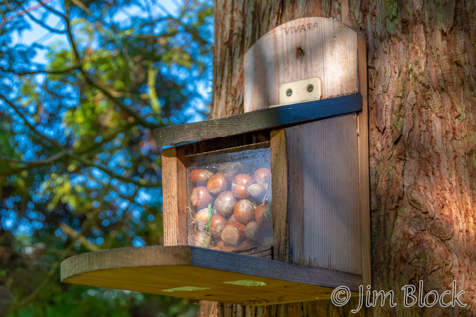
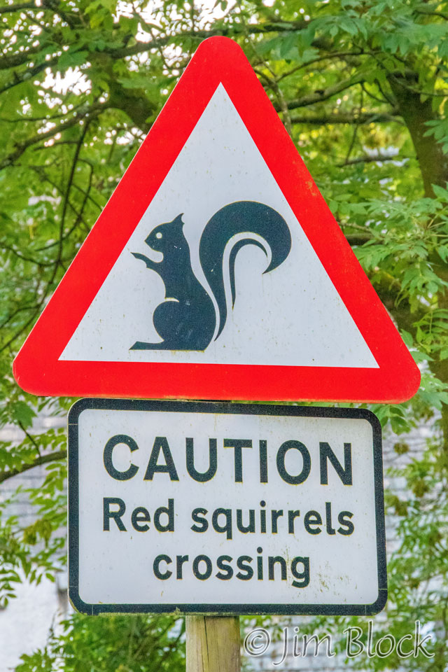
Red Squirrels are prized and protected in this part of the world. Here is a squirrel feeder.
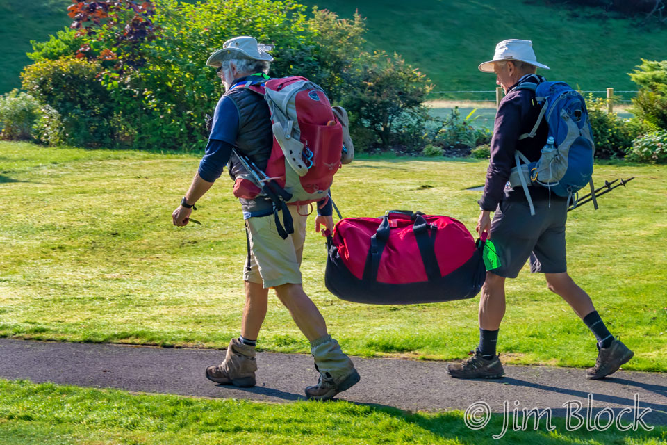
After breakfast, Jim and Stephen carried my transfer bag from their room in a separate building to the front lobby where it would be picked up and driven to our next lodge. I took a transfer bag on the trip pretending it was for my second camera, camera backpack, and tripod. But it also allowed me to put some of my other gear in it to lighten my pack. It seemed that most people used transfer bags as evidenced by the piles of luggage in the living rooms and lobbies of each lodge in the morning.
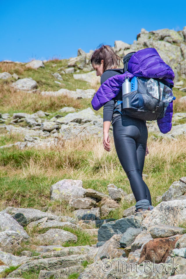
Like Jim did the whole trip, Stephen planned to carry everything himself. However, before leaving the US he received a few last minute gifts from a house guest and took them with him adding several pounds to his pack. That, coupled with some struggles on the first day, encouraged him to offload a bunch of his pack weight to my transfer bag. I was happy that I could help him. Without that his knees would have probably been even more bothersome. You might note in the photo below that Jim’s pack is quite full while Stephen’s is less full.
This was the day I was concerned about in advance of the trip because our lodging that evening was well off the C2C trail. Jim was staying in a room in Patterdale at the White Lion, while Stephen and I were sharing a room at a farmhouse about a mile out of town. I knew there would be no dinner at our lodge. So I ordered a lunch (a sandwich, candy bar, and apple) at the Glenthorne Guest House to carry with me. I believe this was the only box lunch I purchased at a hotel the whole trip. I wasn’t sure when or where I would eat it. It turned out it came in handy in the evening.
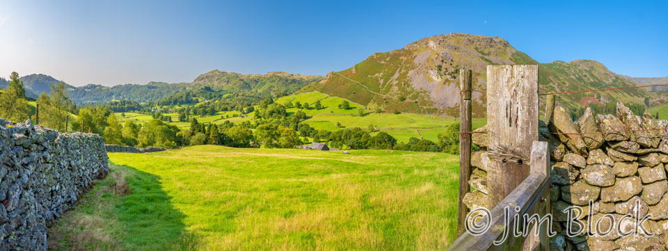
By 9:15, we were off. Helm Crag and stone walls seemed to dominate most of the photos I took during the first 10 minutes of our walk.


")


I photographed a house made of stone with many stone walls in front and behind it.
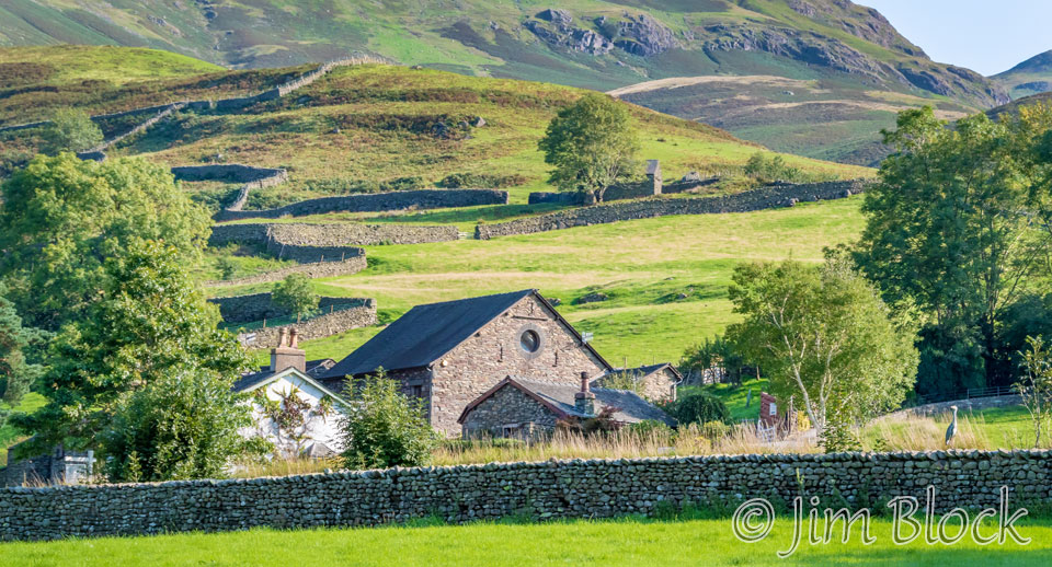
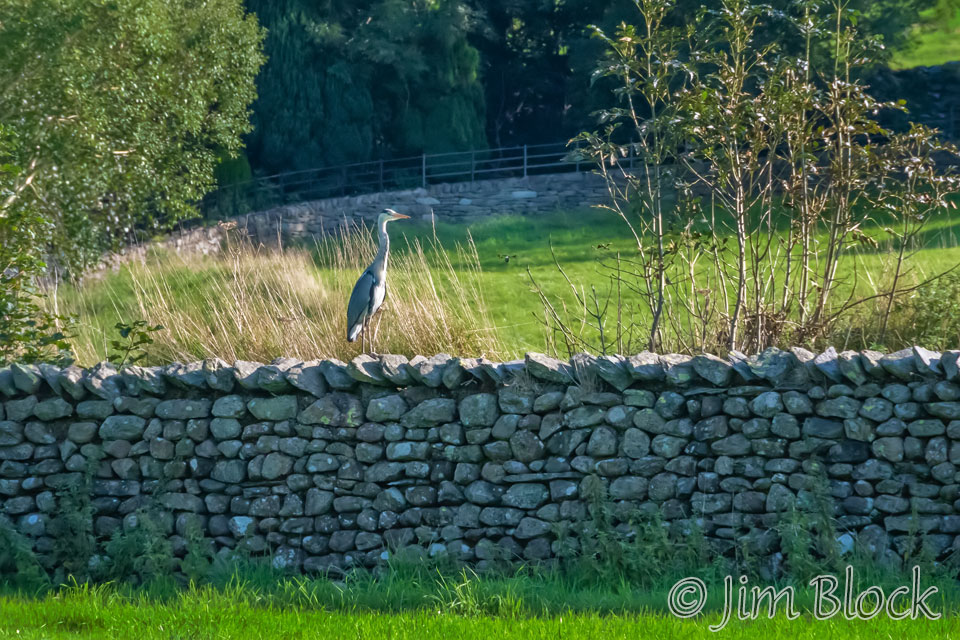
And then I noticed something was standing on the front stone wall. It was a great blue heron, much to my surprise.
We passed some houses, and I photographed one with an interesting set of stones keeping rain out. Behind it is Seat Sandal, which is actually higher than Helm Crag.
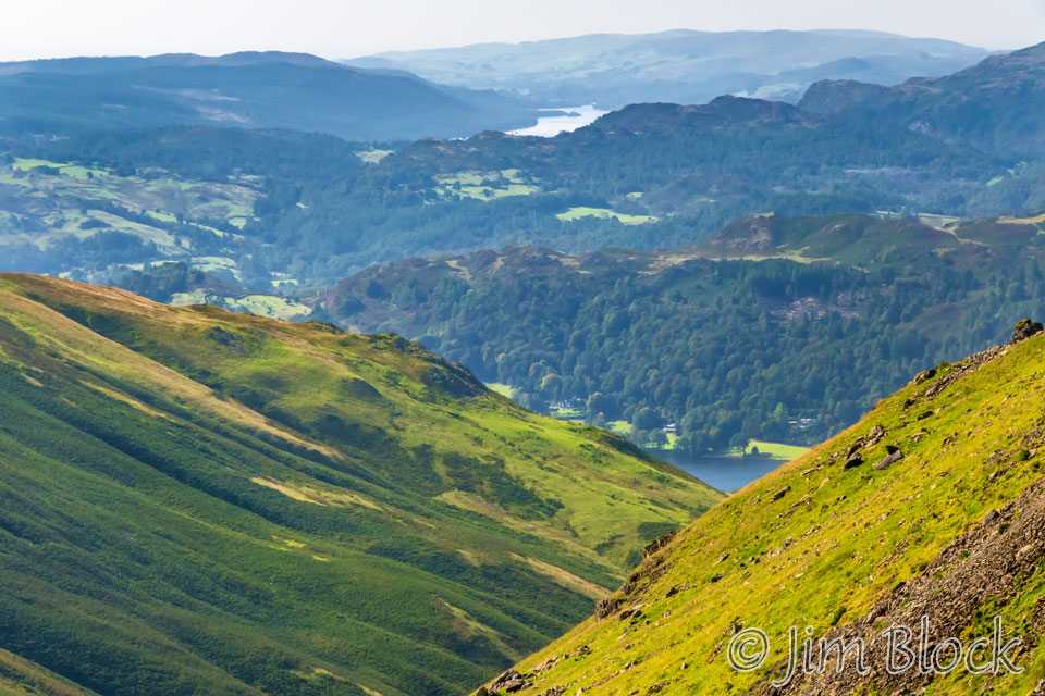
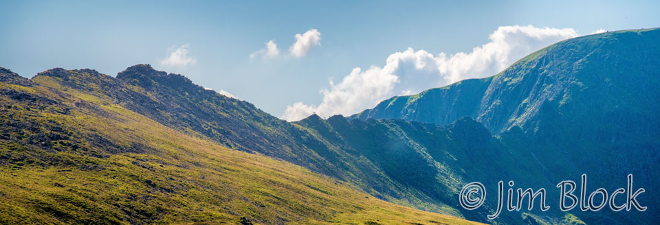
As we climbed, I got this view back into the valley with Helm Crag on the left and Calf Crag on the right.
Here is a broader view with Helm Crag and Calf Crag in the distance in the center and Seat Sandal dominating the right half of the photo.
As we climbed higher and higher I got a series of photos looking back toward Helm Crag and the valley of Grasmere.
")


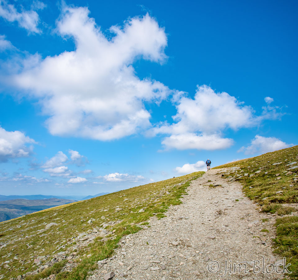
I also took photos looking ahead at the pass we were going to cross, Grisedale Hause.


")
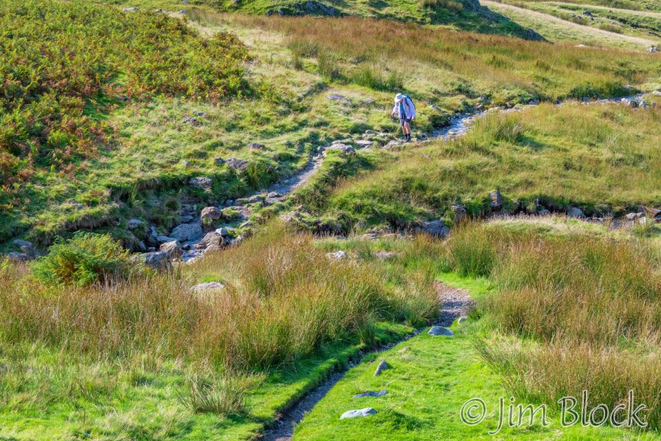
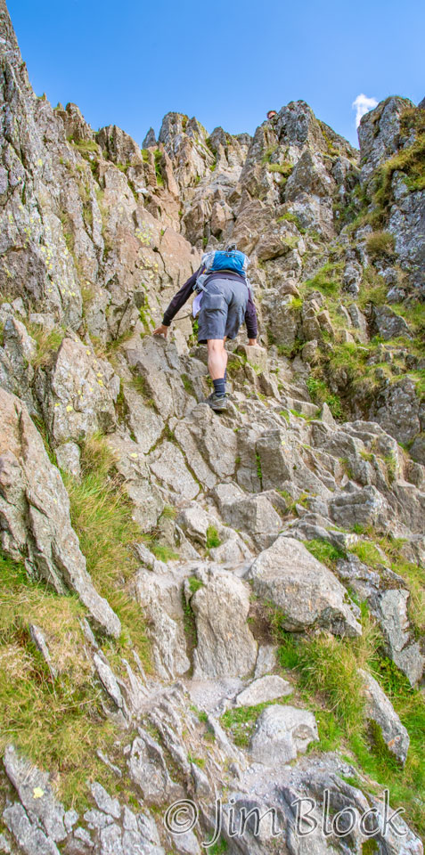
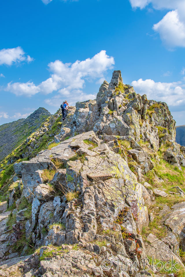
Jim was ahead of me, and Stephen was a bit behind. Here are two photos of Stephen coming up the path, although you will have trouble finding him in the left one.
Looking forward, I could see the beginning of the col.
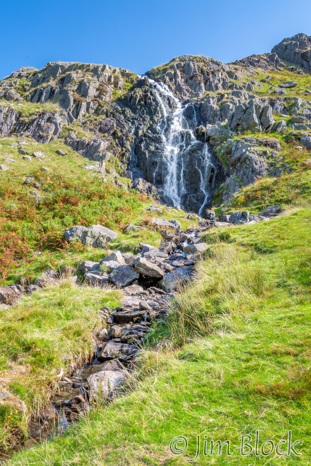
We were climbing up along Tongue Gill. Here is one of the waterfalls along the way. The photo on the right below shows another view looking back.
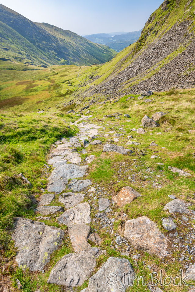
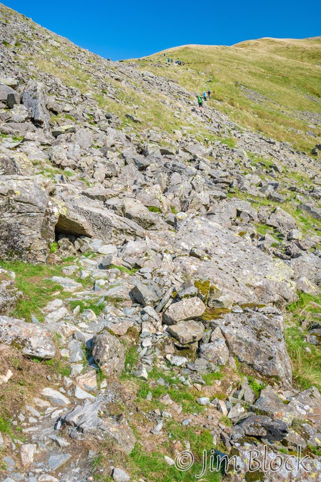
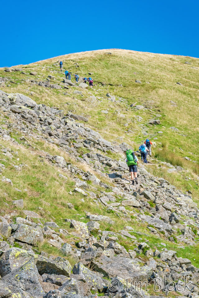
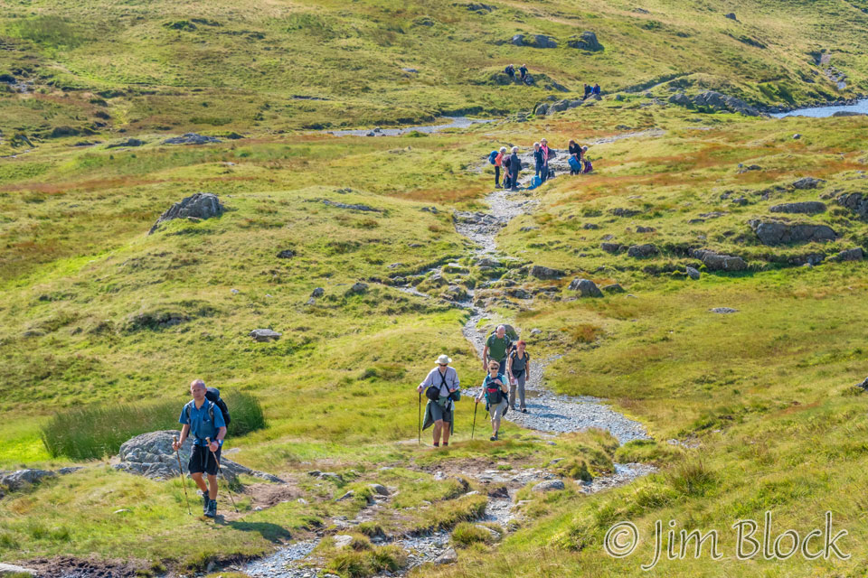
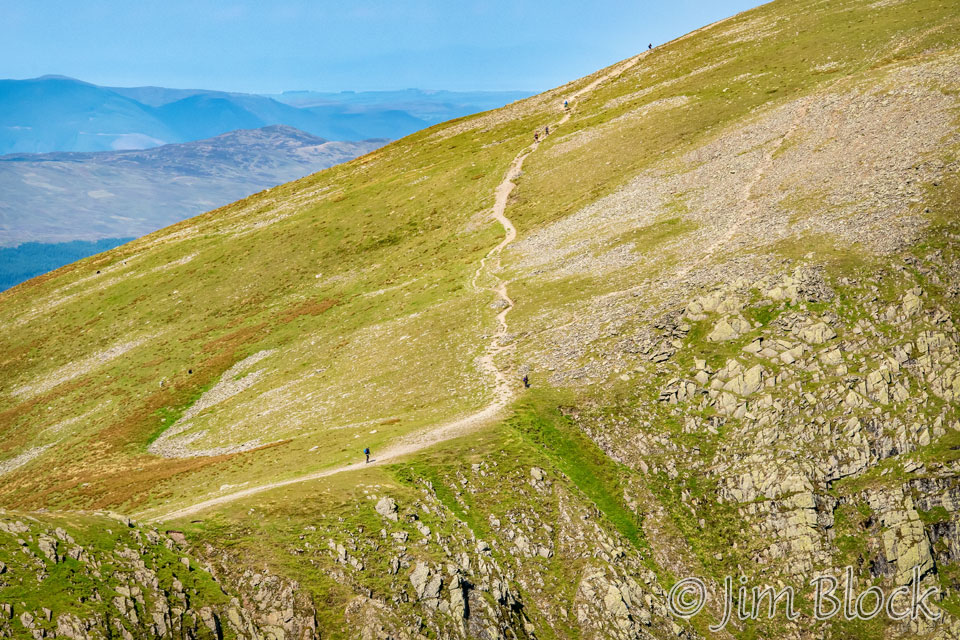
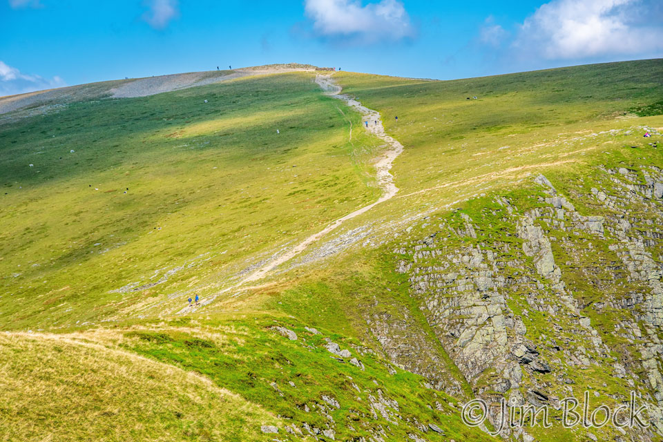
Here are a pair of photos of the folks ahead of me as we hiked to the pass. It looks like the trail is fairly crowded. That was because everybody seemed to leave Grasmere at about the same time.
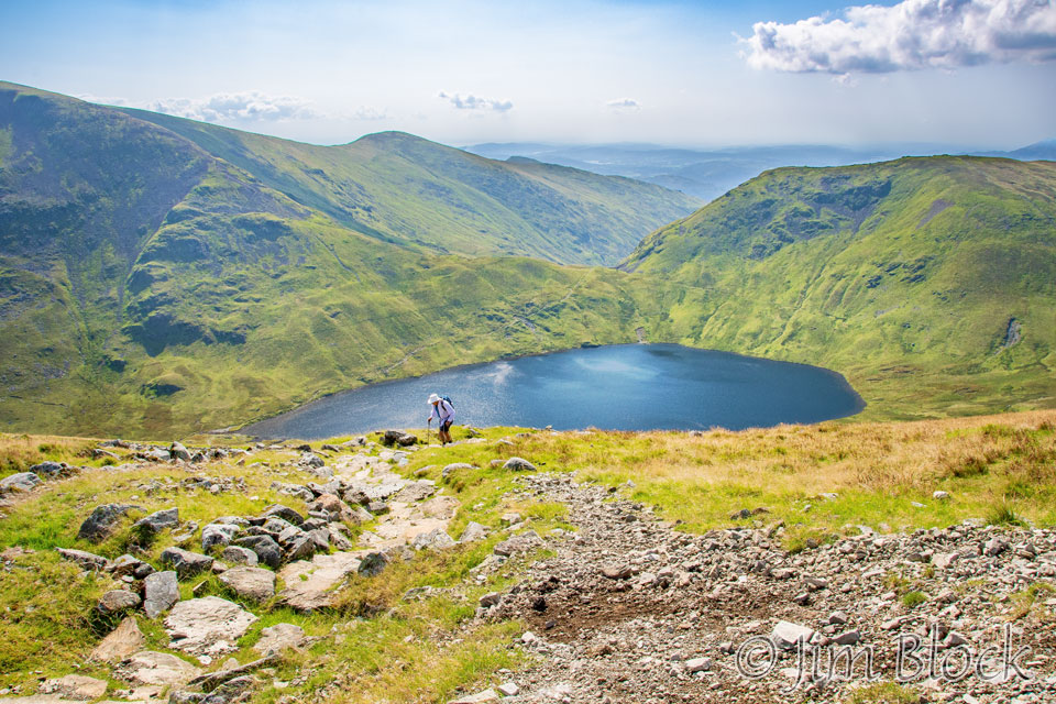
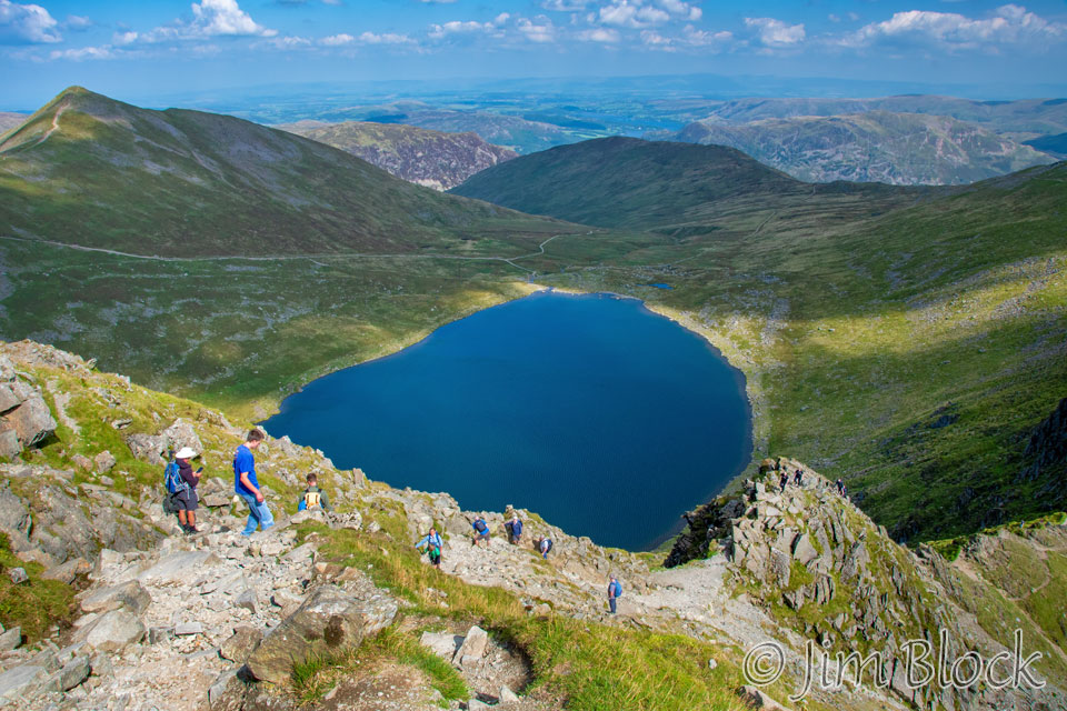
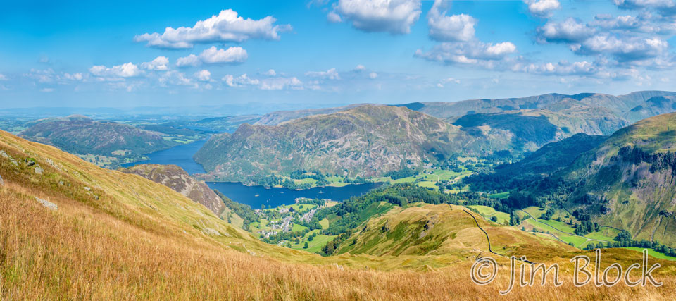
Eventually we climbed high enough to get a brief view of Grasmere Lake.
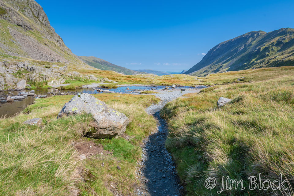
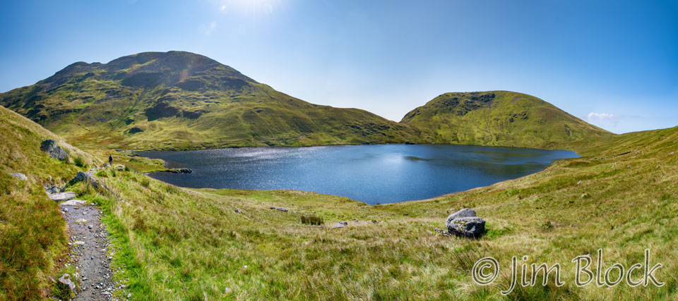
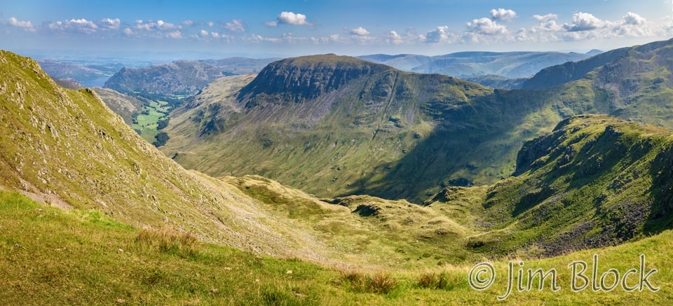
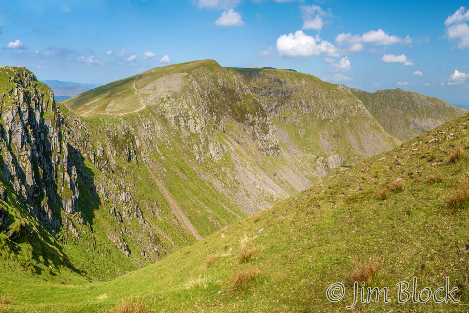
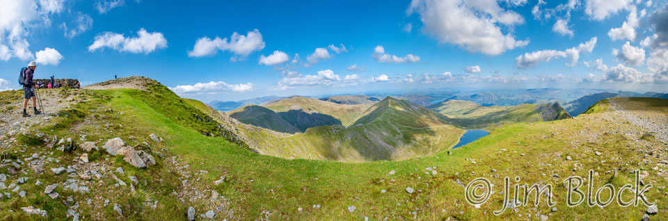
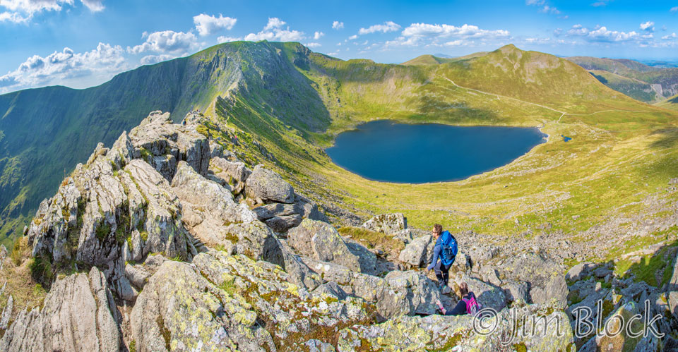
Suddenly Grisedale Tarn was in front of us with Dollywaggon Pike, which we would soon summit, behind it. To the right we could see a piece of St Sunday Crag. The valley down to Patterdale is between them beginning from the outlet of Grisedale Tarn.
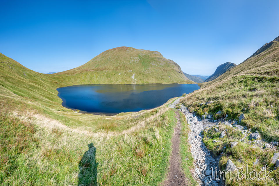
I took the photo below as we neared the outlet of Grisedale Tarn. Dollywaggon Pike rises steeply to the left and St Sunday Crag can be seen on the right.
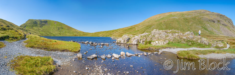
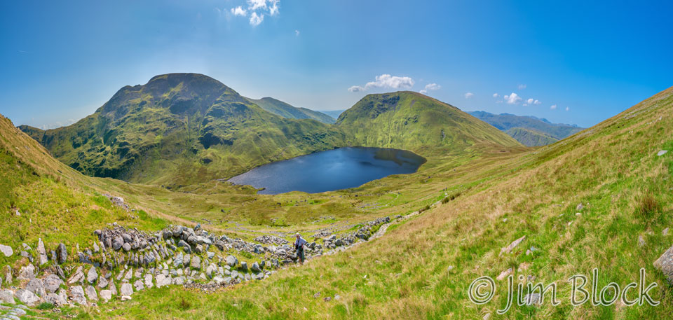
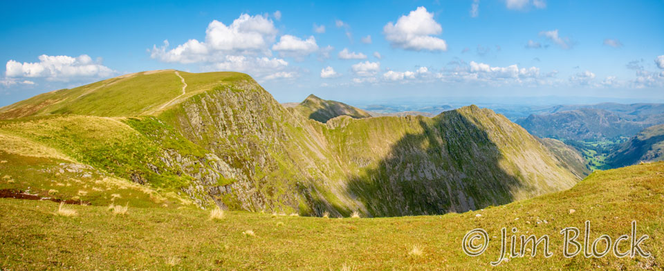
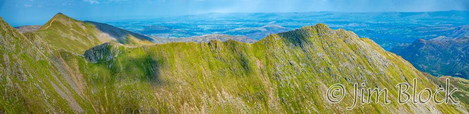
I made a ten-photo panorama from the outlet of Grisedale Tarn. In it you can see Seat Sandal on the left, Dollywaggon Pike in the center, and St Sunday Crag at the right.
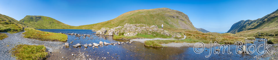
Below are cropped portions of the left and right parts of that panorama so that you can see the details better.
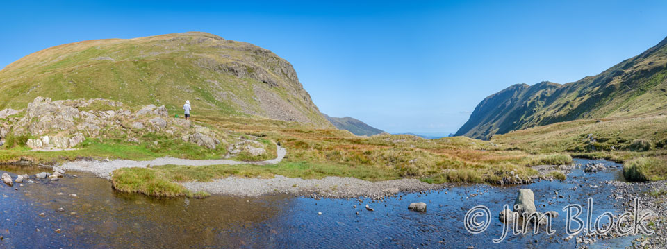
A group that we had not met previously had stopped to have a snack. Here is Stephen taking their photo, and a photo of them that I took. I gave them my email address and promised I’d send them a photo if they would email me, but people never seem to take me up on this offer.
Most of the group decided to take the standard route down into the valley to Patterdale. But we were going to take a high alternative to Helvellyn.
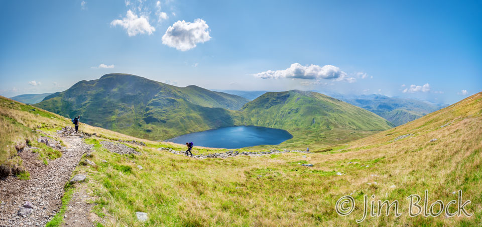
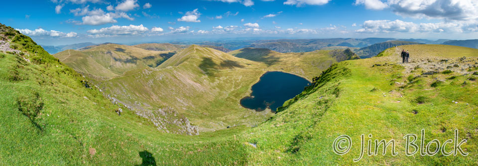
A short distance up the trail to Dollywaggon Pike, I got this photo looking back at Grisdale Tarn and the col we had crossed between Fairfield at 2864 feet on the left and Seat Sandal at 2414 feet on the right.
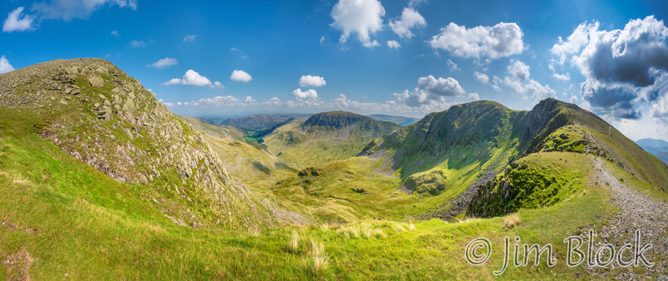
As we climbed, we got a view down the small valley to the right of Seat Sandal. Here it is with some of the peaks labeled. The numbers are altitudes in feet.


As we climbed I made a number of multi-photo panoramas looking back. The one below is composed of 16 individual photos. It shows St Sunday Crag on the left and Seat Sandal on the right.
Below is a panorama that shows a couple walking up toward me.
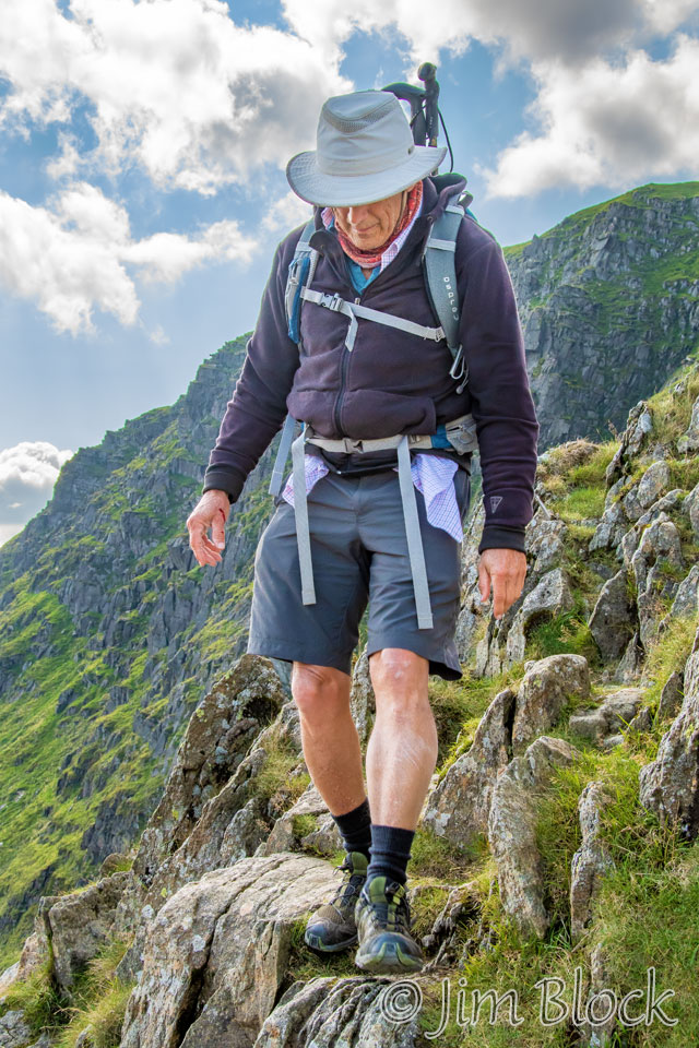
The couple passed me while I waited for Stephen, who is coming up the path in the image on the right below.
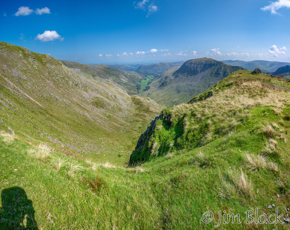
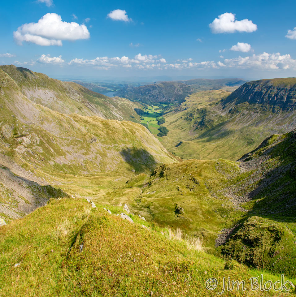
As we headed to Dollywaggon Pike, I got this view looking down toward the Grisedale Valley.
The trail leveled off a bit as it skirted the summit. I got this photo and labelled some of the distant peaks. The numbers are altitudes in feet. They certainly do not compare with Nepal or Bhutan or even New Hampshire.


In the photo below of Stephen taking a photo with his iPhone, you can see the Grisedale Valley on the left, St Sunday Crag near the center, and Fairfield to the right.
The photo below shows a closer view of the Grisedale Valley and St Sunday Crag. This is a two-shot panorama taken with my iPhone.
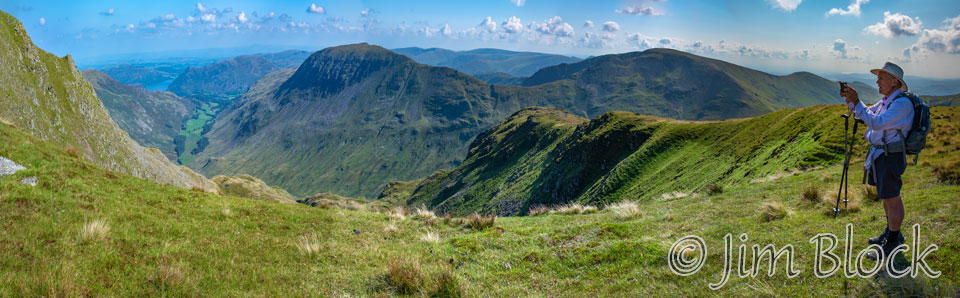
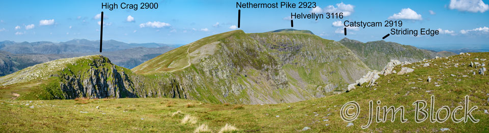
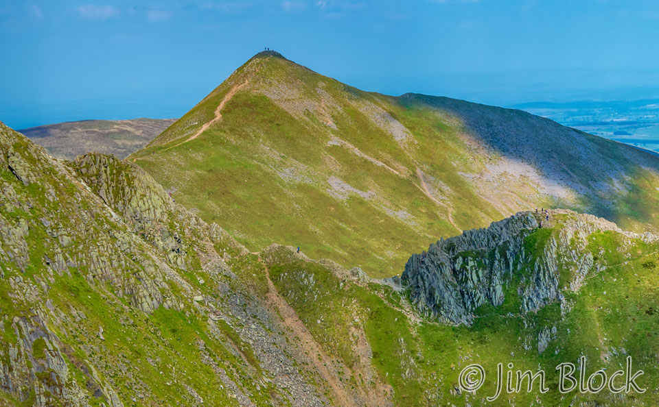
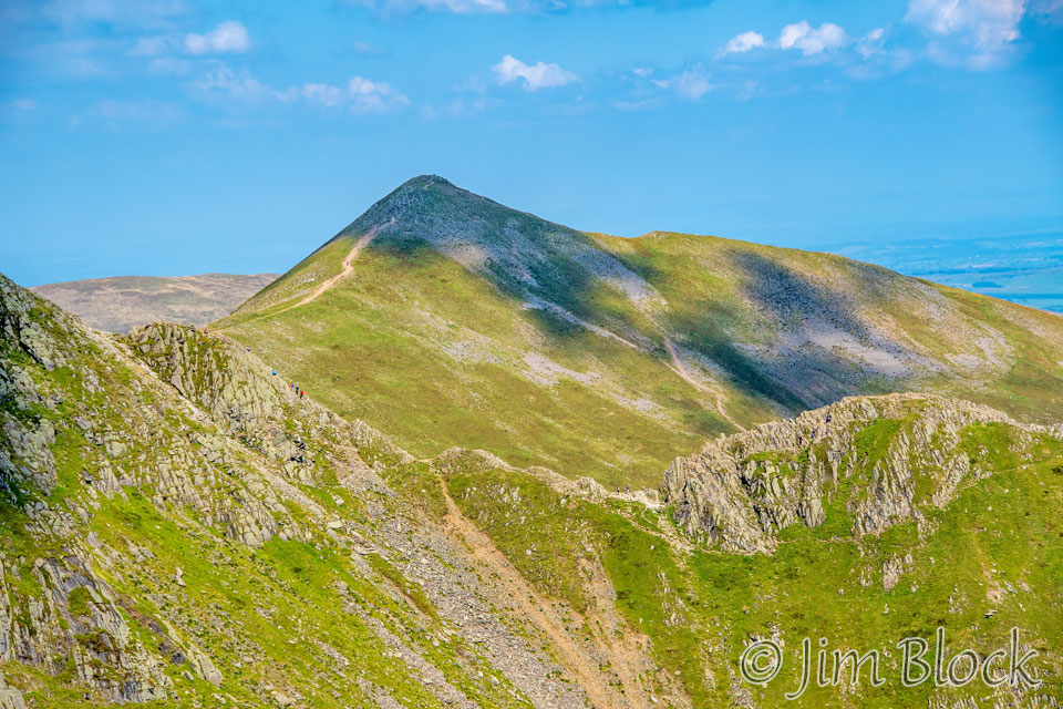
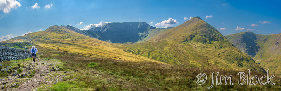
We decided to deviate from the path and hike up to the summit of Dollywaggon Pike. On the way there I made this six-photo panorama. In it you can see the three other peaks we would be crossing: High Crag, Nethermost Pike, and Helvellyn. You can also see Striding Edge, although when I took this photo I certainly didn’t know what I was looking at.


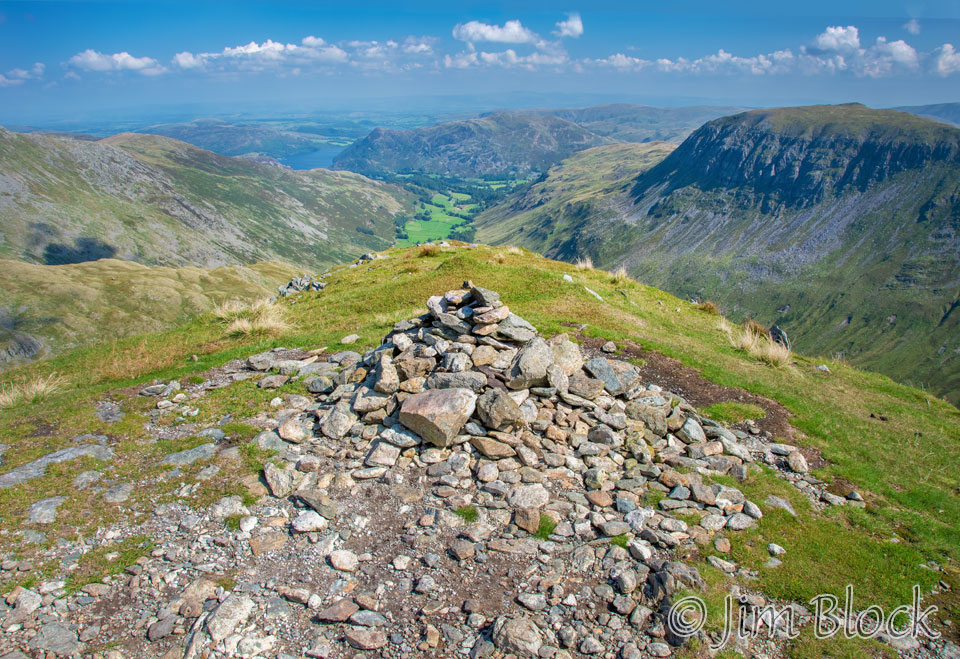
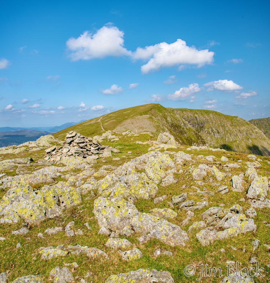
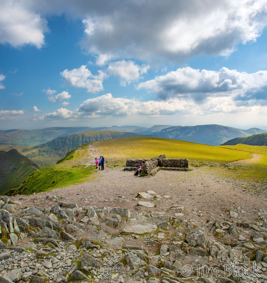
Here is the summit cairn of Dollywaggon Pike with Grisedale Valley in the distance above it.
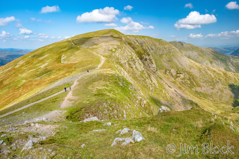
From the summit, I took this view of the trail to Nethermost Pike.
Below are two more views of Nethermost Pike and the trail leading to it. In the photo on the left, the small peak on the left side of the photo is High Crag. In the view on the right you can see Striding Edge at the far right edge of the photo.
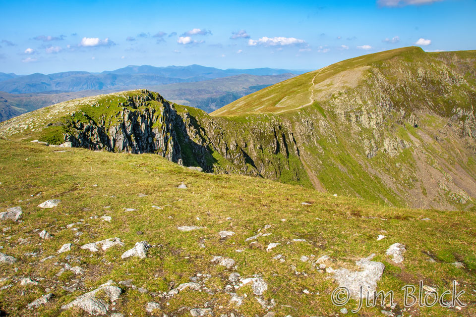
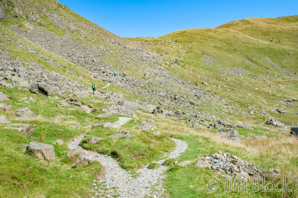
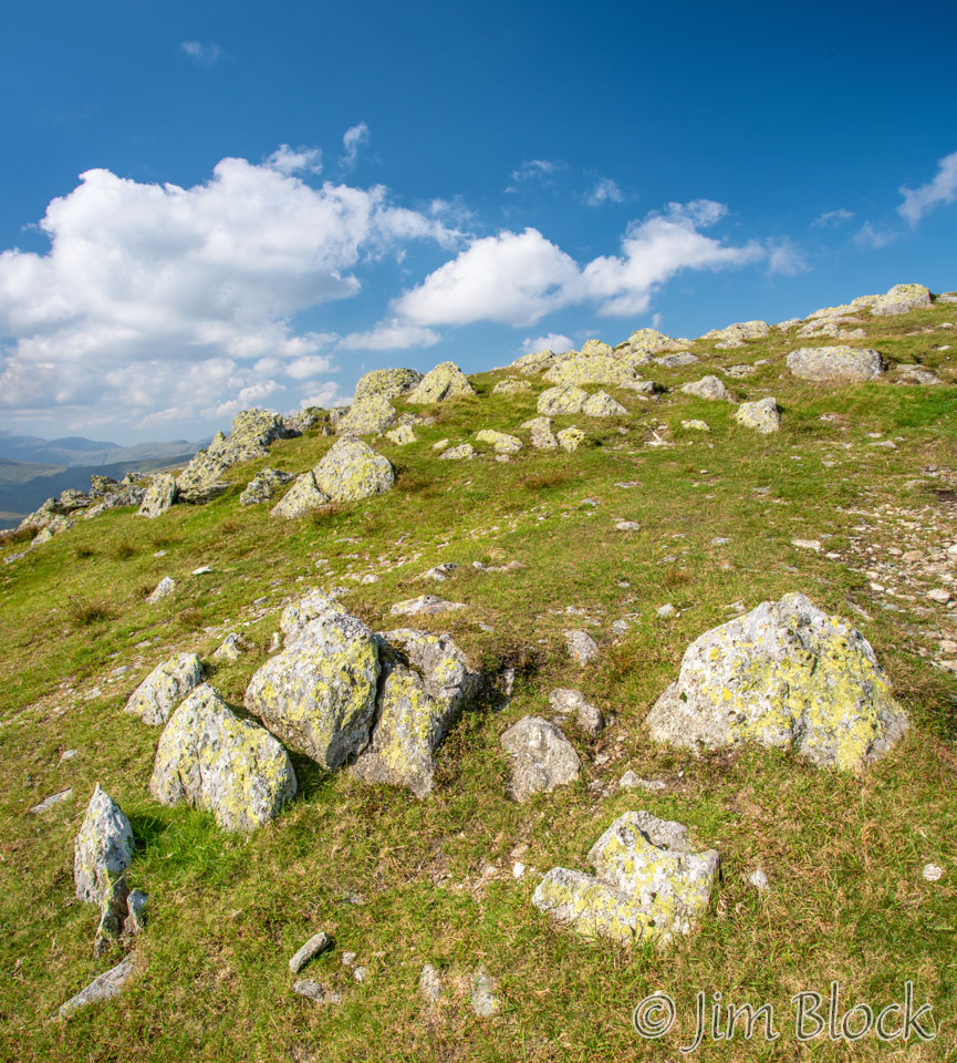
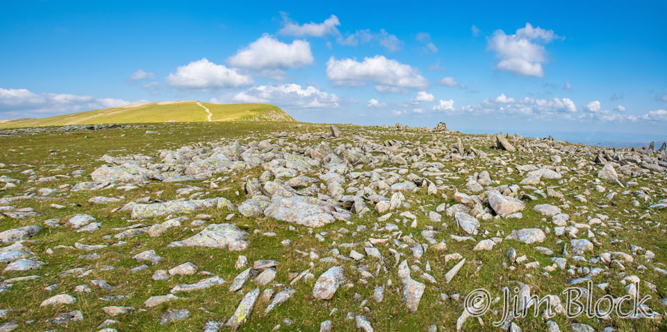
As we approached the summit of High Crag we noticed large fields of rocks protruding from the soil.
Here are two more photos of the rocks. In the photo on the right you can see the summit cairn of High Crag and, behind it, Nethermost Pike.
This was our view down toward the Grisedale Valley from the summit of High Crag.
Here is a view of Nethermost Pike as we dropped down from High Crag.
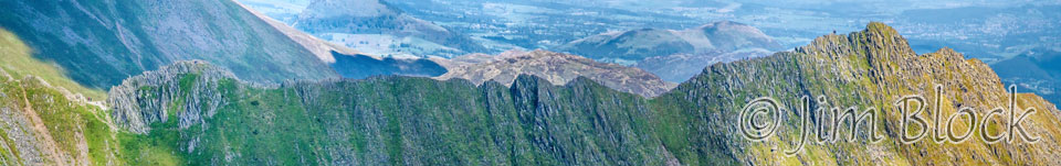
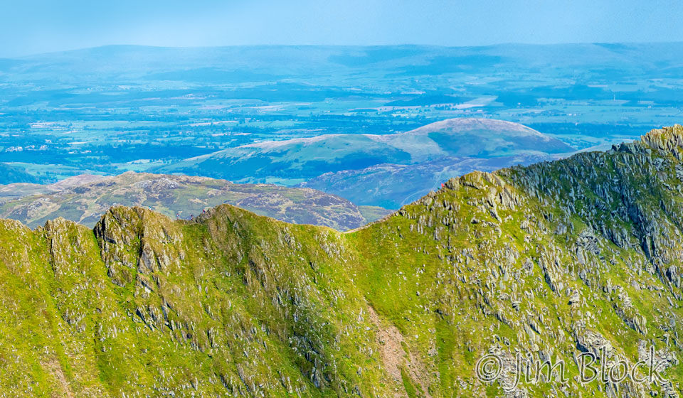
Dropping down from High Crag, I made an 18-photo panorama as seen below. On the left is Nethermost Pike, in the center in the distance is St Sunday Crag, and to its right is Dollywaggon Pike and High Crag.
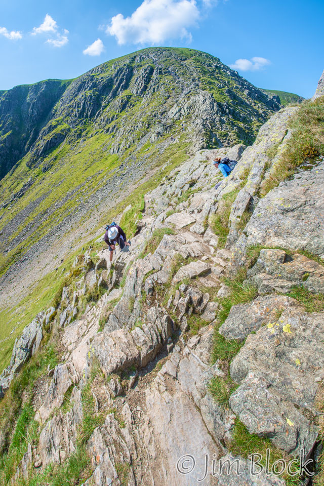
Below we see Stephen heading up to Nethermost Pike.
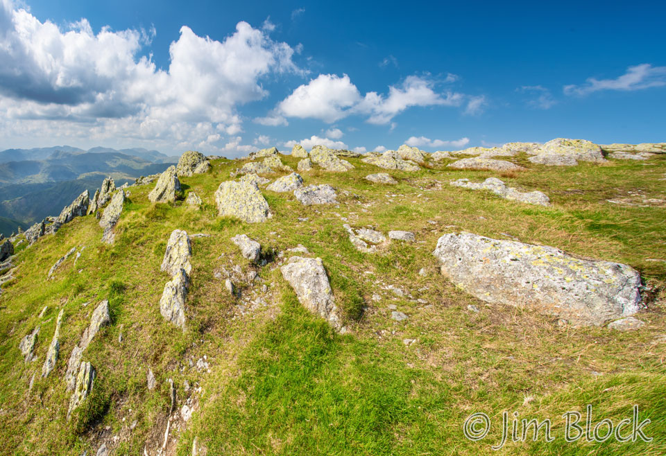
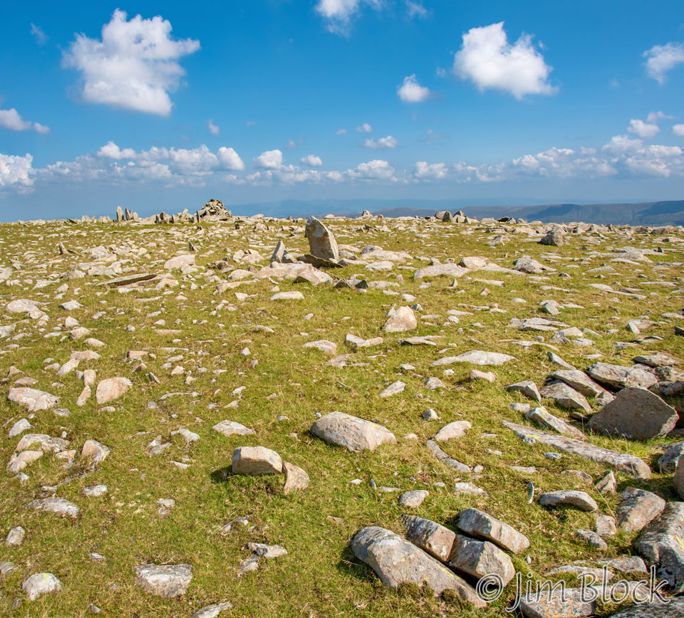
We again deviated from the path, this time to hike to the summit of Nethermost Pike. Again we found a large field of boulders. In the photo below you can see the summit cairn of Nethermost Pike on the right at the edge of the hill and on the left you can see the summit of Helvellyn.
The two images below were taken from near the summit of Nethermost Pike. In the left photo you might be able to see the summer cairn in the distance. In the right image you will notice that there was some cloud iridescence in the sky.
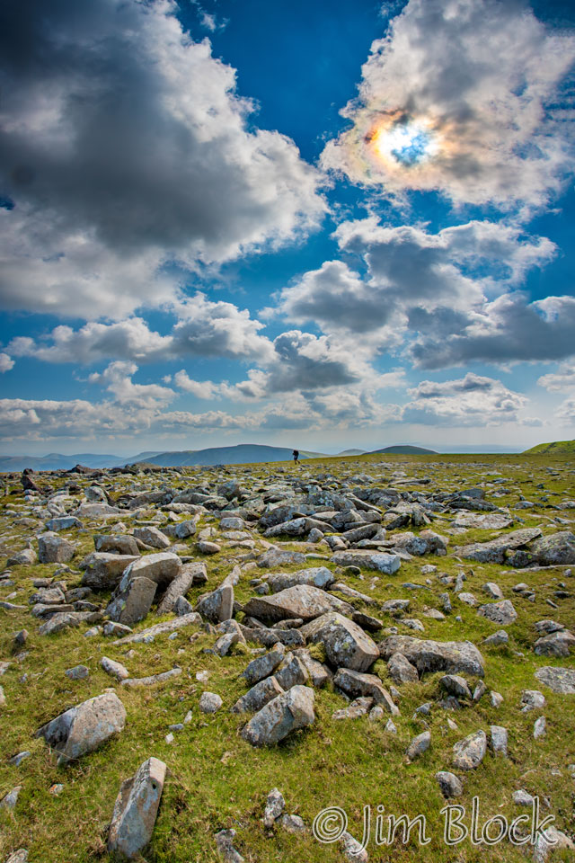
Here is a closer view of the iridescent clouds surrounding the sun.


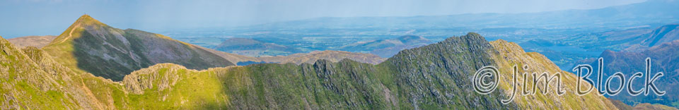
I made the five-photo panorama below from the summit of Nethermost Pike. I didn’t realize at the time what I was looking at. The photo shows Helvellyn, Catstye Cam, and Striding Edge.
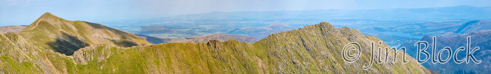
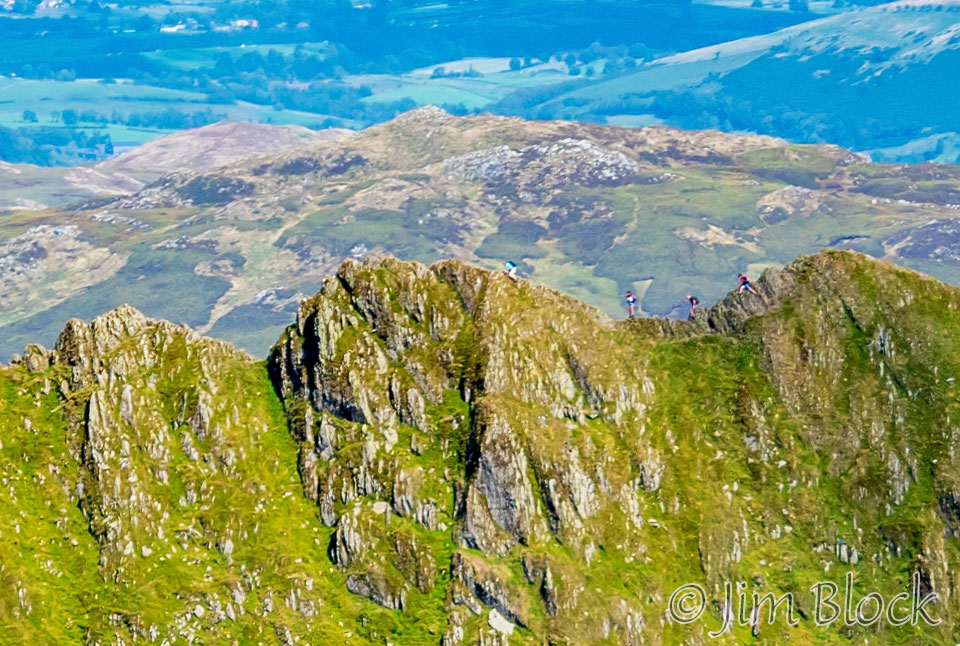
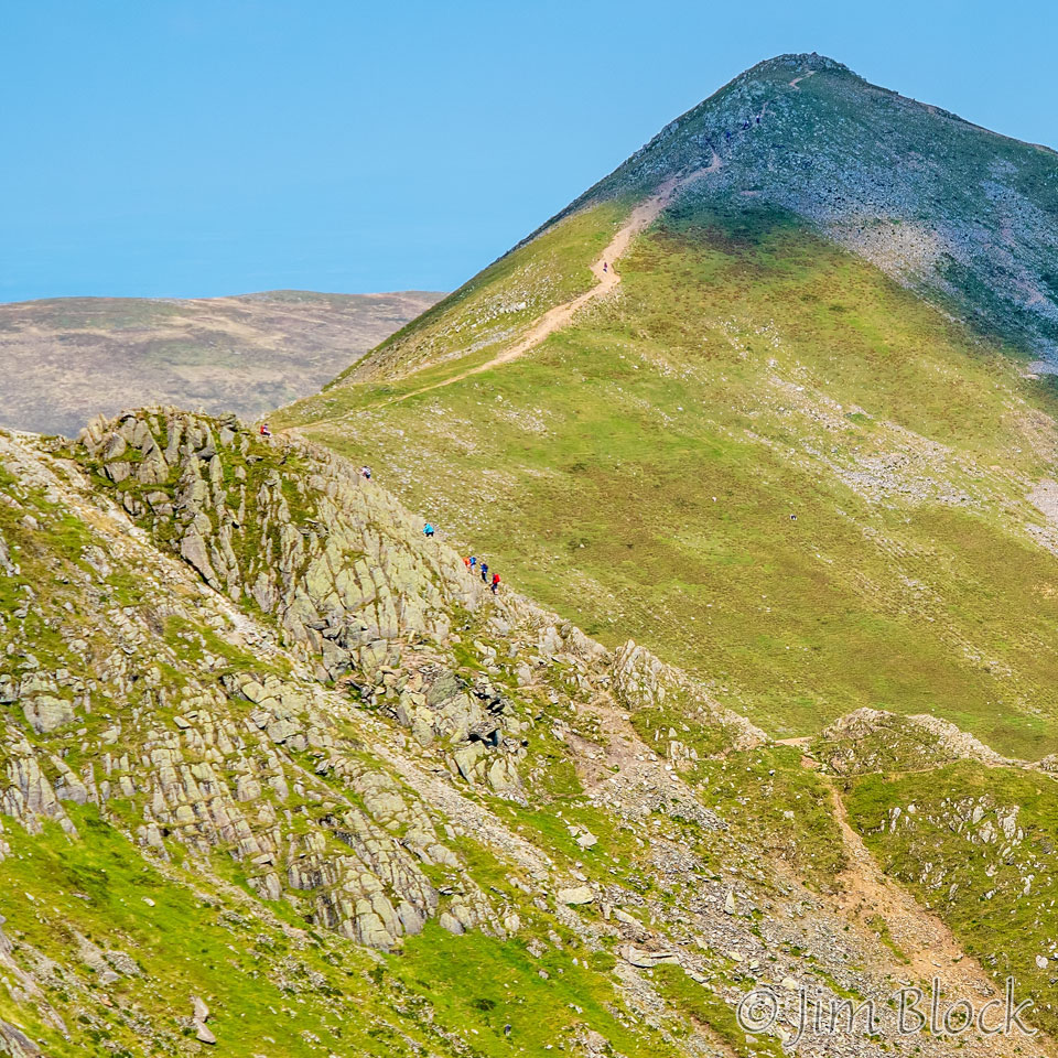
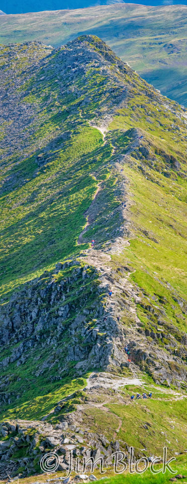
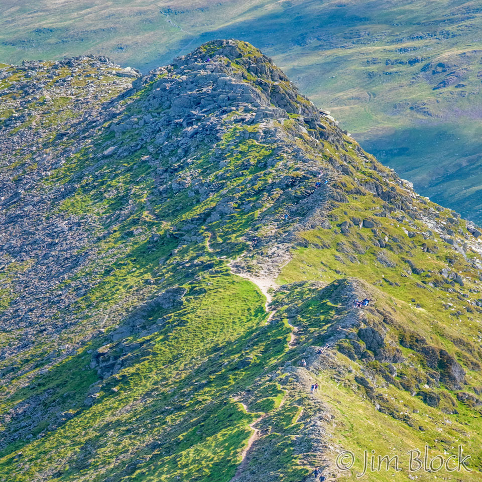
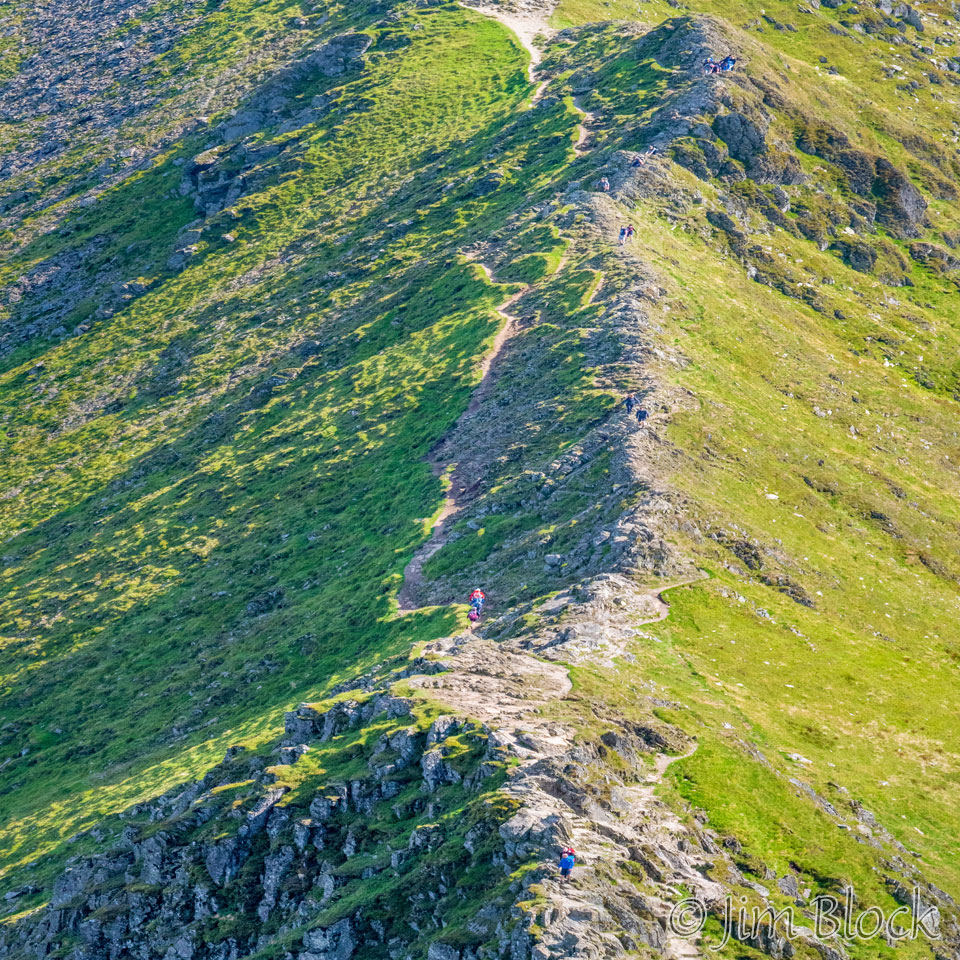
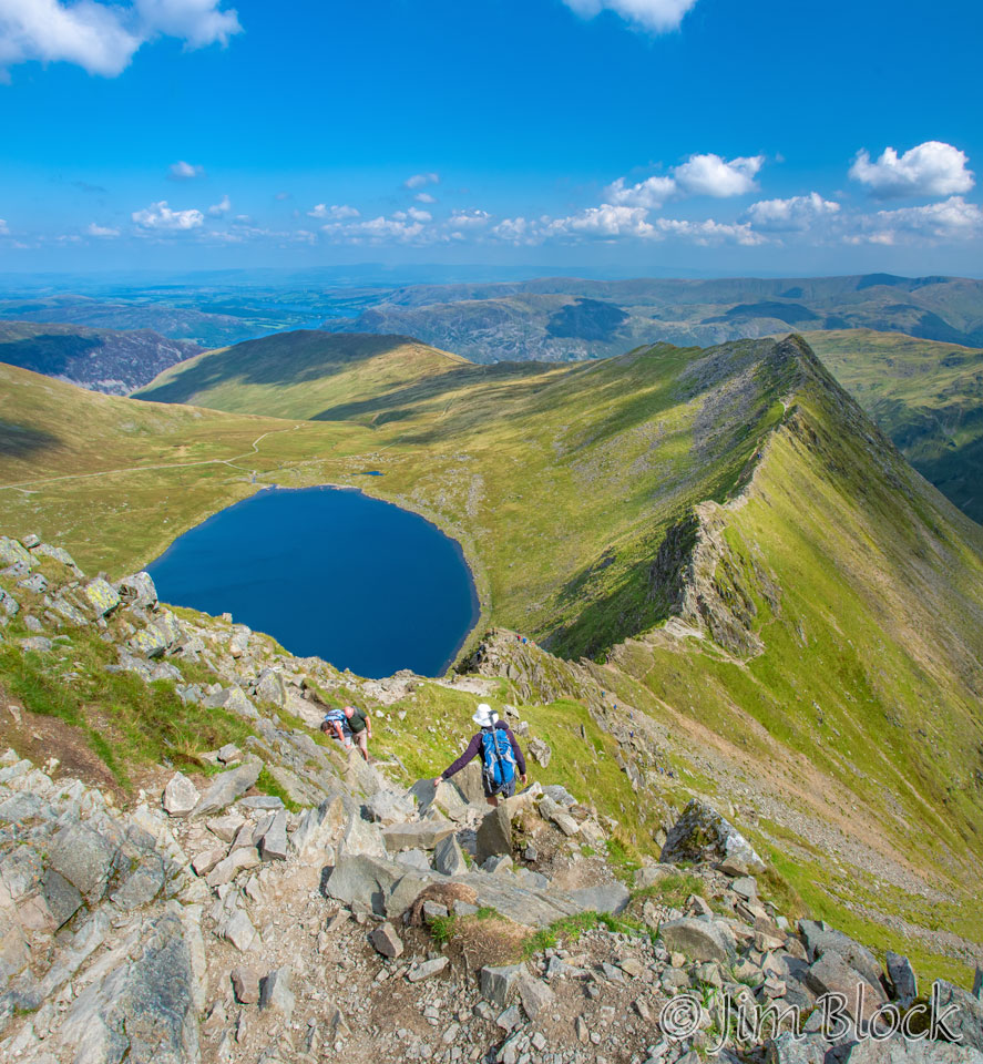
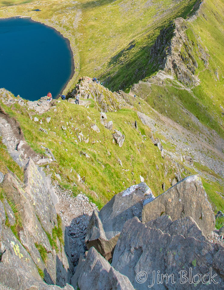
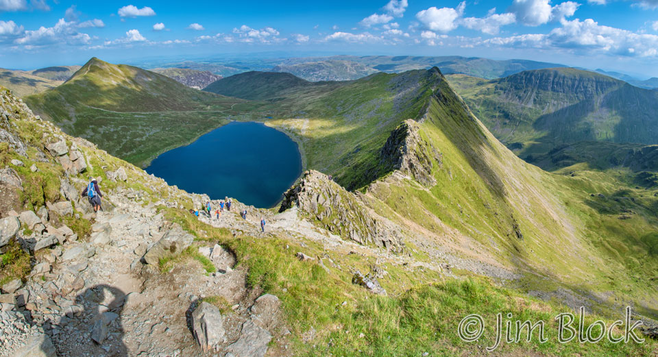
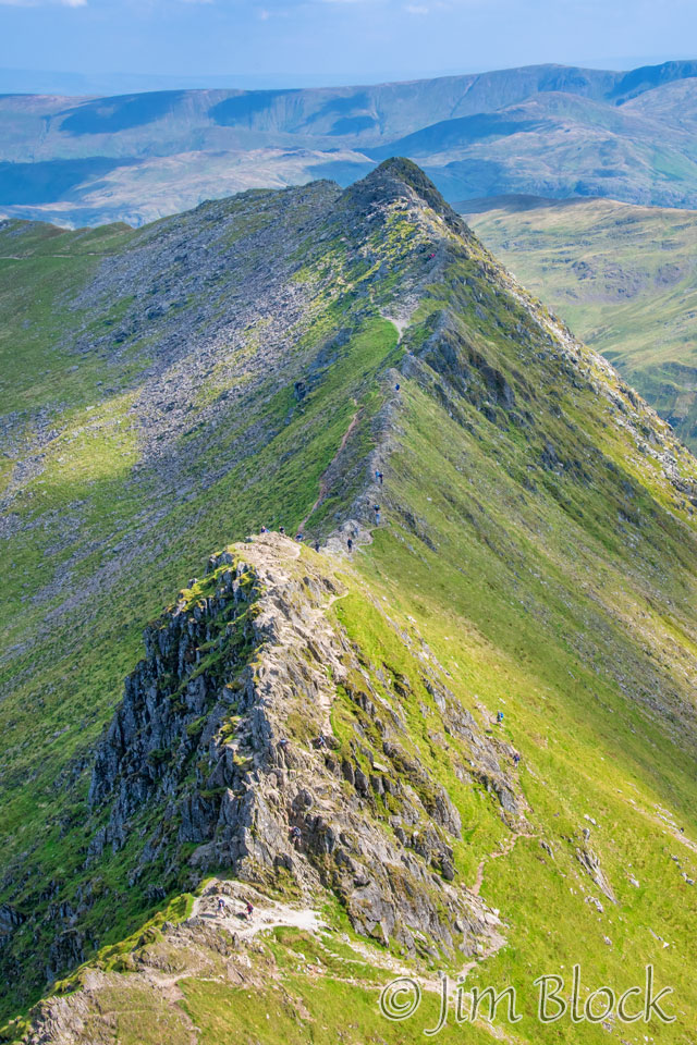
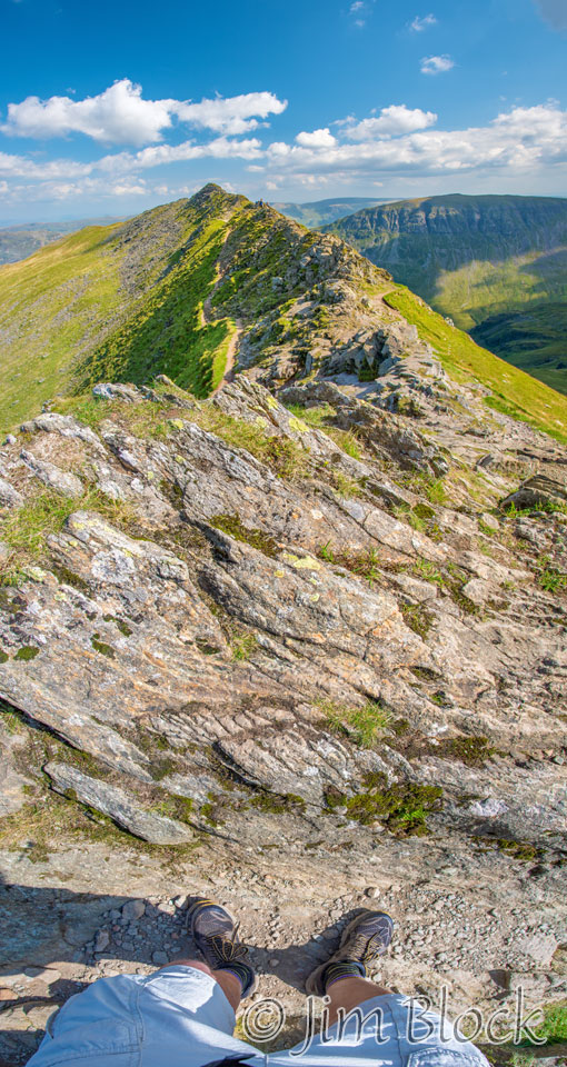
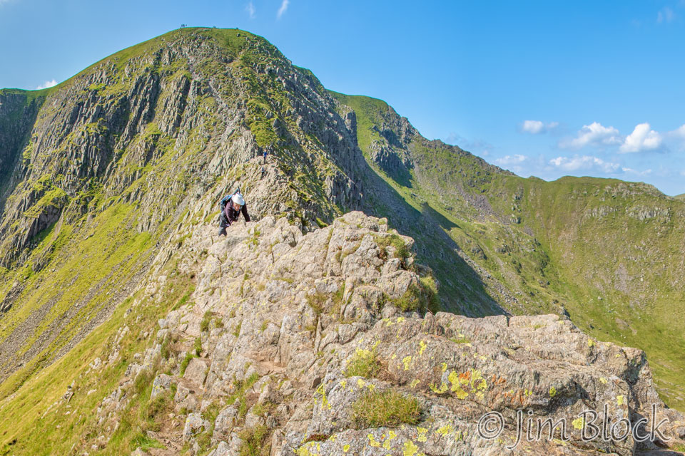
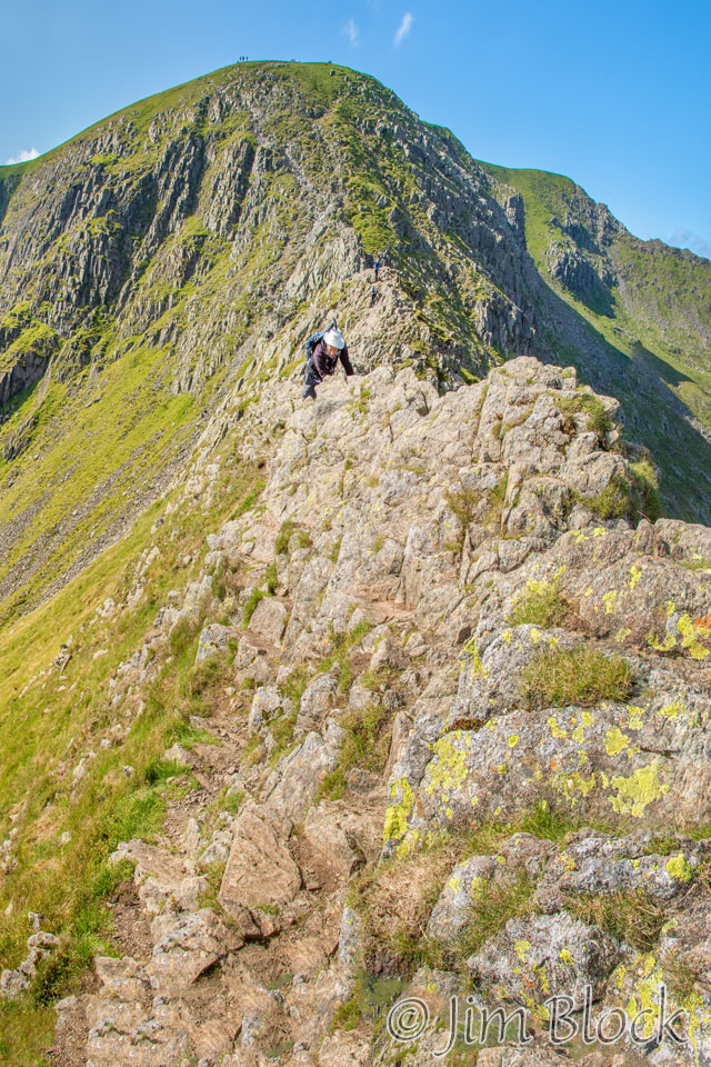
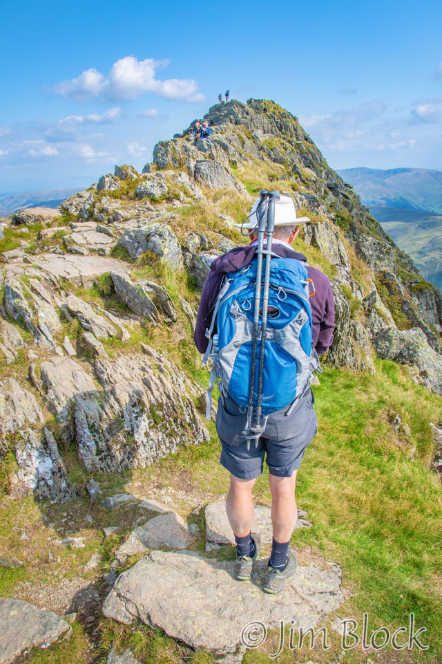
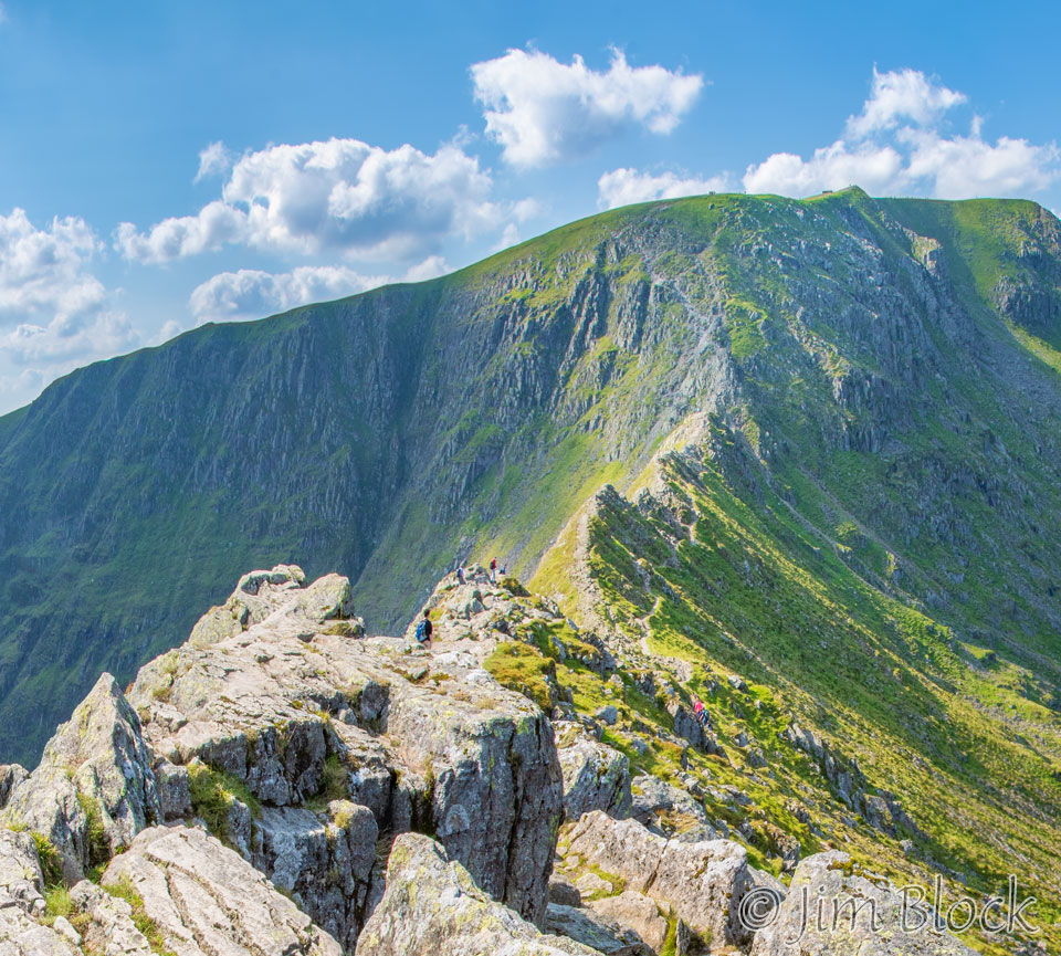
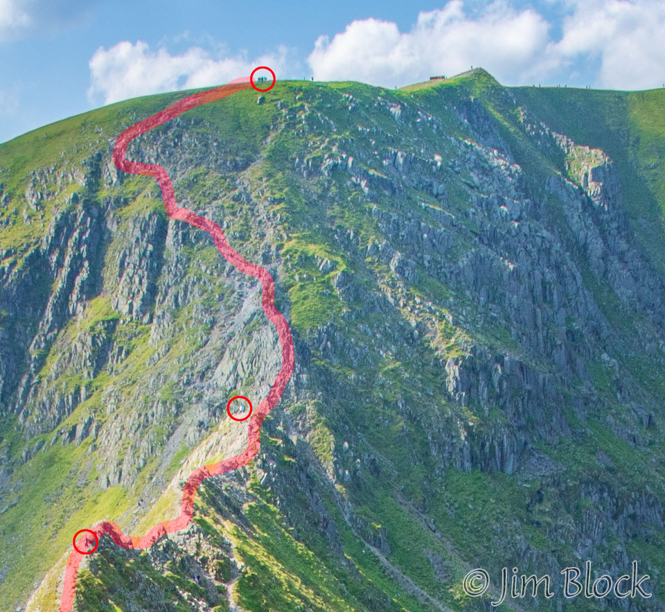
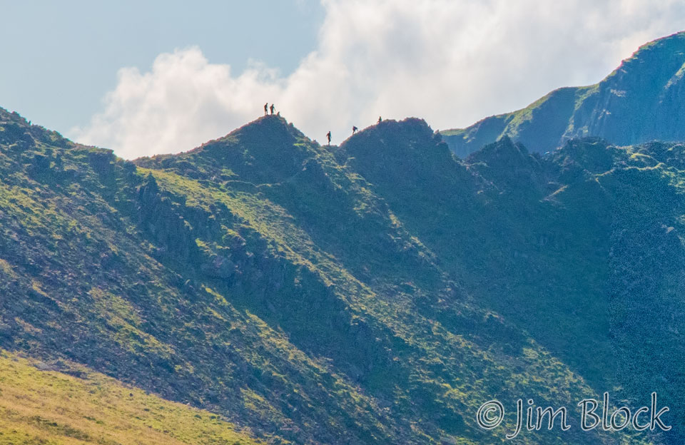
A little beyond Nethermost Pike, but well before we reached Helvellyn, I made the 12-photo panorama below. It was starting to dawn on me what I was looking at — a long narrow knife edge. This is Striding Edge. As I looked closer and zoomed in my lens, I saw to my amazement that people were actually hiking this treacherous edge. I did not yet realize that in 40 minutes we would be descending to it and traversing it ourselves. But it did not take us long to decide we had to do it. Of course, I did not realize it at the time that there was no other reasonable way down, although once one made it down the precarious drop from Helvellyn to the edge, one could take an easier path somewhat below the edge.
Here is a slide show of five cropped versions of the above panorama. You can probably spot some people on the edge.


The light kept changing as the clouds moved overhead, and I kept shooting. Below are eight and twelve photo panoramas of Catstye Cam and Striding Edge.
Hiking to the edge, one drops down from Helvellyn on a very steep slope with loose rocks, out of view in these photos at the far left, then a series of challenging ups and downs along the knife edge makes you glad you are alive and are staying that way. After we got down I learned that, on average, one person a year loses their life there.
After I returned home I ordered the 8th edition of Stedman’s classic guidebook, “Coast to Coast Path”. I knew about it before the trip, but I didn’t want the extra weight, and I also knew a new edition was in the works, so I waited. Now I see Stedman wrote, “IMPORTANT NOTE. Since the descent via Striding Edge is precarious and, given the sheer drops on either side, can be very dangerous indeed even in calm weather with little wind, this route is only for people experienced in such conditions and certainly not for anyone who suffers at all from vertigo. … The climb is arduous and, having reached the top, you then face a nerve-tingling drop on a crumbing slope above Red Tarn, followed by a knife-edge walk along Striding Edge … “
Here are three cropped versions of the image above. The peak in the first one is Catstye Cam. Helvellyn is off the left edge and well above. Perhaps you can make out people in these photos.
Still approaching Helvellyn, I took this photo of the beginning portion of Striding Edge with Catstye Cam in the background. You might be able to see people walking on the knife edge.
Below are two cropped versions of this photo to help you see the people on Striding Edge.
The photo on the left below shows the trail up to the summit of Helvellyn. Just below the summit is an X-shaped structure made of stones. It is basically a windbreak. You can see it in the photo on the right below. To the left of the people is Striding Edge. Above the people is the trail that leads to the steep, loose descent to reach Striding Edge.
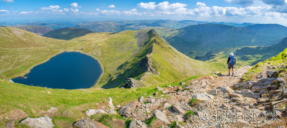
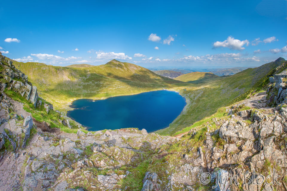
We proceeded to the summit of Helvellyn. Here we are approaching it in this 23-photo panorama. The peak in center to the left of the lake is Catstye Cam. To reach Striding Edge one drops over the ledge at the far right of the photo and then scrambles down on all fours. You can see the far end of Striding Edge just to the left of the ledge across the lake from Catstye Cam.
Here is a 17-photo panorama from the top of Helvellyn. The path down to Striding Edge is behind the two people who are on the right side of the photo. The lake is called Red Tarn, and you can just see just a piece of Striding Edge above it to the right.
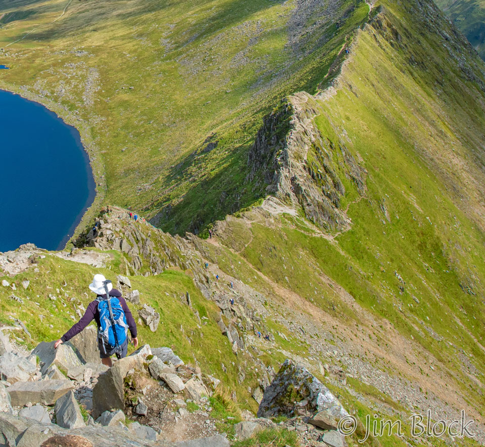
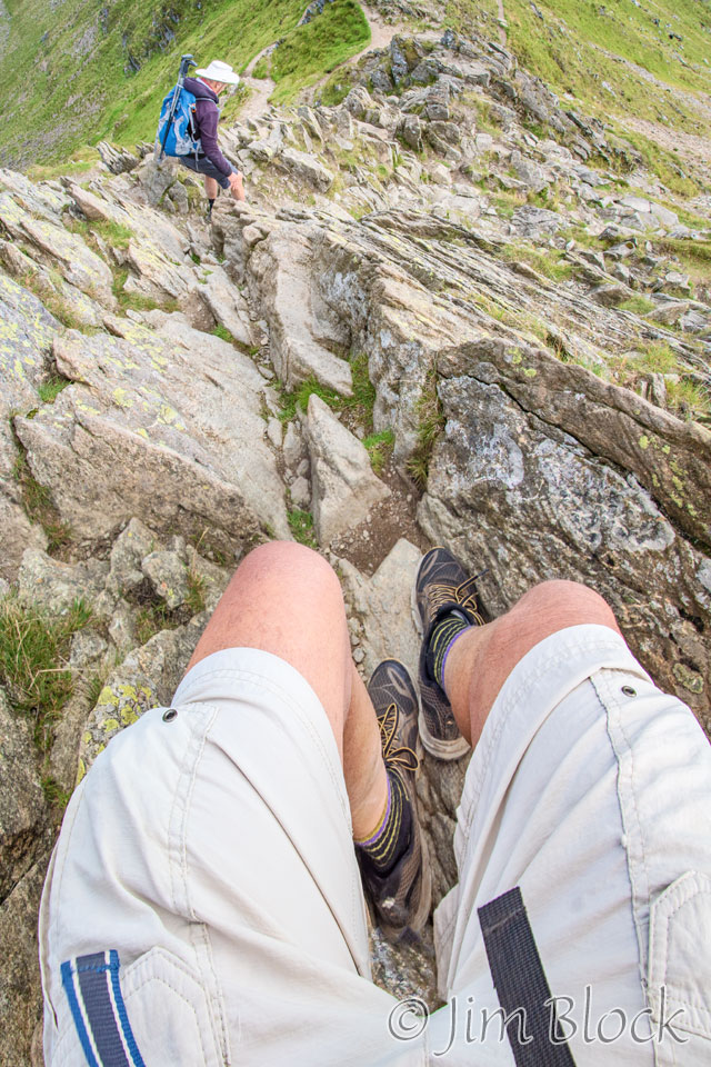
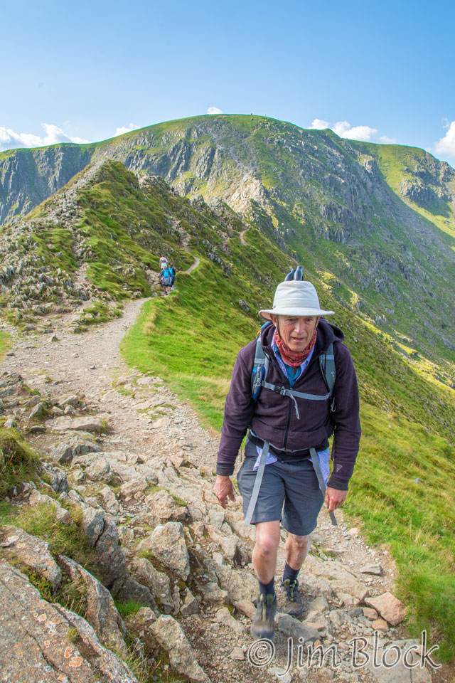
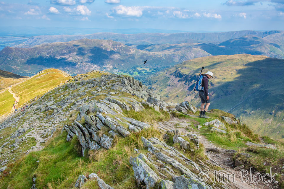
Here is Stephen starting down the path to Striding Edge. He still has his trekking poles since we haven’t yet reached the steep part. But soon we would. We quickly realized that we needed to stow our poles on our packs because we often needed to use our hands, and sometimes our knees or butts, in addition to our feet during our scramble down to and along Striding Edge, and the poles would just get in the way.
As we neared Striding Edge I made this 4-photo panorama.
Here are three cropped versions of this pan from top to bottom. Perhaps you can see people in these photos.
Here is Stephen part way down to Striding Edge, followed by a cropped version of the photo so you can better see the 9 people immediately to his right and well below him.
Here is my view of the path ahead at this early point. The route down, from where I was standing, is the opening at the bottom, a third of the way in from the left edge of the photo. We had not even gotten to the ups and downs along the knife edge.
Below are two more photos taken as we headed down. The first is an 8-photo panorama. I figured if I kept clicking away I wouldn’t have to worry about the steepness too much.
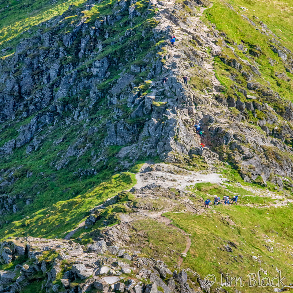
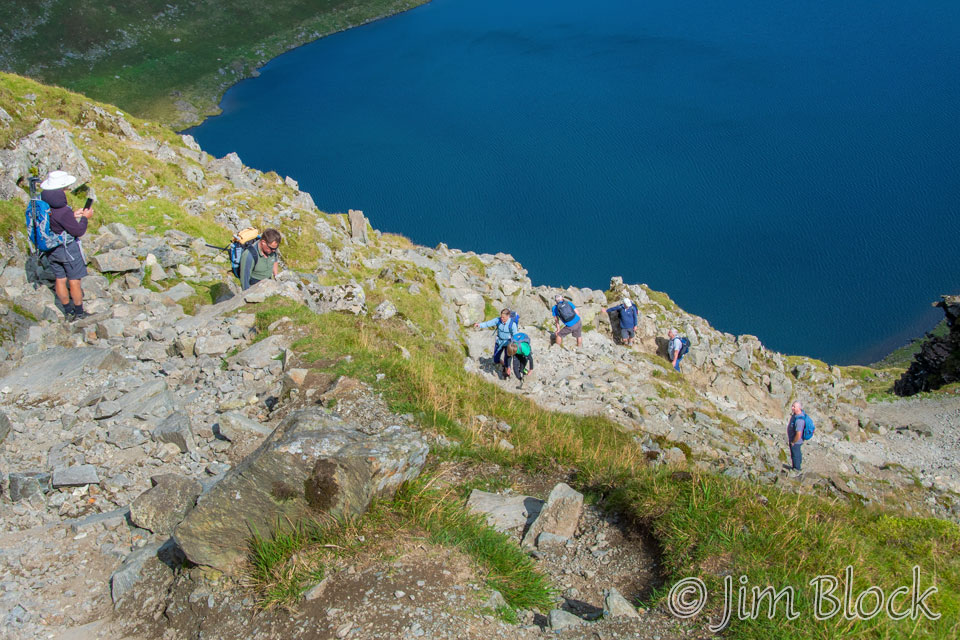
Due to the very steep downhill with loose rocks, the climb down from Helvellyn to the beginning of Striding Edge was very treacherous. Here are two photos I took as we were working our way down. Many of the people you see in these photos are day trippers. They came up from Patterdale or Glenridding and are hiking with small packs or none at all.
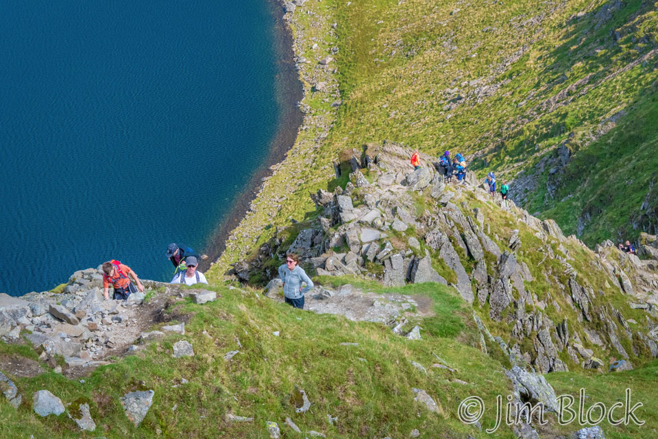
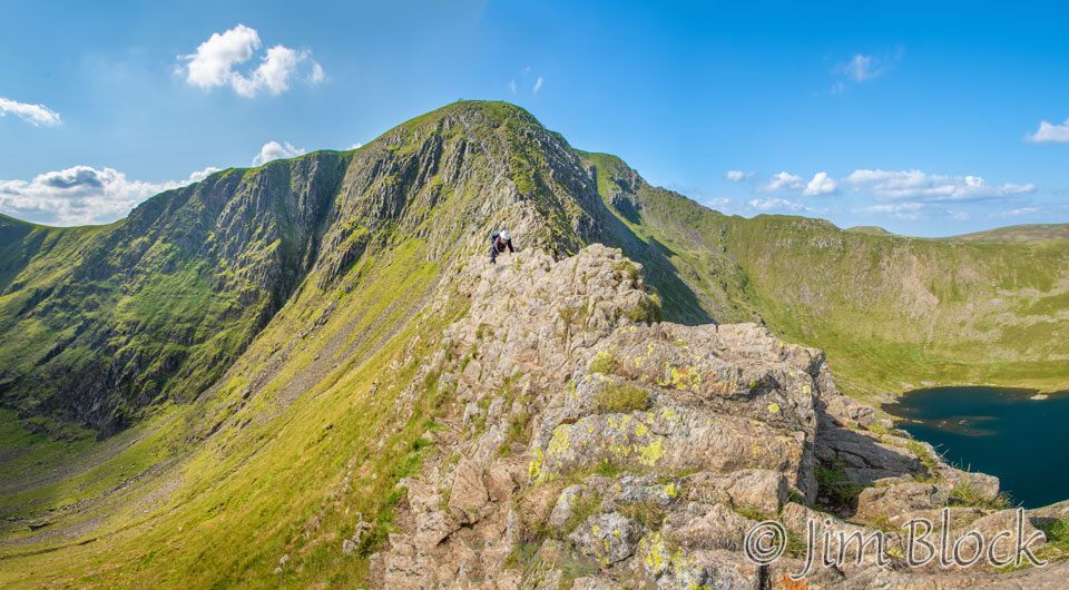
Below are two views of Striding Edge. In the left image you can see there is a trail on the left below the knife edge designed for wimps. But we would have none of that. We did virtually the whole knife edge.
In describing this alternate route via Helvellyn that we were taking, our route card stated, “The walking is standard fare for the mountains, all except the descent to and the crossing of Striding Edge. The steep, loose descent to reach this famous ridge cannot be avoided, but the rocky pinnacles of the ridge itself can mostly be bypassed on a traversing path just to the north of the crest. And poor weather, if carrying a big pack, if short of time, or if unsure of your balance or navigation, this route is not recommended.”
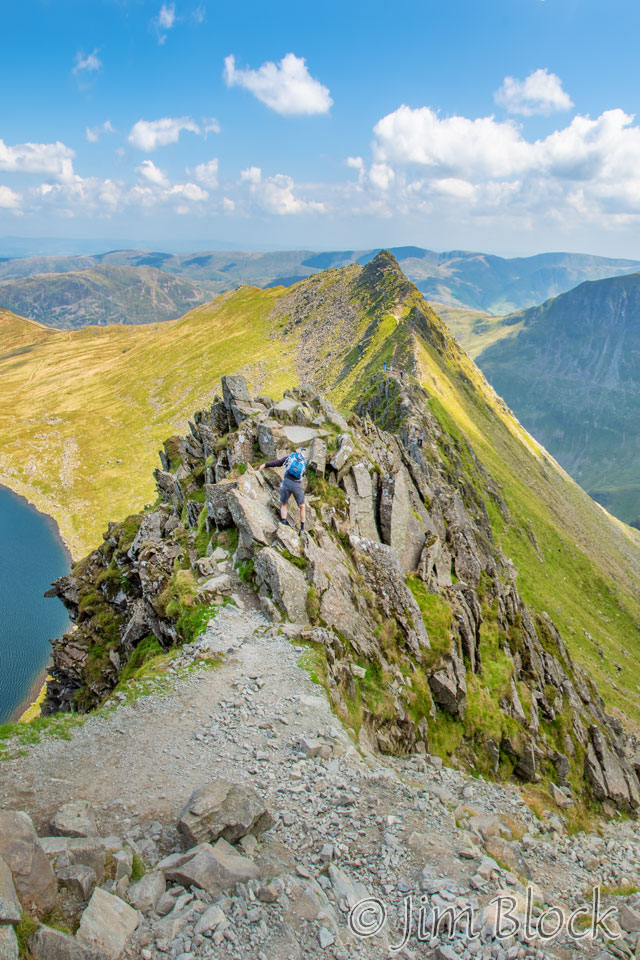
In the photo on the right you can see Stephen beginning his travels on the knife edge, after we finished the very steep downhill.
Below is a somewhat whimsical photo of me about to work my way down the “trail” that you can see between my feet and Stephen. To the right we see Stephen using the 5-point scramble technique.
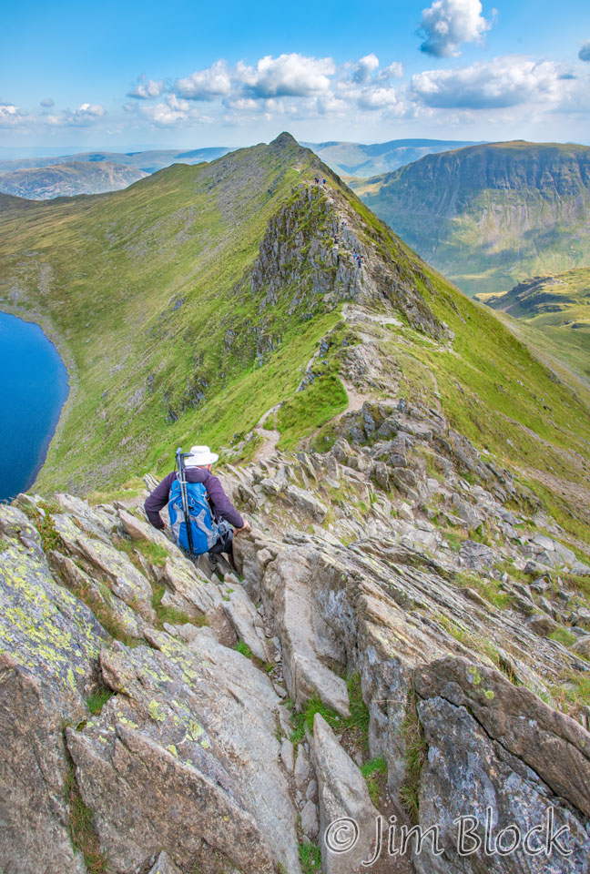
Below is a view looking back at the Helvellyn ridgeline. You can see the tiny people there. The bottom part of the trail down is hidden by part of Striding Edge behind Stephen. Stephen is working his way carefully along one of the many spots where a slip would be unfortunate.
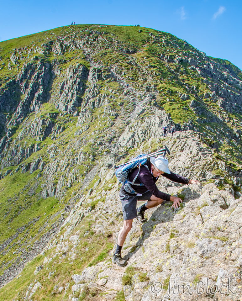
Below we see Stephen wondering where he is going to step next, and then a photo of him scrambling up a tricky section.
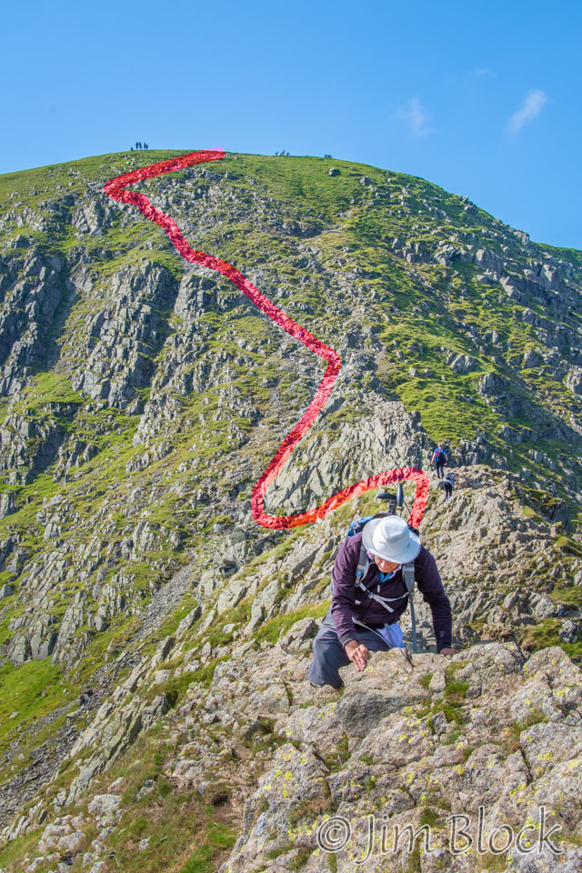
In the photo on the left below we see Stephen working his way along the cliff face with a woman sitting near him. The photo on the right below is a cropped version of that photo where I have circled the people on the trail and outlined the path down in red.
Below is another somewhat whimsical seven-image panorama showing me standing and trying to figure out where to take my next step. On the right is a view along Striding Edge. You can see a couple of people working their way up along the side of the knife edge.
Here is a view of Red Tarn from Striding Edge. It is a 15-photo panorama.
Below is a six-photo panorama showing Stephen working his way along the edge and Helvellyn in the background. Below it is a cropped version of the same image. Perhaps in this version you can see the tiny figures on the top of Helvellyn.
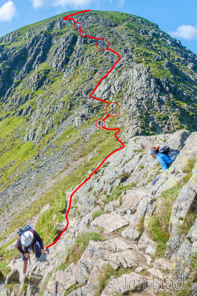
Below left as another cropped version of the previous photo. Below right, I have marked in red the approximate path from the top to where Stephen is now.
Here is a photo of some day trippers on the left and Stephen coming up toward me on the right.
In the photo on the left below we see Striding Edge and Helvellyn. It appears that we are almost done. But in the right photo taken two minutes later, you can see there are still some challenges ahead.
Below is another look back toward the summit of Helvellyn. This is an 11-photo panorama. The peak to the right is Catstye Cam.
Below is a cropped version of the above photo. You can perhaps make out some people along the edge.
Below is a crop of a tiny part of the previous photo. It shows the summit of Helvellyn and people along the ridgeline. The structure near the peak is a cross-shaped shelter (basically a wind break).
I have indicated the approximate trail and circled a group of people near the top, some along the trail, and a person near the bottom of the photo.
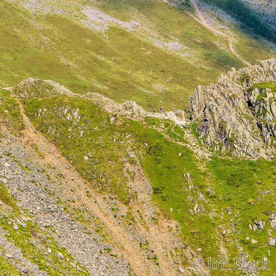
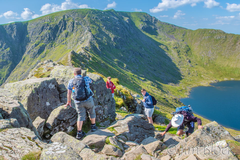
Finally, we neared the end of Striding Edge and started to work our way down. You can see our trail at the far left and the valley we were heading to in the distance in the center.
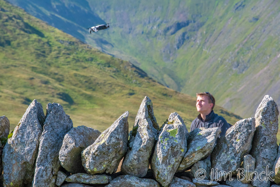
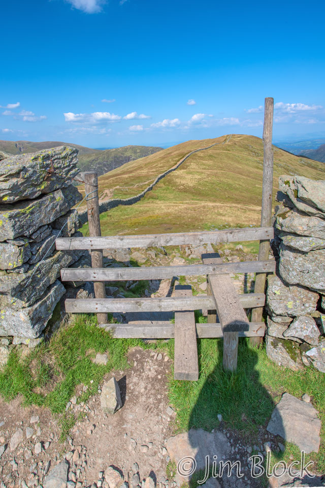
We reached an impressive stone wall with a gate and stile for crossing the gate.
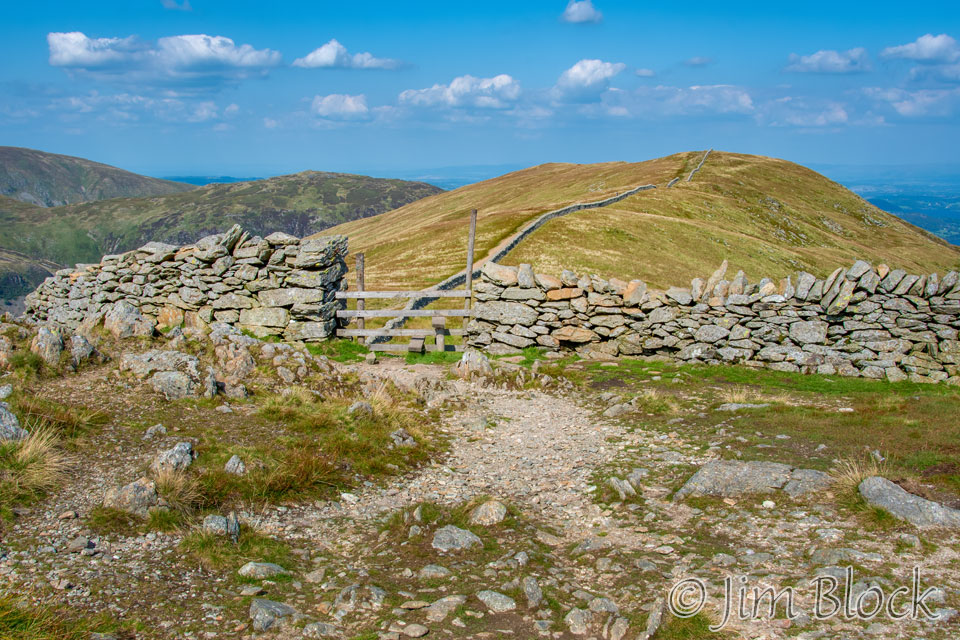
We were somewhat distracted by a man flying a drone nearby. We did not notice a trail to the right immediately after crossing the gate. Instead we went left and over another opening in the long stone wall you can see in the photo. We then walked around along the left side of that stone wall. We wound up walking several miles out of our way, but got to see the town of Glenridding from above and up close and personal before getting to Patterdale.
We could not use Wikiloc for guidance here because the pre-recorded track we had on our phones was recorded by a person who went straight down the valley. And we didn’t think to look at our route cards which would have gotten us to the right path.
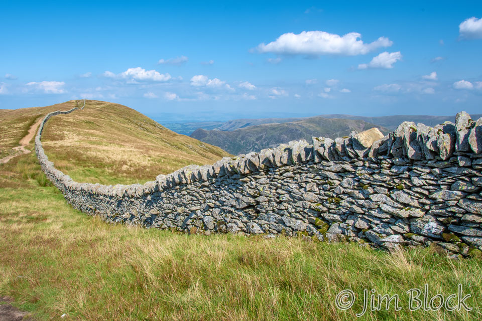
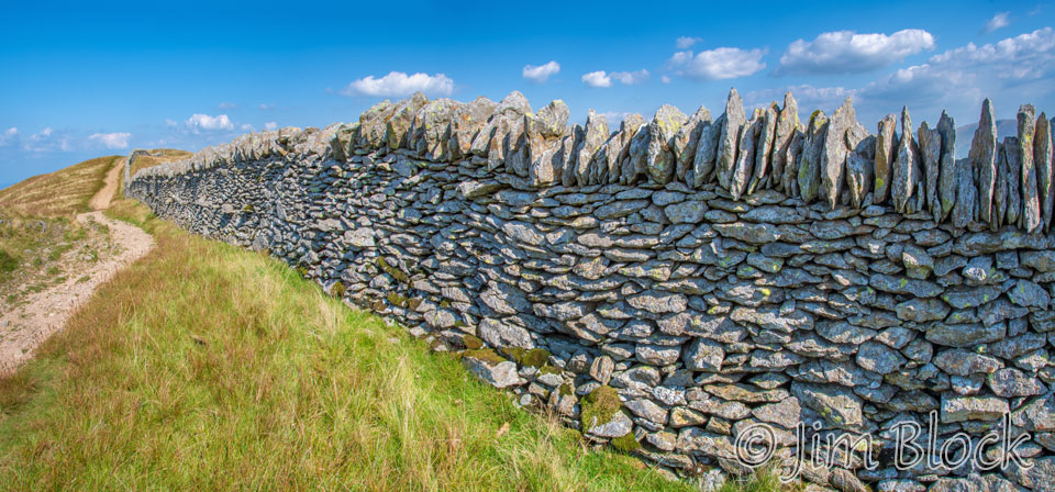
We followed a very long and impressive stone wall. Below are two views of it. We learned later that different regions of the country have different styles for the capstones on the walls. Here they were placed vertically, as you can see.
The four-photo panorama below shows Stephen walking along the wall, Striding Edge edge-wise behind him, Helvellyn in the center, and Catstye Cam on the right.
Here is a distant look back at Striding Edge. The summit of Helvellyn is just off the photo at the top right. The path down to the edge is along the face you see on the right side of the edge.
Below is a cropped part of the above photo to help you better see the people and get a sense of scale.
Heading down to our farm-stay, we had some nice views of the resort town of Glenridding, a few miles north of Patterdale which is to the right of this photo.
As we walked down, we got more nice views of Glenridding. Here are four of them. One was shot with my iPhone.


We were pretty exhausted when we got to Glenridding. I stopped at a small market thinking I might buy something for dinner and suggested that Stephen go on ahead without me. In the end I decided to not buy any food. I hiked, without taking any photos, the several miles farther to the Noran Barn Farm where we would spend the night.
The road from Glenridding to Patterdale was at times very narrow and somewhat dangerous. There were buildings and walls close in on both sides in places. But other sections had decent sidewalks or side trails.
I met Bret from Australia at a shop and told him that Jim Gold was up ahead at the White Lion. He pointed directly across the street to the White Lion Inn. I didn’t realize it at the time, but Stephen had stopped at the White Lion for a beer.
I mentioned earlier that red squirrels get special protection and attention in this part of England. Here is an interesting road sign.
Because Stephen had stopped at the White Lion, I got to the Noran Bank Farm before him. I initially spread out on the two beds but soon moved everything aside so that he could use one.
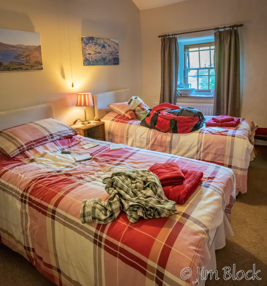
The room was quite small, and the bathroom was down the hall. But it was a very pleasant place. When I asked our hostess, Heather, what time breakfast was, she gave me the right answer. She said, “when would you like it?” That was a pleasant change from other lodges, because it allowed us to get an earlier start on a very long next day.
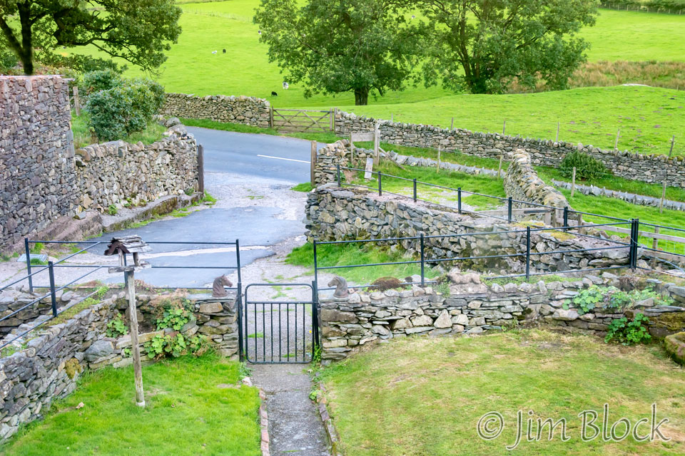
Below is a view of our bedroom and a view of the front courtyards and stone walls from my bedroom window.
When Stephen arrived I shared the sandwich I had bought earlier that morning. That was sufficient dinner for two tired hikers.
Hidden slightly behind the curtain on the right side of the window in the photo above was a basket of goodies that Heather had put out for her guests. Stephen discovered some ibuprofen in the basket. This was just what he needed for his aching knees.
I took a great hot bath with some “muscle relaxer” liquid poured into the tub. That was a far better way to spend the evening then wolfing down a huge meal. In my notebook I recorded that I was in bed falling asleep before 8 PM. It was going to be a very long day tomorrow, and we had to walk some extra distance at the beginning just to get back to the Coast-to-Coast trail.
![]()