Patterdale to Shap
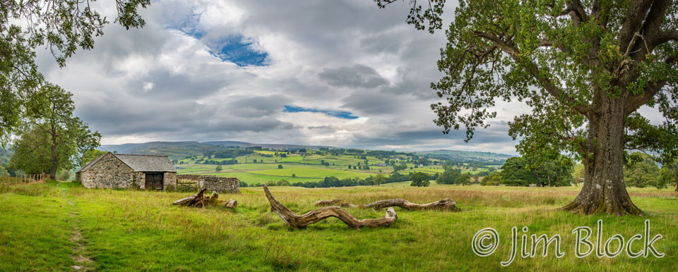
Up at 6 AM after an excellent 10 hours of sleep and raring to go. Yesterday was a long, very exciting day yesterday, and this day was going to be even longer. At 6:30 AM I took this photo from the Noran Bank Farm dooryard.
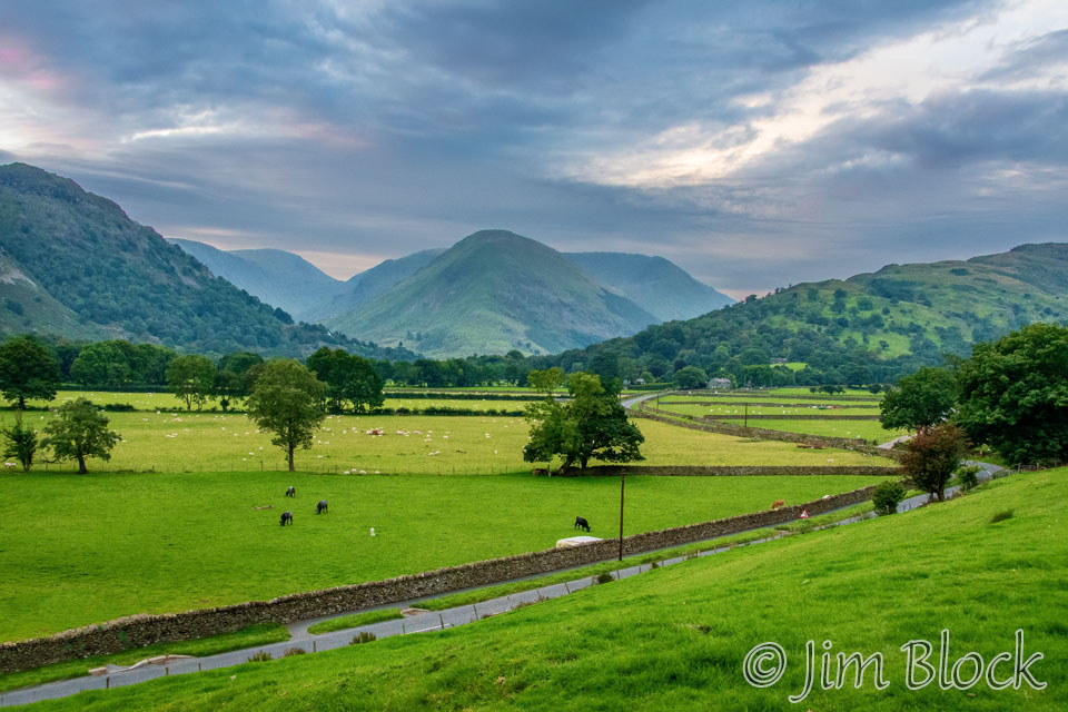
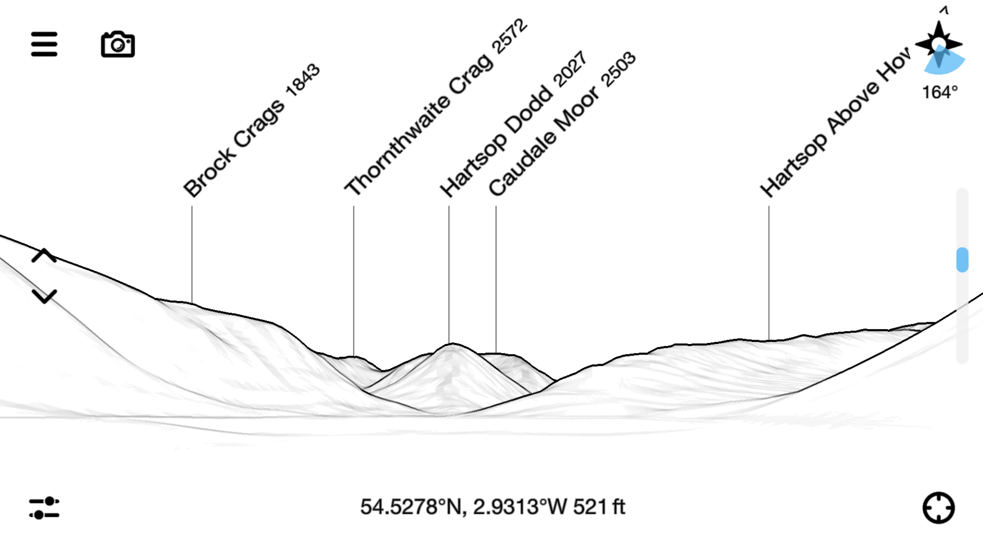
“PeakFinder” is an amazing app. On my iPhone, I went to Viewpoint selection> Peak directory and entered Arnison Crag, which is the hill behind Noran Bank Farm. Then to Viewpoint selection> Map, and I quickly zoomed into Noran Bank Farm on a satellite view that showed the farm buildings in great detail. Then I hit the Fly (bird icon) button and quickly got to this drawing. Look at how closely it matches the photo above.
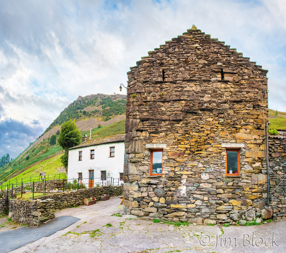
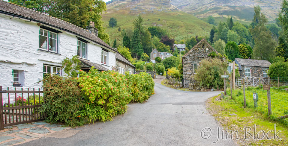
Still before breakfast, I took this photo. It shows the white farmhouse, dating back to 1617, where we stayed and the stone “Shepard’s Crook Bunkhouse” on the right side of the photo. This is a very wide angle view that makes the bunkhouse look much larger than it is.
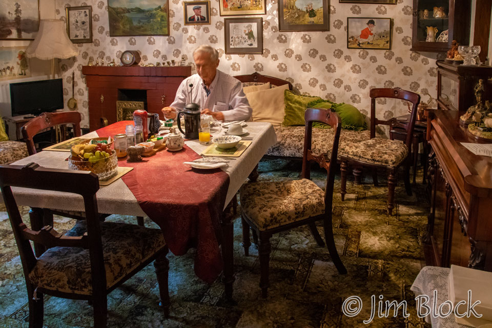
We had breakfast at 7 AM — a great time to start the morning. There was a splendid variety of fresh fruit with our breakfast. This was the only meal I had the whole trip where the pepper was served in a real grinder rather than that terrible powdered stuff that seems to be so prevalent.
The photos and drawings on the wall of the dinning room are of Heather’s father, Anthony Barker, a very well know figure in the local hunting world. Thank you, Heather, for a pleasant stay at your B&B.
By 7:40 AM we were heading back toward town to pick up the Coast to Coast path.
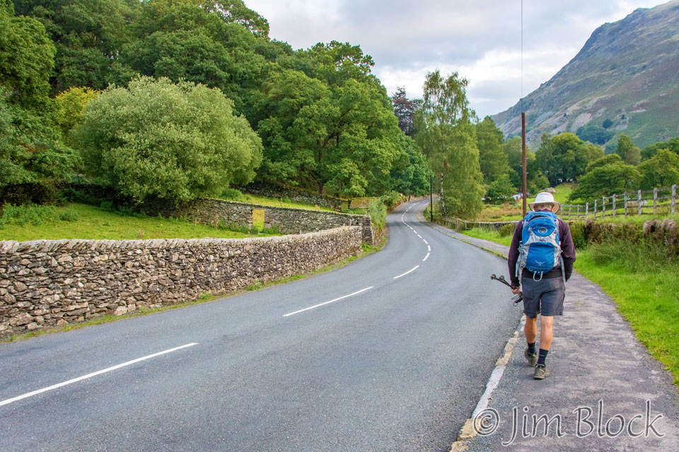
Around 7:50 AM we turned right onto the C2C path just before the White Lion Inn where Jim spent the night. This was 10 minutes before Jim would even start eating breakfast.
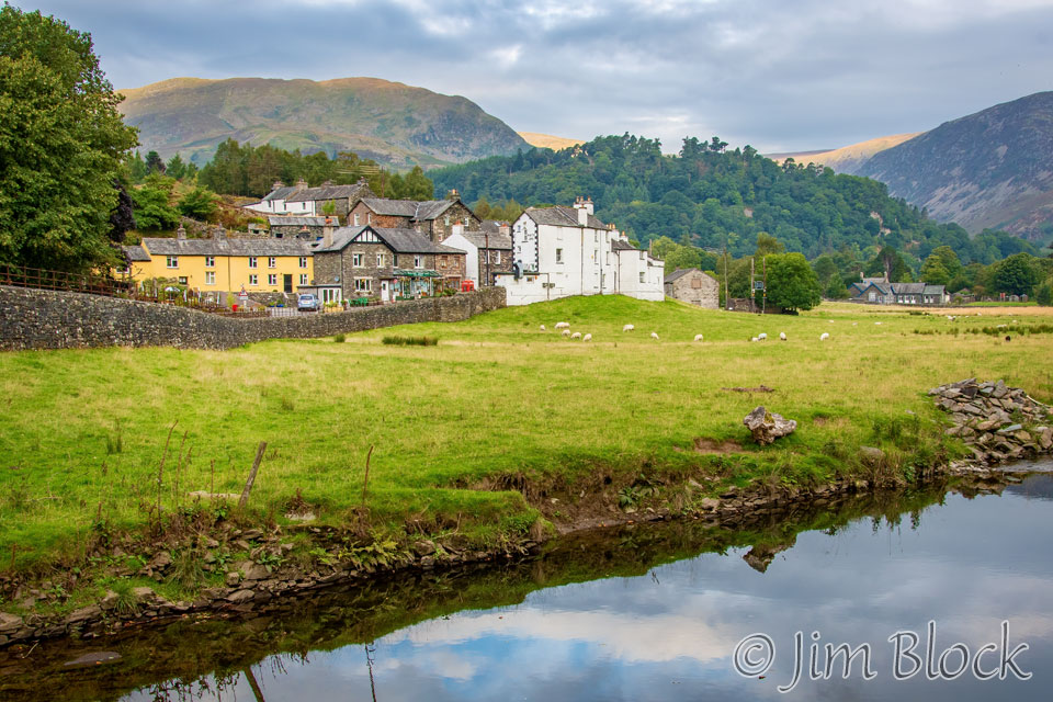
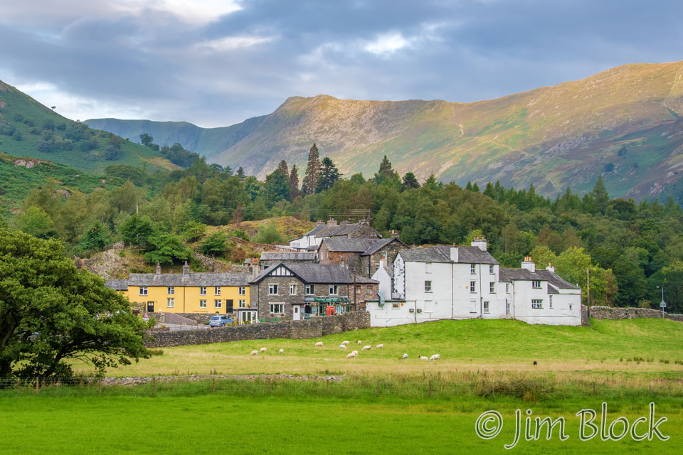
The White Lion Inn is the white building seen in the background in the two photos below. In the photo on the right, Helvellyn is above and a bit to the left of the White Lion, and Nethermost Pike is above the yellow building. We hiked over these peaks the previous day.
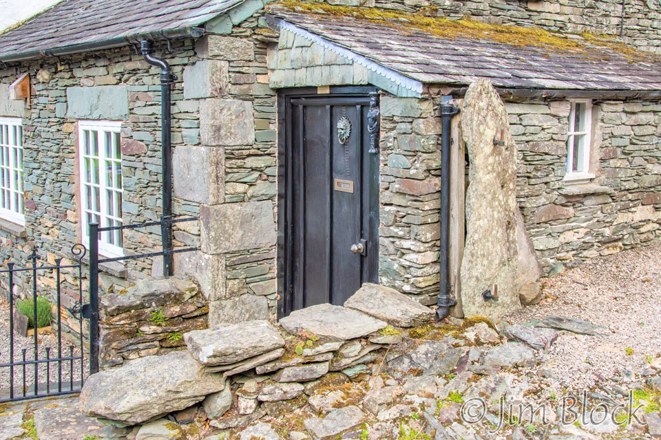
As we walked through part of Patterdale village, I photographed a few of the interesting stone buildings.
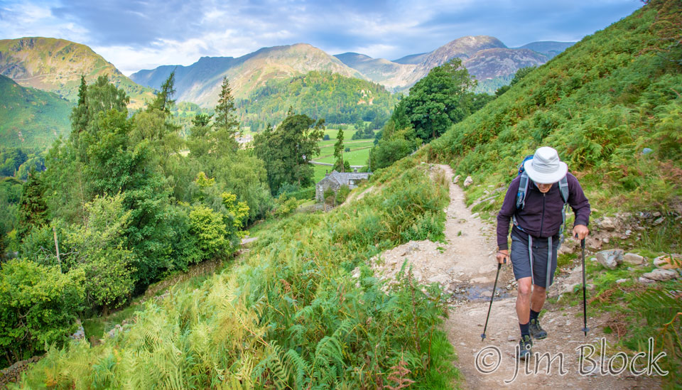
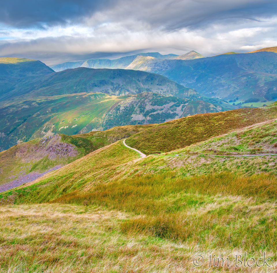
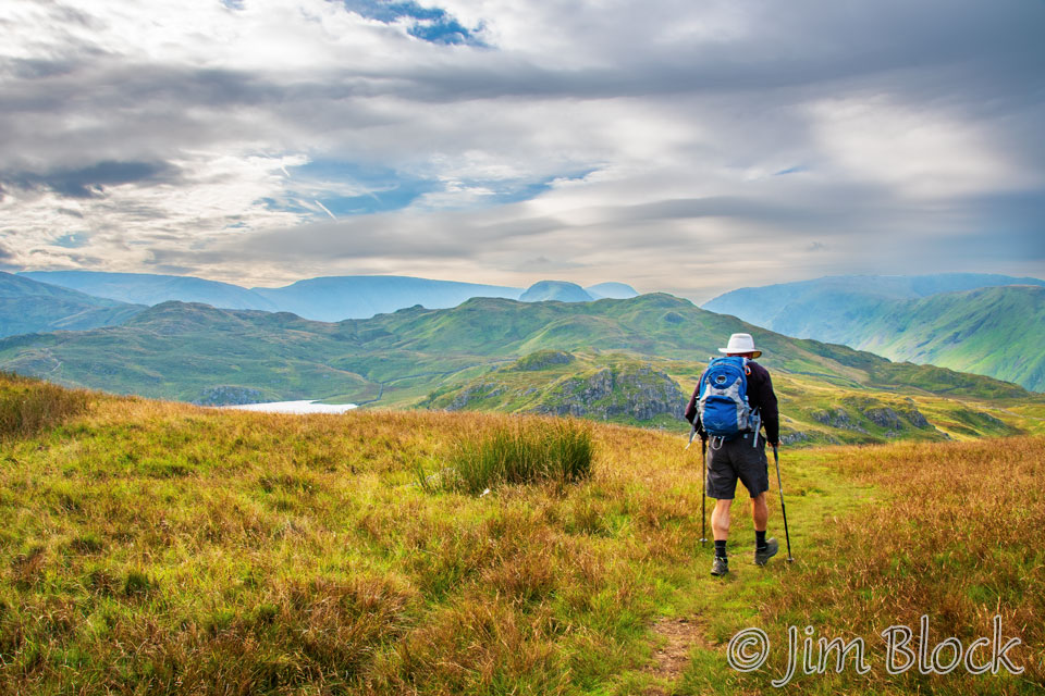
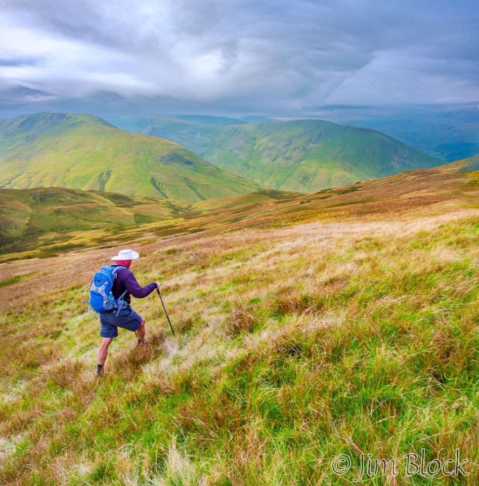
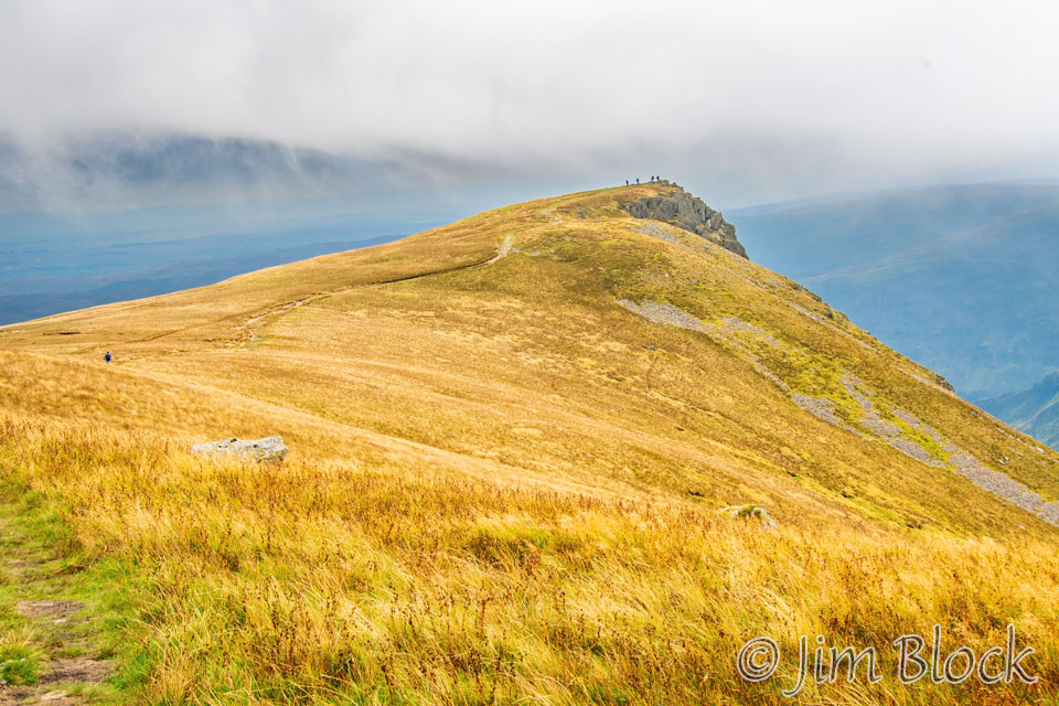
We soon started the long uphill climb that would dominate the first few hours of the day. We would quickly gain 2000 feet in elevation, but the amount of uphill was more than that since there were some downhills mixed in. By the end of the day we would do 4400 feet of “up”. Here is Stephen heading up the path.
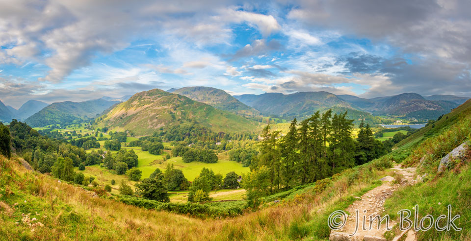
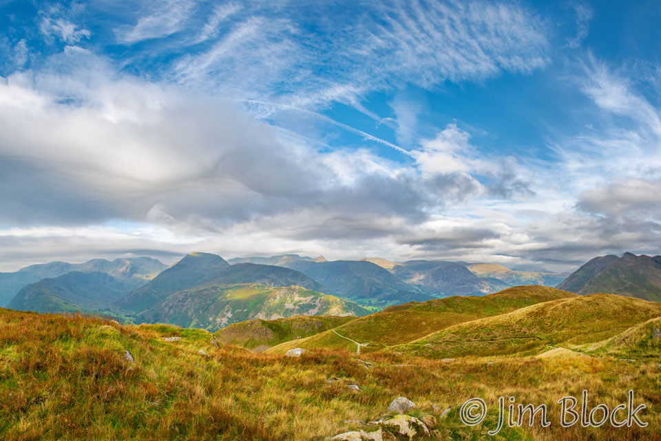
Below is the view looking back as we left Patterdale. The village of Glenridding and Lake Ullswater can be seen in the right part of this photo.
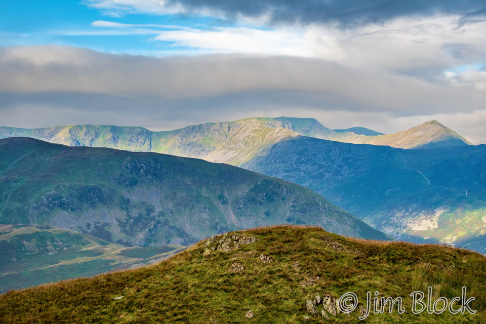
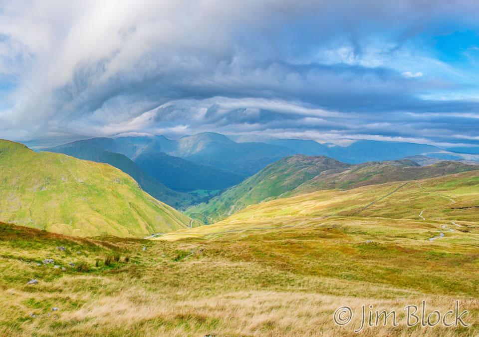
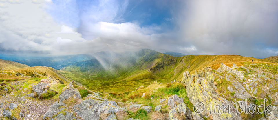
As we climbed, we got some great views of where we hiked the day before. We had crossed Nethermost Pike and Helvellyn before scrambling along the amazing Striding Edge and then down into the village of Glenridding and along the narrow road to Patterdale. The two circles indicate the Noran Bank Farm on the left and the White Lion Inn on the right. The hill behind Noran Bank Farm is Arnison Crag.
-WITH-LABELS")
")
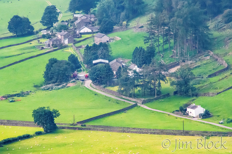
As we climbed, I took this photo looking back at some farms.
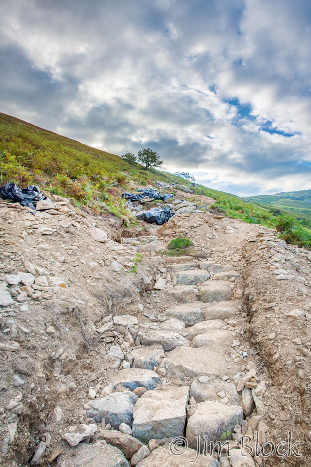
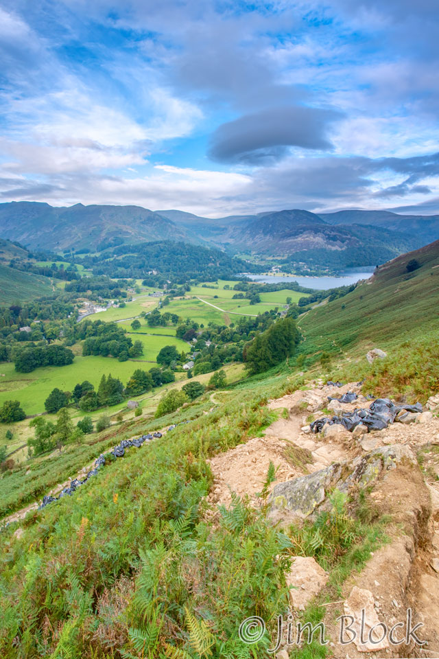
Part of the trail was under repair as can be seen in the two photos below. The black bags contain rocks dropped by helicopter.
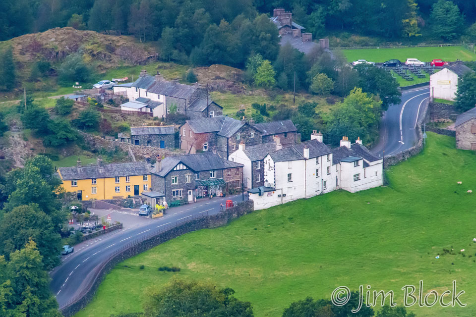
Looking back I got this photo of the village of Patterdale and the White Lion Inn.
Here are three photos of the charming Noran Bank Farm where we spent the night with Heather, who took good care of us.
")

We met a young woman out for an exhilarating mountain bike ride. Here are some photos of her with Stephen and heading up the slopes.


")
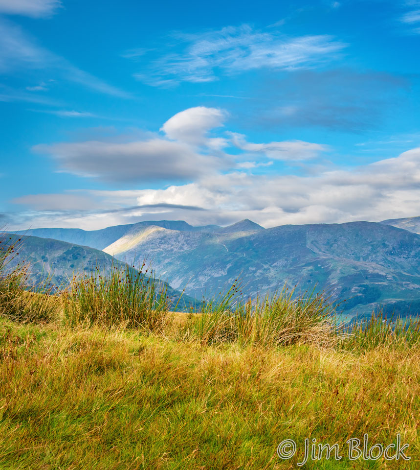
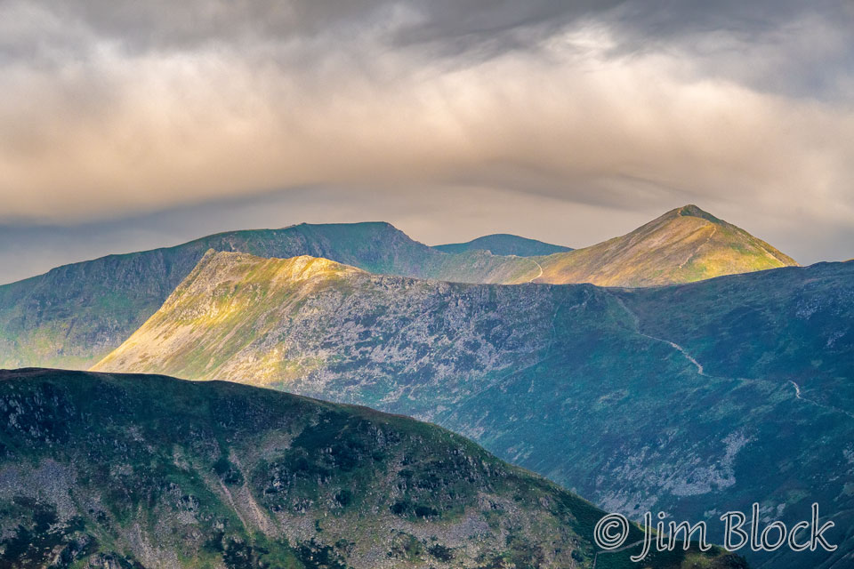
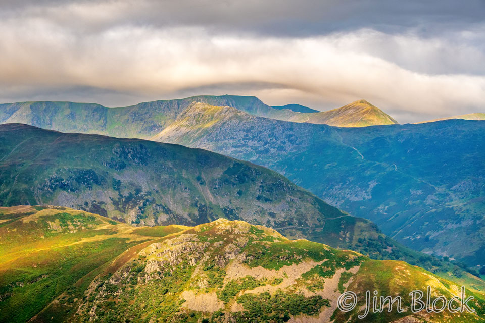
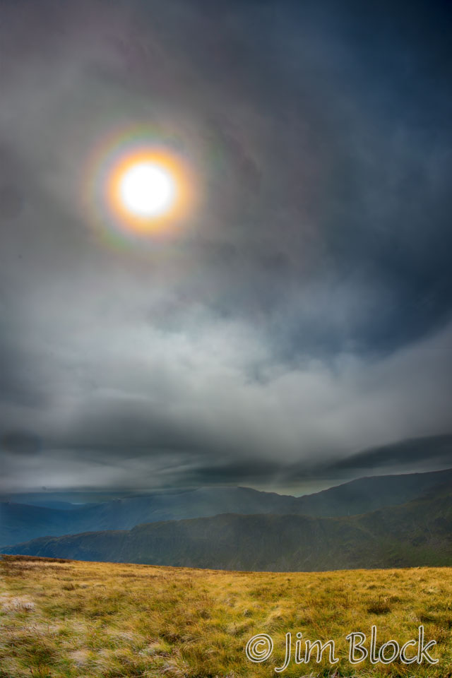
This was a cold and windy day. We could see some early clouds building over Helvellyn. We were happy we there the day before instead of today, as it appeared the summit and possibly also Striding Edge would soon be engulfed by the clouds. Helvellyn is just to the left of center in the photo below under the thin dark cloud. Below it you can see the ridgeline of Striding Edge lit by the morning sun. To the right is Catstye Cam with its pointed peak.
Fifteen minutes later, the clouds over Helvellyn and Striding Edge had changed.
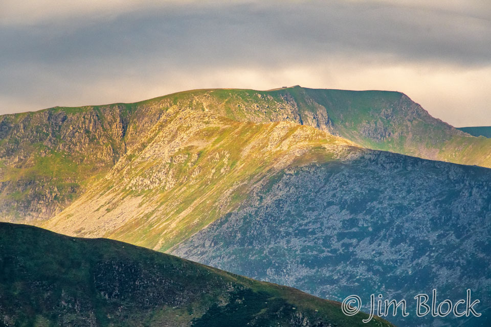
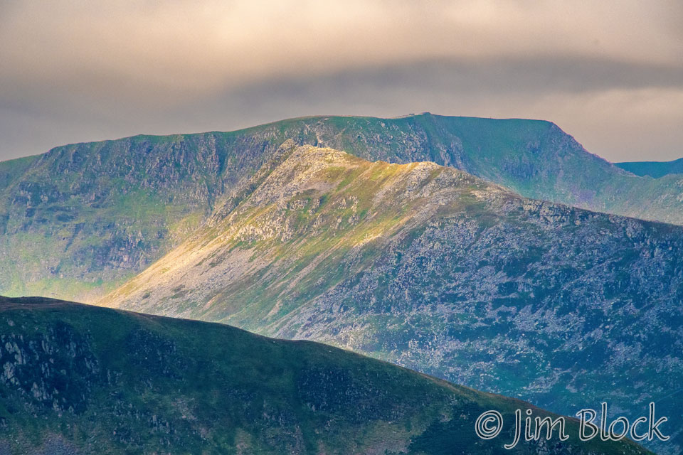
I zoomed in on Helvellyn and Striding Edge and got the photo below. You can see the summit of Helvellyn and the little square rectangular element which is the cross-shaped wind break near the summit. Below the summit, heading left to right in the photo, is Striding Edge. This is a very different view of it than we had the previous day when we scrambled along the knife edge.
Ten minutes later, I took the pair of photos below looking back at Helvellyn, Striding Edge, and Catstye Cam.
Just three minutes later, I got the three photos below. The top one is a cropped portion of a 14-photo panorama. Helvellyn and Striding Edge are near the center of the photo. To the left is the dark peak of St Sunday Crag. In the second two photos, we zoom in closer and closer to Helvellyn and Striding Edge.
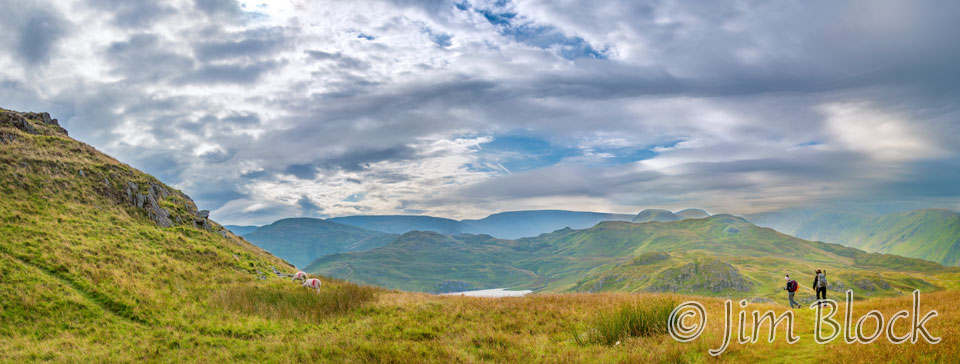
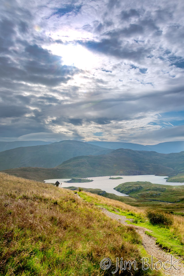
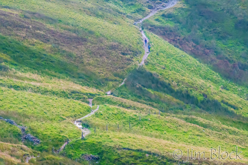
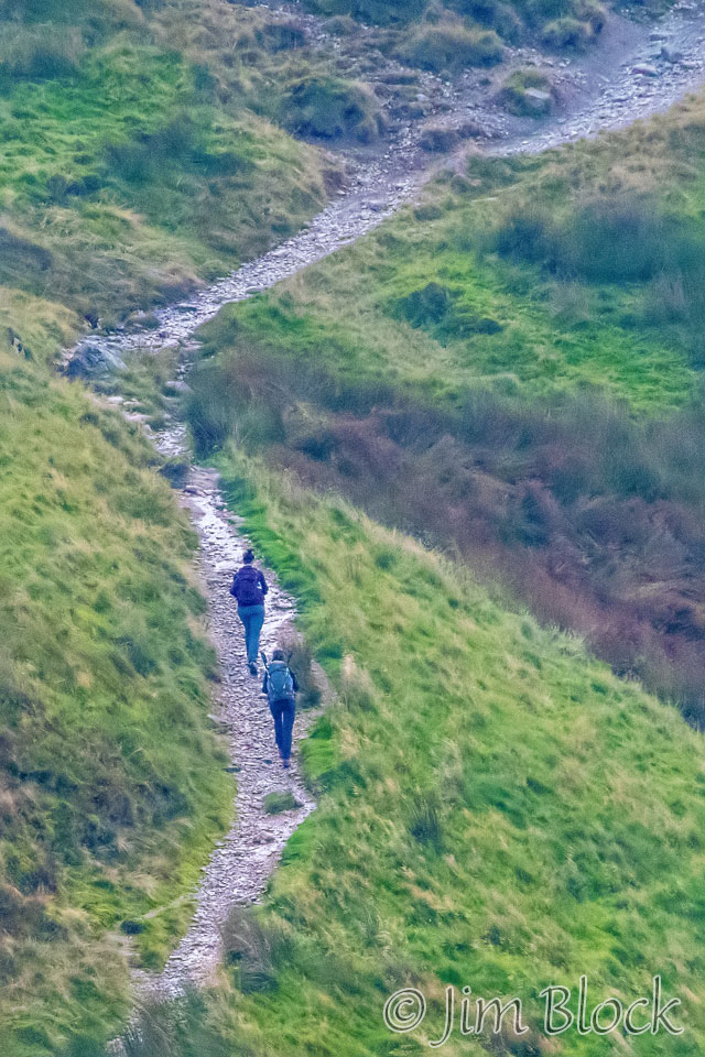
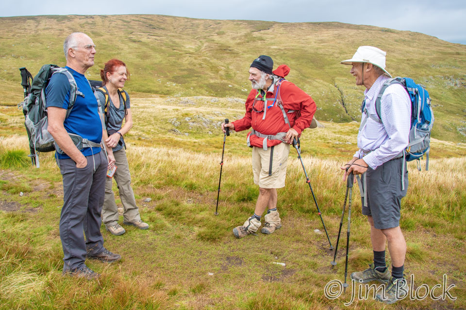
We caught up with Kim and Paige at a trail Junction. Shortly after that we reached a spot where we could see Angle Tarn in the distance.
Here are two photos of Stephen heading down toward Angle Tarn.
Below are four images, each composed of between four and nine photos, showing the trail down toward Angle Tarn. You might be able to spot some faint iridescent clouds in some of them.
")
")
")
")
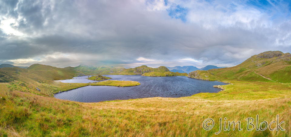
As we were passing Angle Tarn, I made the 14-photo panorama seen below.
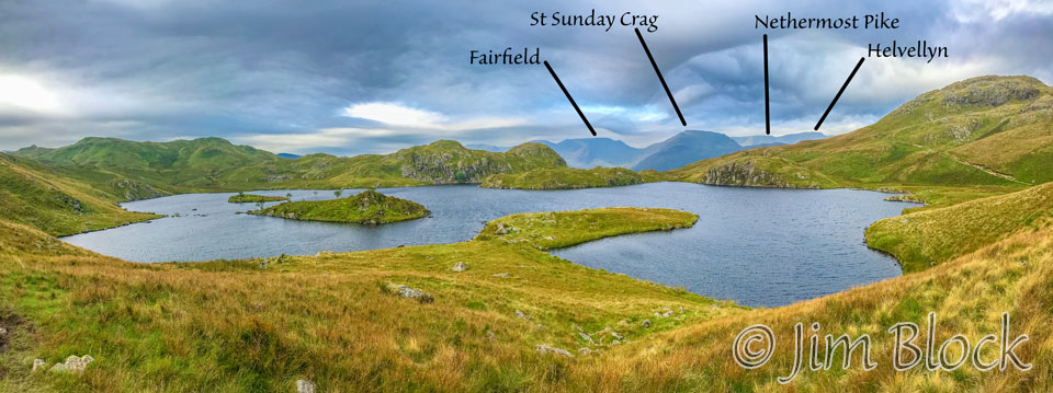
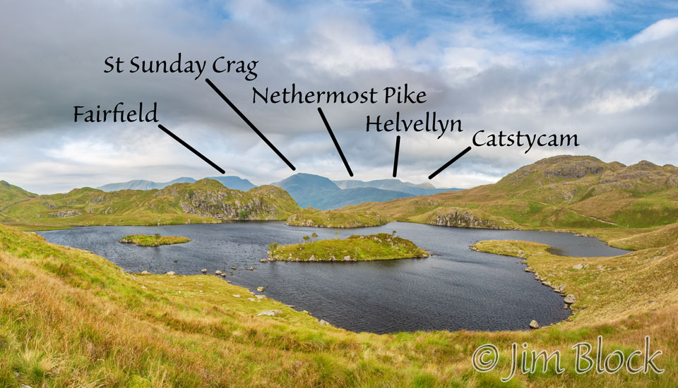
Below is a four-photo panorama taken with my iPhone looking across Angle Tarn. I have labeled the key peaks we saw the previous day. We hiked behind Fairfield and St Sunday Crag and over Nethermost Pike and Helvellyn.
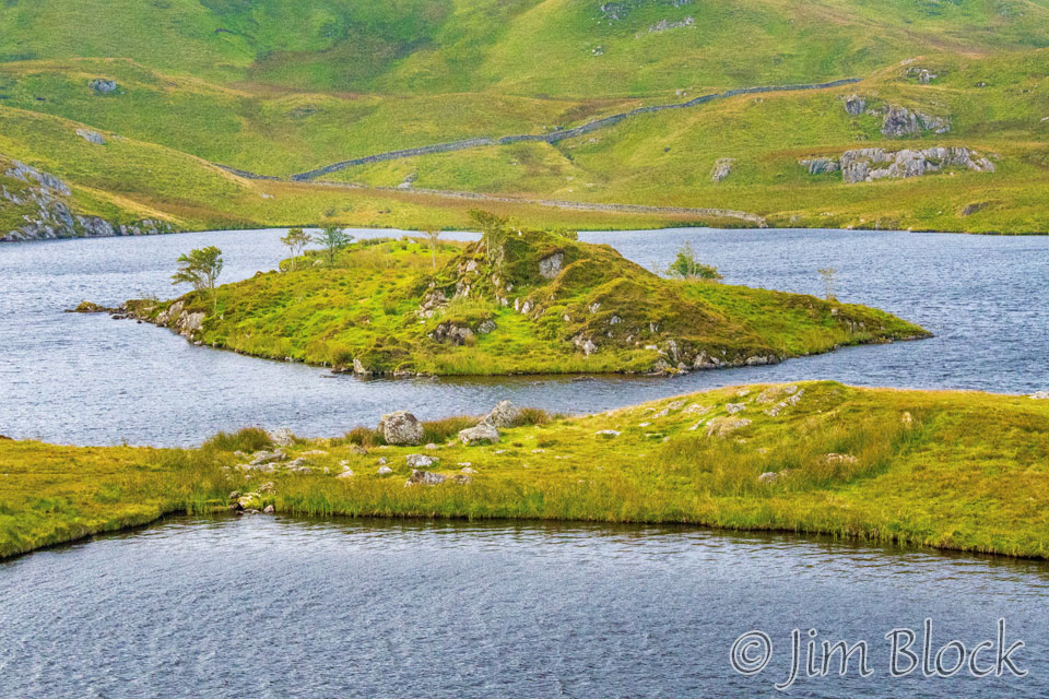
Angle Tarn has two small islands, one of which is seen below. The land below the island in this photo is a peninsula, or at least it was the day we were there. Perhaps when the preceding months are not so dry, it would be an island too.
Here is another labeled view of the distant peaks as we looked across Angle Tarn while passing it.
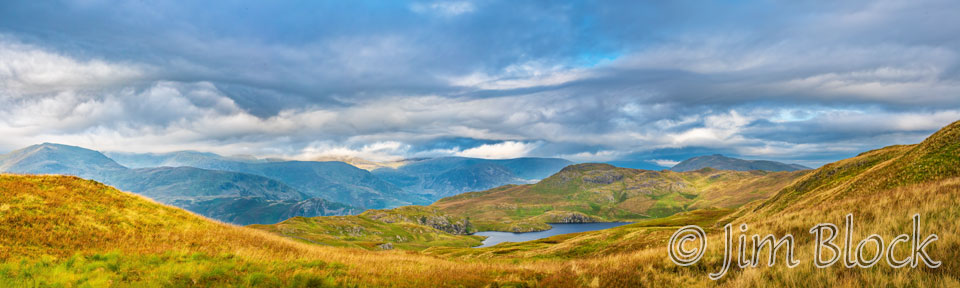
Here is a final look back at Angle Tarn. In the far distance, St Sunday Craig is in the center of this 15-photo panorama. You can see the clouds moving in on the distant mountain peaks.
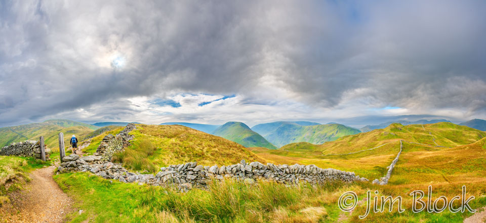
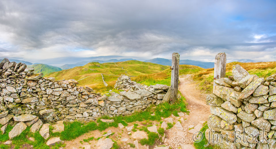
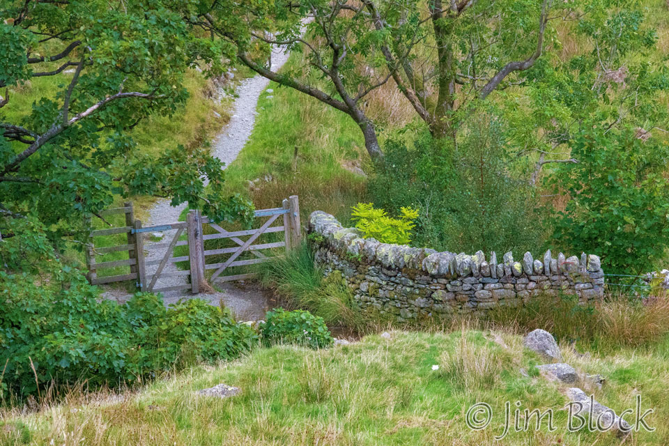
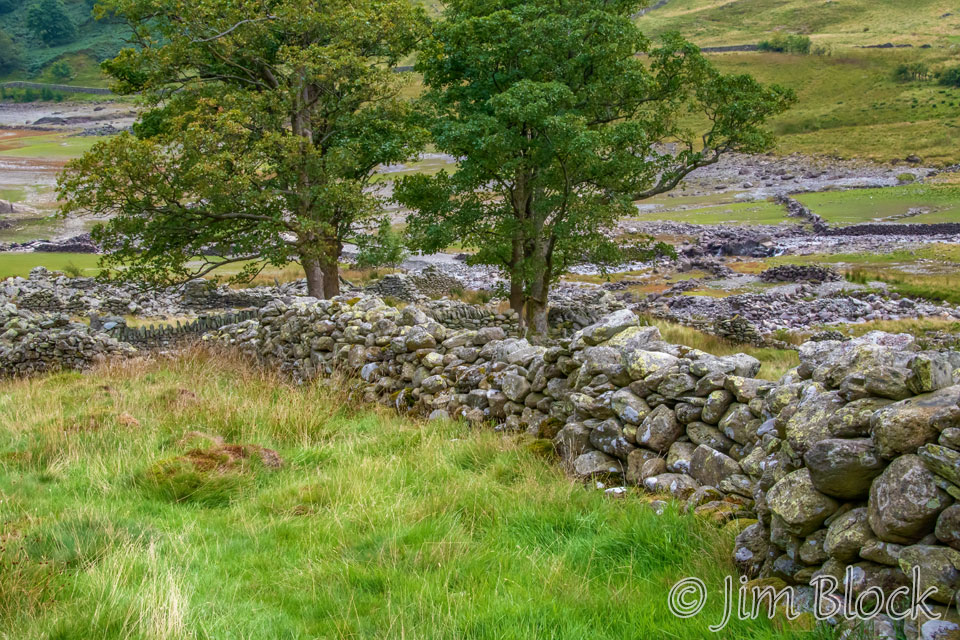
We passed through an impressive series of stone walls. Below are two photos of us passing through a gate that no longer existed. It was cold and very windy so we sheltered next to this wall for a short while and had a snack.
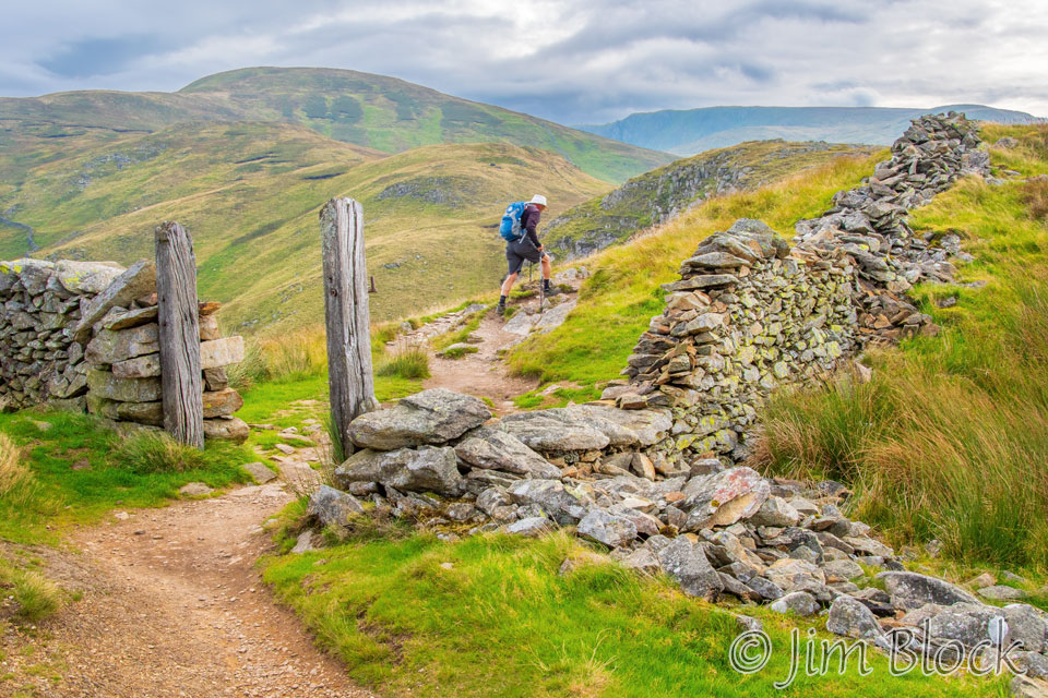
We reached another absent gate along the trail.
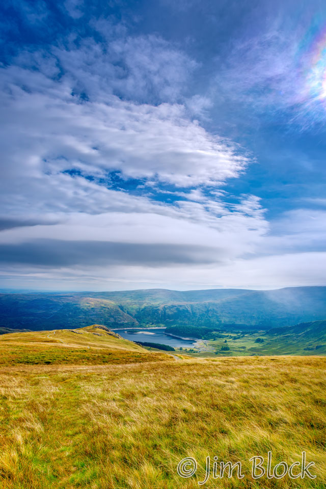
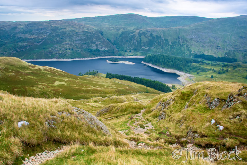
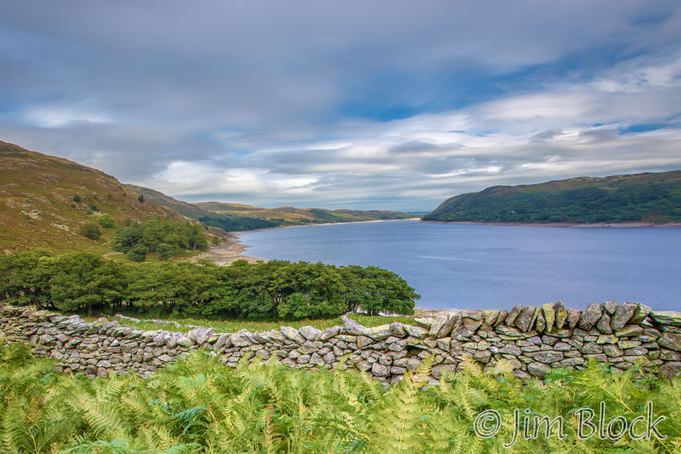
We were climbing and descending and climbing again as we headed toward Hayeswater, seen in the photo below. We would pass well above it.
At this point, Paige and Kim were somewhat ahead of us. They must have moved fast because I did not see them again until the afternoon of the next day.
Below is another view of Hayeswater as we got closer to it.
You can perhaps tell how cold and windy it was by the wrapping Stephen had around his head and ears.
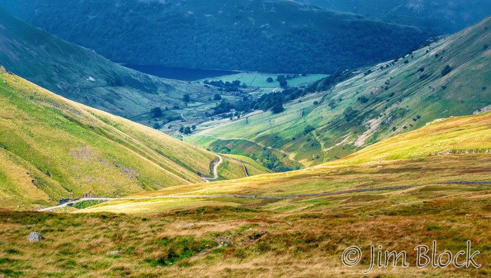
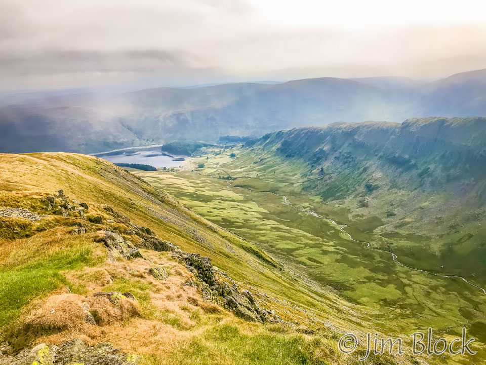
As we approached The Knott, we saw some dramatic clouds over St Sunday Crag across the valley in the center of this photo. Helvellyn, Striding Edge, and Catstye Cam are in the clouds to its right. Fairfield and Dollywagon Pike are to its left. In the valley is the village of Hartsop, which is about 2 miles south of Patterdale where we spent the previous night.
Here is a zoomed in view of Hartsop. You might be able to spot the dark blue of Brotherswater just to the left of the green fields.
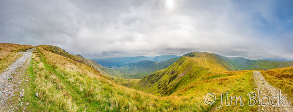
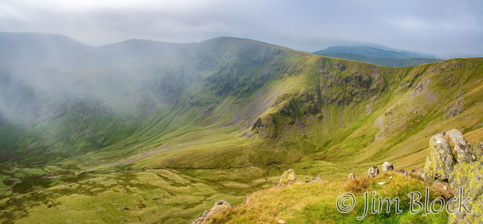
Below is a photo of a sharp left turn that some folks on the trail ahead of us missed. You can see them ahead on the far right of this 16-photo panorama. If they would have kept going they would have climbed High Street, which you can see in the middle right of the photo. From High Street one can either backtrack to this spot or take the east ridge down to the southern end of Haweswater Reservoir that is at the far end of the valley in the photo below. There the C2C path could be regained.
Wikiloc on my phone told me that the correct C2C route was a left turn along the path that you can see on the left side of the photo. I yelled to the other folks and they turned around, not wanting to hike up to High Street on this already very long day.
Twenty minutes later I made the seven-photo panorama below. The small dark peak to the left of center is Kidsty Pike. High Street is on the right side of the image. The Riggindale Beck Valley is in the center.
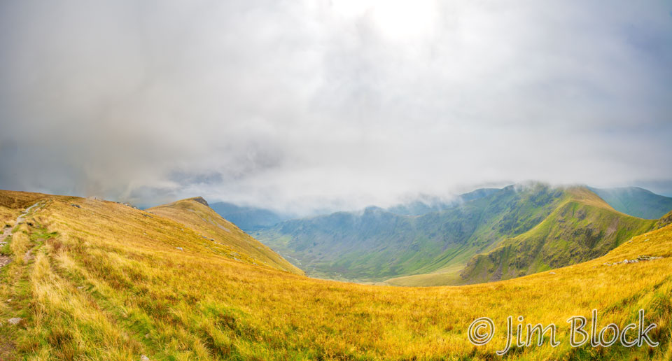
The clouds were getting lower. It now appeared that if the other folks did climb High Street and take the east ridge down to the southern end of Haweswater Reservoir, they might have been walking in clouds or fog.
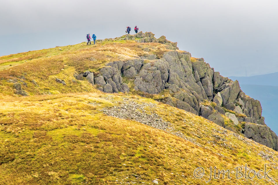
Earlier, when we sheltered against a stone wall, we met four women who were making a special trip to Kidsty Pike because they got lost and missed it on a previous trip. Perhaps they missed the sharp left turn shown above. In any case, this day they were hiking up to the summit of Kidsty Pike and then heading back down. When I met them again at the summit as they were leaving it, they said “don’t follow us”. They were heading back somewhere down a different trail. Below are wide and telephoto views of them reaching their destination for the day.
Below is a photo taken with my iPhone showing the Riggindale Beck Valley and the beginning of the Haweswater Reservoir. I stared down at it looking for a parking lot and concession stand, thinking I might stop for a bit of lunch, not realizing at the time it was a reservoir.
Here is a view down to the beginning of the Riggindale Beck Valley.
This 33-photo panorama shows a very wide view of the valley from Kidsty Pike. You might be able to spot a piece of the Heweswater Reservoir at the left end of the valley. High Street is partly in the clouds across the valley in the center. The figure at the far right is Stephen approaching.
I spotted some iridescent clouds from Kidsty Pike. They are revealed dramatically in the underexposed top part of the photo below left. Looking down toward Haweswater Reservoir from Kidsty Pike, one can see a little cloud iridescence in the top right of the photo below.
Resting at Kidsty Pike a while, I nibbled on a bit of cheese. Stephen caught up to me. He arrived with Bob and Birgit from the Boston area. Soon after, Jim arrived.
We still had a long way to go, but fast-walker Jim wanted to stop for a lunch break. So I proceeded on ahead on the longest descent of the walk, 1700 ft down to the partly dried-up reservoir.
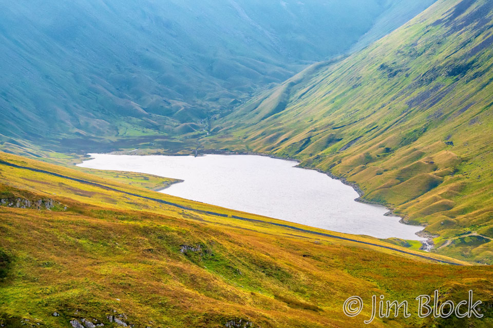
For the next 90 minutes Bob and Birgit walked sometimes with me, sometimes ahead, and sometimes behind as we reached and then walked along the Haweswater Reservoir. Here is our descent to the reservoir. Notice how low the water is in the reservoir. This was an extremely dry year, at least until the 7th day of our hike.


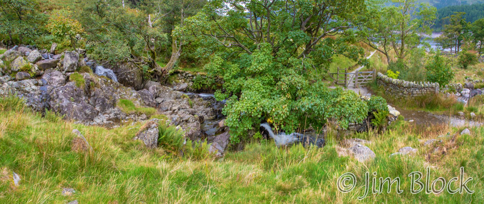
There was a bridge over Randale Beck and a gate just beyond it near the end of the long downhill.
Randale Beck is a small stream flowing into the reservoir. Here are a few photos of it from near the bridge.
Below are two photos taken from near the bridge. The first one was shot with my iPhone. In them you can see the remains of the Mardale, discussed below.
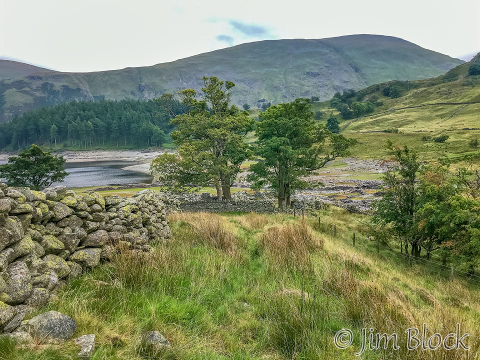
Earlier, I pictured an easy, level walk along the shore of a beautiful lake. Instead, the trail was up-and-down and up-and-down, steep and rocky in parts, and muddy in other parts. Along most of the almost 5 mile hike near the reservoir, we couldn’t even see it. We were sandwiched between a hill on our left and a fence and shrubbery guarding the reservoir on our right.
Stedman, in his “Coast to Coast Path” book, says it better that I. On a map he labels the first part along the reservoir as an “annoyingly steep climb”. Then he says about the walk along the reservoir: “… a lakeside amble while spinning your dainty parasol is sadly not in the cards. You’re soon panting like a hippo on a treadmill high above the shore … until the dammed waters terminate …”
The best views of the reservoir came early on after that annoyingly steep climb. The dam is at the far end of the reservoir around the bend to the right in the two photos below.
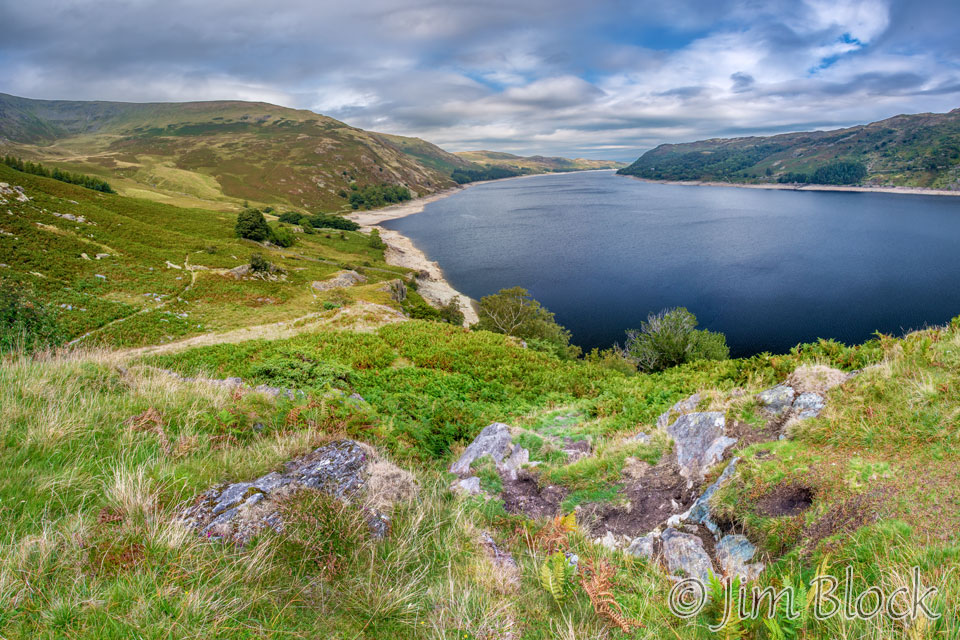
Heweswater was originally a natural lake about 2.5 miles long. In 1929 work was started to build a dam across the valley floor in order to supply water to the city of Manchester. The local public rebelled against this move without success.
The farming villages of Mardale and Mardale Green were flooded and the picturesque valley was destroyed, or at least greatly altered. Hundreds of villagers were evicted from their homes. Most of the buildings were blown up by the Royal engineers who used them for demolition practice. The 18th-century Holy Trinity Church was dismantled and, as perhaps an extra insult, the stones were used to construct the dam. All the bodies in the churchyard were exhumed and reburied in Shap, where we spent the night. They probably slept much better than Stephen and Jim who had a room just above the very noisy lounge of our hotel.
Alfred Wainwright lamented the passing of the old valley. He wrote: “Mardale is still a noble valley. But man works with such clumsy hands! Gone forever are the quiet wooded bays and shingly shores that nature had fashioned so sweetly in the Haweswater of old.”
The remains of Mardale were again visible during a heatwave in 2014 when some of the reservoir dried up. This also happened a month or so before we arrived in 2018. You can see how low the water is in a few of the earlier photos on this page.
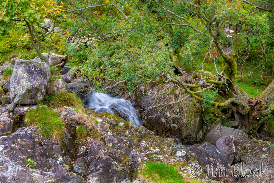
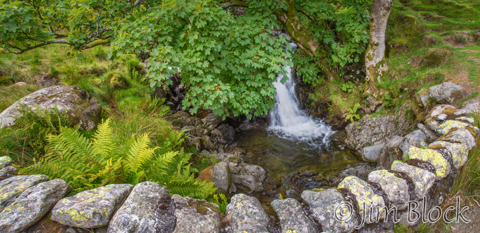
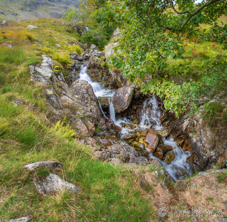
During my 90 minute walk along the reservoir, I took almost no pictures. The scenery was very uninteresting. One photo I did take was of one of my favorite subjects – moving water – here the Measand Beck.
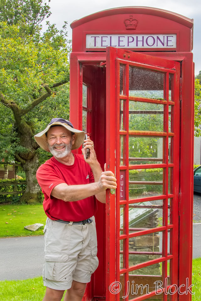
When I reached the small village of Burnbanks, I stopped briefly to rest on a bench in the small village green. Jim arrived shortly after me. Although he had stopped for lunch earlier, he is quite a fast walker, so he caught up. Jim took a photo of me making a gag phone call with my iPhone in a British telephone booth. Stephen’s knees were giving him a lot of trouble on the way down. I believe he was a ways back at this point.
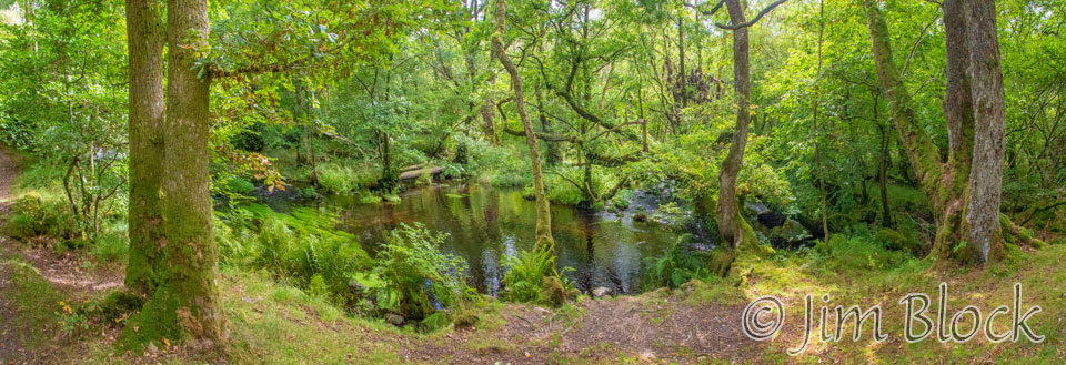
Just outside of Burnbanks was a pretty area along Haweswater Beck, which I captured with this four-photo panorama.
The remainder of the walk to Shap was quite pleasant. Over the next 30 minutes I took the photos in the slideshow below. Two of the photos were taken with my iPhone.


")
Here is a 13-photo panorama of the area seen in several of the photos in the slideshow above.
I was approaching the village of Rosgill. Here are some photos as I walked toward it and then turned to the right just before the bridge.
")


")


")
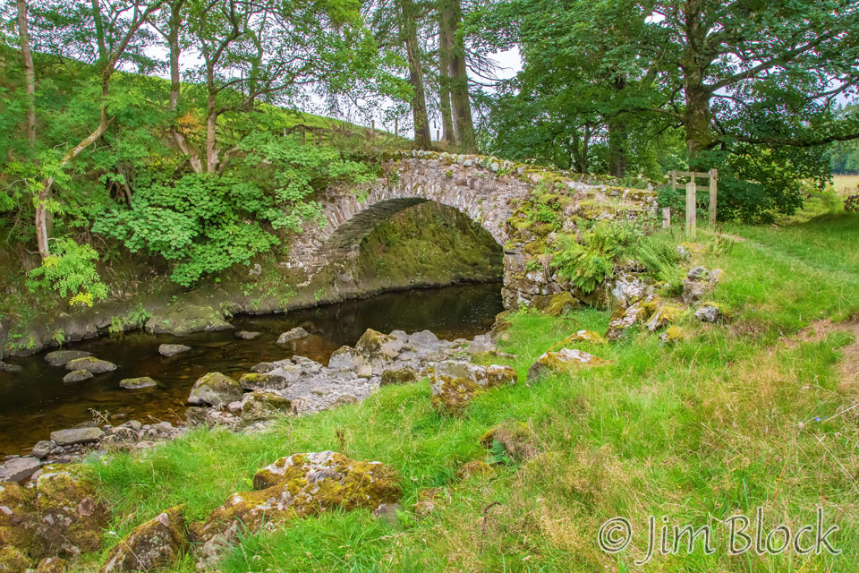
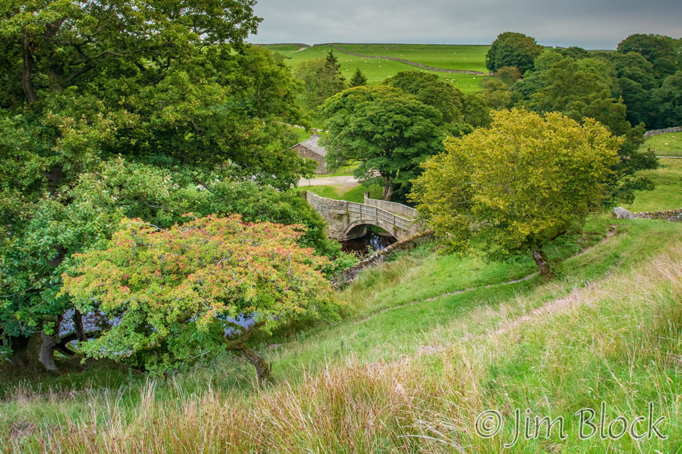
The next landmark was Parish Crag Bridge, also known as Packhorse Bridge. Stone arch bridges are amazing pieces of construction. We have a number of them not too far from where I live in New Hampshire.
I entered the farmyard of a ruined farm house and took a wrong turn. I should have gone through the gate you can see at the right side of this photo.
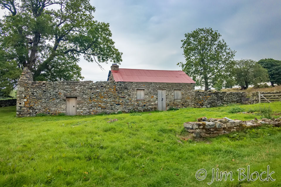
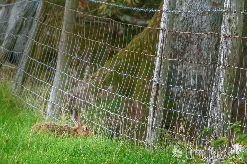
But instead I was attracted by other elements in the farmyard and turned left to take some photos. My Wikiloc app on my phone beeped at me indicating I was on the wrong path. Eventually I found my way to the correct path, but not before twice climbing over a stone wall and also getting a quick photo of a hare.
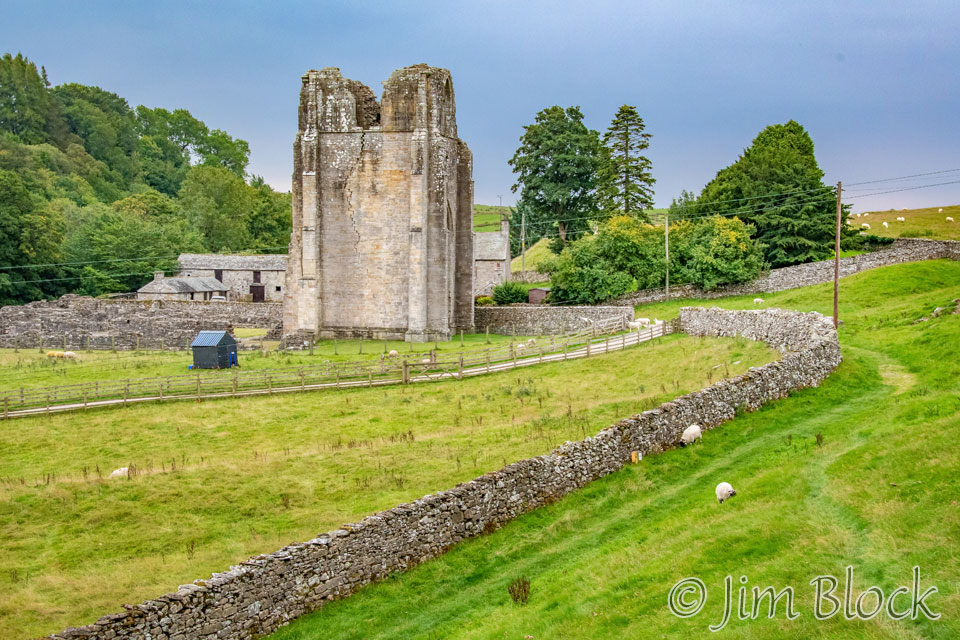
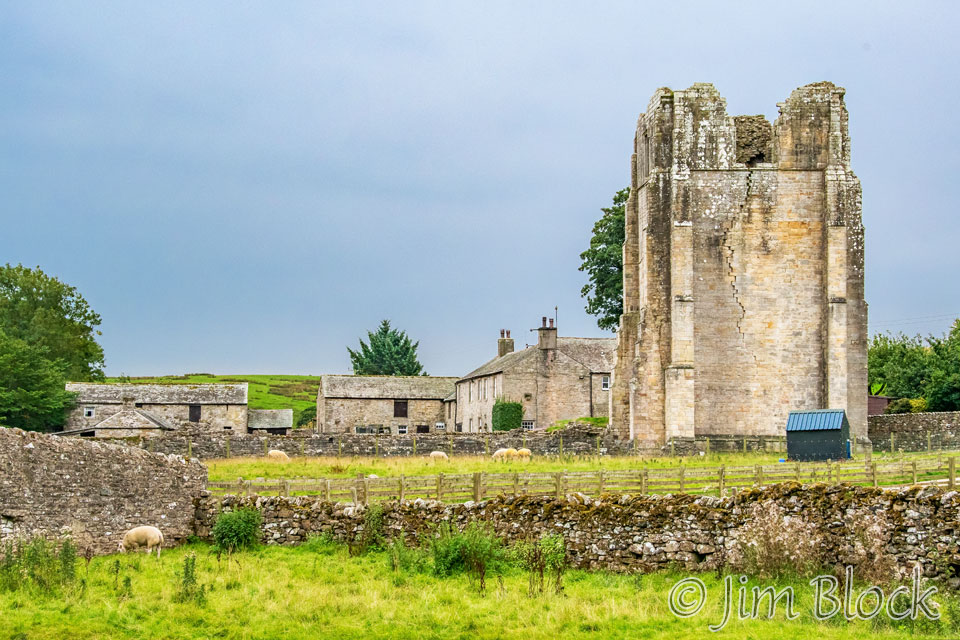
Below is a photo I took as I approached Shap Abbey. That’s River Lowther under the bridge.
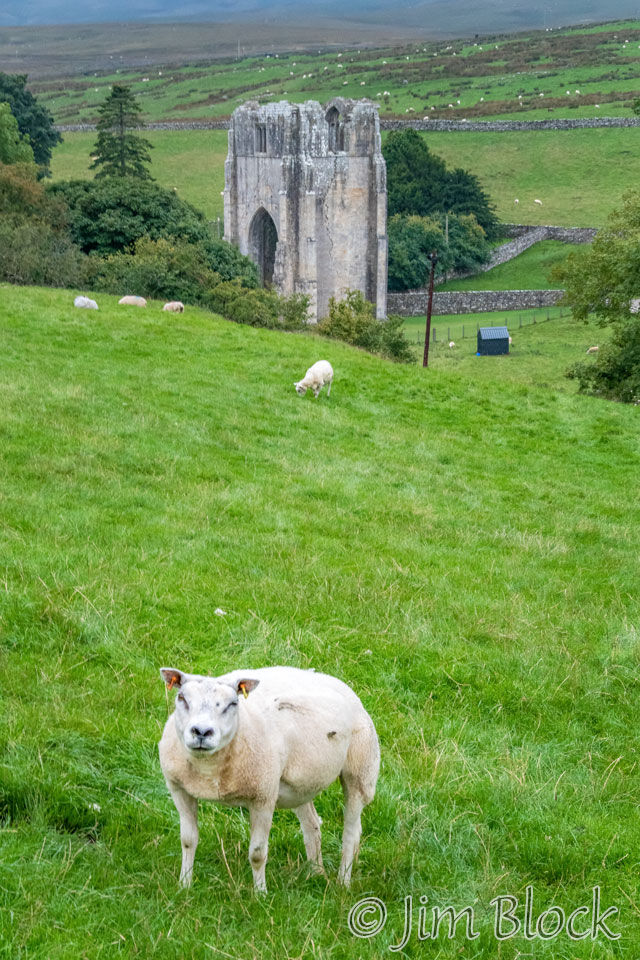
Shap Abbey was the last abbey founded in England, in 1199. The impressive tower was built in the 15th century. Most of the abbey lies in ruins, but the remains of the tower can still be seen, as well as some other buildings.
Stedman comments about Shap Abbey, “It’s just regrettable that, by the time you get here, you’ll probably be somewhat of a ruin yourself, your thought having long turned from holy orders to hors d’oeuvres following a hot bath.” Personally, I wasn’t thinking of hors d’oeuvres or even a big evening meal, but I very much longed for a hot bath. Unfortunately, our hotel only served up cold water and loud music that evening.
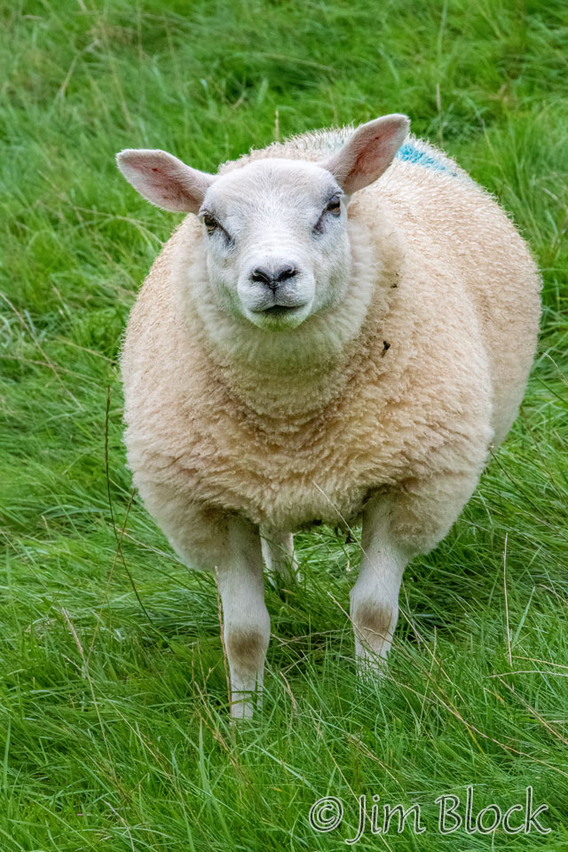
There were sheep on the hill as I climbed above Shap Abbey.
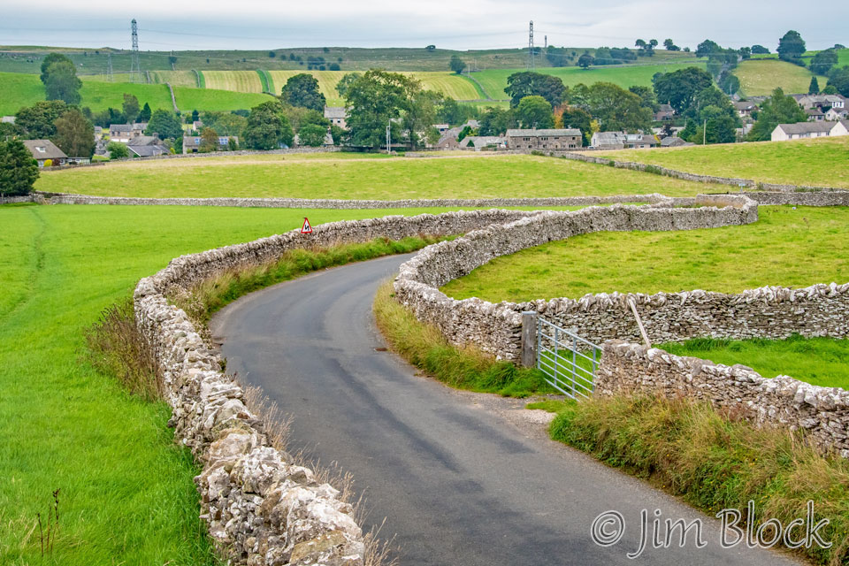
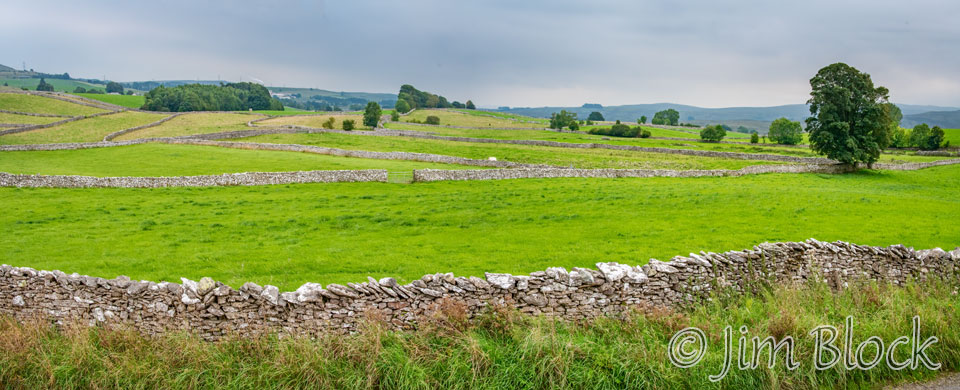
The walk into the long and narrow village of Shap was characterized by many stone walls along the road and in the fields.
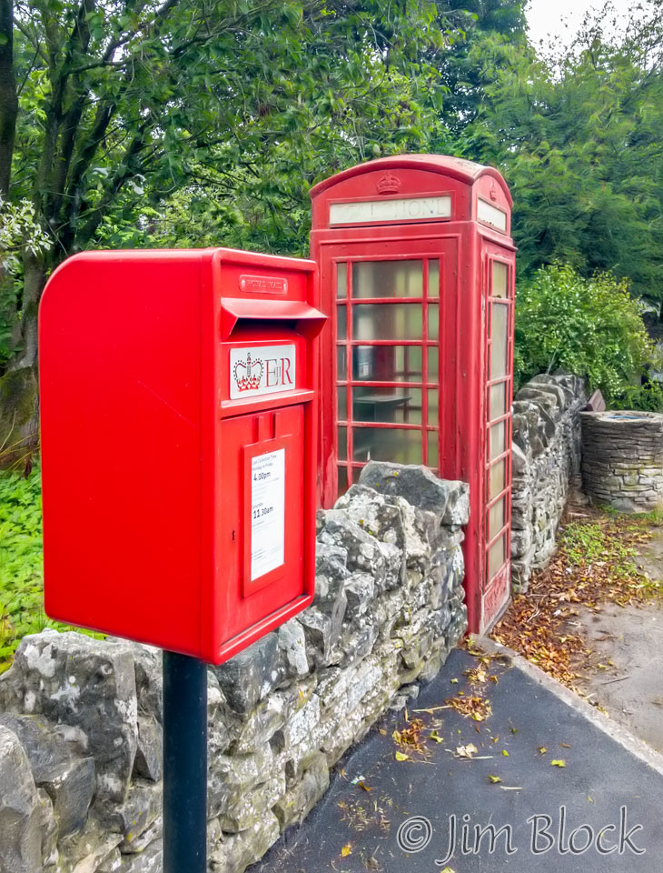
I took a few photos with my iPhone as I walked the mile through the village to our hotel.
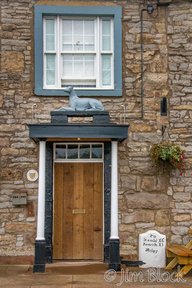
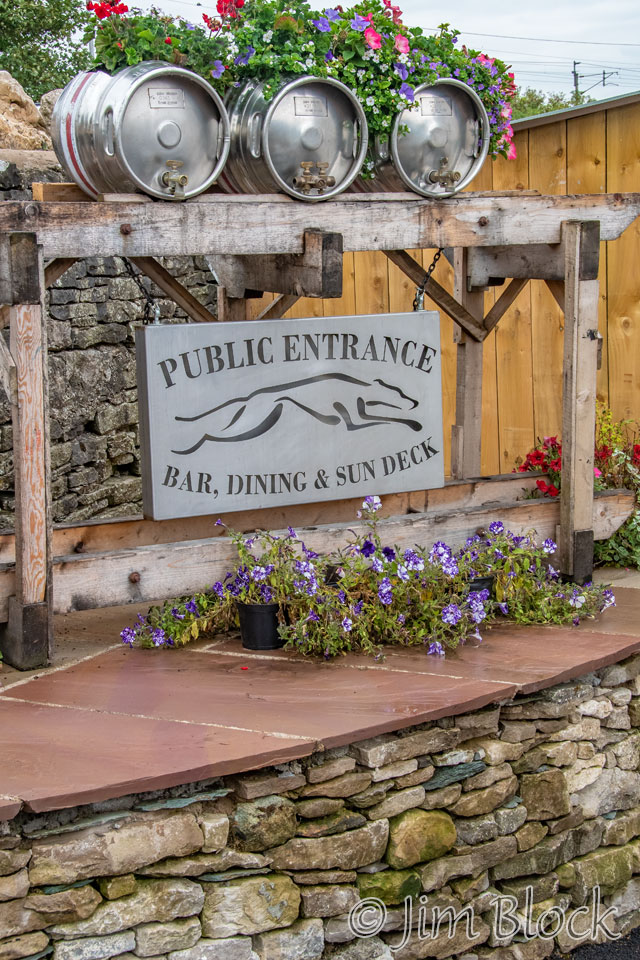
It was a long day — over 17 miles with 4400 feet of elevation gain. I walked for 10 hours arriving at the Greyhound Hotel around 5:40 PM.
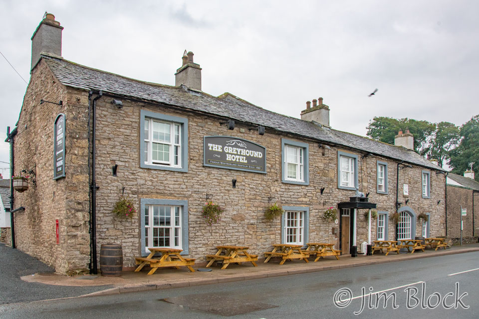
I had a large room and bed. However, there was no hot water in either the bathtub or the shower, something I very much wanted after the cold, long hike. The road outside my front window, which was right above the entrance, was quite noisy as cars were speeding by all night long. The breakfast in the morning was marginal.
It appeared to me that this hotel was more intent on catering to local beer drinkers and party goers then Coast to Coast hikers who needed a good night’s rest and a hot bath after a long walk. I had a poor night’s sleep. But my night wasn’t that bad compared with Jim and Stephen who were kept up until after 1 AM by music from the lounge below their room. The 1680s hotel had been recently reopened under new ownership who hopefully will get their act together by next hiking season.
![]()