This page that has links to pages of words and photos from the Jomolhari Trek that we did mid-November, 2014 in Bhutan. You can click on any image or heading to get to the respective pages.
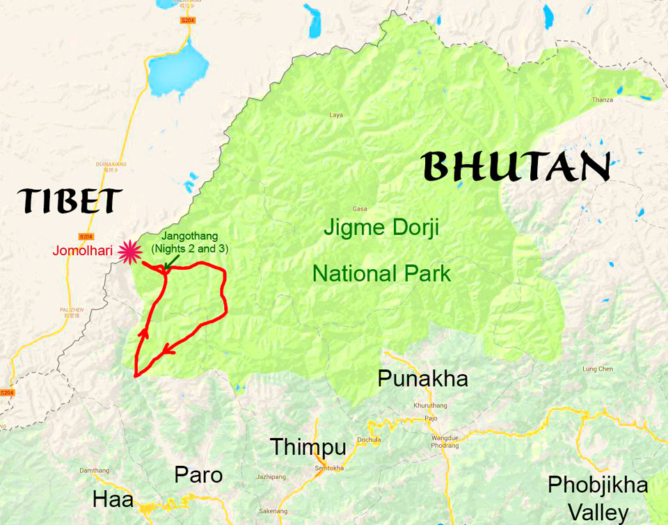
At the top of this page is a detailed view of the trek. At the bottom of this page is a map that shows the approximate route of our trek and some of the key places in Bhutan we visited.
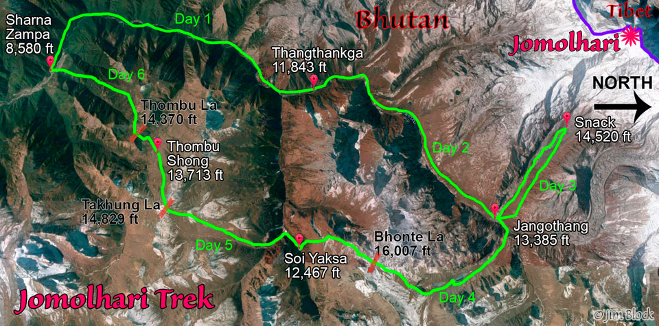
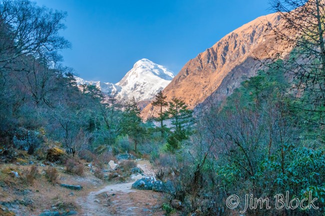
Sharna Zampa to ThangthankgaAfter tea at Sharna Zampa we hiked 22 km in 7 hours to our camp at Thangthankga and our first view of Jomolhari. It was a tiring first day gaining over 3,000 ft of elevation. |
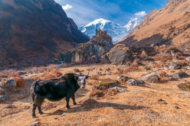
Thangthankga to JangothangWe hiked for 6 hours mostly uphill to a beautiful camp at Jangothang with Jomolhari immediately to our west. Along the way we had a fascinating visit with a Nomad. |
|
 |
 |
|
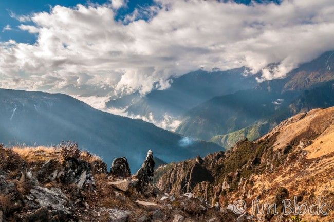
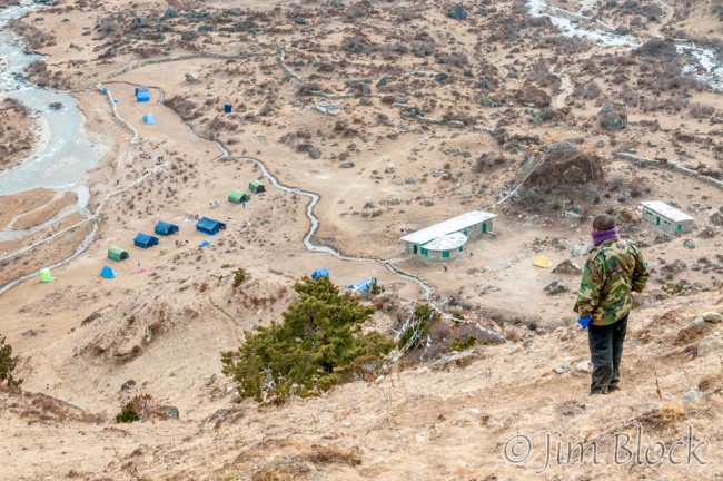
Rest Day at JangothangThis was a “rest day”, so we did not going anywhere. That is, except for an 8 km, 6+ hour excursion uphill well over 1000 ft to the base of Jomolhari. |
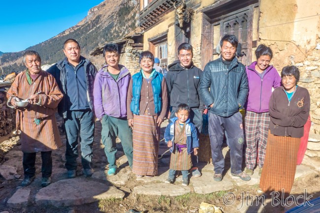
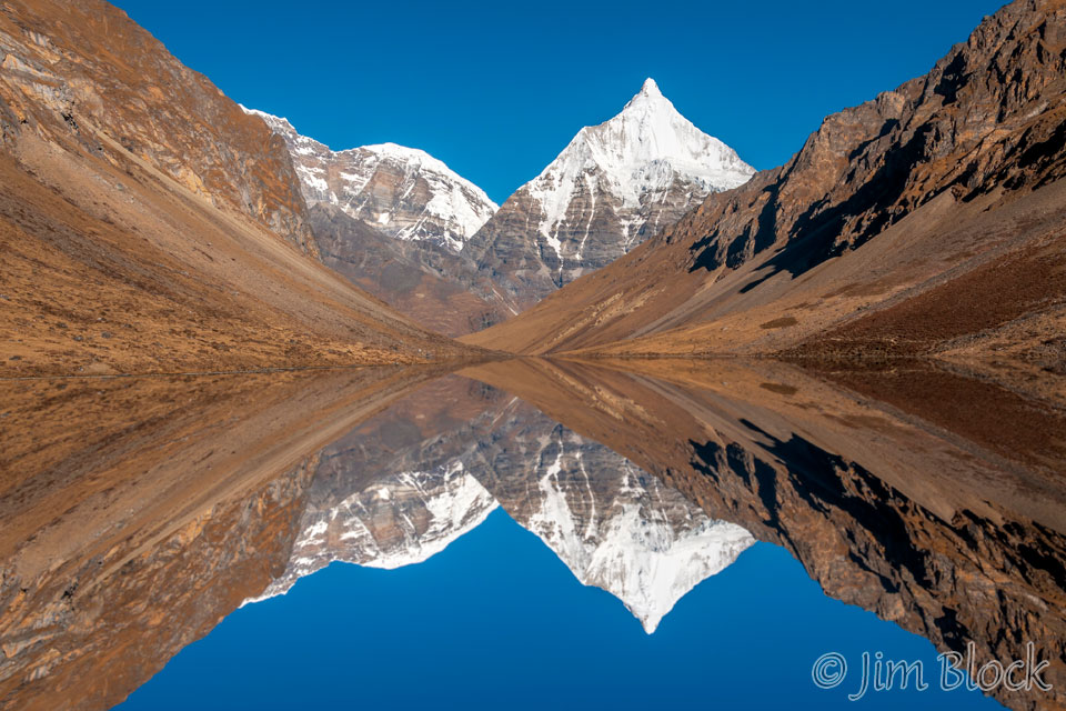
Jangothang to Soi YaktsaThis was our big day crossing the Bhonte La (pass) at 16,007 ft, almost 3000 ft above our camp at Jangothang. After an 8 hour trek, we had a very special treat staying with a nomad family in their winter home. |
|
 |
 |
|
Soi Yaktsa to Thombu ShongWe enjoyed a few pleasant hours in the morning with a nomad family and then crossed a second high pass before descending to a beautiful high altitude plain. |
Thombu Shong to Sharna ZampaAfter a short steep climb over our final pass we had a very long downhill walk losing 5,790 ft of elevation to conclude a challenging but very enjoyable trek. |
|
|
|
|