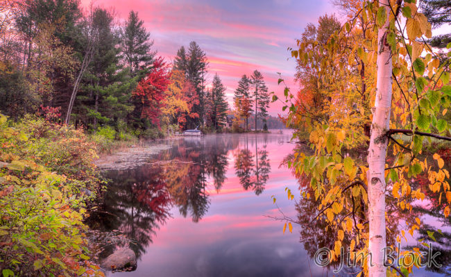
If you like to visit or photograph New England’s scenic icons, don’t bother with NH 4A in Kearsarge country of west-central NH. But if you like to discover places that few visitors, photographers, or even locals see and create images few will make, then this is the place for you.
Route 4A is a rarely visited or photographed gem. It is less than 24 miles long, but it has a lot to offer for those who look deeply and explore a few of the side roads. You can reach NH 4A from I-89 Exit 11 (head east on Rt. 11) or Exit 17 (head east on Rt. 4). This description assumes travel SE to NW touching pieces of Andover, Wilmot, Springfield, Grafton, Enfield, and Lebanon in turn. NH 4A is also known by some as the 4th New Hampshire Turnpike.
Cilleyville
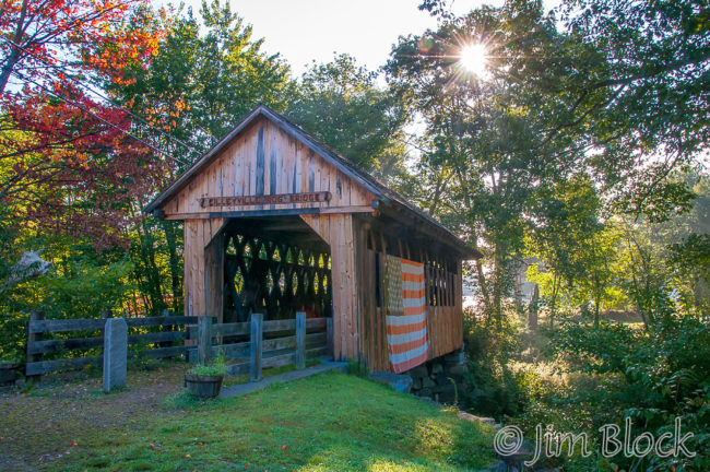
NH 4A starts just west of a covered bridge in, where else, Cilleyville. But even before you turn off Rt. 11 onto 4A venture along the nearby roads to explore Potter Place and its old train station (2/3 mile NE up Rt. 11 then a right through a huge parking lot). There is a small sunken garden near the preserved station. From here take Cilleyville Road to a bridge with an overlook of the Blackwater River and some nice rapids.
Wilmot & Bog Mountain
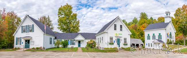
Heading northwest on 4A you reach the village of North Wilmot on your right with its white buildings and a few interesting houses.
You can park here and walk back 4A a short distance to a view of some very nice rapids along Kimpton Brook with perhaps a bit of scrambling through brush.
Back at your car, if you walk behind the white buildings you will see part of the bog below Bog Mountain and a holding area for Kimpton Brook.
If you follow North Wilmot Road north through town about four miles you will get to the beautiful historic North Wilmot Church, unless you get lost that is. But getting lost in this part of NH can be very rewarding photographically.
One of the two trailheads for the Sunapee-Ragged-Kearsarge Greenway Trail 7 over Bog Mountain is in North Wilmot. SRKG Trails 1, 7, 9, and 11 are the best hikes of this 75-mile loop, in my opinion. You can buy a guidebook for the Greenway for around $10. The other trailhead for SRKG 7 is a bit farther along 4A near School House Road. If you want to shorten this hike you can turn up Stearns Road and park near where the trail crosses. Along this road are some very nice views of Bog Mountain and the bog. If you click HERE you can see more photos from Bog Mountain and SRKG 7.
If you head south from North Wilmot on Bunker Hill Road and then follow Cross Hill Road (just go straight), in less than 2 miles you will reach this view of Mount Kearsarge.
Gardner Memorial Wayside Park
Two miles northwest of North Wilmot along 4A is the entrance to the Gardner Wayside in Gile State Forest on your right. You can walk downstream along Kimpton Brook and explore old mill ruins or take an easy half-mile hike to rarely visited Butterfield Pond. This is also a great area for xc-skiing or snowshoeing.
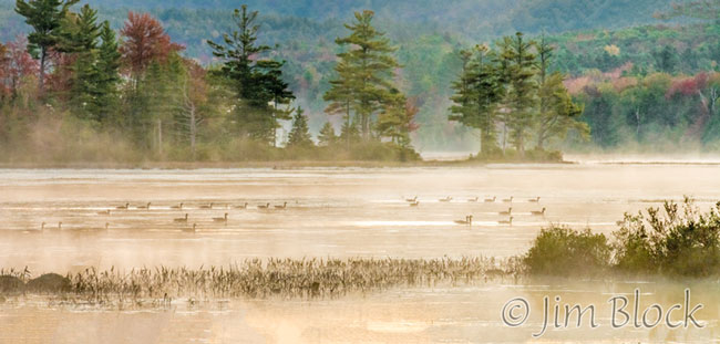
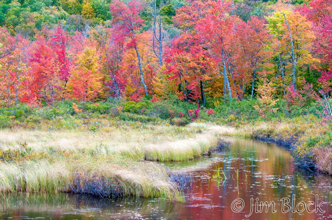
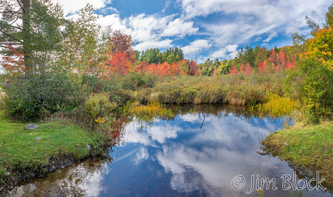
Springfield & McDaniels Marsh
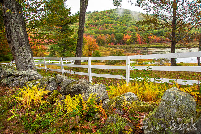
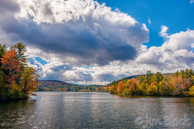
Just beyond the Gardner Wayside entrance and still in the state forest are a wonderful series of ponds along 4A — part of one is seen below. These make great photo subjects, especially in fall. You can park and follow a logging road to the back side of the larger one. Definitely watch for moose here and as you continue along 4A.
A very attractive loop off 4A takes you through Springfield. Turn left at Four Corners Road and follow it to the right at a 3-way intersection with Bowman Road. Take a quick right onto Lorent Drive (it is easy to miss – it looks like a driveway) to loop past a beautiful old cemetery along Cemetery Road which soon returns to Four Corners Road. If you backtrack a short distance here you will get a nice view of Kolelemook Lake.
Four Corners Road merges with Main Street (Rt. 114) just past some classic white New England buildings. In 1/2 mile take George Hill Road on your right to the beautiful McDaniels Marsh. There are hiking options and nice photo spots along the woods road across the falls from the parking lot. If you brought a kayak, this is the place to use it. From the marsh parking area you can take George Hill or Bog Road back to 4A.
McDaniels Marsh State Wildlife Management Area actually borders 4A, but it is hard to get there directly from 4A. An adventurous person can park at the small town garage at Hardy Hill Road and 4A and bushwhack about 100 yards into the marsh across the road.
Enfield Highlights
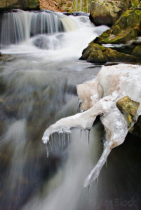
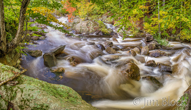
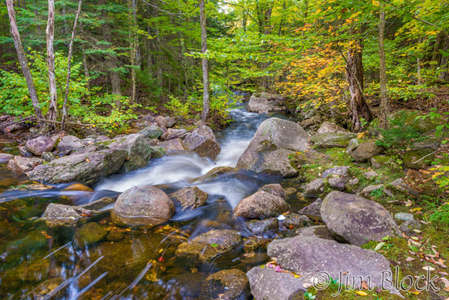
A few hundred feet SE of where George Hill Road meets 4A is Boys Camp Road heading north. Park in a wide area on the left just past a one-lane bridge about a mile down this road and explore the Colette Trail in either direction along the spectacular Bicknell Brook. The most dramatic falls are downstream, but upstream is also very beautiful. I love this spot in winter and early spring, but the brook can be running full in fall as an upstream pond is drawn down. If you click HERE you can see more photos of Bicknell Brook.
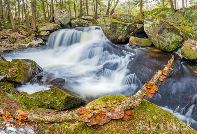
Below is a photo I took April, 2015 along Bicknell Brook one mile from Rt. 4A. It is a 14-shot “panorama”. By taking more than a single shot I was able to get a wider field of view, but most importantly it allowed me to get increased sharpness and depth of field as well as compress the tonal range. The mushrooms were very close to my lens and the scene was quite contrasty. I used a technique I describe HERE.
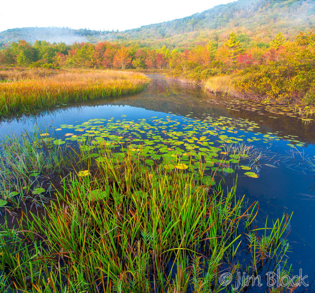
About a half mile past NW of Boys Camp Road along 4A is Bog Road. This is a must in the fall. It takes one past George Pond and some beautiful wetlands and eventually reaches McDaniels Marsh. Along the way there is a trailhead for a one-mile hike to beautiful and remote Cole Pond. The photo below was taken at the start of the Cole Pond trail just a few feet off Bog Road.
A huge area west of Bog Road is the Enfield Wildlife Management Area. This encompasses Cole Pond and the beautiful Smith Pond which is best reached from Exit 15 of I-89.
About a mile from 4A is Crystal Lake. You can visit it on foot by walking downstream along Bicknell Brook about a quarter mile along the Colette Trail or by car from Boys Camp Road with a left at Lockhaven or by taking a right on Crystal Lake Road just past Bog Road and Enfield Center.
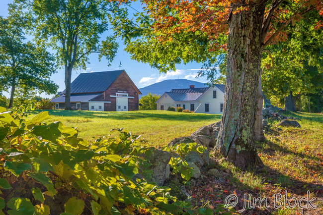
Eventually 4A skirts the shore of Mascoma Lake and passes the historic Enfield Shaker community. Take time to explore the massive stone buildings here. A hike uphill across 4A yields beautiful views of the Shaker area, the lake, Mount Cardigan, and beyond. This area has an old Shaker Cemetery and a very impressive old canal the Shakers built to bring water down from Smith Pond.
Route 4A ends at Route 4 in Lebanon. Near this junction is Mill Road which can be driven a short distance and then hiked in a loop with the Northern Rail Trail along a beautiful stretch of the Mascoma River and past an old mill site.
All of the photos here were taken within 2 miles of NH 4A. You can see more photos by clicking HERE.
And you can see a set of photos along Rt. 4A taken in September 2016 HERE.
And you can see a set of photos along Rt. 4A taken during one wonderful week in October 2016 HERE.