Kearsarge from Afar
Standing like a tall warrior guardian over our area, the 2,936 foot Mount Kearsarge is visible from many locations. Most of the viewpoints are accessible by car. Some are reachable only by hiking. The wonderful 75 mile hiking trail that circles parts of this region — the Sunapee-Ragged-Kearsarge Greenway (SRKG) — offers a number of unique views of Mount Kearsarge.
Interestingly, of the three namesake mountains of the Greenway, only Kearsarge is devoid of ski slopes. It stands the tallest of the three, and the summit of Kearsarge is the most accessible by car. Simply drive into Rollins State Park from Warner and follow a short easy hike to the summit. If you are a more serious hiker, you can summit Kearsarge from Winslow State Park or by way of the Lincoln Trail which starts in Sutton and first crosses Black Mountain.
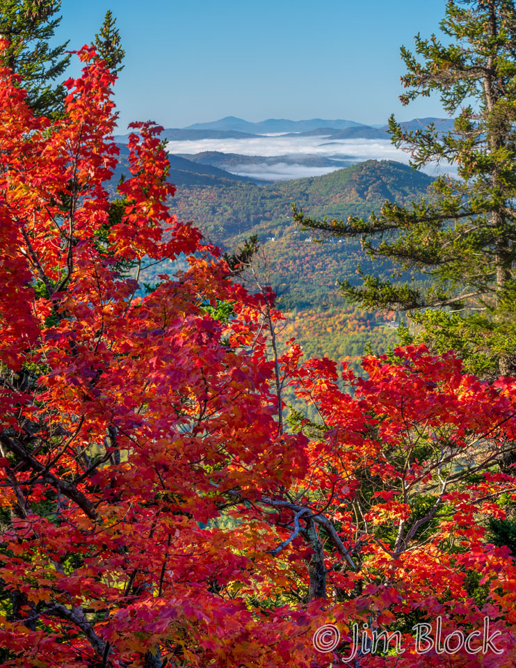
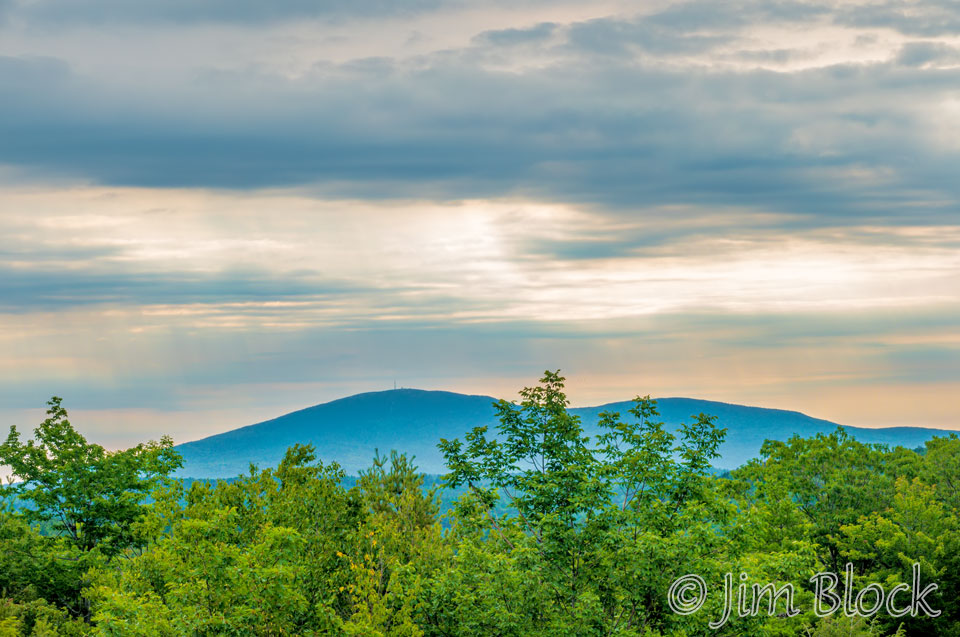
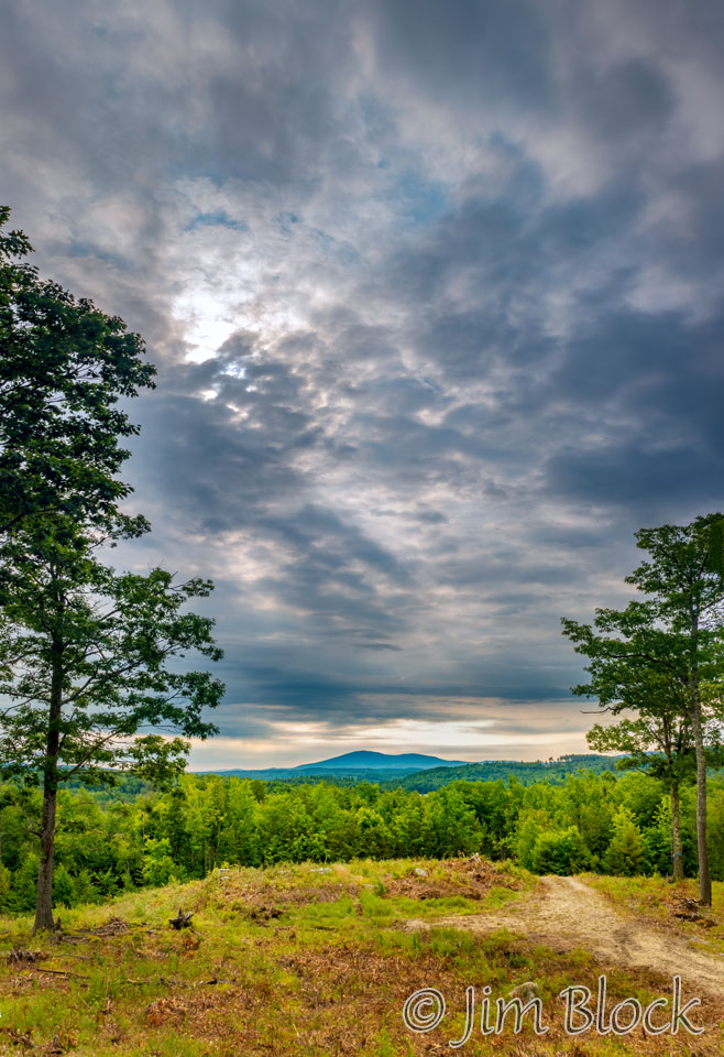
The elevation of Kearsarge is moderate compared with the White Mountains to the north, but its isolation gives it a prominence that ranks it in the top dozen NH mountains. So it is not surprising that there are many great viewpoints.
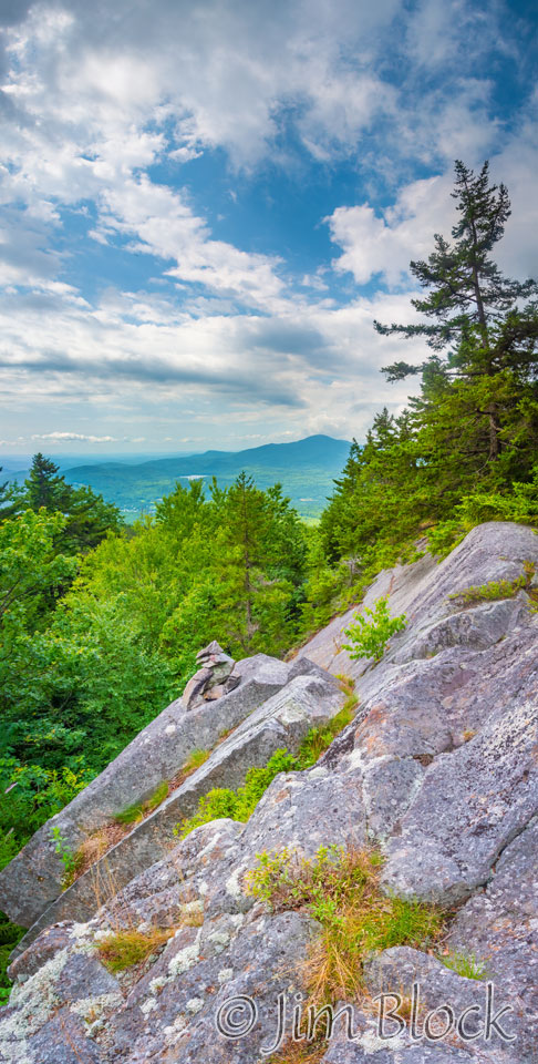
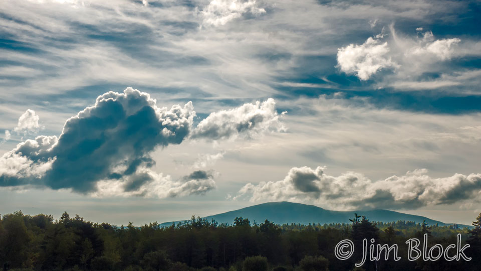
It is challenging to get to the viewpoint in the photo on the right along SRKG Trail 9 on Ragged Mountain. Someone has constructed an interesting sculpture of rocks in a precarious position. Kearsarge can be seen in the distance under some beautiful clouds.
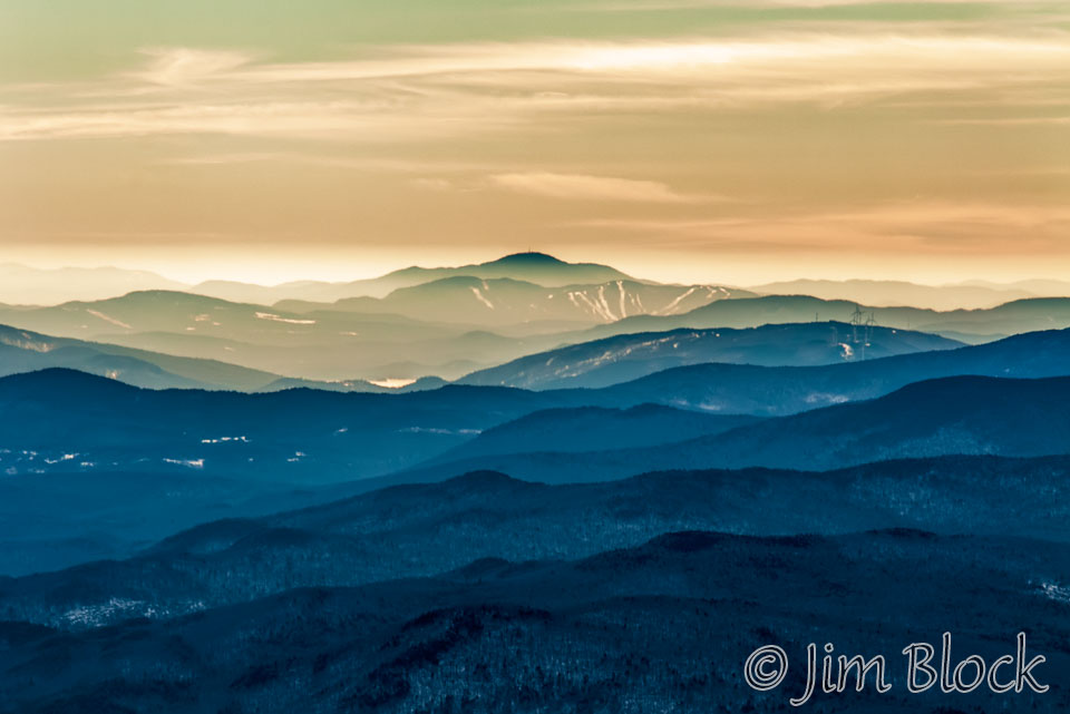
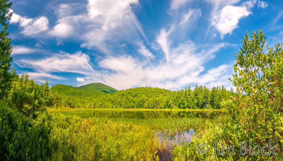
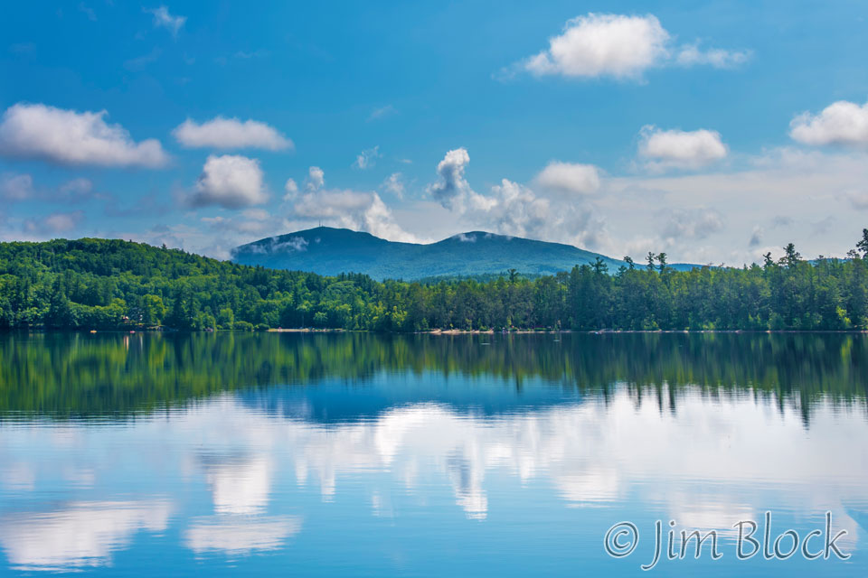
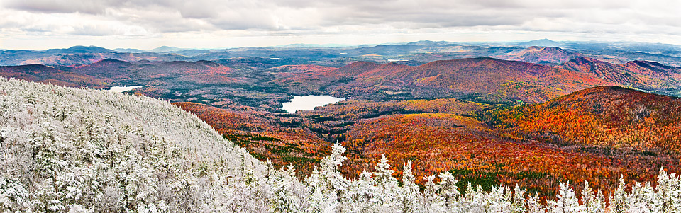
Below are four more photos of Mount Kearsarge from Ragged Mountain, its closest neighbor except for Black Mountain on its south shoulder.


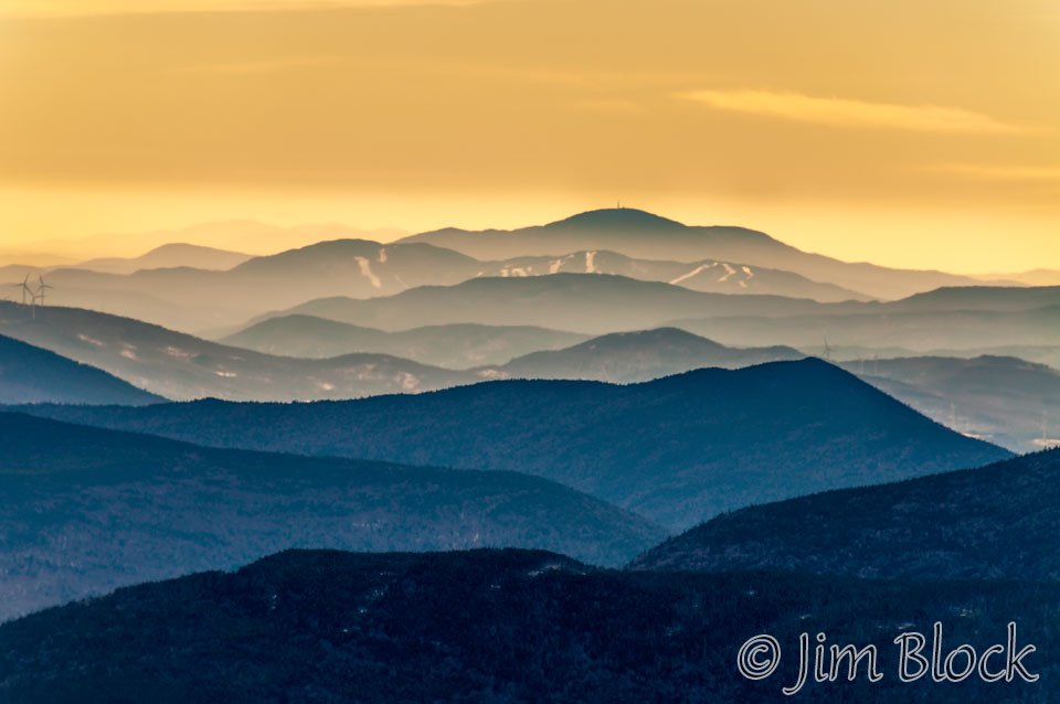
For a magazine assignment, I had some amazing single-engine airplane rides in a 1946 Aerona Champ and a 1946 Piper J-3 Cub with skis attached for landing on snow and frozen lakes. On my first of the four flights I took, I photographed Mount Kearsarge with an amazing yellow sky after just cruising the ridgeline between Lincoln and Lafayette. You can see the ski slopes of Ragged Mountain in front of it.
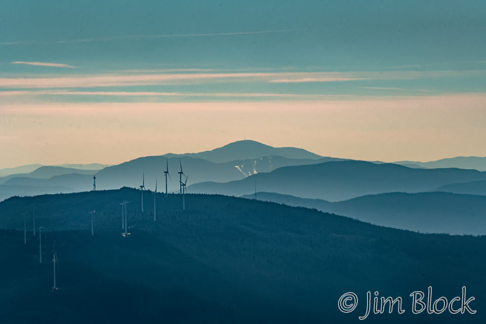
Kearsarge is seen behind Ragged Mountain and above the wind turbines on Tenney Mountain in the photo below taken from Mount Stinson in Rumney.
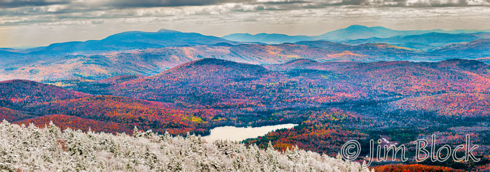
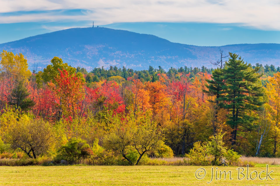
The Welch-Dickey Loop in Thornton and Waterville Valley is a wonderful 4.4 mile hike over the Welch and Dickey Mountains. It has several distant views of Kearsarge. Below are two of them. From this viewpoint Ragged Mountain is to the right of Mount Kearsarge.
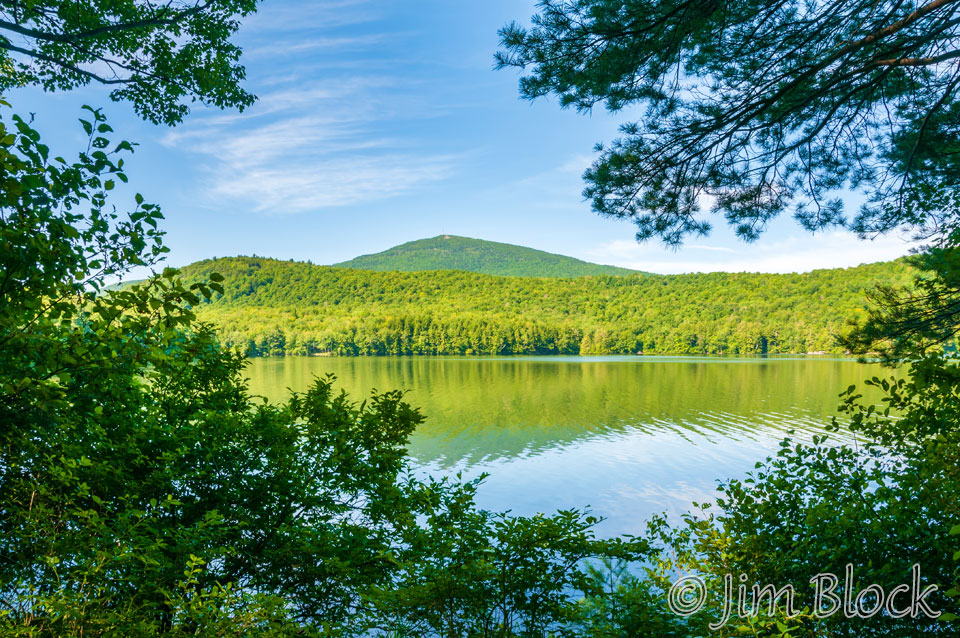
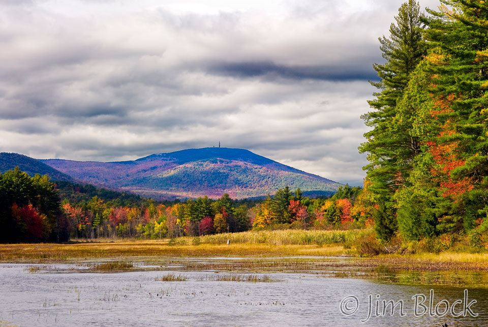
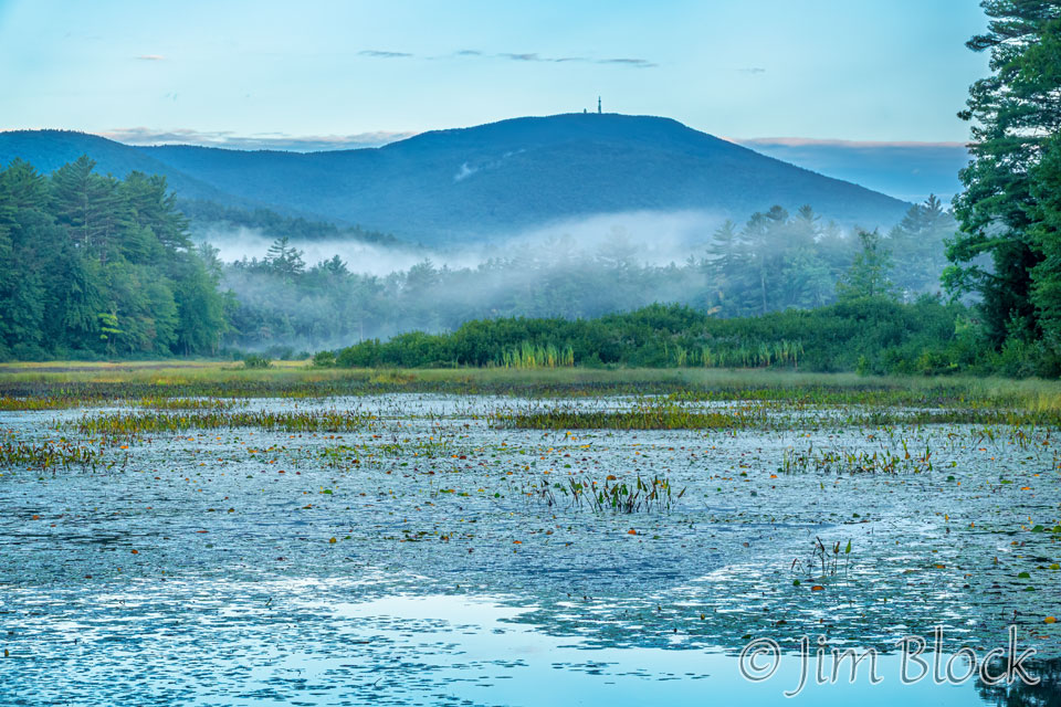
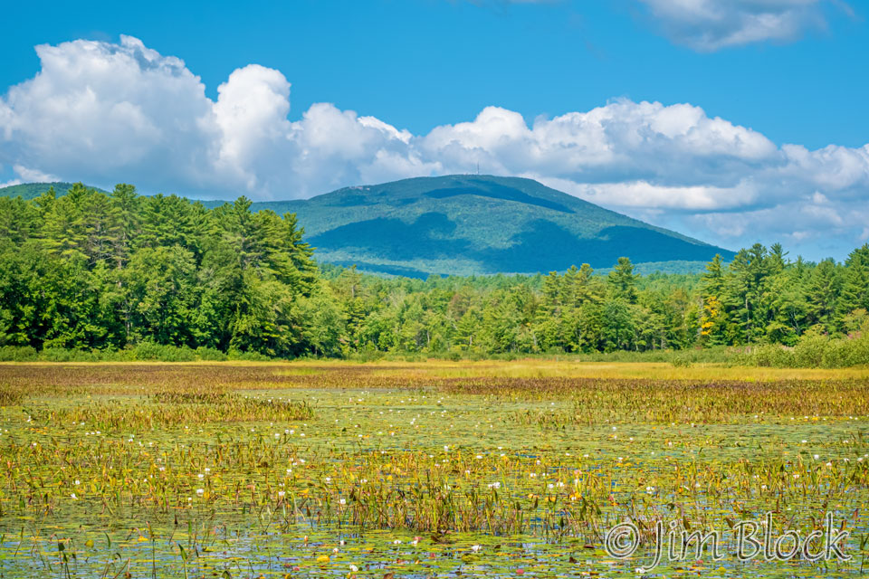
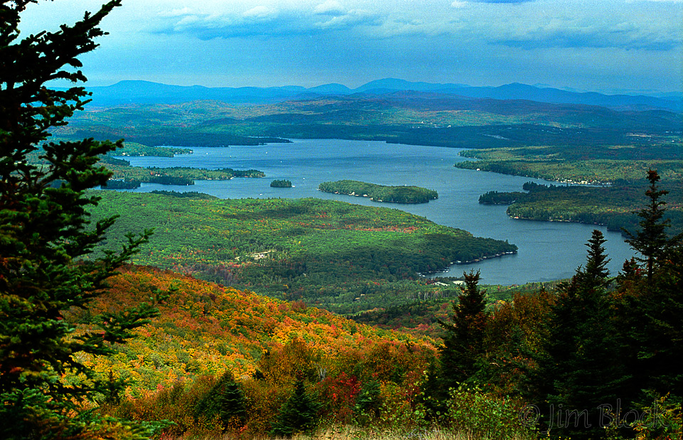
Bradley Lake in Andover is seen clearly when hiking down Kearsarge on the Barlow Trail. The photo below looks up from the lake at the mountain.
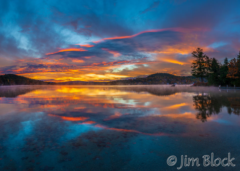
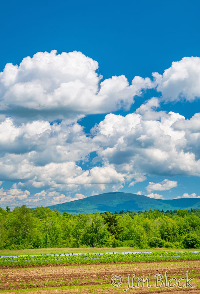
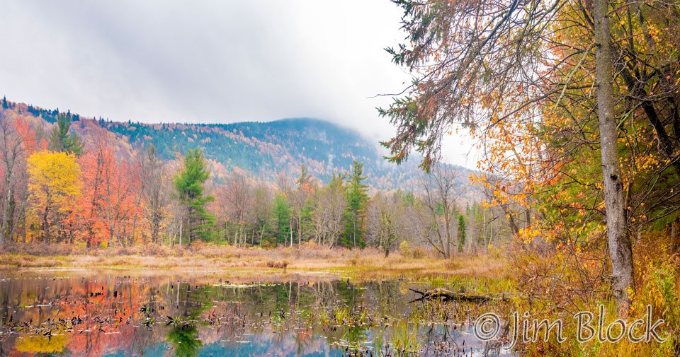
Remote Wilder Pond is located in Salisbury. An SRKG-sponsored hike led a group of 18 from Bradley Lake south along trails and a partial bushwhack to this wonderful viewpoint of Mount Kearsarge to the west across Wilder Pond. Photos of Mount Kearsarge are often best when the clouds are dramatic.
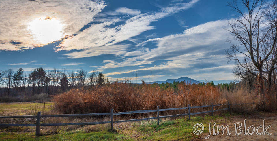
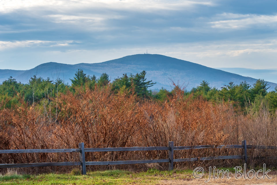
While returning from an assignment to photograph several winemakers, I spotted Kearsarge from Route 4 in Salisbury. Here are two views of Kearsarge from the east. You can see the hump of Black Mountain on its left shoulder.
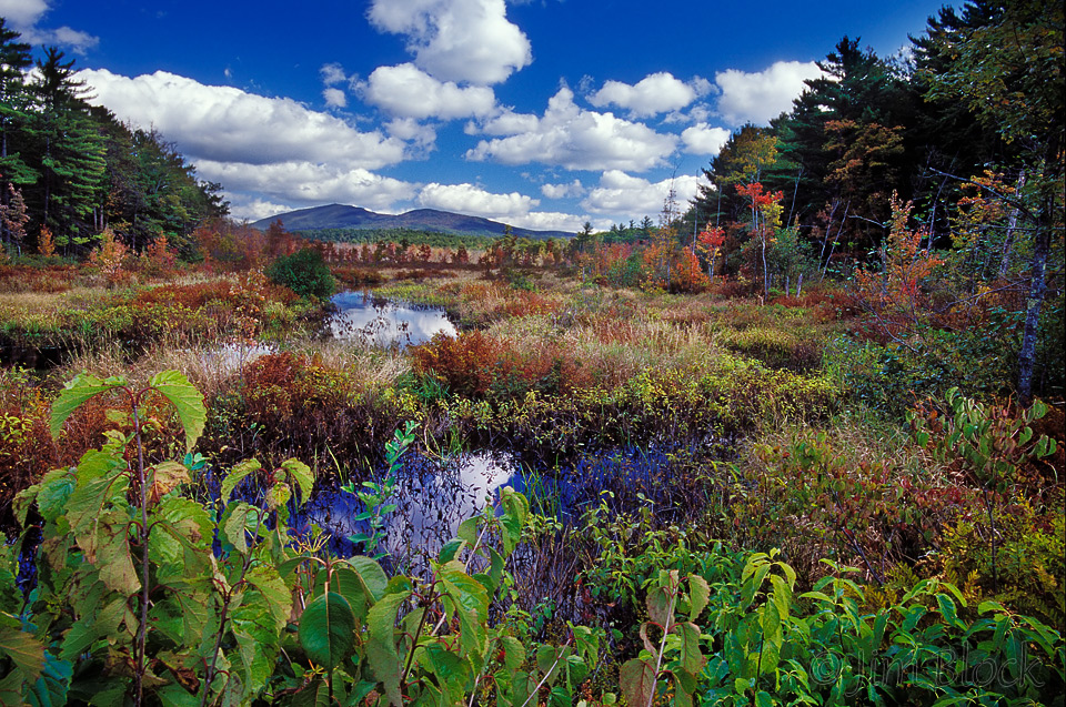
Below is an unusual viewpoint from a spot in Webster that few people visit. Schoodac Road in Warner becomes White Plains Road in Webster and passes the western shore of Lake Winnepocket. Just south of that point, Knights Meadow Road heads north to Knights Meadow Marsh ending at a small dam. From here one can walk along the southern shore of the marsh for about 100 yards to reach this view of Mount Kearsarge to the northwest.
Here are five more photos of Kearsarge from across Knights Meadow Marsh.


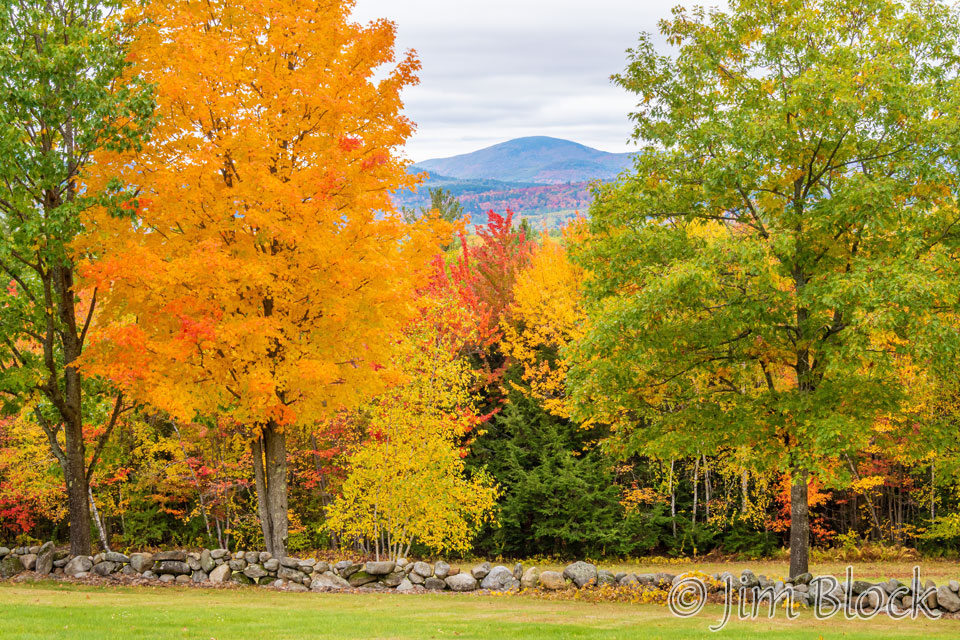
Along beautiful Pumpkin Hill Road in Warner one can find very nice views. This one includes Kearsarge.
I’ve canoed Cascade Marsh in Sutton and photographed a very accommodating American Bittern there. You can see the bittern near the bottom of this blog. The three photos below were taken very near where I found the bittern. From this angle, Black Mountain on the right looks almost as high as Keasarge, but its summit is 400 feet lower.


White Ledges, high on the east shoulder of Mount Sunapee, is one of my favorite spots in NH. From there one has a wonderful view of Lake Solitude, almost straight down. From the north end of the ledges there is a nice view of Mounts Kearsarge and Black.
In the photo below of Lake Sunapee taken from near the top of a ski trail on Mount Sunapee, Kearsarge is the peak about 1/4 way in from the right edge.
The Lane River drains Kezar Lake in North Sutton. Along a back road to Sutton Mills is a very nice viewpoint along the river. Below are two photos from there.
There are views of Kearsarge across Kezar Lake from Penacook Road. Below is one with Black Mountain to the right.
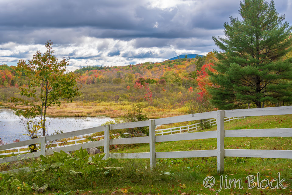
Kearsarge and Black are also seen across Kezar Lake in this view taken one and a half months after the photo above. The three mile loop around Kezar Lake is a beautiful walk that Jann and I do several times each summer. Then we stop at Muster Field for veggies.
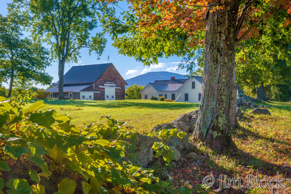
Muster Field Farm in Sutton has a great honor-system farm stand. Steve and his crew do a fantastic job at this wonderful spot where there is a nice view of Kearsarge. Here is one photo.
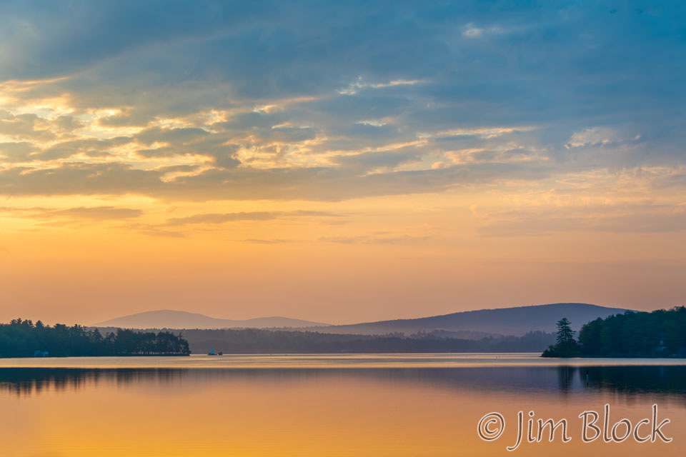
There are many great views of Kearsarge across Lake Sunapee. The photo below was taken on a very calm morning from Garnet Street. Kearsarge and Black are in the haze on the left side of the photo.
Here are five more photos from across Lake Sunapee.


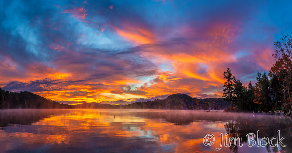
A friend and I planned a late fall photo trip around southern NH. The night before I noticed that the clouds would be clearing around dawn. This can lead to a great sunrise. So we met very early and headed to Dewey Beach in Sunapee. In the two photos below, taken with a very wide angle lens, Mount Kearsarge is the low peak about 1/3 of the way in from the left side.
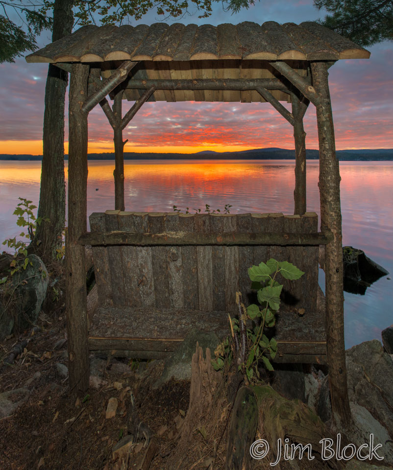
I photographed an Adirondack bench along the shore of Lake Sunapee for a magazine assignment. I figure it would be best at sunrise, so I arrived with a headlamp when it was still dark. Mount Kearsarge is centered behind the bench. I took this photo with a fill-flash to light the structure.
Above North Road in Sunapee is a private property with nice views of Kearsarge. Here are two photos.
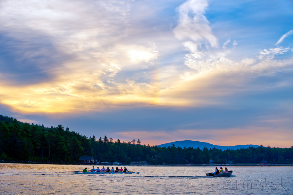
I was in my boat photographing the Lake Sunapee Rowing Club for a magazine assignment when I took the photo below. You can see the rowers on the left and the coach in the boat on the right. In this photo taken from the George’s Mills area of Sunapee, you can see Mount Keasarge is in the background.
For another magazine assignment, I had an exciting helicopter ride from Parlin Airport in Newport over Newbury, Sunapee, and Grantham. When we flew over Georges Mills I took this three-photo panorama of Otter Pond on the left, Lake Sunapee to the right, and Kearsarge in the center back with Black Mountain lying on its right shoulder.
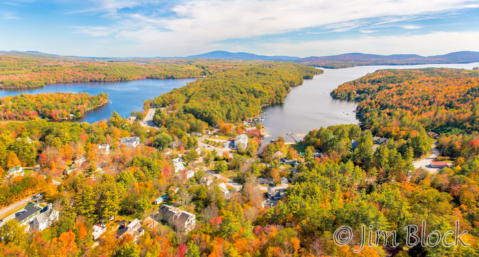
Since New London is on a hill and very close to Mount Kearsarge, it is not unexpected that there are many nice viewpoints from the town. Here are some of them from a half dozen locations.
Clark Lookout in New London is an easy hike to a wonderful viewpoint across Lake Sunapee to Mount Sunapee. Part way up there is a peek-a-boo view of Mount Kearsarge.
There are a number of nice viewpoints of Kearsarge along Route 11 near Route 114 in New London. Here are four photos from there.


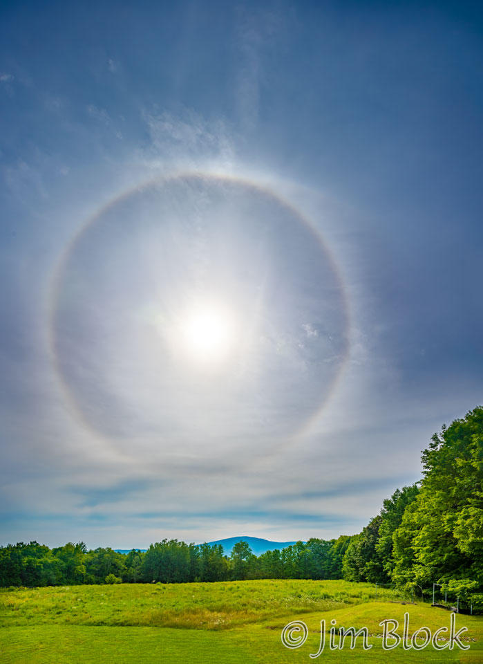
Colby-Sawyer in downtown New London has some nice spots to view Kearsarge, especially on the east side of the campus. During August of 2021 there was a 22-degree halo over the area that lasted for an amazing seven hours. I madly toured the area to photograph it. Below is a photo showing the halo over Mount Kearsarge.
A common viewpoint for Mount Kearsarge is along Little Lake Sunapee Road in New London. It is very interesting to observe how this scene changes with the season and the atmospheric conditions. Here the mountain was highlighted by very dramatic clouds.
Along Route 114 northwest of the village of New London is the Kidder Lot. It has nice views of Mount Kearsarge.
Above Route 114 is Morgan Hill. Here are six photos from Morgan Hill Road.


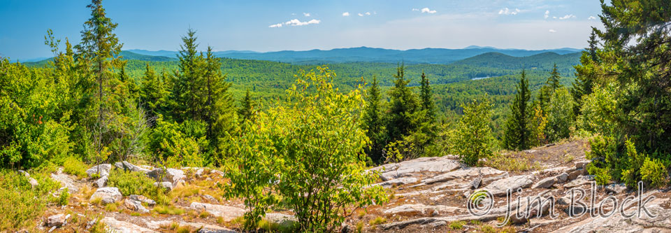
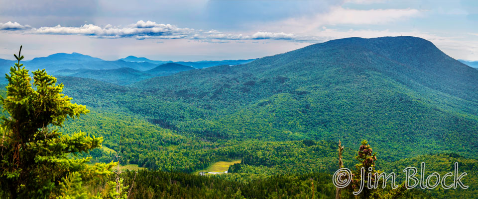
Little Mount Washington is a nice hike in Grantham to a 180-degree view from Smart Mountain to Mount Sunapee. The five-photo panorama below shows only part of the view — from Firescrew and Cardigan on the left to Kearsarge and Black on the horizon toward the right above the ©.
If you would like to see a version of this photo that you can zoom into and read the labels of the peaks, you can click the image below.
Mount Kearsarge is also seen from Little Mount Washington in the four photos below.


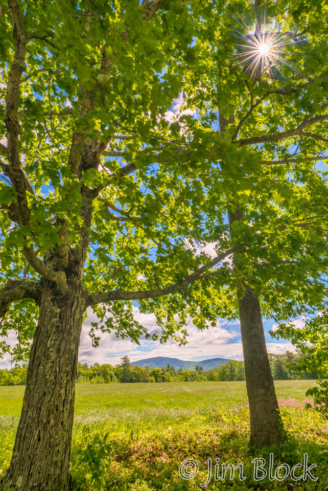
Cross Hill Road is a beautiful drive from Route 4A in Wilmot. One passes charming stone walls and huge oak and maple trees. Along the way one gets this exceptional view of Mount Kearsarge.
One of my favorite fall spots in Wilmot is just off Route 4A. Below are wide and telephoto photos of Mount Keasarge.
A very special optical event happened around the sun – luminescent clouds. They are fairly common, but people rarely notice them because one rarely looks at the sun or takes photos toward the sun. You can read a discussion of this and other interesting optical phenomenon HERE. This photo of Kearsarge was taken along Route 4A heading down into Andover.
A friend and I hiked Smarts Mountain as a training hike for my second of four treks in Nepal. We hiked up the Appalachian Trail in beautiful fall foliage and were surprised to find snow at the summit. I made the large panorama below. Mount Kearsage is about 1/4 of the way in from the left side.
If you would like to see a version that you can zoom into and read the labels of the peaks, you can click the image below.
The first image on this page is a three-photo panorama taken the same day from Smarts. Below is a version of the panorama cropped to Mount Kearsarge.
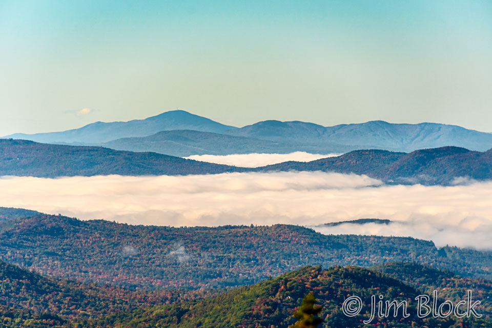
The photo below from Smarts was taken in the summer. The trees were green and the atmosphere hazy.
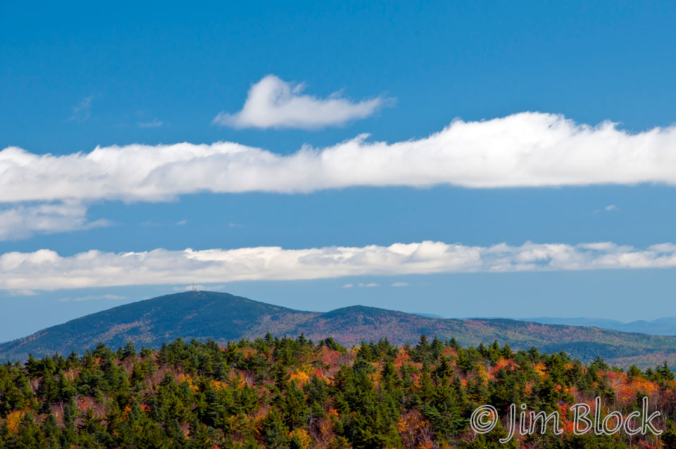
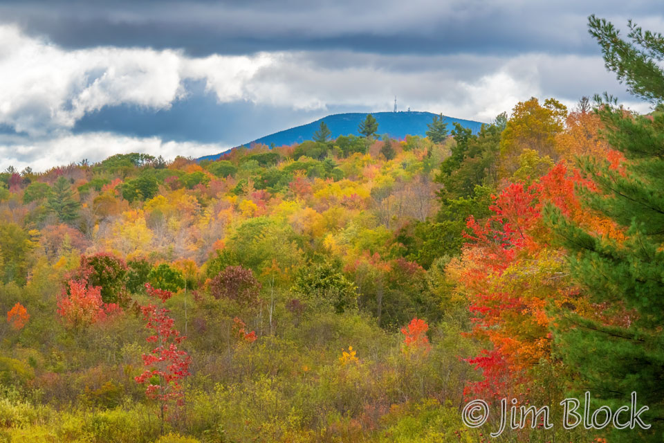
Mount Cardigan in Orange has an extensive bare summit. Views from here can be spectacular, but hike it on a day when the wind is calm. This photo, taken from a bit below the summit, shows Ragged Mountain on the left and Mount Kearsarge on the right in the distance.
In the fall the mountain ash can be very colorful. Above the center one is the bare South Peak and above it on the left is Ragged Mountains. Mount Kearsarge is at the top just to the left of center.
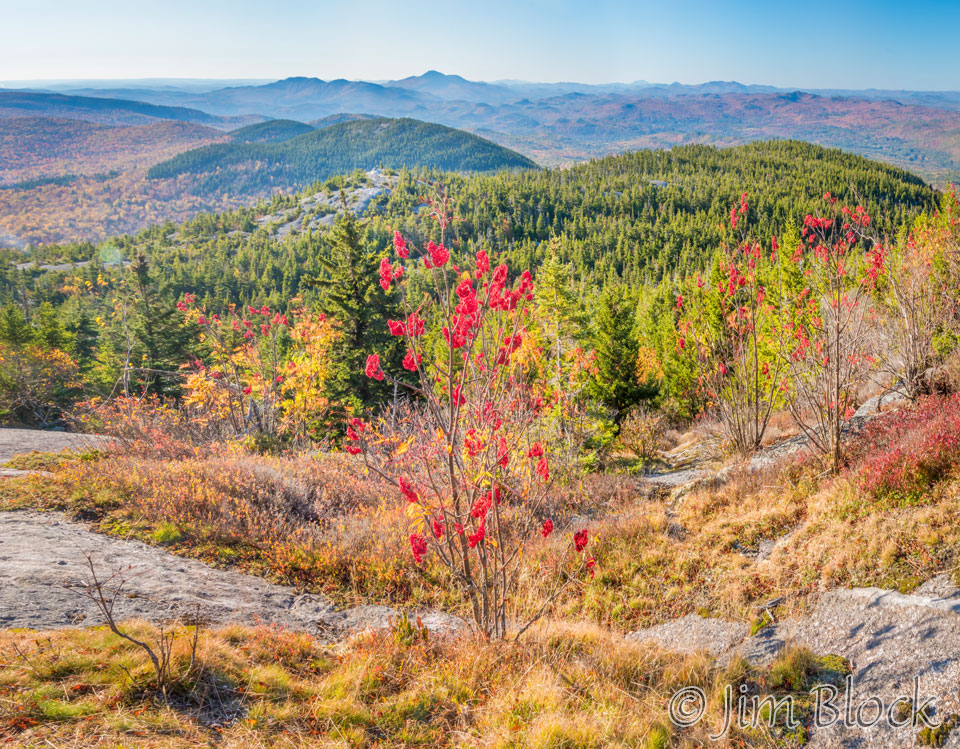
In the photo below, South Peak of Cardigan is at the bottom, Ragged is at the top left, and Kearsarge is on the top right.
Here are more photos of Kearsarge from Mount Cardigan.


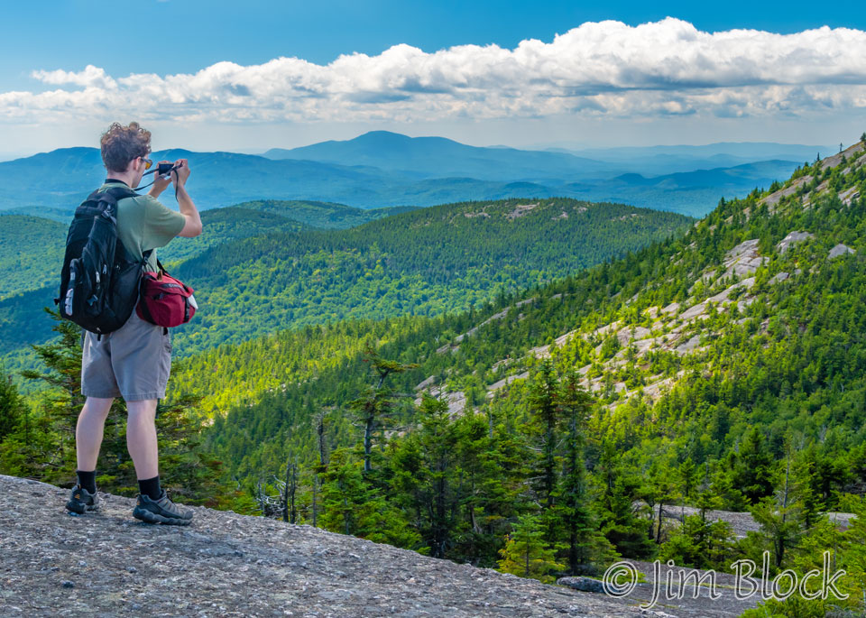
Firescrew Mountain has a beautiful cotton grass marsh near the summit just a short distance from beautiful views of Kearsarge. Below is Julian photographing Mount Kearsarge from Firescrew Mountain. Ragged Mountain is behind his head, Kearsarge and Black are in the middle, and part of Cardigan is on the near right side of the photo.
Mount Cube is along the Appalachian Trail north of Smarts Mountain. From the summit I made a ten-photo panorama. Here is a small part of it. Firescrew and Cardigan are near the left edge and Kearsarge is just to its right about 1/4 of the way from the left edge. The large mountain on the right is Smarts.
If you would like to see a version of the photo that you can zoom into and read the labels of the peaks, you can click the image below. That version has more mountains on the right side from Holts Ledge to Killington.
Located just off the drive up to Winslow State Park on Mount Kearsarge is Twist Hill Road. From it, there are some nice, very close views of Keasarge. Below are four photos from this area.


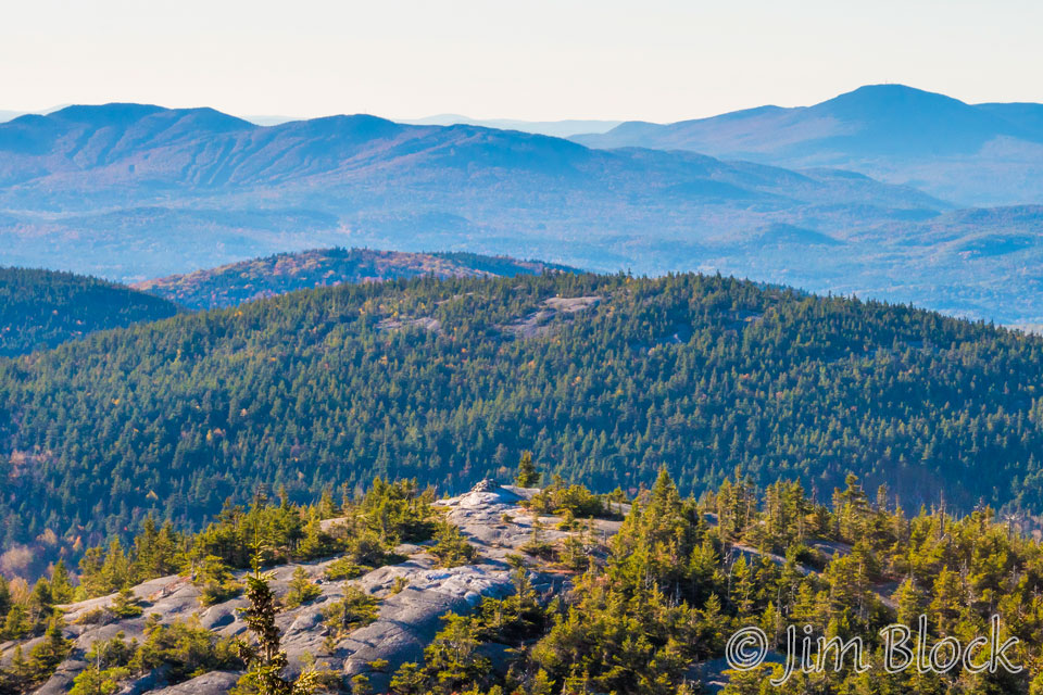
Morey Pond is located a short distance east of SRKG Trail 10, which is a mostly-uphill hike from Proctor Academy to Winslow State Park. It is a wonderful spot for lunch or a snack when hiking up or down this trail. And the views of Mount Kearsarge are quite nice, even if it is somewhat shrouded in clouds as it was this day. From this spot Mount Kearsarge to the south looks much flatter than it does from other viewpoints.
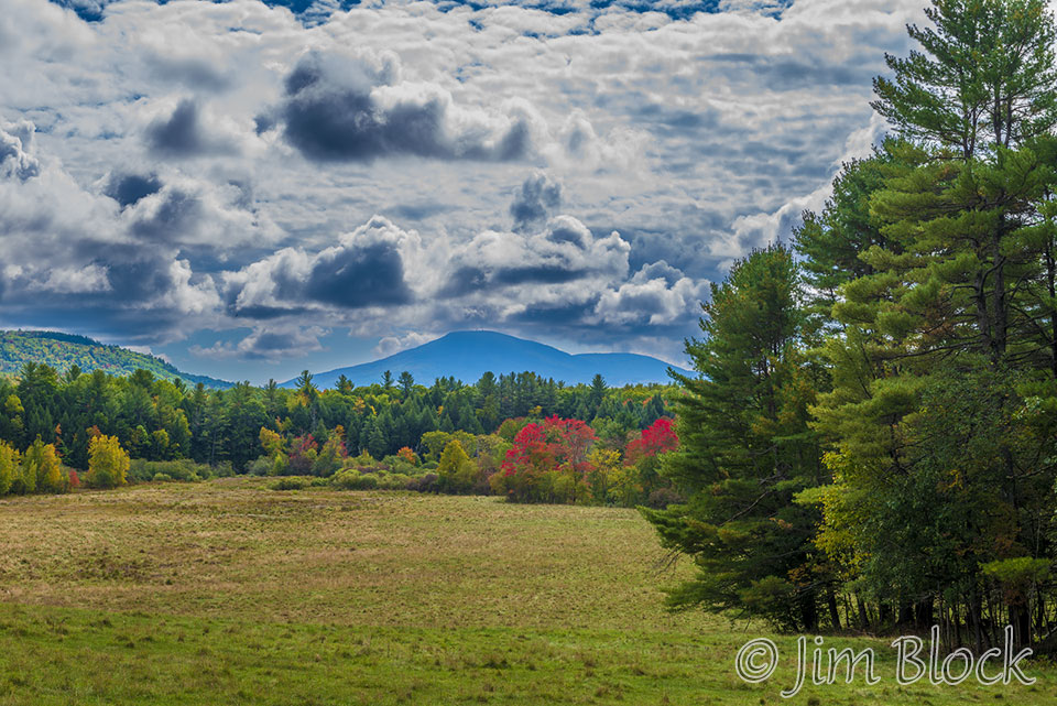
Turning west from Route 4 in South Danbury on Walker Brook Road one reaches a large field sloping downhill with this view of Mount Kearsarge to the south. Here are three photos.
The final photo is another view from a 1946 plane taken from near Mount Moosilauke.