This page has photos taken on two flights between Delhi, India and Paro, Bhutan in November, 2014. It shows the Himalayan Mountains of the Khumbu and Annapurna regions of Nepal plus a few from Bhutan.
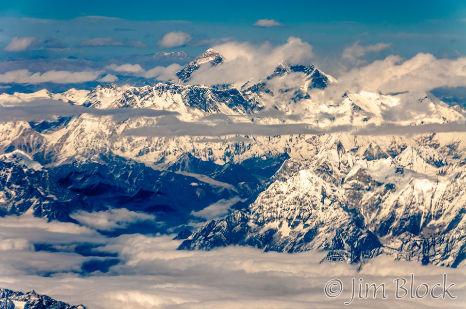
Heading to Bhutan we got a nice view of the Himalayas, although there were some clouds. The photo below shows the dark triangle that is Mount Everest in the center back. To its right is Lhotse. In the middle ground below and slightly to the right of Lhotse is Ama Dablam with this peak just below a gray cloud. In the right foreground is Thamserku to the left and Kangtega to the right.
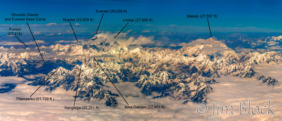
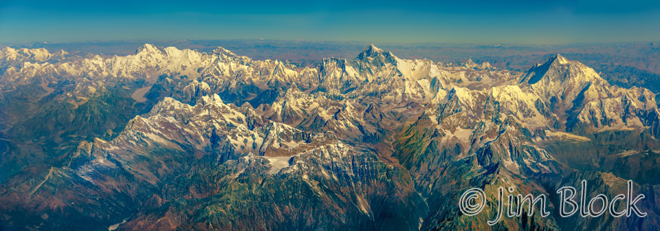
As we travelled east toward Bhutan, about two minutes after the photo above was taken, I made a 6-shot panorama of the Himalayan Mountains in this Khumbu region of Nepal. That panorama is below. You can click this image to get to a site where you can zoom way in then pan around. When you get there, click the double arrow above the image on the right to see it full frame. Please wait for the resolution to download. You can use the + and – keys to zoom and the arrow keys to scroll. Or use the scroll wheel to zoom and the left mouse to drag.
If you wish to purchase a print of this image, please CLICK HERE. If you would like a print of any other photo, please CONTACT ME.
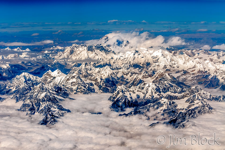
Three minutes later, I took the photo below. You can see the quite typical cloud to the right of Everest. In the middle ground on the left side of the photo are, left to right, Thamserku, Kangtega, and Ama Dablam with a gray cloud just above its peak.
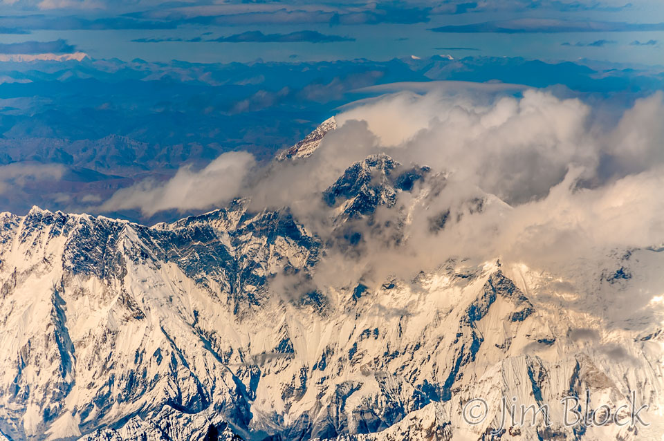
Here is a closer up view of the clouds near Everest. Nuptse is to the left and Lhotse is to the right in front of Everest.
The third highest mountain in the world is Kangchenjunga (28,169 ft) which lies partly in Nepal and partly in Sikkim, India. Until 1852, Kangchenjunga was assumed to be the highest mountain in the world. It is known as the mountain of “The Five Treasures of the Snows”, because of its five peaks. The treasures represent the five repositories of God: gold, silver, gems, cereal and sacred books.
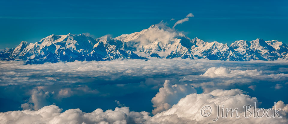
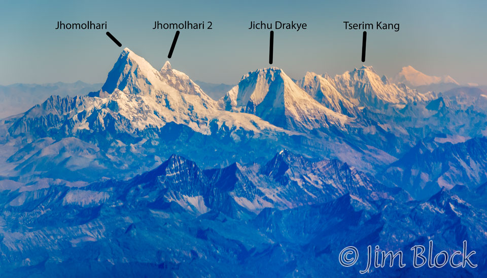
At about the same time Kangchenjunga came into view, we got our first look at Jomolhari on the border of Bhutan and Tibet. In two weeks we would trek to the base of Jomolhari and get an up close view of it and its neighbors. You can read about this amazing trek if you CLICK HERE.
Returning 23 days later after a fantastic time in Bhutan orchestrated by Dhamey Tenzing Norgay, we got a final look at Jhomolhari, a mountain we were now very familiar with. Clearly this flight was going to have beautifully clear weather.
We passed the Kangchenjunga Massif again and entered the Khumbu region of Nepal.
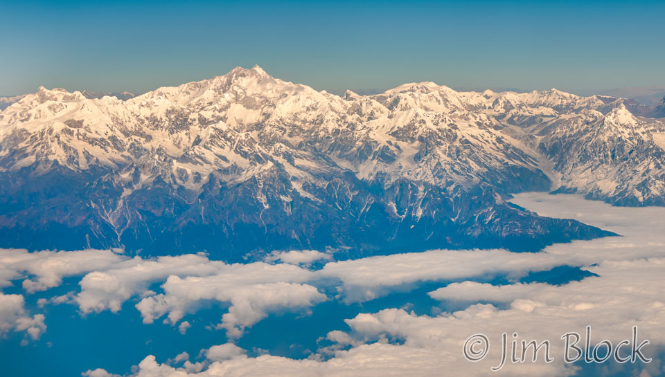
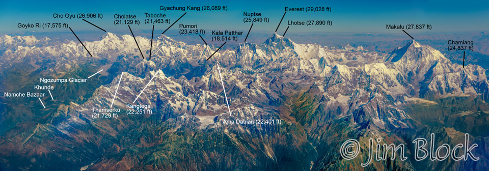
By now you should be able to identify many of the peaks in the panorama below — Everest in the rear, Ama Dablam in the center, Thamserku and Kangtega at the left and Makalu on the far right. But can you find Pumori, Cho Oyo, or even Namche Bazaar? Don’t peek at the panorama with labels that follows if you want to try to identify the locations and peaks yourself.
The 4-shot panorama below shows the Himalayan Mountains of the Khumbu region of Nepal. You can click this image to get to a site where you can zoom way in then pan around. When you get there, click the double arrow above the image on the right to see it full frame. Please wait for the resolution to download. You can use the + and – keys to zoom and the arrow keys to scroll. Or use the scroll wheel to zoom and the left mouse to drag.
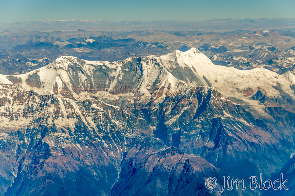
Below are three closer view of this region.
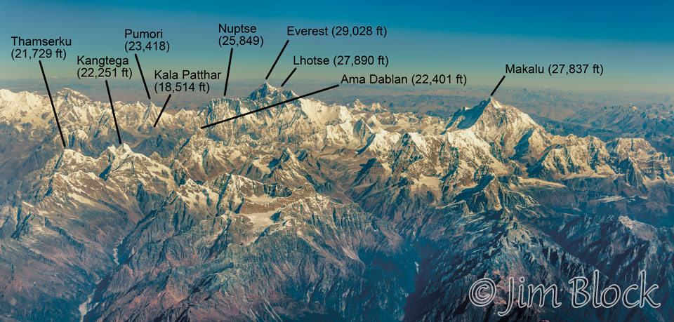
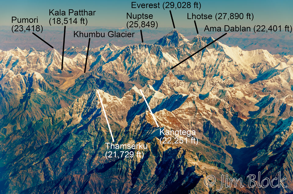
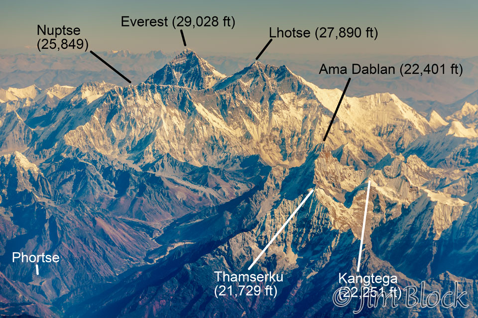
In the photo above you can see Phortse, the home of the Khumbu Climbing Center. While I was struggling to identify these mountains, I consulted Chhongba Sherpa, a good friend who has safely guided me on 4 treks in Nepal, and Dr. Steve Mock, Co-Directors of the Khumbu Climbing Center. It turns out they were both at the Khumbu Climbing Center at the time. In particular, Steve helped me considerably with the mountain IDs. I take full credit for any remaining errors.
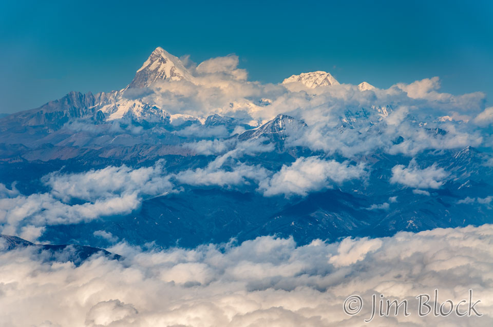
About 30 minutes later, Annapurna I and Tilicho came into view with Annapurna South below Annapurna I. Annapurna I (26,545 ft) is the tenth highest mountain in the world.
Here are two views of the Annapurna Massif taken about a minute apart. If one hikes the valley that starts at the bottom middle of the top photo and then takes the left branch at the Y, one gets to the Annapurna Sanctuary and Annapurna Base Camp.
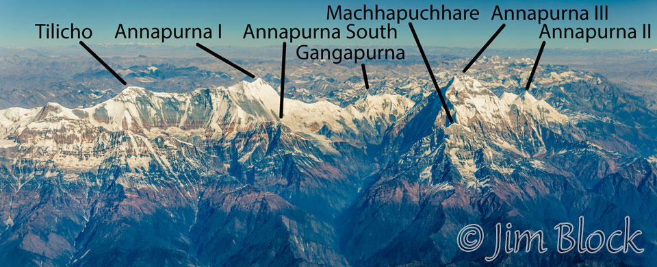
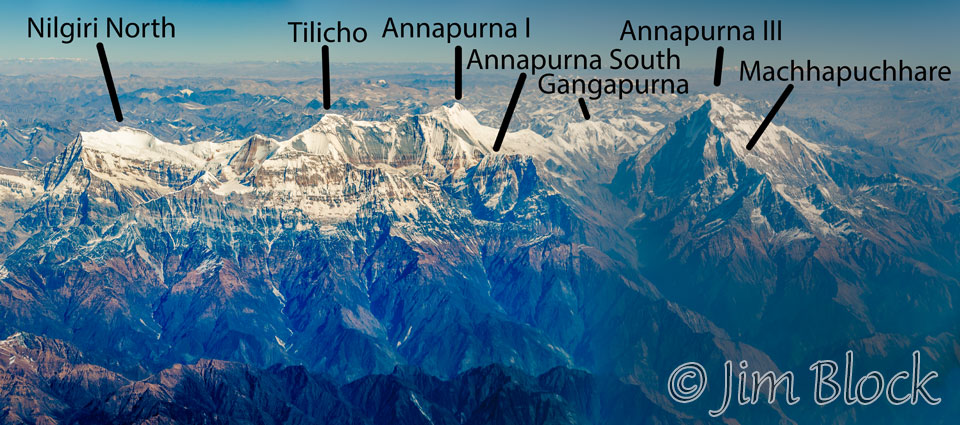
In 2011 Chhongba Sherpa led a group of eight of us around the Annapurna Circuit. We circled behind the peaks you see above. Near the end of this trek I got some nice views of Nilgiri from the window of my lodge in Jomsom and on our hike to Marpha. The next day we had an amazing low altitude flight beginning with a crystal-clear view of Nilgiri and passing below Annapurna I, Annapurna South, and Machhapuchhre. The Terrain Alert light was flashing the whole time. The views of the two Annapurna peaks as the sun rose behind them were beautiful.