The Beaver Brook Trail is a steep downhill from Mount Moosilauke when heading north along the Appalachian Trail. But our goal this day was to hike it up about a mile and a half. We intentionally went on an overcast day so that I could get decent photos of the many cascades of Beaver Brook along the trail.
This was my first time on this trail. My hiking companion, Bruce, had done it numerous times. We planned this hike for spring many months previously when we passed the trailhead in Kinsman Notch when returning from a winter hike into Greeley Ponds.
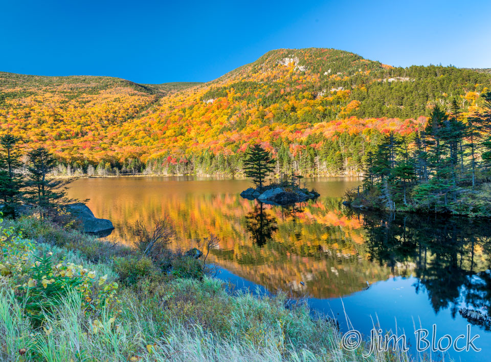
I had been to Beaver Pond many times. It is a beautiful spot, especially in autumn, as seen here with Mount Moosilauke in the background.
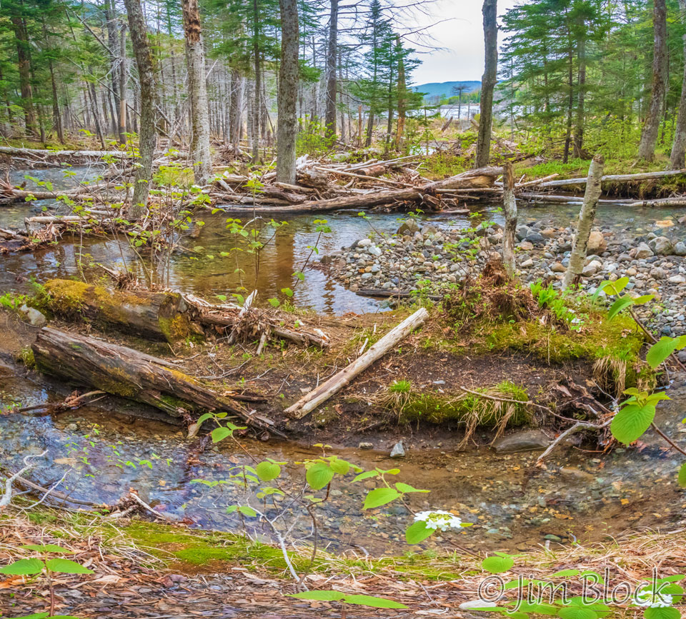
I have always parked at the western edge of the pond. This day we parked east of the pond near the trailhead for the Beaver Brook Trail. Here is a view looking across the inlet wetlands to the pond.
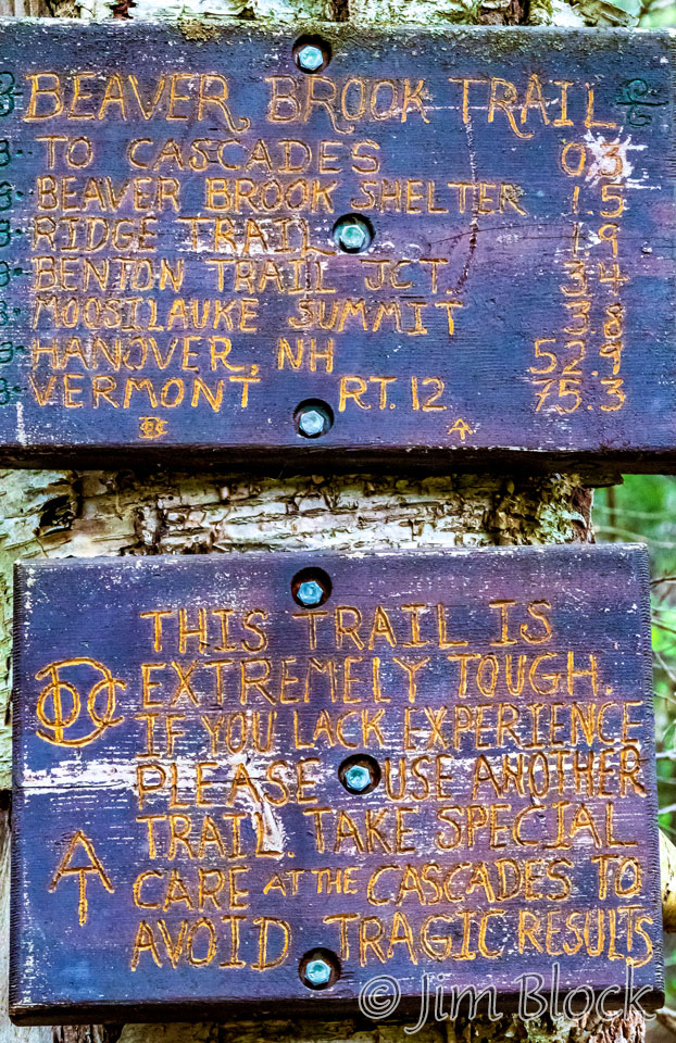
I expected a steep climb, and I was not disappointed. The first hundred yards or so were gentle, and then we reached this sign.
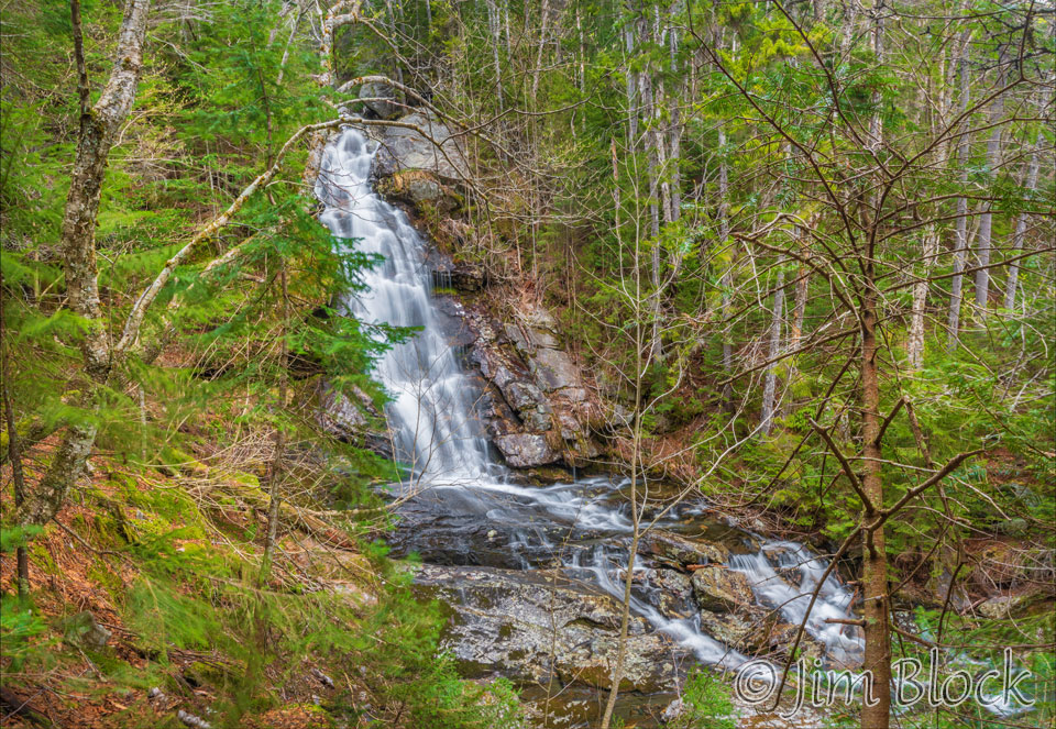
I carried a lightweight tripod attached to my backpack but did not use it for the first several cascades. I figured I could always photograph them later on the way down. So the first few cascades we reached were photographed with a faster speed than I like to use for moving water. They were shot at what I could reasonably handhold — around 1/10 to 1/20 of a second.
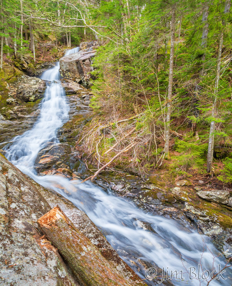
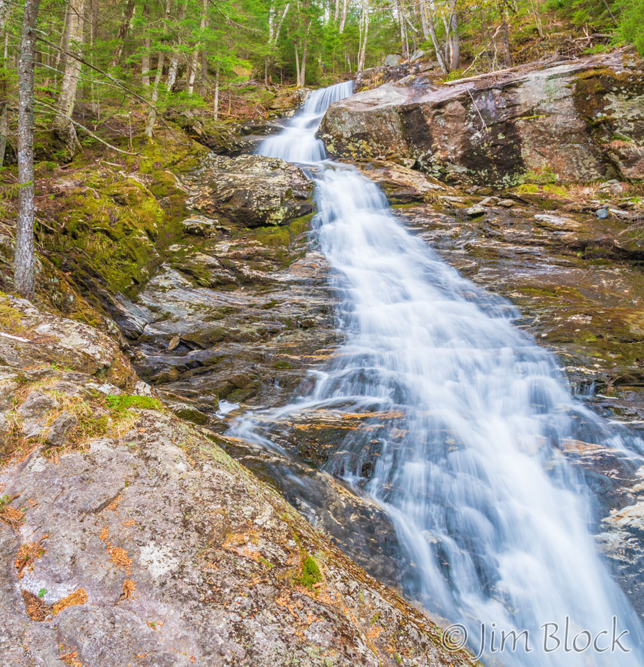
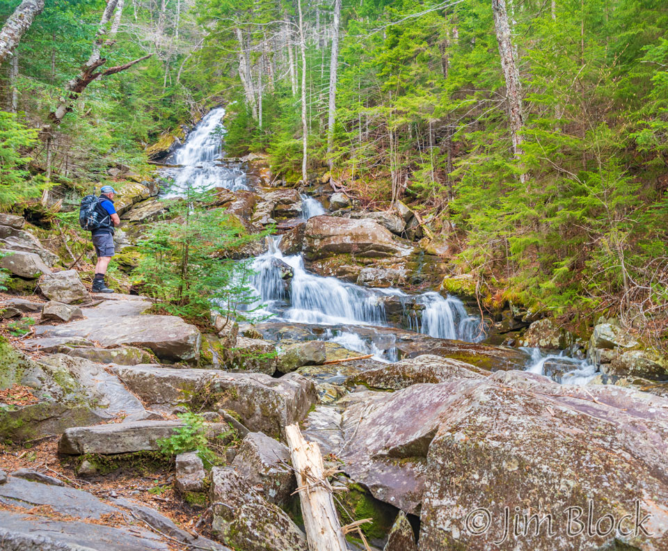
But soon I could restrain myself no more so I unpacked the tripod. Most of the images here are multi-shot panoramas — between two and 16 photos each. The cascades were just too vast to capture them well in a single photo, even with an 18 mm lens. This image is a modest 3-shot panorama.
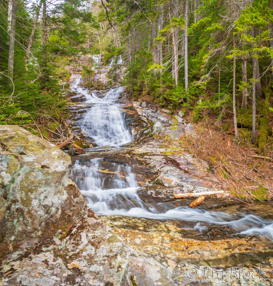
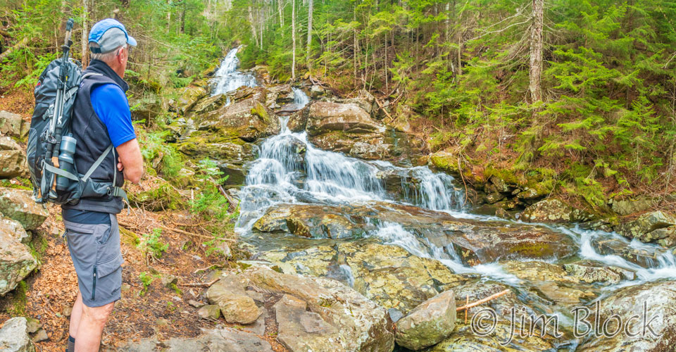
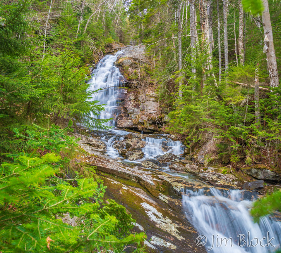
While this one is composed of 8 individual photos.
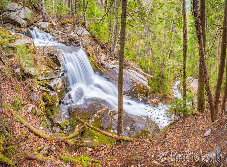
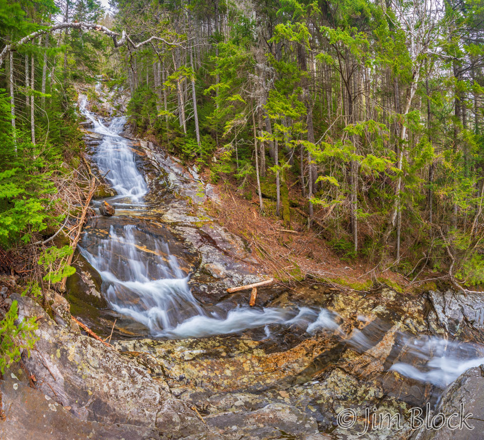
The cascades continued non-stop as we climbed.
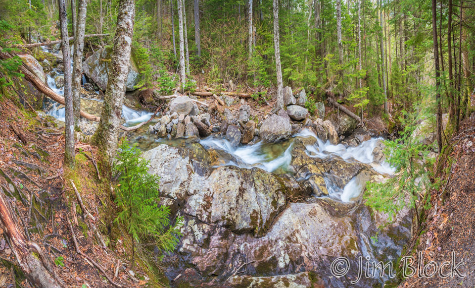
Carrying a camera-mounted tripod and two trekking poles up a steep trail was somewhat challenging. So soon I packed up the tripod again.
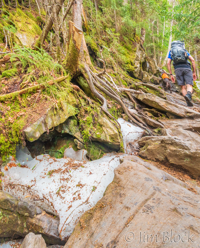
It was late May, but we still found traces of ice along the trail.
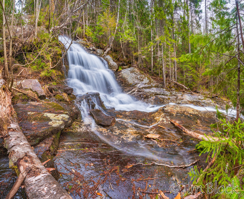
The following are 3- and 7-photo panoramas shot handheld at 1/10 second.
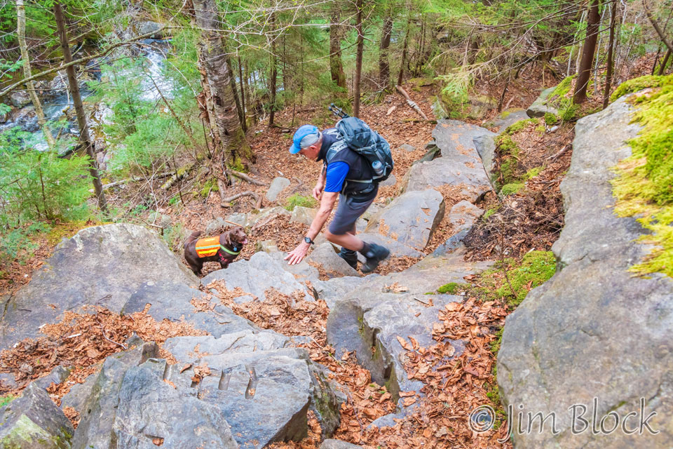
What is missing in this photo?

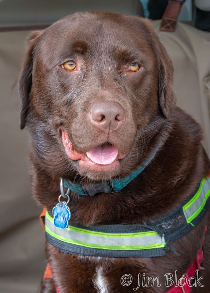
It’s Bruce’s dog Caro. He is down below in the area you can see near the middle of the photo but off to the side. He is looking for an alternate way up, unsuccessfully. He refused to climb any farther up the trail. It was too steep for him, even though he has two more legs than we do.
Bruce backtracked and spent quite a while urging his 80 pound dog to climb up toward me without success.
So we turned around. We had made it most of the way to the Beaver Brook Shelter according to my GPS, so that was not a tragedy. Plus it gave me more time to photograph the amazing cascades on the way down.
Coming down I carried two poles, a tripod, and a camera. I tried several combinations of these four items and found the best one was two poles in one hand, a tripod in the other hand, and the camera around my neck rather than mounted on the tripod. This was somewhat challenging along the steep downhill but much faster than taking the tripod on and off my backpack.
Below is a slide show of large panoramas composed of between 6 and 19 photos each.
")
")
")
")
If I had been hiking alone I might have spent four or five times more time photographing the cascades than I did hiking with Bruce. Bruce is wonderfully patient and tolerant of my desire to make photos. Still, I did not want to overstay my welcome. I certainly understand that photography is not a spectator sport. Perhaps I will go back alone in fall.
Below are two 12-photo “panoramas”. As far as I am concerned panoramas can be square or any aspect ratio.
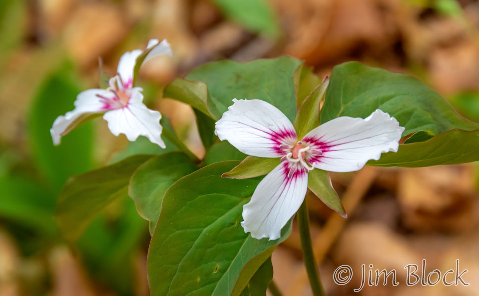
After we got back to our car, I spent a little time wandering through the area between the parking lot and the pond. I found some Painted Trillium, Hanover, New Hampshire’s new official town flower.
Caro seemed happy to be down and able to rest in the back of Bruce’s car. The day was still young so we headed to another trail in Kinsman‘s Notch, but that’s another story.
The trailhead for a climb up Beaver Brook Trail to the summit of Mount Moosilauke is located along Route 112 about 6 miles west of Woodstock, New Hampshire.