Kala Patthar
Our fourth trip to Nepal featured another try to summit Kala Patthar (18,514 ft). On my second trip we had to turn around short of our goal when gastrointestinal illness struck.
From Kala Patthar we expected to look down at Everest Base Camp. We did this four-week trek the hard way by starting in Jiri, the traditional starting place where Edmund Hillary and Tenzin Norgay started for the first successful ascent of Everest. From Jiri we walked eight days to pass below the amazing airport at Lukla at 9,383 feet. After another ten days, we started over the first of two high passes (approximately 18,000 ft each) before eventually arriving at the very basic village of Gorakshep just below Kala Patthar and about three hours below Everest Base Camp.
The day before the first high pass, Renjo La, we met Jennifer Lowe Acker, who gave Chhongba some beef jerky from Montana that Milt and I enjoyed most of the rest of the trip. She is in the middle of this photo taken as we hiked from Thame to Lungden, a place I did not want to stay for more than the one necessary night.
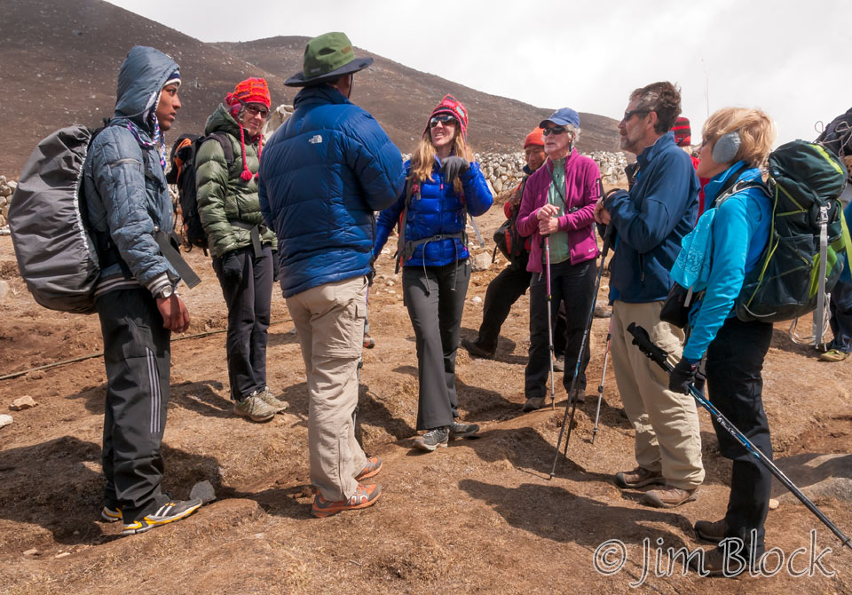
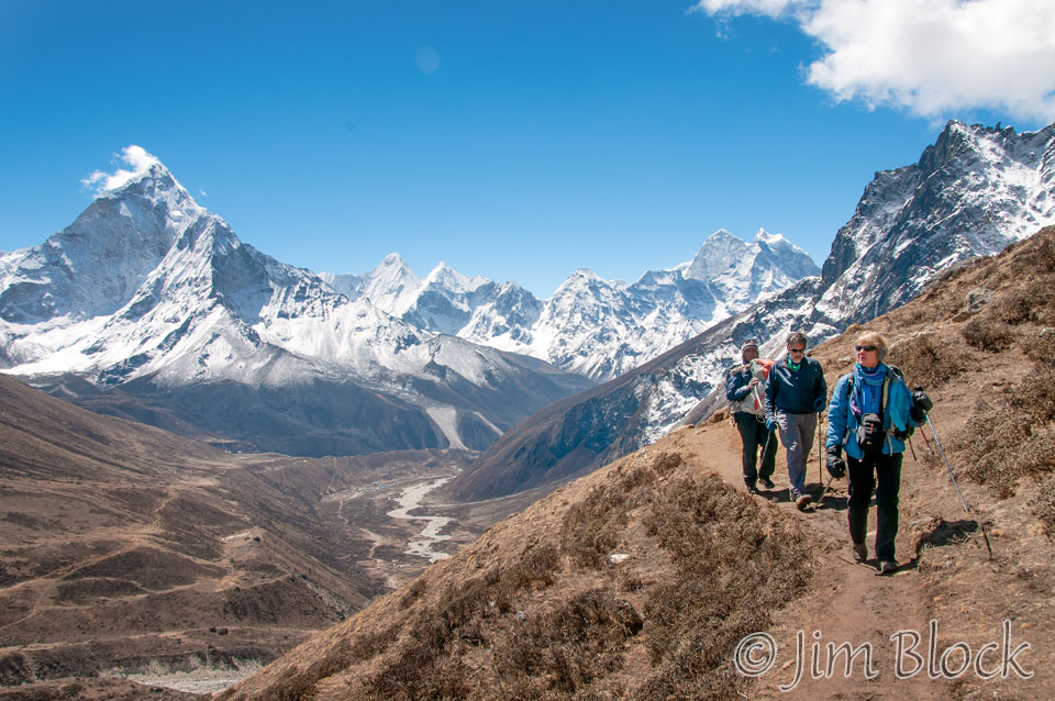
There were five of us from NH and VT on the trek, but for almost one week we were not together. Leeli and Denise had problems with a very bad cold and a touch of altitude sickness part way up to Renjo La (La mean pass). They turned back with Chhongba and a porter to loop through Namche and take the traditional route that avoided the challenging high passes. Carolyn, Milt, and I talked Chhongba into letting us continue along the planned route with an ample number of sherpas and porters along with real coffee and beef jerky. Here we are approaching Renjo La.
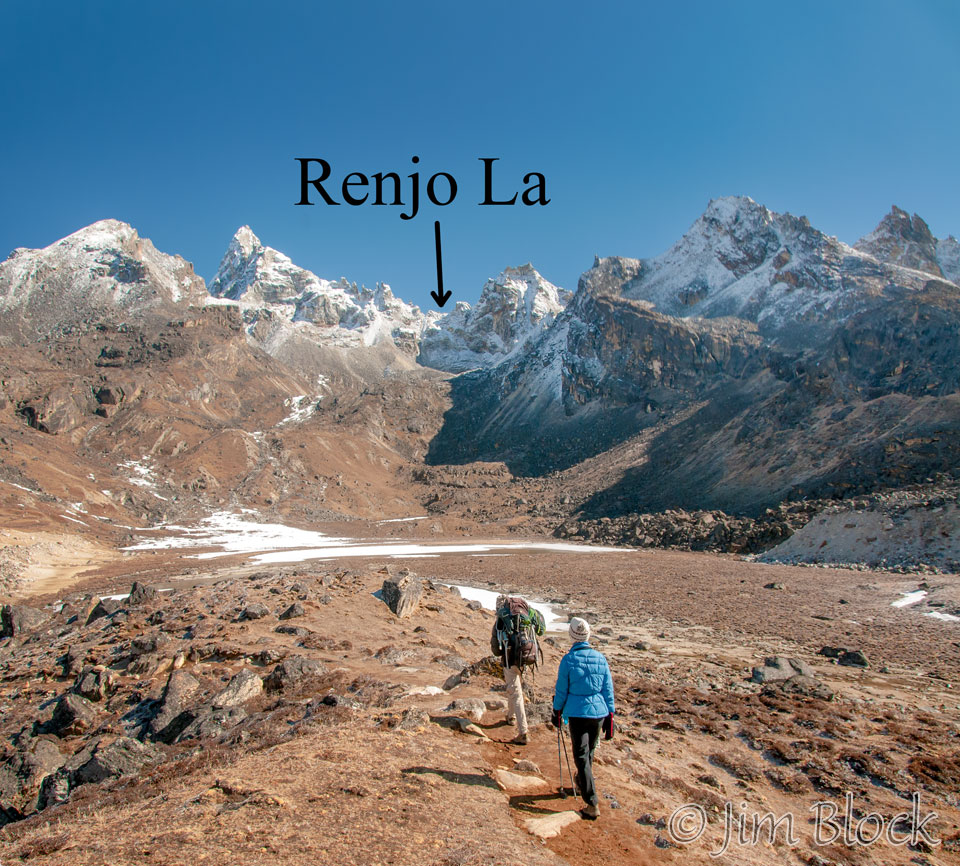
Here we are 45 minutes later, still well below Renjo La, a bit after 9 AM.
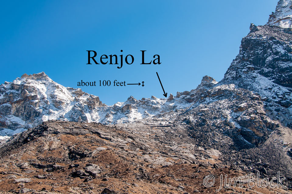
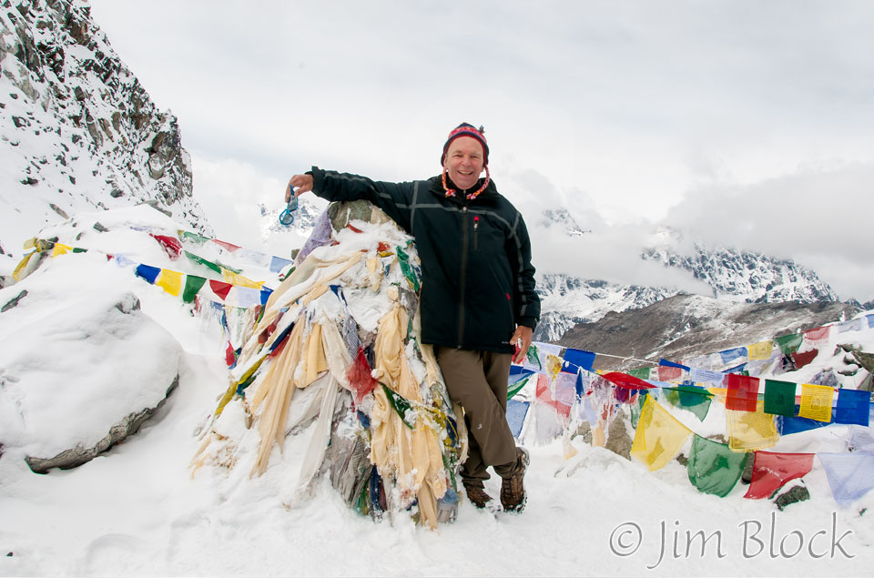
Shortly after noon we reached the pass. Alawa Sherpa took the two photos below.
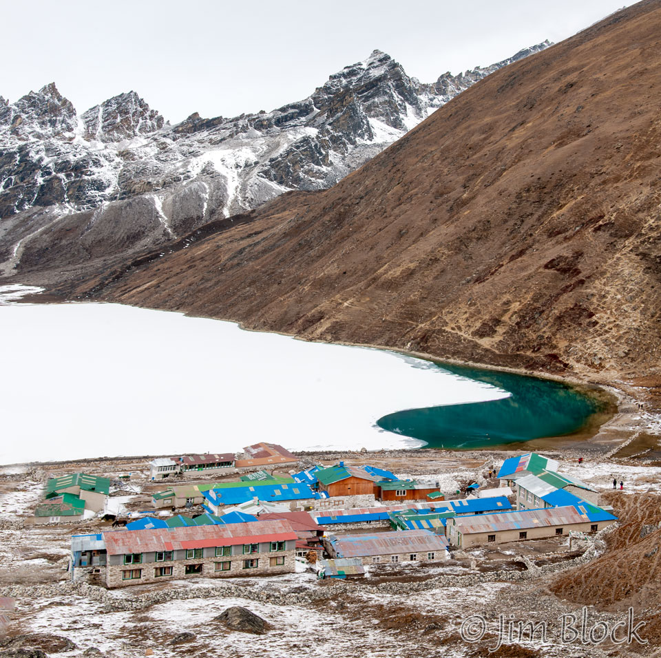
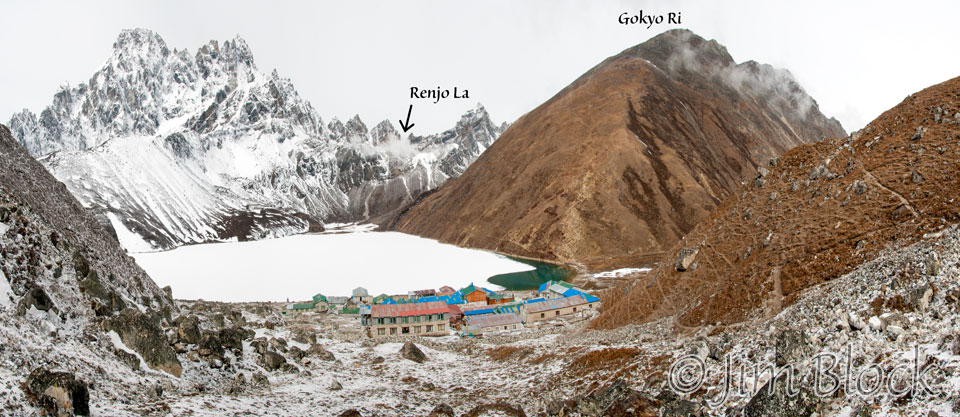
We stayed the night in Gokyo. The photo below shows pretty much the whole village — mostly just lodges in an amazing setting. The lake is Gokyo Cho, the main lake of a 19-lake system. Renjo La is at the top about 1/4 of the way in from the left edge. Gokyo Ri rises to the right.
Early the next morning I hiked up hill with a sherpa, whose purpose was to keep me safe, and made this 7-photo panorama showing where we had been. I’ve always regretted we did not try to talk Babu Sherpa, the person now in charge of our group, into letting us hike up Gokyo Ri. Apparently the view of Everest from there is specular. This was a short day, so we would have had time.
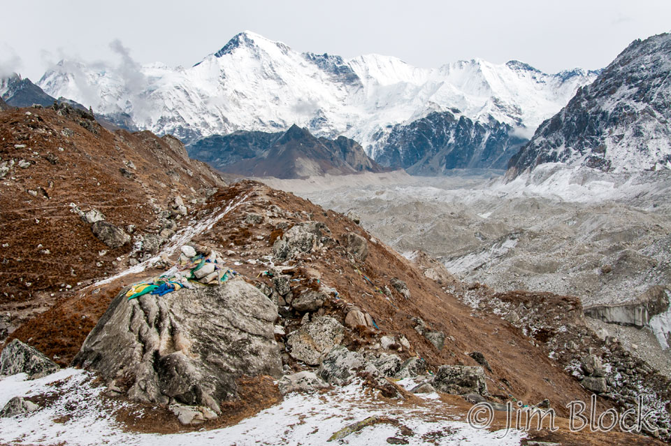
Before meeting up with the rest of the group above Gokyo, I took this photo of the Ngozumba Glacier and Cho Oyu (26,864 feet) on the border of Tibet and Nepal. Cho Oyu means “Turquoise Goddess” in Tibetan.
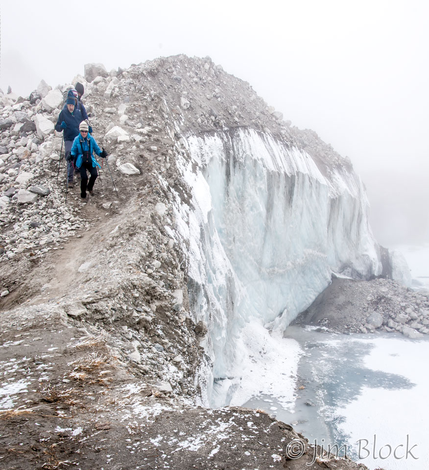
The group caught up with me. We skirted the treacherous lateral moraine of Ngozumba Glacier.
We arrived in
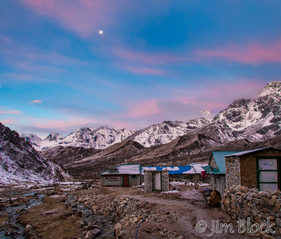
I took the photo below at 6:21 PM from near our lodge.
The next day was a strenuous trek over the next high pass, Cho La. I was awake at 3:45 AM, naturally without an alarm. The wake up notice at our rooms, the call “Bed Tea” (coffee for me and Milt), occurred at 4 AM since we had a long day ahead.
We started hiking by 5:30 AM. A short distance up the trail I looked back and took this photo of our lodge.
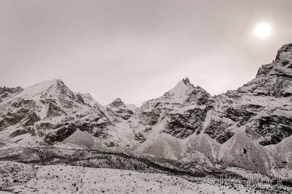
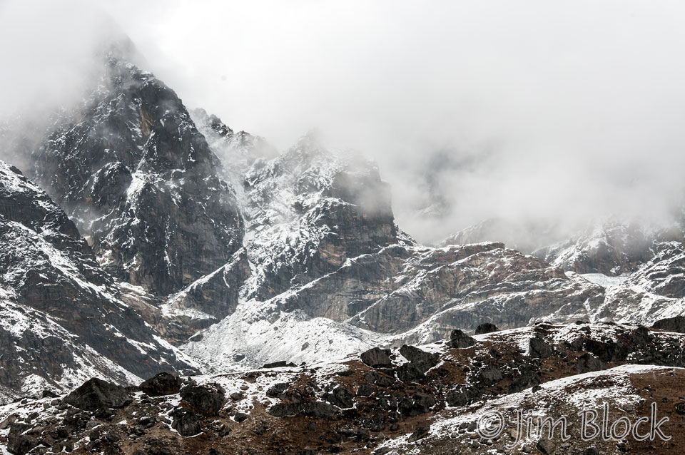
This was a snowy and desolate landscape. After almost 2 hours of hiking we still had a long way to go to reach the pass.
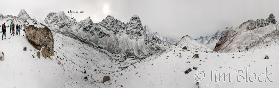
The pass is about a third of the way in from the left hand edge of the photo below taken shortly after the previous one.
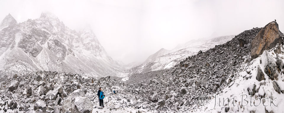
Fog moved in. This 13-photo panorama was taken at 8:16 AM after 2-3/4 hours of hiking.
I had to struggle to get by some wide-bodied German trekkers as they slowly trudged up the trail. They seemed oblivious to others who might want to pass. Carolyn and Milt are in the center of the four-photo panorama below that I made as I neared the pass.
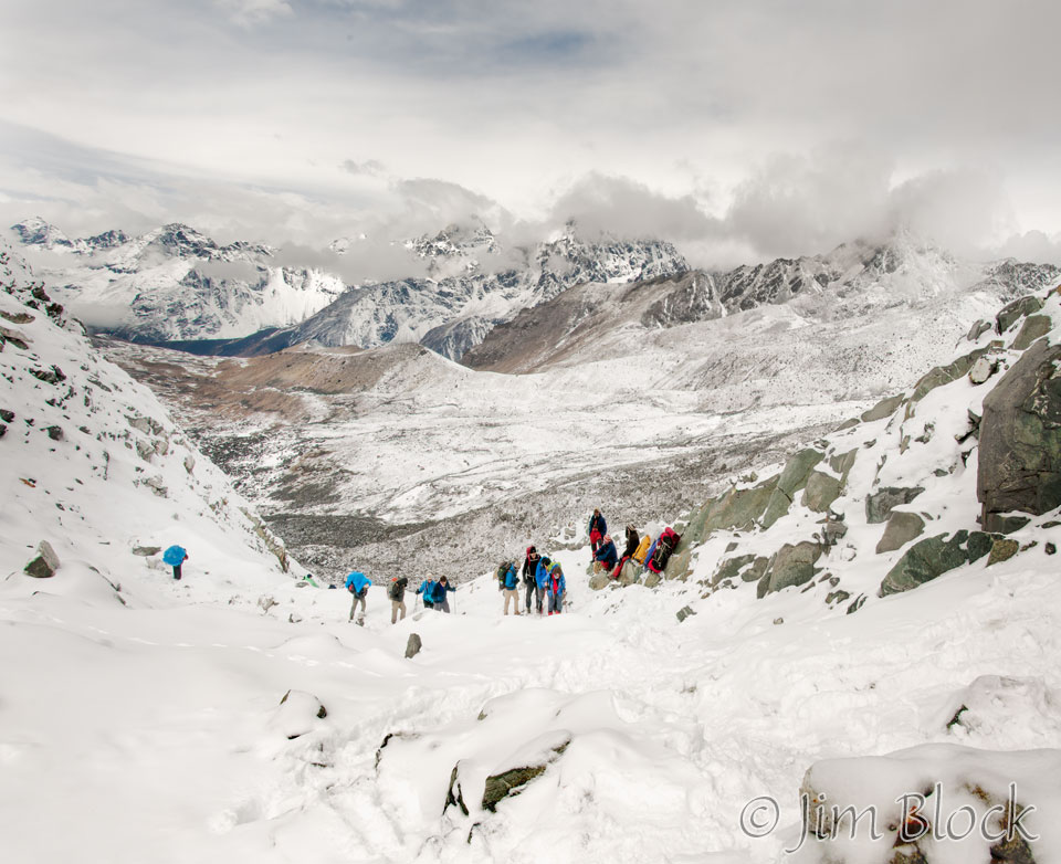
We made it! After a few celebratory hugs and photos, we started the very tricky descent to Dzonglha over huge boulders covered with ice. Carolyn and Milt had microspikes, but I relied on my trekking poles.
 Descending from the pass was treacherous. It was made much more difficult because others were attempting to climb up the narrow trail at the same time. To the right far below was a snow covered body of water.
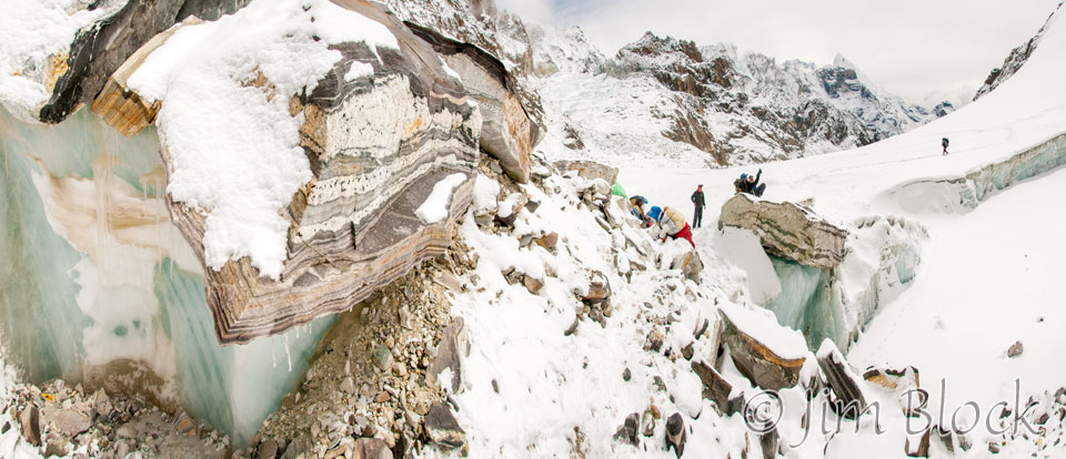
The nine-photo image below is a bit hard to “read”. Up close on the left you can see a strange blend of ice and rocks. In the middle distance you can see people on the trail below. At the lower right is the snow-covered lake. Near the middle of the photo is the red jacket of a person on the steep trail below the pass.
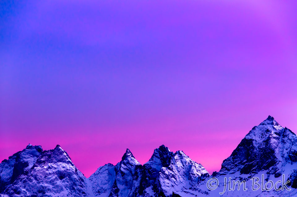
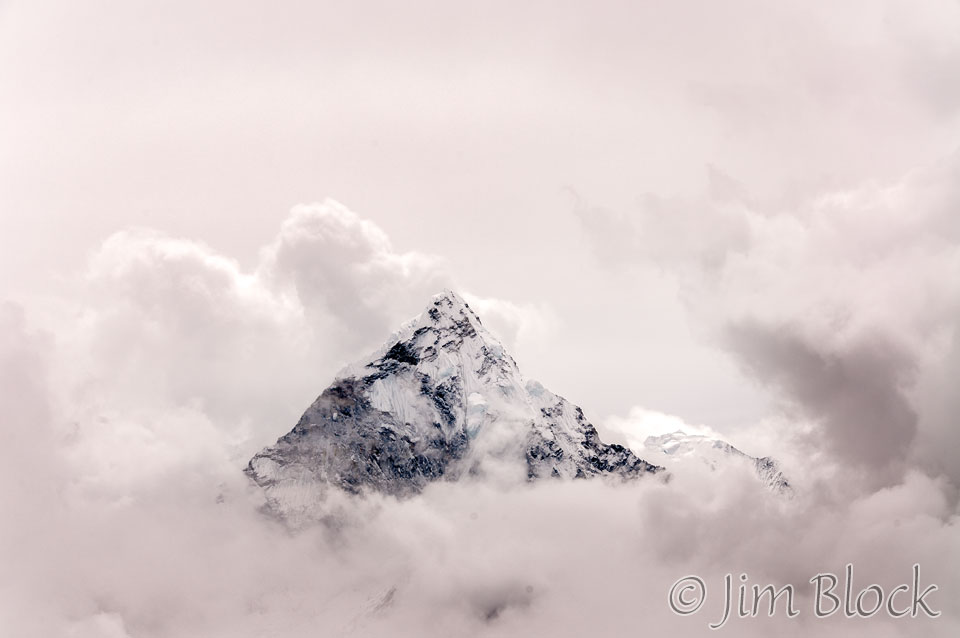
The clouds parted briefly and we got a great look at Ama Dablam.
Almost 3 hours later I turned around to take a photo of where we had come from. The Cho La is somewhere back in those clouds.
The hike to Dzonglha was very long over a sometimes icy and sometimes wet trail. We were cold, wet, and tired. But that did not stop Alawa Sherpa. Shortly after we arrived in Dzonglha, Alawa literally ran downhill to Periche to meet the rest of our party and help them get to Lobuche where we would all stay the next night.
That evening in Dzonglha everyone crowded around the one stove and placed their boots and clothes nearby trying to dry them. It was a real zoo.
I took a photo of Ama Dablam at 6 PM when the clouds parted and Ama Dablam made a very brief appearance. It had an interesting shadow on its face. I had left my boots behind to dry and headed out in the snow wearing my Crocs when an excited Nabin told me of the photo opp.
The next morning the view of Ama Dablam was stunning.
Periche is far down in the valley before Ama Dablam and to the right. Lobuche is down and to the left.
We hiked down east toward the valley where Periche was located then left. In the photo below we are heading north toward Luboche. On the far left if Ama Dablam. Above Milt’s head is Kangtega. You might be able to just make our the village of Periche in the valley. Periche has the only clinic in the area staffed mostly be volunteers from England, the US, and elsewhere.
We stayed in the very cold village of Luboche (or Loboche or Lobuche; spelling is optional in Nepal, Leeli tells me) in a very cold lodge that had a plastic-enclosed sunroom. The thermometer Milt carried read 93°F in the sunroom.
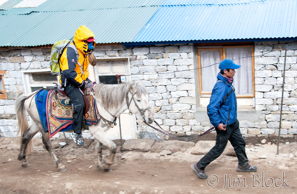
From my room in Luboche I watched a person struck with altitude sickness get fitted with an oxygen mask, helped onto a horse, and led downhill, presumably to the clinic at Periche.
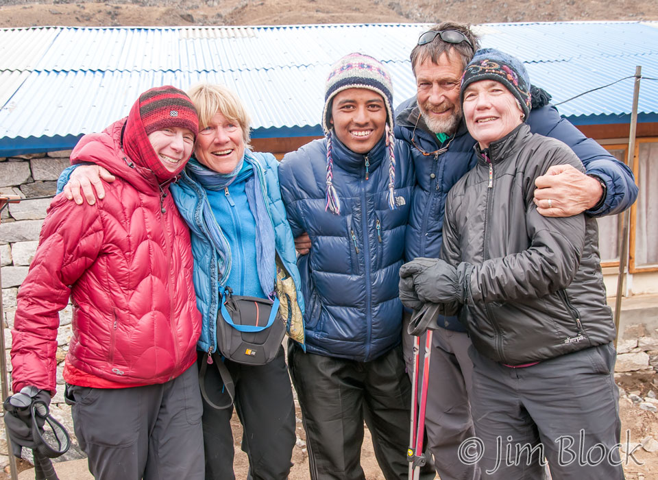
That afternoon around 4:30 PM Denise and Leeli arrived. Here are left to right Denise. Carolyn, Nabin, Milt, and Leeli.
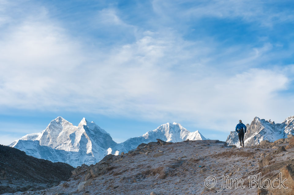
Improbably, the next morning I watched part of a long-distance race — at over 16,000 ft. Here of one of the runners with Kangtega (“The Saddle”) on the left and Thamserku on the right.
According to my notebook all the lodges in Luboche, Namche, and Gorakshep were jammed full. This was the height of the trekking and climbing season for Everest, and there were lots of tourists. Chhongba said he had never seen so many people before in this region. (I hate seeing tourists when I’m on vacation.)
Chhongba decided we would have a rest day in Luboche and then, fortunately, changed his mind. We were split up again since Leeli and Denise really wanted a rest day. So three of us, with our support crew, would head up toward Kala Patthar hoping we could somehow get an overnight lodge in Gorakshep.
We left Luboche in the morning. That morning Milt used his thermometer to record 29°F in their room. My room was slightly warmer because there was a stove vent pipe running through it from the first floor.
Chhongba was not sure we would be able to stay overnight in Gorakshep so he sent Babu Sherpa ahead early to try to get us a few rooms. We hoped to stay there two nights, but in the end we were lucky to get two rooms in Gorakshep for one night. I’m not sure where Chhongba and the shepas slept.
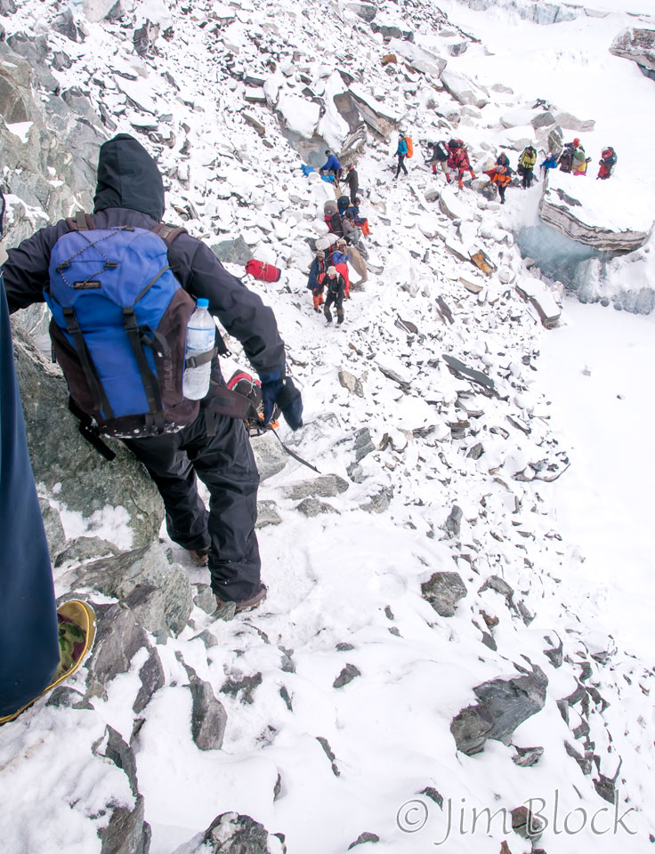
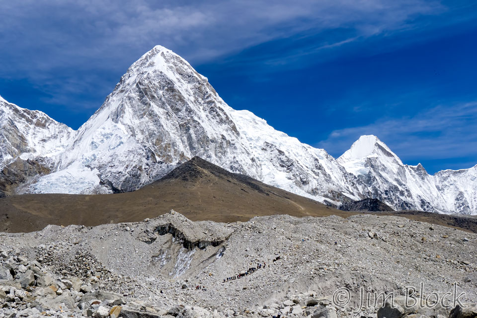
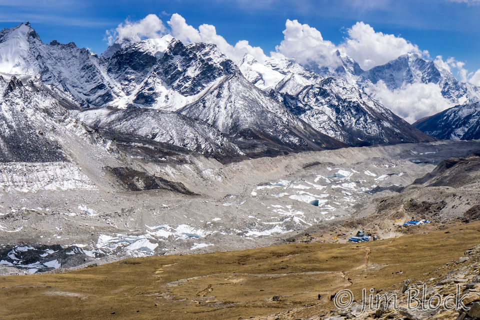
The photo below, one of my favorites, was taken as we hiked to Gorakshep. You can see the black pyramid in the middle that is Kala Patthar (18,514 ft). In the foreground hiking along the Khumbu Glacier, you can see lines of trekkers, sherpas, and porters heading toward Base Camp. In the background is Pumori (23,494 ft), a mountain that straddles Tibet and Nepal. Everest Base Camp is out of sight before the mountains at the right edge of the photo. Kala Patthar looks like an easy climb, but looks are deceiving, especially at 18,000 ft. The standard time up is 2 hours from Gorakshep at its base.
We lunched in Gorakshep, but I was unhappy with Chhongba that we did. I did not care in the least about food, wanting to summit before the clouds moved in and blocked the view of Everest and the other huge Himalayan peaks. For me photography is much more important that eating. One does not go to Nepal for the food anyway; it is pretty bland and often takes forever to arrive at the table.
I finally convinced Chhongba to let me leave somewhat before the rest of the group. I headed up with Babu Sherpa at 12:30 PM. I almost ran up Kala Patthar arriving at the summit at 2 PM. This is normally a two hour hike. Kala Patthar is the highest altitude most will reach without a climbing permit.
On the way up I got these photos of Everest and the Khumbu Glacier valley. In the top photo Everest is the black triangle in the middle. In the second photo you can see the lodges of Gorakshep on the bottom right.
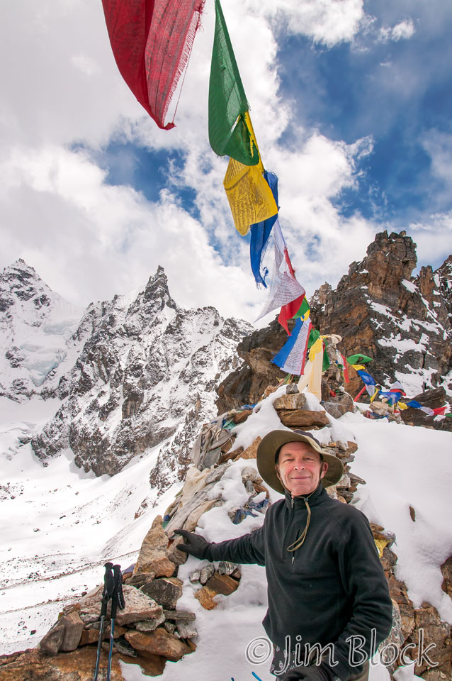
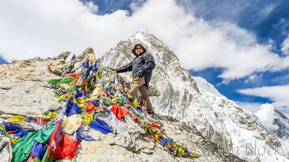
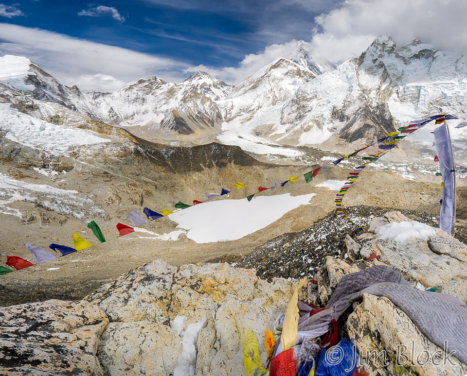
I expected the summit would be a broad area, but instead it was just a tiny peak — a pile of rocks covered with prayer flags. I scrambled to the top pulling myself up using the thousands of prayer flags to help. Purmori is in the background of these two photos.
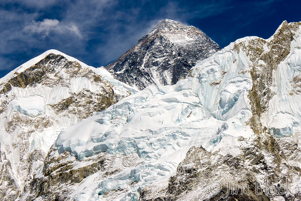
My 18-200mm lens was damaged a few days before. I did not know what caused it. I took the 7-photo panorama below with a 50mm lens on a DSLR. Everest is the dark peak to the right, Base Camp is at the bottom left, and between the two is the treacherous icefall that climbers and sherpas need to cross multiple times.
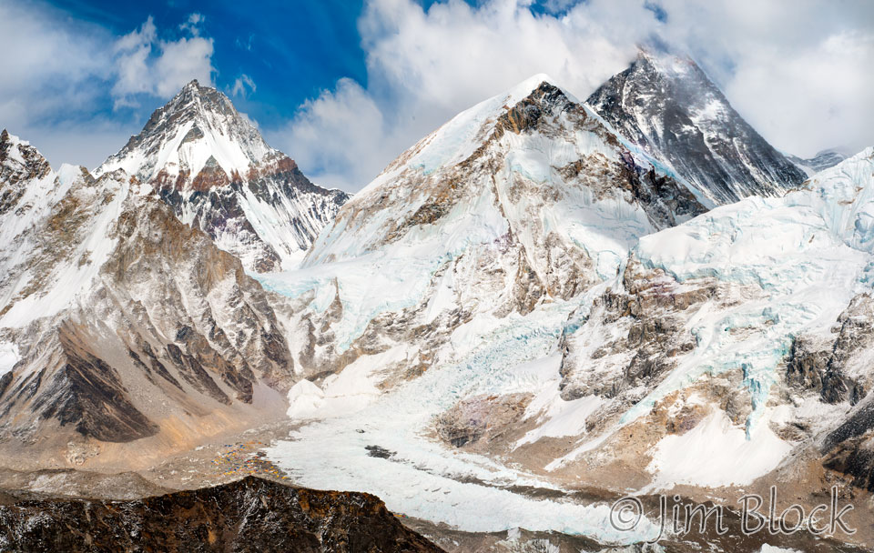
I also had a small Panasonic DMC-LX5 camera with a nice wide angle lens. I used it to make the six-photo image below from the top of Kala Patthar. Mount Everest is partially in the clouds to the right of center. Before it and a bit to the left is the West Shoulder. Base Camp and the icefall are below it. The peak in the center back is Changtse in Tibet. On the right side of the photo is Nuptse.
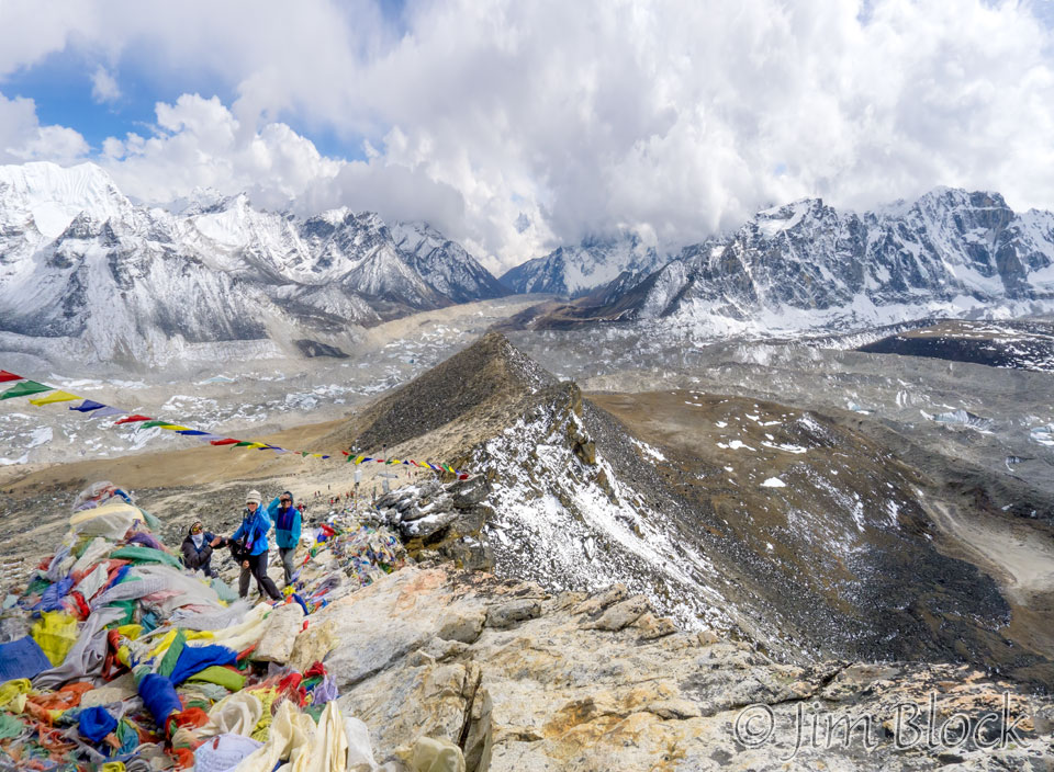
While I was perched on the summit alone enjoying the view, Carolyn and Milt arrived. You can see them on the left beyond the prayer flags in this photo looking down the Khumbu valley from the summit.
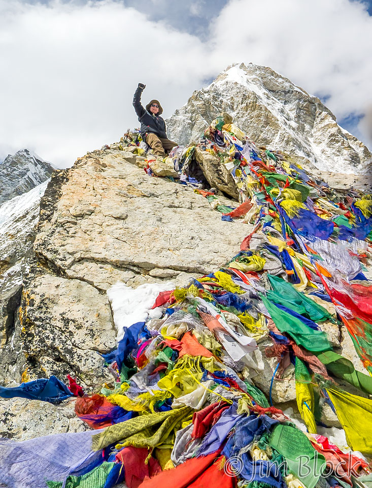
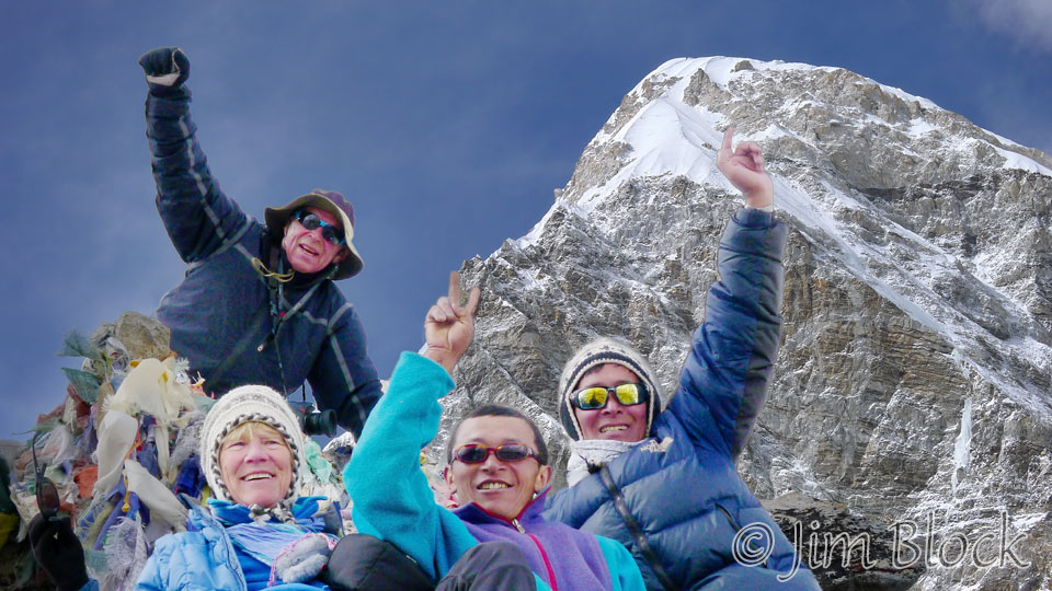
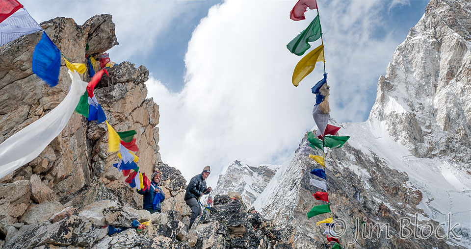
I was just a little bit below the summit when the photo below was taken. Below me are Carolyn, Maila Rai, and Babu Sherpa.
I descended from the narrow peak and moved to a small lookout area that had a sharp drop off in several directions. From here our sherpas climbed precariously to some rocks to string prayer flags. You can’t tell from this photo but they were very near the edge of a 1500 foot straight down cliff. That is approximately the climb from Gorakshep to Kala Patthar.
That evening in the dining room at our lodge in Gorakshep we met a woman who was born in Nepal but had been living in Canada. She was planning to summit Mount Everest. We mentioned the two passes we had crossed. She said she did them too and found them extremely difficult. About a month later she died on Mount Everest.
A young woman named Dawa Yangzum Sherpa was in the dining room of our lodge that evening. Chhongba introduced her to us. She was an instructor at the Khumbu Climbing Center in Phortse and was hoping to summit for the first time with the National Geographic team. Chhongba’s son, Mingmar, was also on that team hoping to summit for the first time. They both did.
She left the lodge fairly late in the afternoon to walk back to Base Camp, about a three hour walk. I expressed a bit of concern to Chhongba. He said that she was a very strong person and would probably do it in 90 minutes. You can read about what she has done since then HERE.
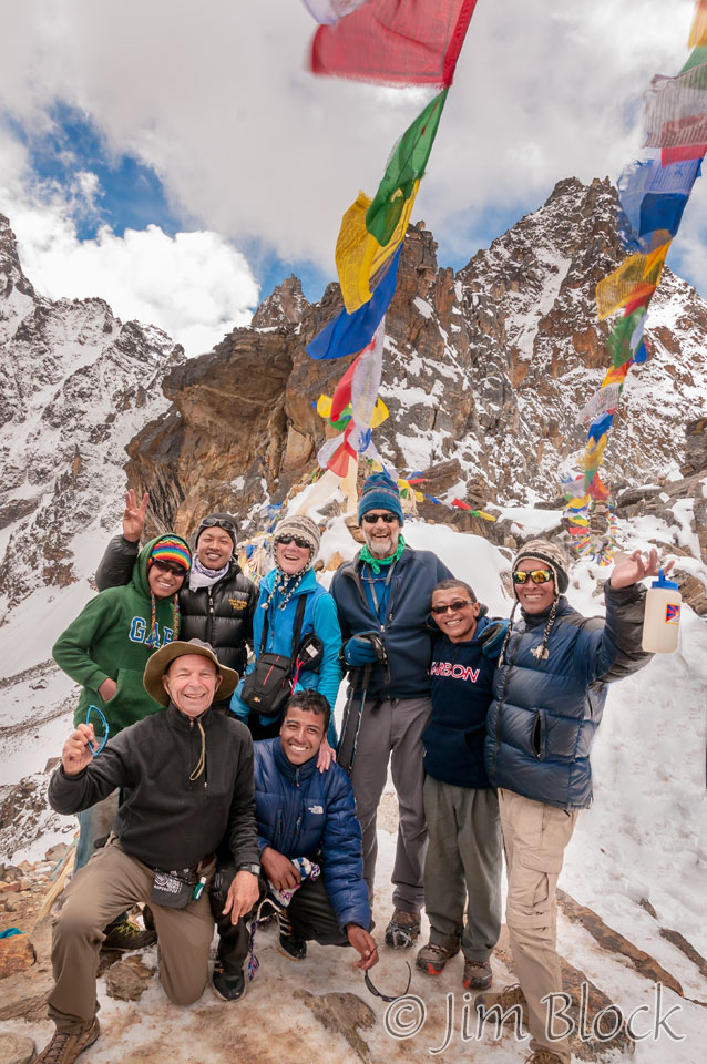
That evening Carolyn commented, “Not a bad Friday the 13th”. We had cheese and mushroom pizza for dinner.
![]()