Everest Base Camp
After finally making it to the summit of Kala Patthar, I woke in Gorakshep at 4 AM to a lot of noise. Many people were heading up Kala Patthar before 5 AM. That’s what I really wanted to do, but timing did not work out for that. The Buddha Lodge where we stayed was very cold and noisy. It was not at all attractive, but at least we had a bed for the night.
We could just barely see the tip of Everest from our lodge. Here is a photo taken at 6:34 AM.
Chhongba had allowed an extra day in the schedule which we hadn’t used yet. So Chhongba took Carolyn, Milt and me to Everest Base Camp. A huge bonus that we certainly did not expect on this trip. We left our lodge at 7:45 AM. We already knew that we would not be able to stay for the second night in Gorakshep — we were very lucky we got rooms for one night.
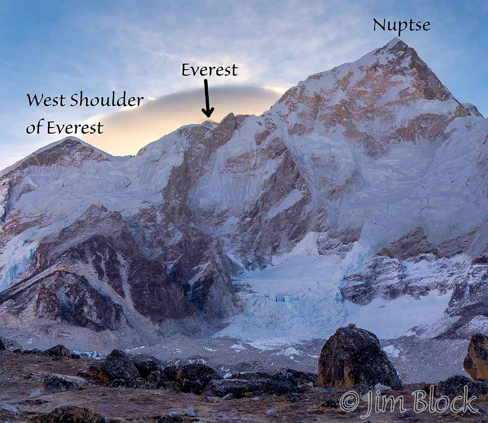
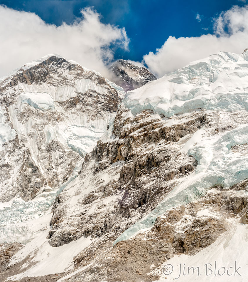
Around 9 AM I took some photos of Everest with its normal trailing cloud. The first photo below shows the West Shoulder on the left and Nupste on the right. The Khumbu Glacier is along the bottom edge of this photo.
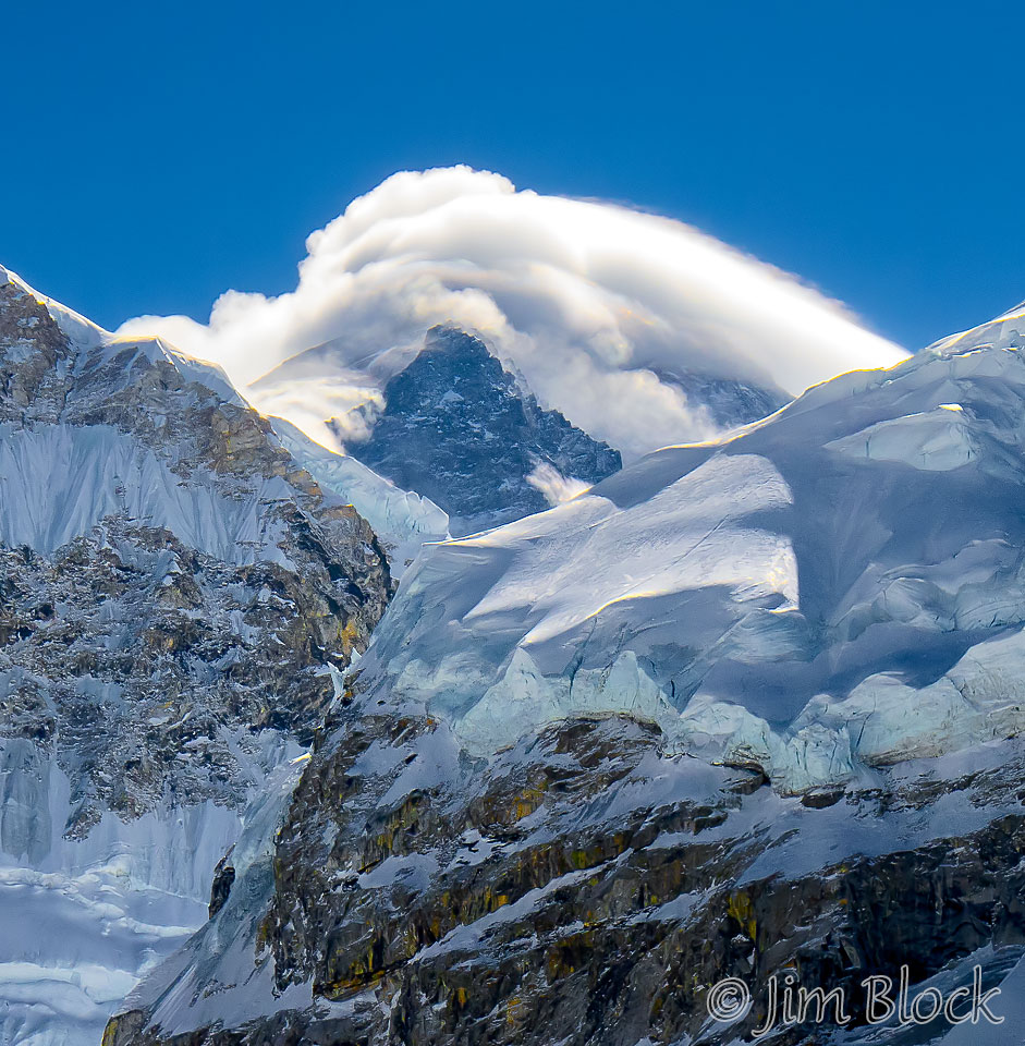
Here is a closer look at Mount Everest. The actual summit is hidden in the clouds.
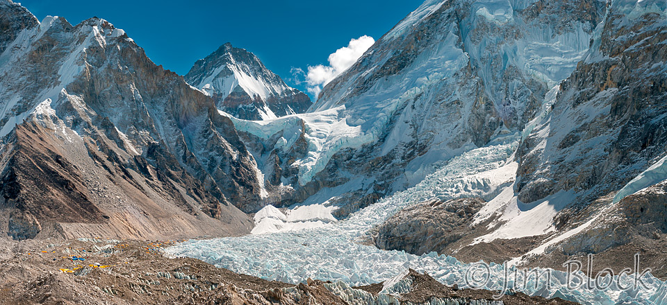
At 9:17 AM we started to get a view of Everest Base Camp, which is at the left side of the photo below. My 18-200mm lens had been damaged somehow so I was mostly using a 50mm lens. The photo below is a 33-photo panorama.
Across the middle of the photo is the Khumbu glacier. Above it and to the left of center is the Khumbu icefall and “popcorn field”. Above the icefall is the West Shoulder of Everest. The mountain to the right is Nuptse (25,850 ft). Everest is just barely peeking over the right side of the West Shoulder in the clouds. The peak to the left of the West Shoulder, which somewhat resembles Everest, is Changtse, a 24,770 foot mountain in Tibet.
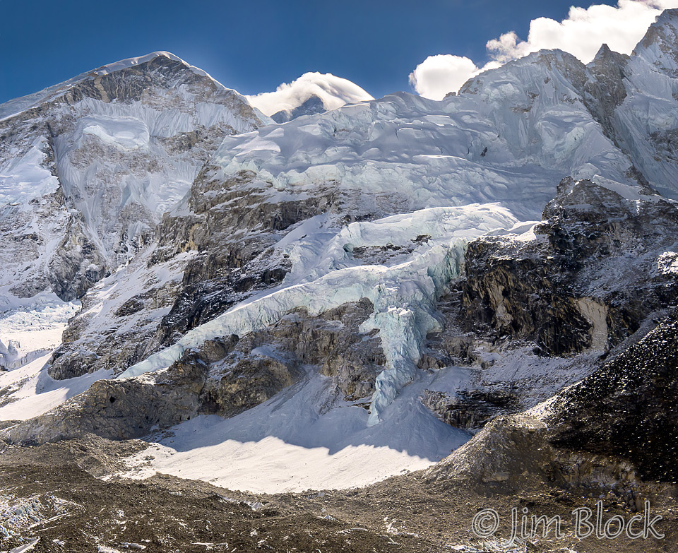
Here is a closer look at the icefall and popcorn field. The peak in the center back is Changtse in Tibet. The route up Everest is along the icefall from the bottom center up toward the right.
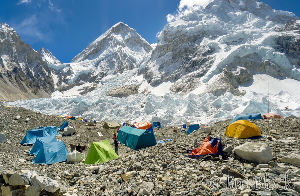
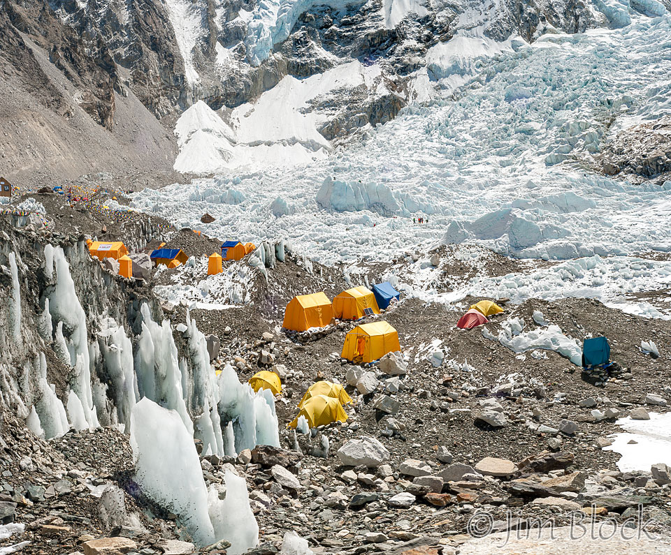
Around 10 AM we began to enter Base Camp. The photo below shows how rugged this area is. Nothing is level. Near the center of this photo is the West Shoulder. The route up Everest passes in front of it and to the right. That is the most dangerous section of the climb up Everest, especially for the sherpas since they have to cross this unstable area with ladders and crevasses many times. On April 18, 2014, four days after the second anniversary of our visit, seracs (huge blocks of glacial ice) on the West Shoulder fell resulting in an ice avalanche that killed sixteen sherpas.
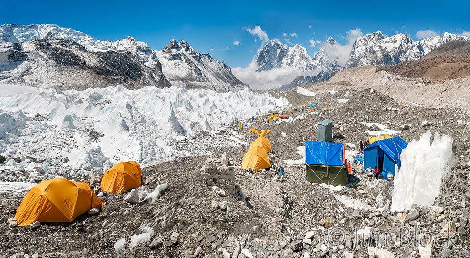
I took the 17-photo panorama below looking south down the Khumbu Glacier toward Ama Dablam, which is the sharp peak to the right of center. Closer to the center is Kangtega (“The Saddle”). To the right of Ama Dablam is Tobuche and Cholatse. This photo again shows how rugged the area is. These tents are quite far from the “action” and the route up.
A bit closer to the two expedition camps Chhongba was taking us to visit, I made this 24-photo panorama.
I made the 18-photo panorama below when we were still heading down to our destinations. In the middle of the photo you might be able to make out climbers practicing. The treacherous icefall and popcorn field head up to the right top corner of the photo.
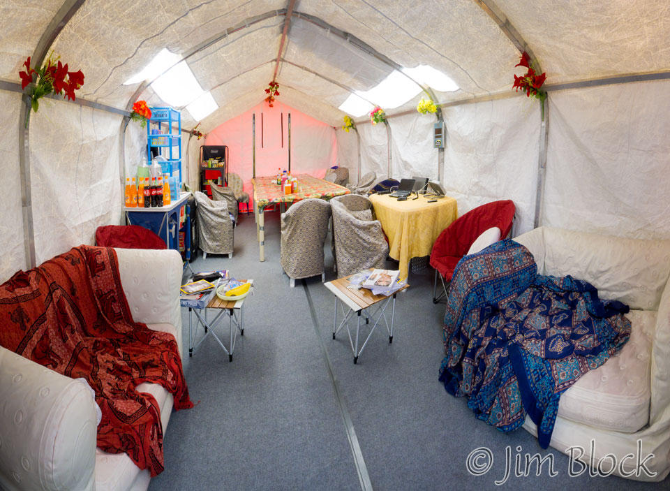
We arrived at the Adventure Consultants camp. Chhongba was the head cook for this New Zealand tour company for a number of years. I was surprised at how luxurious this dining room/lounge was with large couches that looked very comfortable. Everything you see gets carried in and out each year.
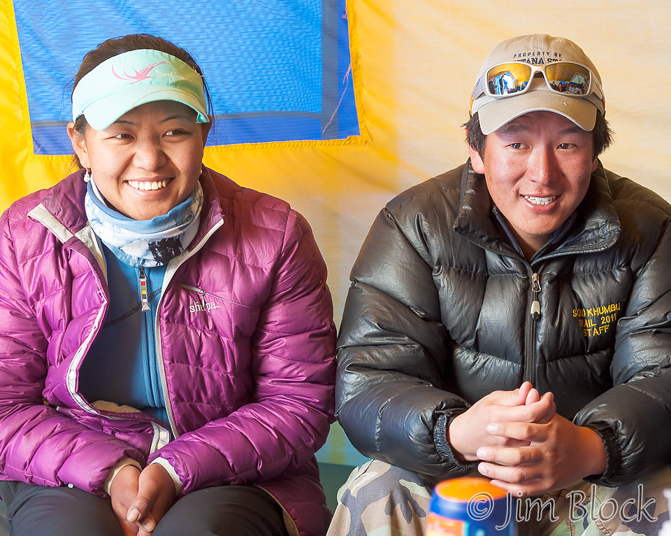
We visited the National Geographic camp where we had tea with Dawa Yangzum Sherpa and Mingmar Sherpa, Chhongba’s son. The next month they both summitted Everest for their first time.
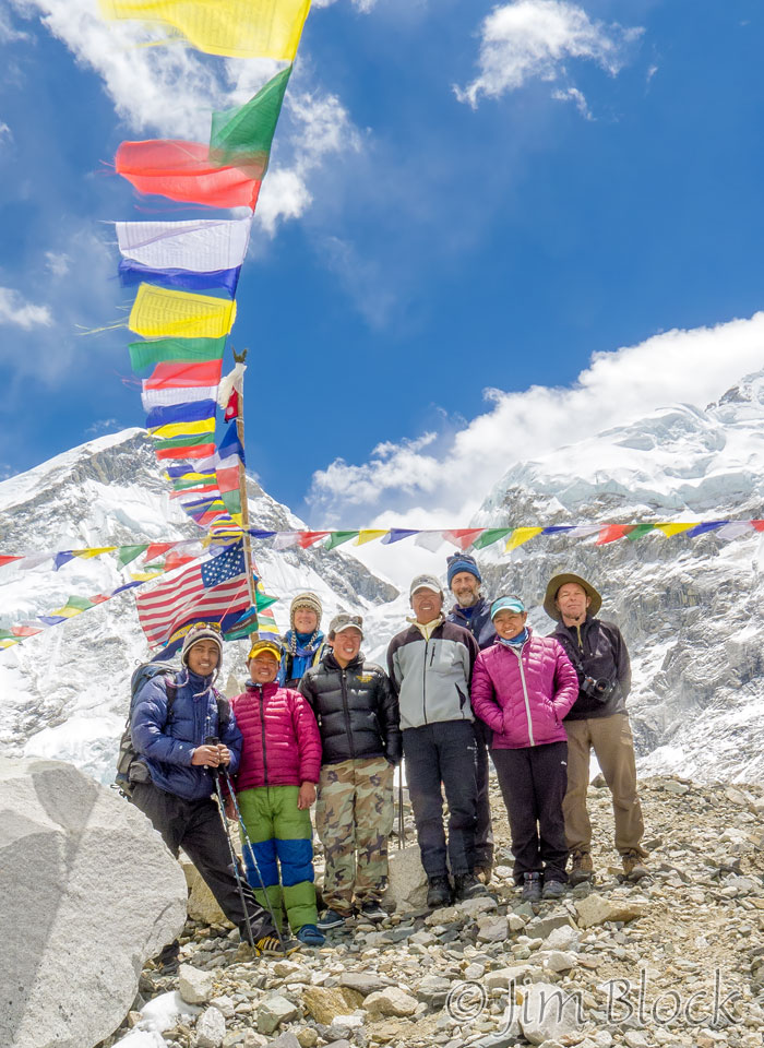
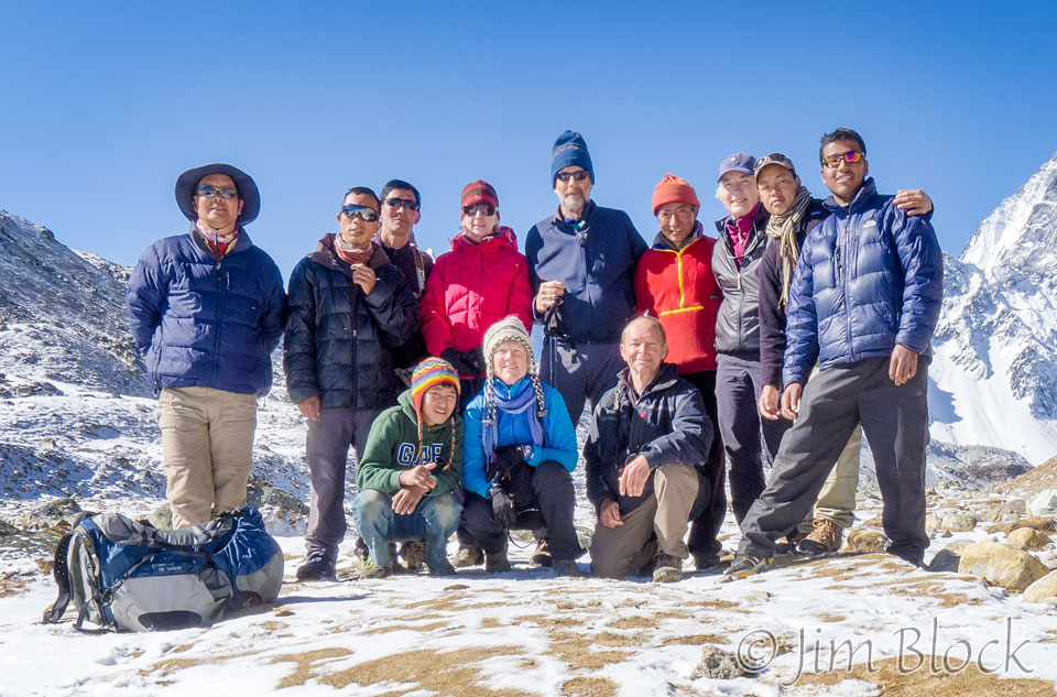
Here is our group in a photo that I believe Chhongba took with my camera. The three Americans are in the back row — Carolyn, Milt, and me.
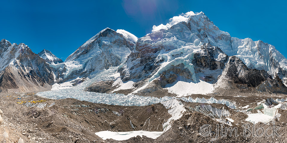
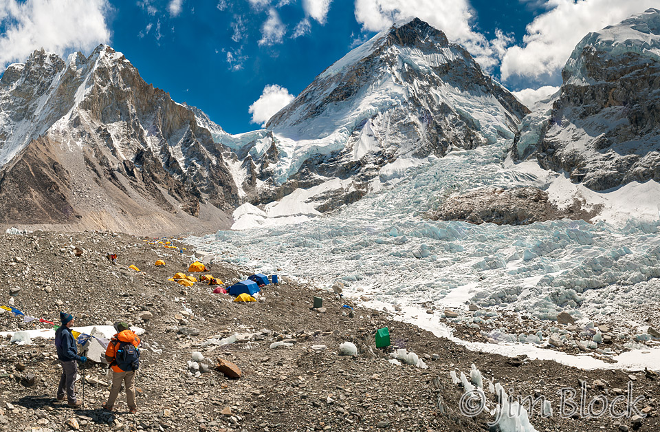
We headed back to Gorakshep, and at 12:23 PM I took this photo looking back at Mount Everest between the West Shoulder on the left and a piece of Nuptse on the right. The icefall is in the bottom left of the photo.
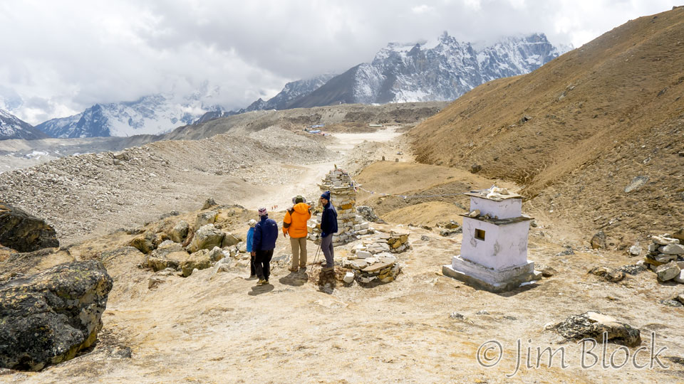
Along the way back to Gorakshep, we detoured to a memorial to four Adventure Consultant climbers who perished on Everest in 1996. The memorial was built in 1998 by Jon Krakauer and Chhongba. Krakauer wrote a bestselling book, “Into Thin Air”, about this disaster. The lower slope of Kala Patthar is seen on the right side of this photo. The two lodges in Gorakshep are just barely visible near the center of the photo.
Leeli and Denise took a rest day in Luboche while we summited Kala Patthar. The day we went to Everest Base Camp, they hiked from Luboche to Kala Patthar and then back to Luboche. I was very happy and impressed that they made it to top of Kala Patthar. Here is our group the next day as we headed down from Luboche.
The sherpas walked with us, but almost always the porters went way ahead. However, in the photo above you can see a porter and good friend to all of us, Alawa Sherpa, in the red jacket in the back right of the photo between Milt and Leeli and above me. He often walked with us even though he had a heavy load to carry.
This day and the previous day when we climbed Kala Patthar were two of the most unforgettable days of my life.
![]()