Our first day of actual trekking took us from Besi Shar at 2,490 ft along the Marsyangdi River — which we followed to Manang — to Bahundande at 4,295 ft with many ups and downs along the way. Nothing is level in Nepal — at least not in the parts I have visited. We saw over-200-year-old terraces, twin goats just born, and a bit of light rain in the late afternoon. Throughout the day we got some nice views of Manaslu to the northeast at 26,781 ft, the 8th highest mountain in the world.

My big mistake for the day happened right at the start. I got behind taking photos and, to try to catch up, rushed down the steep downhill out of Besi Shar. My already-strained left calf paid for this soon after. The sherpas helped me survive the day by carrying my pack. At lunch I asked Dr. Stephen for advice, and he said to ask his son, Keg.
Keg is a runner and hence leg expert. Stephen’s specialty is hearts, and mine was fine. Keg gave me stretching advice and wrapped my leg. I used the Ace-bandage he gave my the rest of the trip, taking it off it at each lunch stop for the 90 minutes lunch normally took. Later I took some Motrin-like pills. Gradually the pain subsided a bit.
Along the way, we crossed two “interesting” bridges. The first, before the village of Khudi, was a broken-down suspension bridge with many holes in the boards where your feet should not go. The second was spotted as we approached our lunch spot in Bhulbhule. I though, wow, look at that bamboo contraption that the locals must navigate. After lunch I learned we too must cross it. At least there were no yaks around at this elevation to share the bridge with us. You can see the bamboo bridge to the right below and in the slide show that follows.


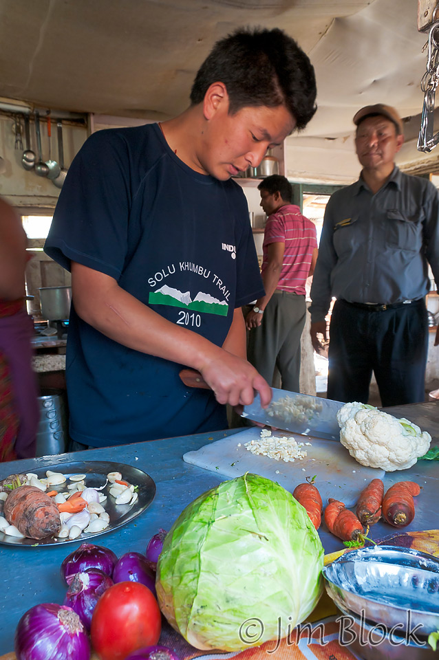
Below is the kitchen window where our shepras and the local folks who ran the restaurant prepared our lunch with Chhongba supervising the operation.

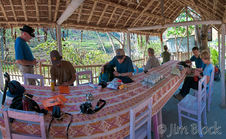
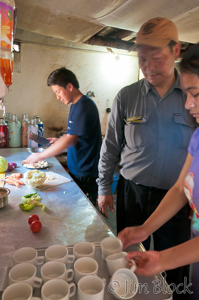
Above is a somewhat distorted view of our table, and below shows the lunch preparations.
Bhulbhule was named after the “bhul, bhul” babble that a natural spring murmurs higher up the slope at the original site of the village. People moved down to the more accessible location near the river 150 years ago as the Tibetan salt trade in the valley grew significant.
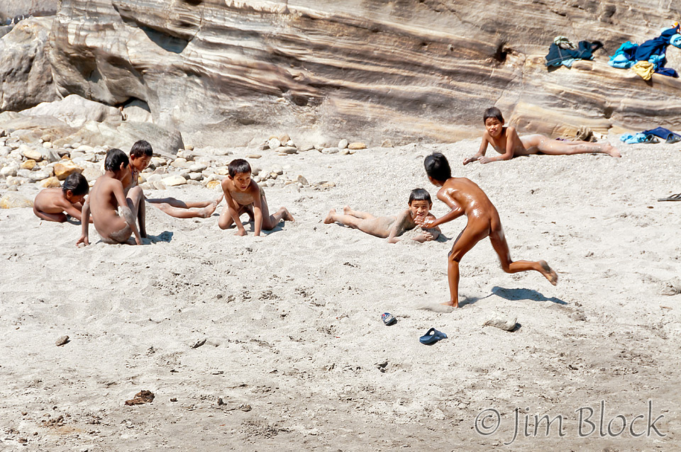
The day was quite warm and local kids took advantage of the river to play and swim. Couples plowed there fields with animals, parts of the trail were heavily fortified with gabions against landslides, and monkeys played not too far off the trail in the brush.
The porters had a full load (bottled water, canned goods, etc) and had trouble with the steep hills. They were 1-1/2 hours late arriving at our hotel for the night. Chhongba sent some sherpas back down to help them.
The owner of the Panoramic Mountain View Hotel is the third generation there. He says the new road, which is on the other side of the river, is hurting business. From the hotel we had beautiful views — like the one below — of the heavily terraced fields below where they plant two crops per year: corn, millet, and /or beans in the spring then rice for the monsoon season.


")


")
")


")


")


")


")


![]()