Rifugio Vazzoler is surrounded by trees and mountain peaks, so it is not a great spot for sunrise or sunset photography. However I did get a little color in the clouds around 6:30 AM.
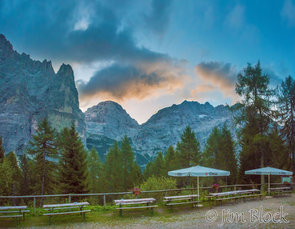
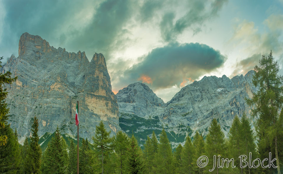
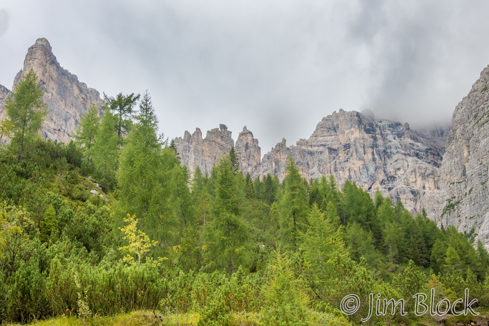
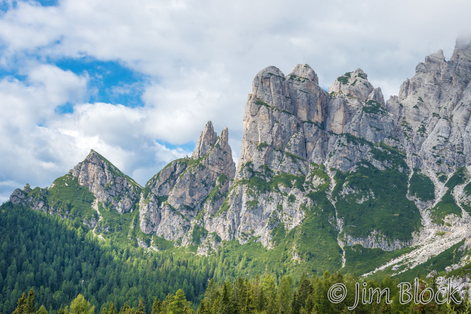
The southern part of the Civetta massif is seen below about two hours later. Torre Venezia is on the left and to its right, Torre Trieste.
Breakfast was very sparce — cheese, ham, bread, and instant coffee. I guess we had gotten spoiled by the great breakfasts at earlier rifugios such at Sennes and Lagazuoi.
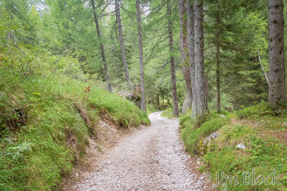
Shortly before 8:30 AM we were making preparations to leave.


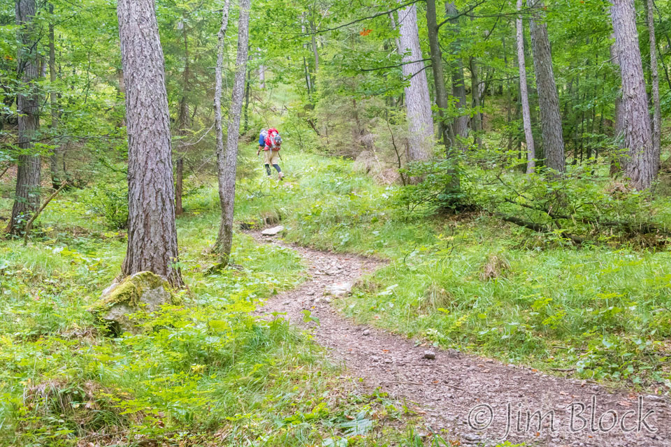
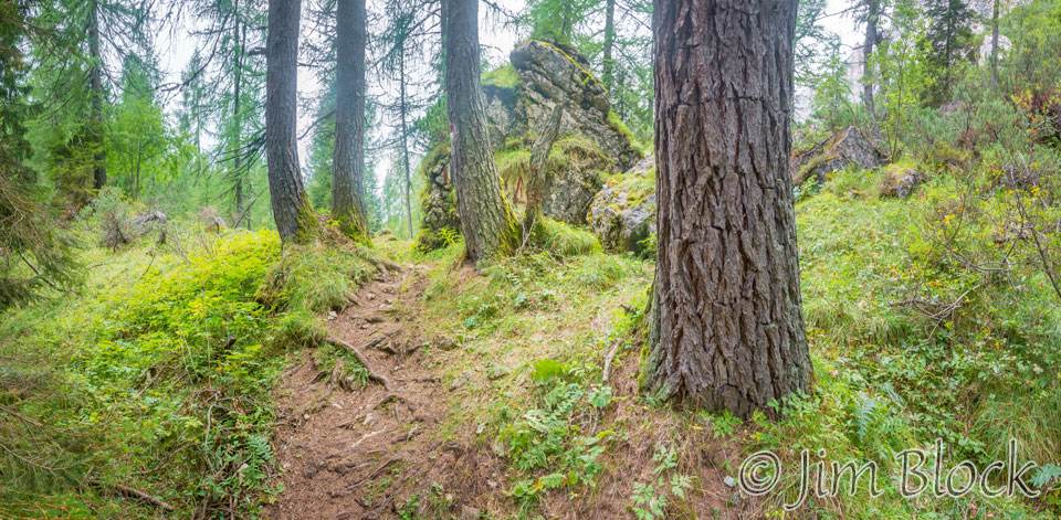
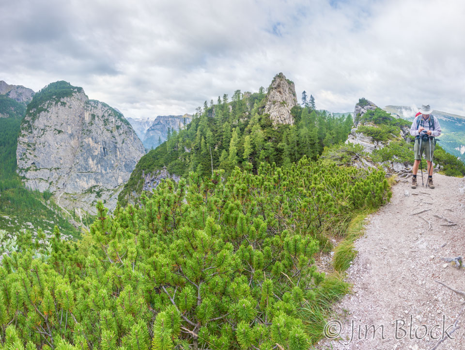
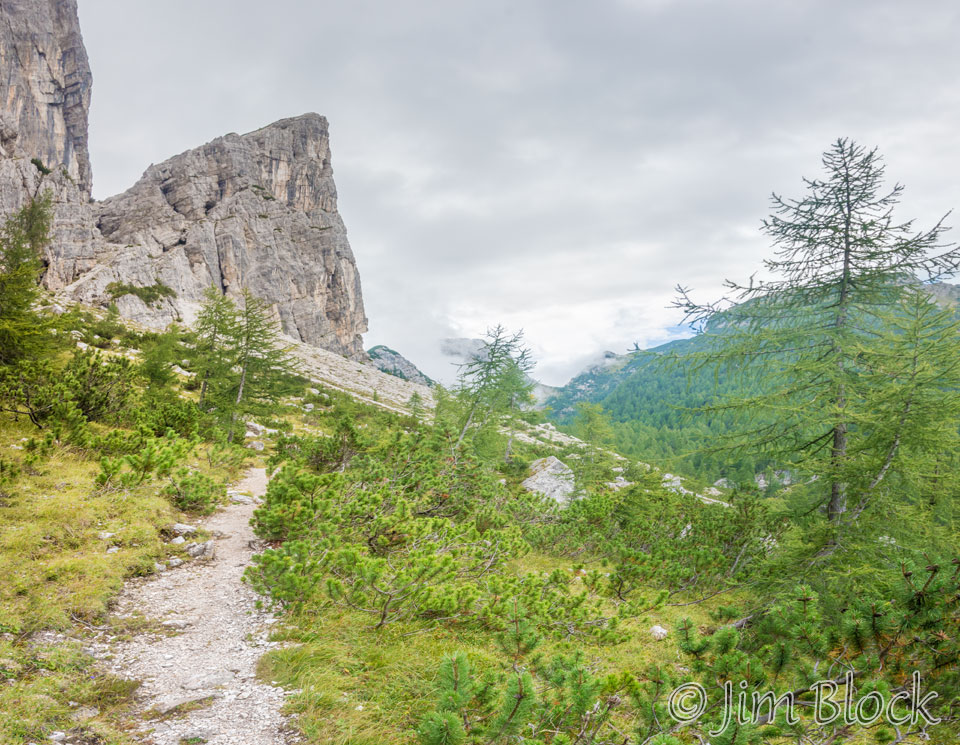
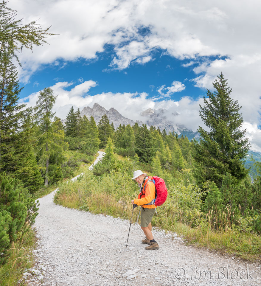
Initially the track was wide and easy as it meandered through the forest.
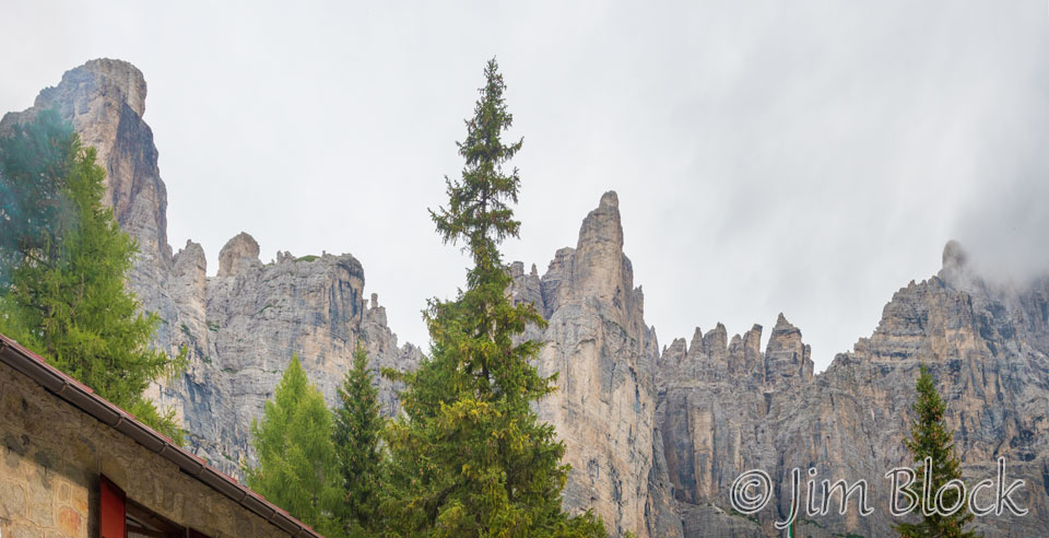
Occasionally we would get views back at the rugged spires of the southern part of the Civetta massif – Torre Venezia on the left and Torre Trieste in the center.
We crossed some dry gullies. One of these photos even has Stephen in it twice! That is an option one has when taking multiple photos that contain a moving subject and then blending them into a single image.
")
")

")
The forest was quite beautiful, and we found some wildflowers to photograph.


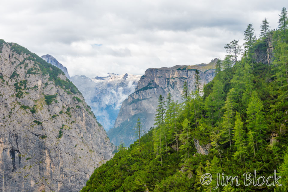
We got several views down to Val Corpassa. We reached the junction with Path 554 and left the track. I think I have finally figured it out. What the route cards call a track is what we might call a gravel road. What they call a path we might call a trail.

")
")
")
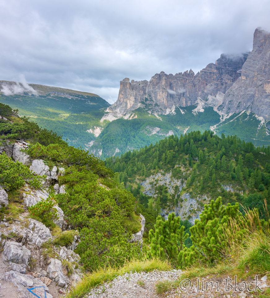
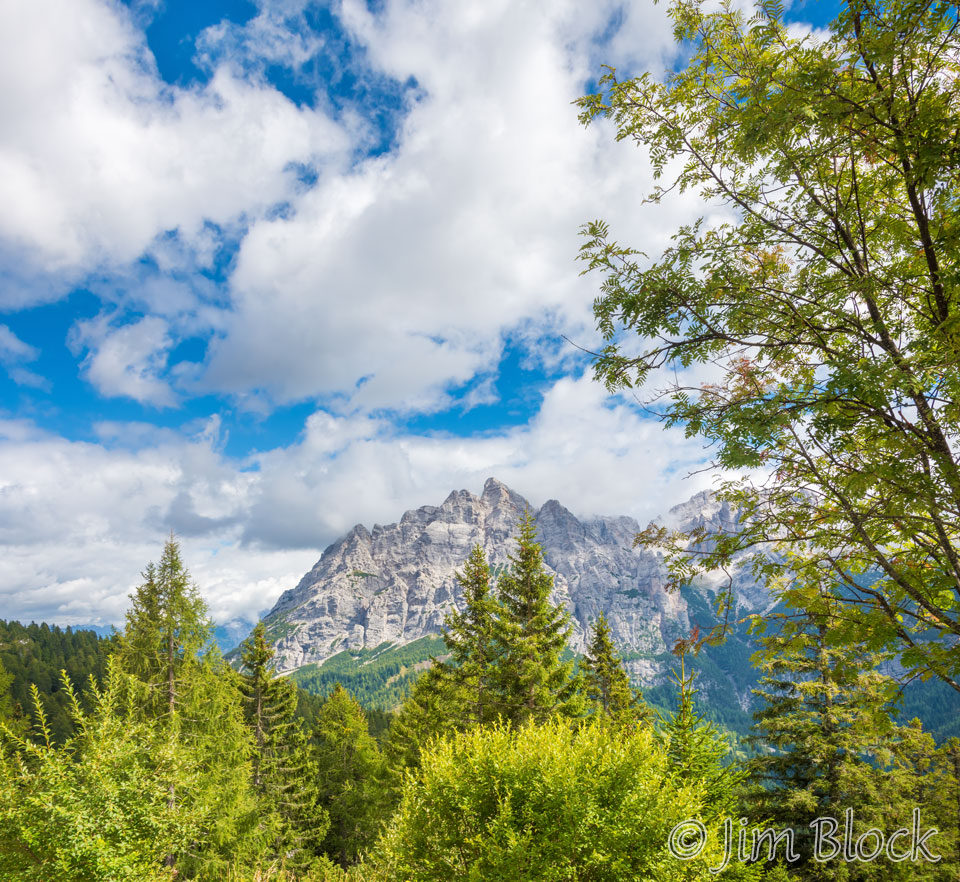
We had many views back at the Civetta massif.
")
")


")
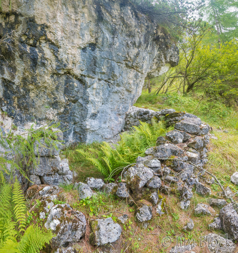
We came upon an interesting abandoned structure near a large rock. I wondered about its purpose.
The path entered the forest again.
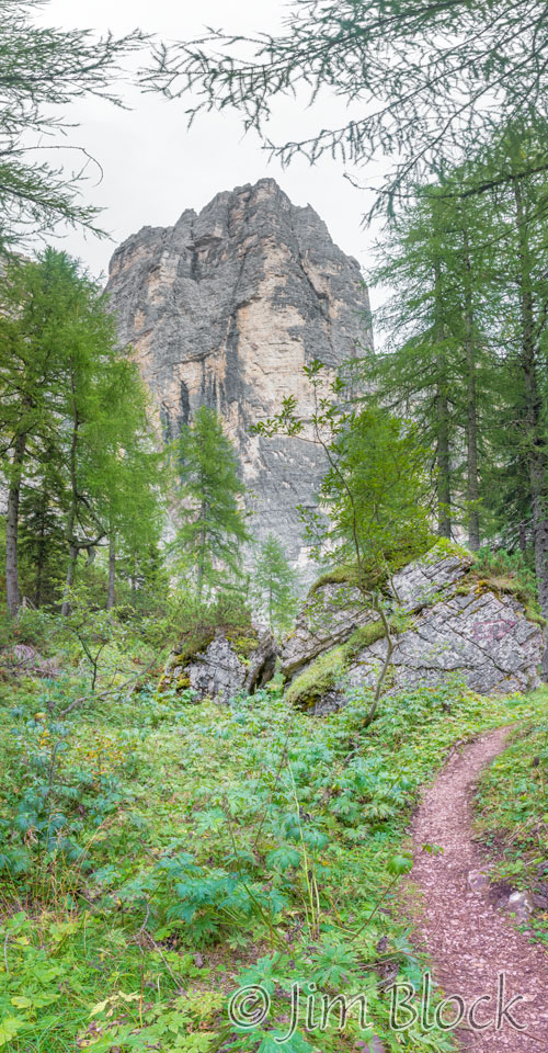
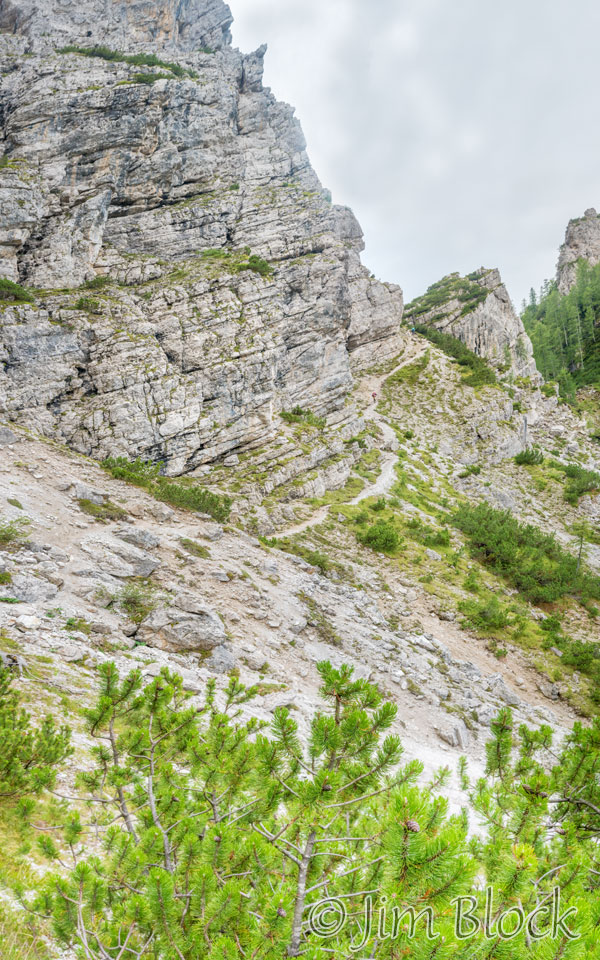
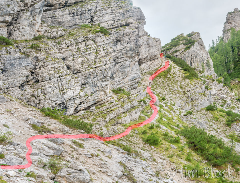
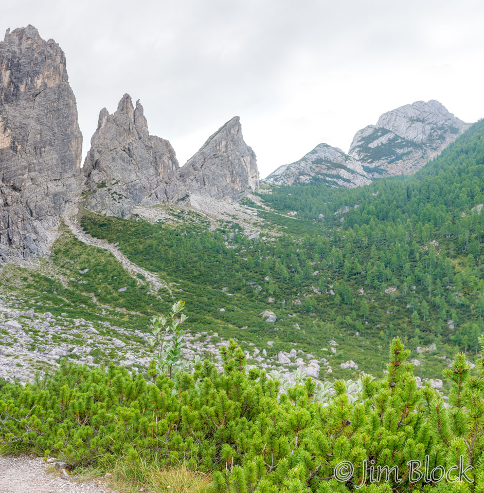
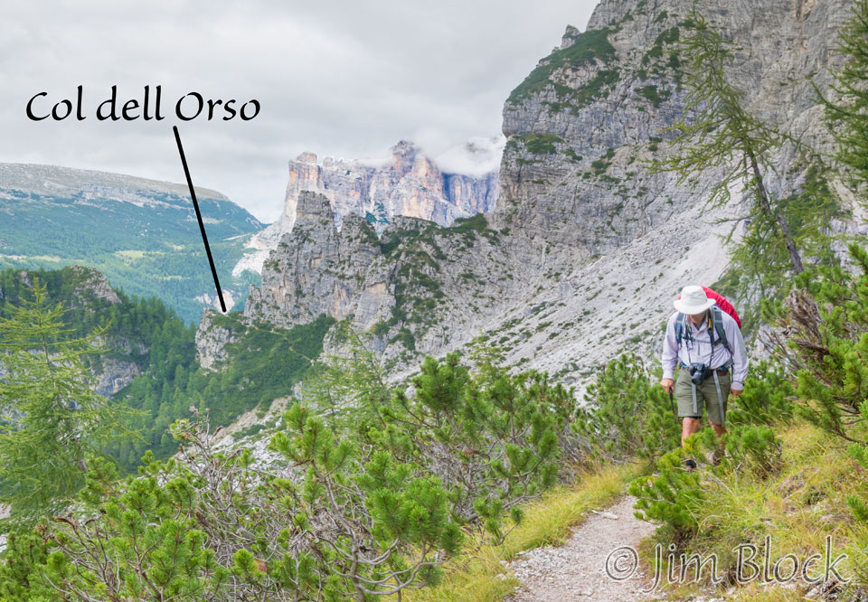
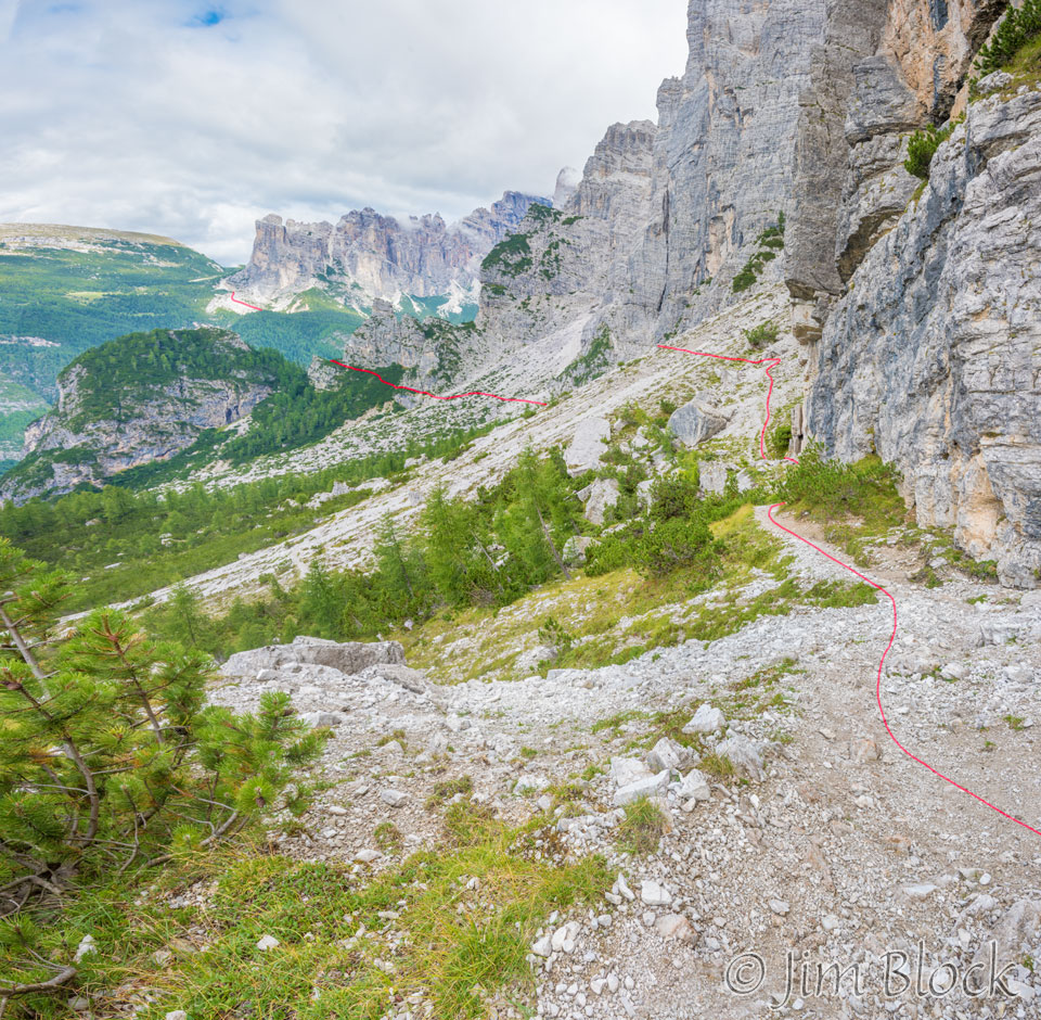
We had to cross many scree slopes and boulder fields as we climbed to Col dell Orso (col of the bear) which we could see in the distance. Here is our path there.
")
")
Col dell Orso is on the left side of the photo below. You can also perhaps make out Jim Gold along the path below the west wall of the Moiazza massif.
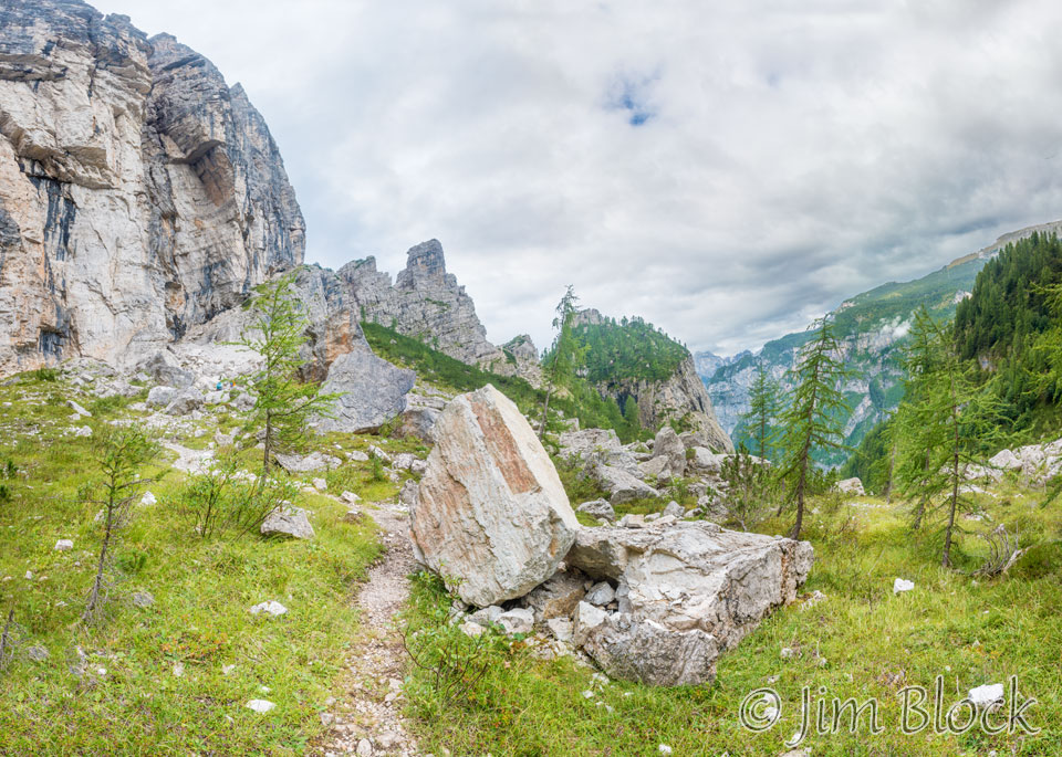
As we worked our way toward Col dell Orso we came upon some very interesting rocks and boulders. The top of the foreground boulder is pointing almost directly up at Col dell Orso.
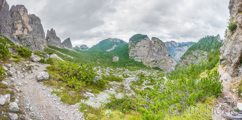
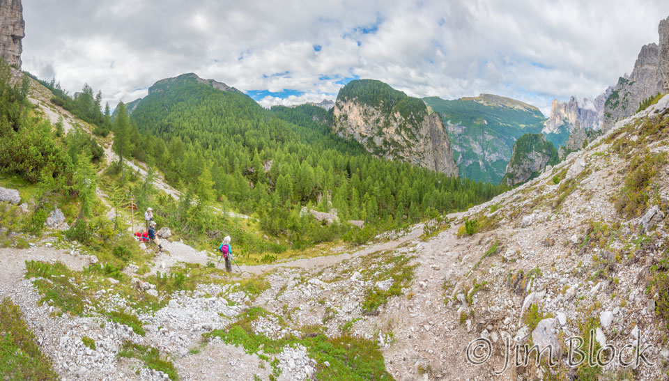
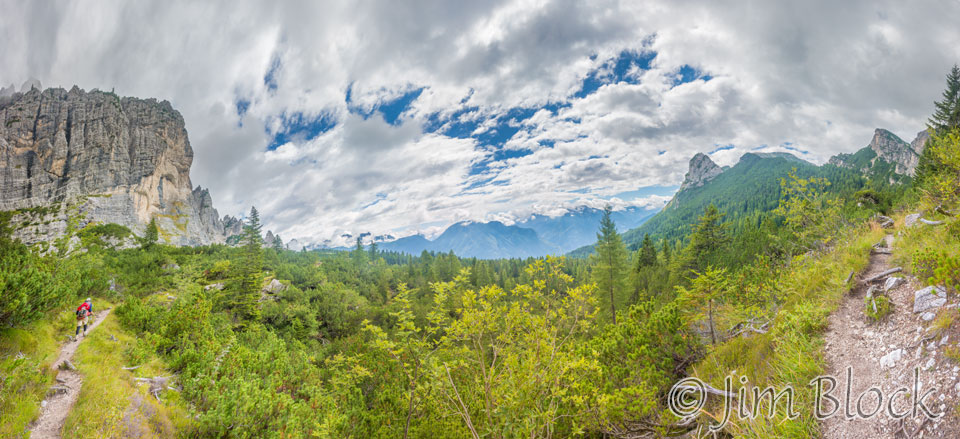
The image below is a 29-photo panorama which shows over 180°. The Civetta massif is at the back right. We came from that area along the trails on the right side of the image. You can perhaps make out where we walked below the west wall of the Moiazza massif. On the left side of the image you can see our route up to Col dell Orso.
Below are two images showing our path to Col dell Orso.
We continue to climb. In the multi-photo panoramas below you can see the Civetta massif near where we started this morning at the back right of the images.
We finally reached Col dell Orso. Here is Stephen at the col and a view from the col.
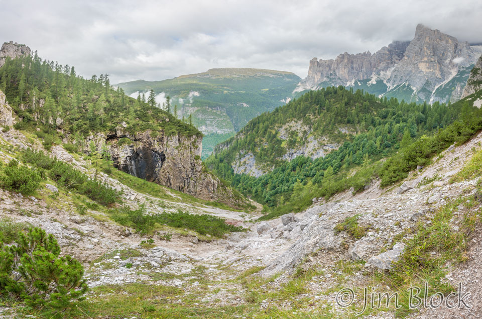
Below is a look back from Col dell Orso at where we were earlier this morning below the Civetta massif.
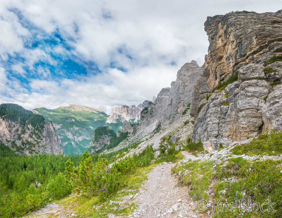
From Col dell Orso we got a view of where we were heading – Forcella del Camp. The forcella is not in view in this photo — we could not see it until just before we arrived. It is just to the left of the peak near the center of the image.
Our path to the forcella is to the left of the peak.
This 36-photo panorama shows where we are heading on the left. You might be able to make out Young at the right hand edge.
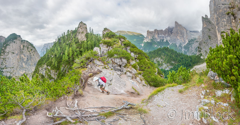
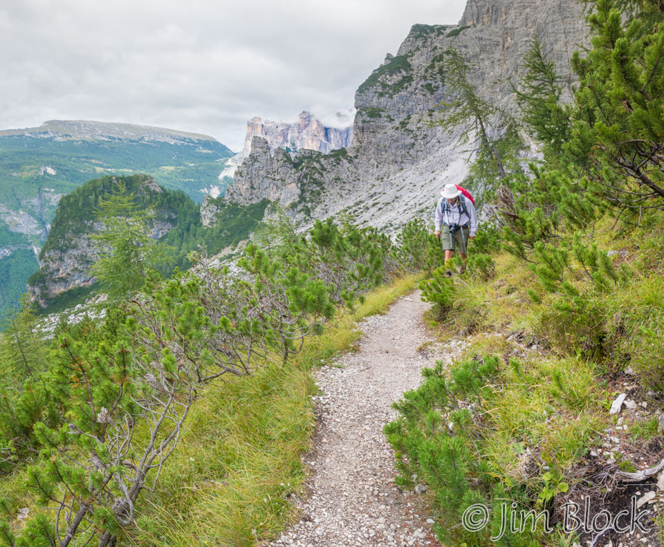
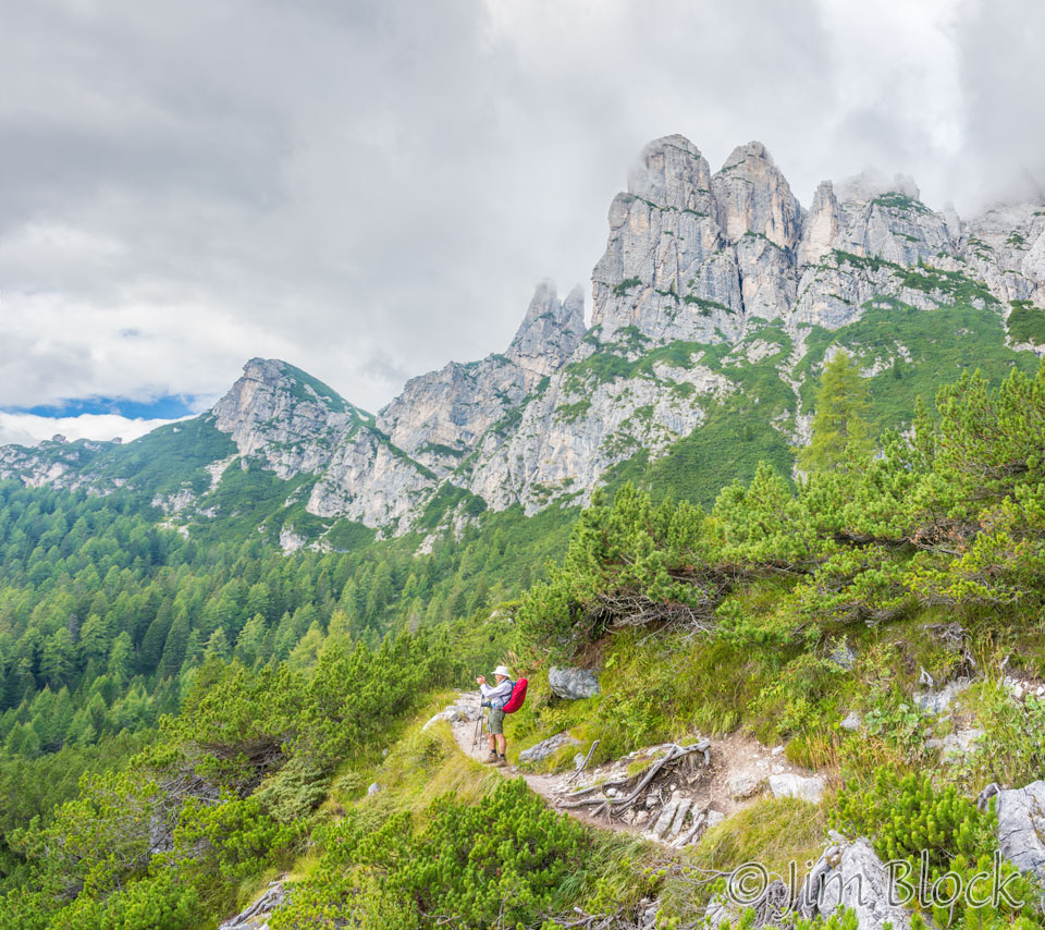
In this 23-photo panorama we look back at Stephen coming up the trail at the far right.
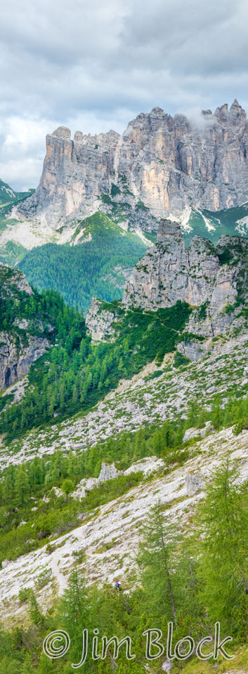
Looking back at Col dell Orso and behind it the peaks of the Civetta massif, the Pelsa ridge on the left and the Busazza ridge on the right.
Here is a tighter crop of the previous image which shows Col dell Orso.
We got to a junction where our route card suggested we take the higher path. I was above the junction when I took this photo.
Two cropped parts of the previous 17-photo panorama follow.


The view behind us back at the Civetta massif was more interesting than what was ahead.
The 10-photo panorama below shows our path for the day so far and also, at the top left, a piece of our path the previous day when we hiked down to Rifugio Vazzoler.
Cropped versions of the previous image, showing the distant path better, are below.


We continued to climb to Forcella del Camp.
")
")
")
")

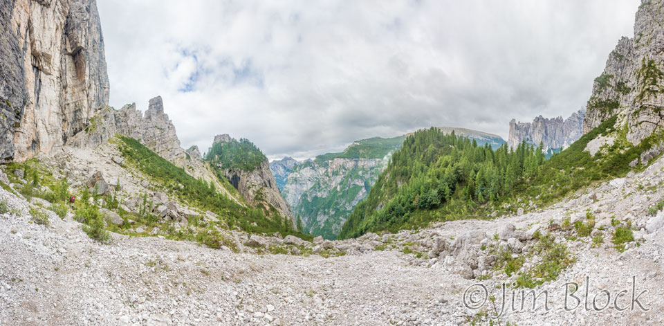
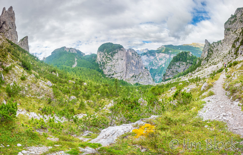
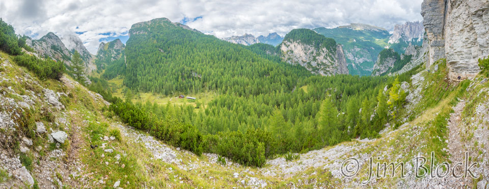
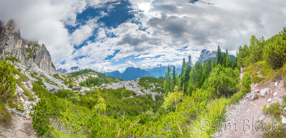
This is 180° panorama of the scene just before we reached the forcella. We came from the path on the right and are heading to the forcella on the path on the left. A small farm can be seen far down in the valley.
We finally reached Forcella del Camp.
")
")

")

As we headed down from the forcella, we trekked through many areas filled with huge boulders.
")
")
")
")

")
")
")
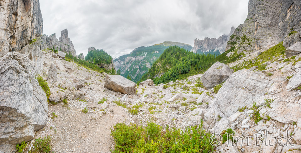
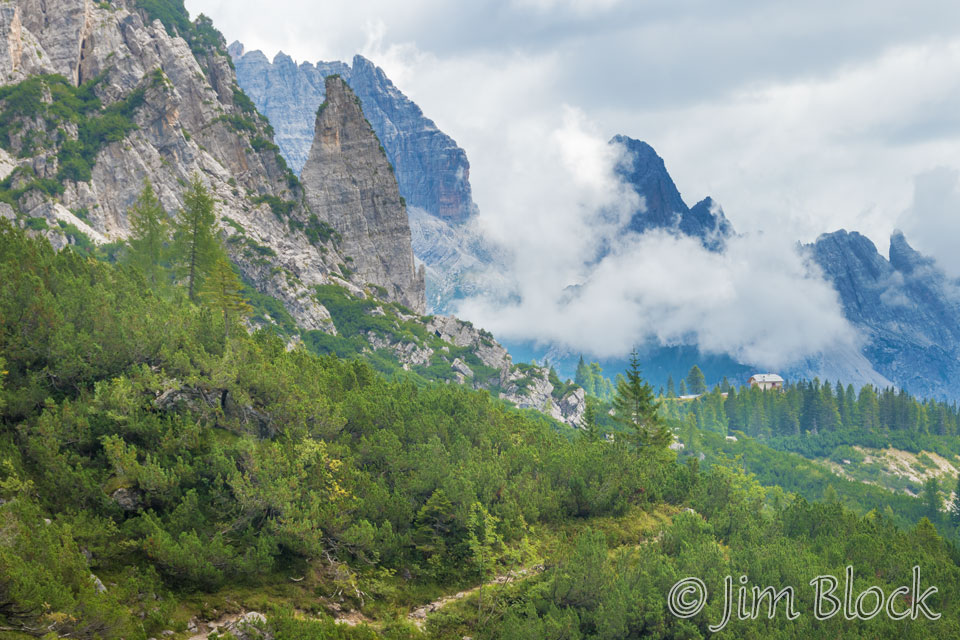
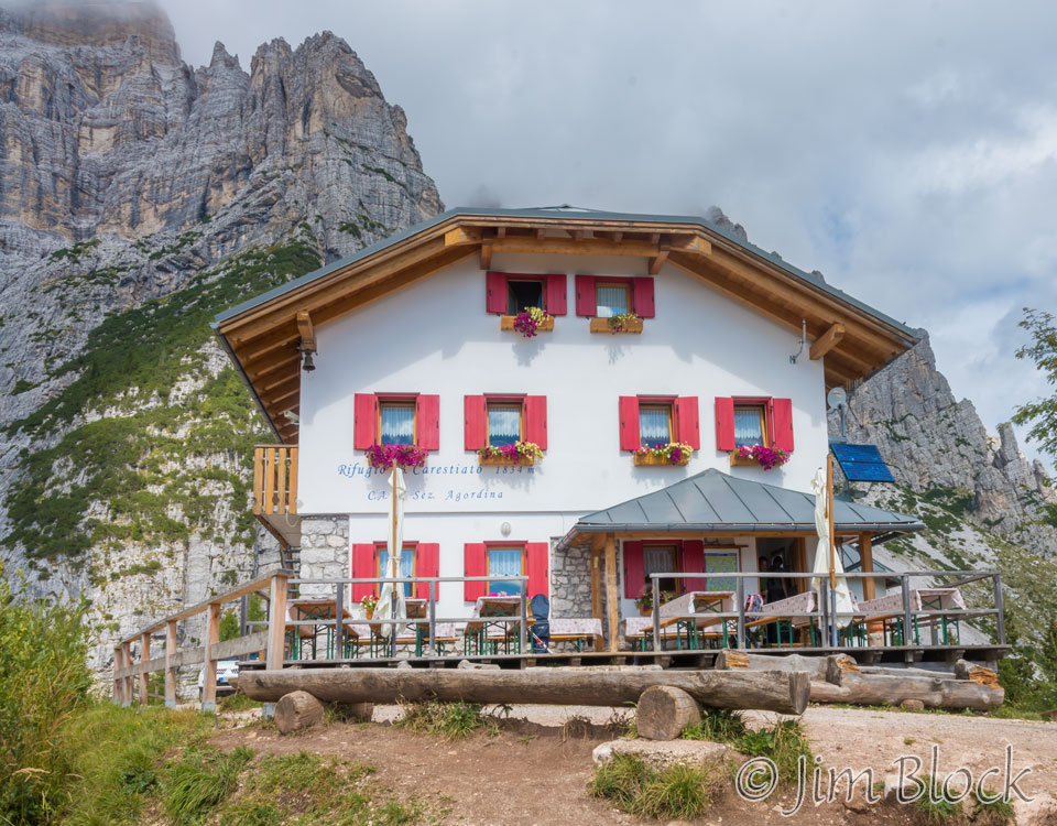
Looking ahead, this is what we saw. Can you spot Rifugio Carestiato?
Another view from approximately the same spot better reveals Rifugio Carestiato on the ridgeline in the distance on the right side of the photo.
The path we came down is on the right side of this 24-photo panorama. On the left you can see Jim walking somewhat ahead of us.
Stephen took a photo with his iPhone with Forcella del Camp in the distance behind him.
Our path ahead on the left and the pathway we took to get to this point on the right is seen in the 35-photo panorama below.
We passed intermittently through some shrub conifer forests and boulder fields.

")


")


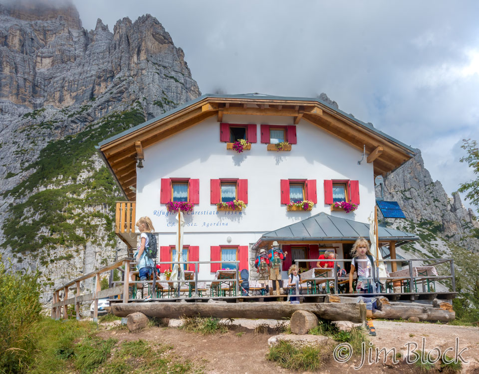
We reached Rifugio Carestiato. There was a family with a young girl who had come up by car and was just leaving. I took three quick shots and tried to see if an automatic program would merge them and eliminate the people. It failed but produced an interesting whimsical image with the young girl, Jim, and a waiter multiple times.
I then took the same three photos that were blended into the image above and, with some manual masking, produced a composite image where the people were eliminated and we simply see the rifugio.
Stephen and Jim got some drinks and perhaps lunch at the rifugio. Young rested, and I, of course, took some photos. I might have also had a bite to eat — I don’t recall.
")
")
")

We could see Forcella del Camp where we had been 90 minutes before.
We could also see San Sebastian which is across Passo Duran from Rifugio San Sebastiano where we would be spending the night.
Martin, Violetta, and Tim arrived. They had spent the night before at Rifugio Tissi and had a longer hike to get to Rifugio Carestiato.


")
")
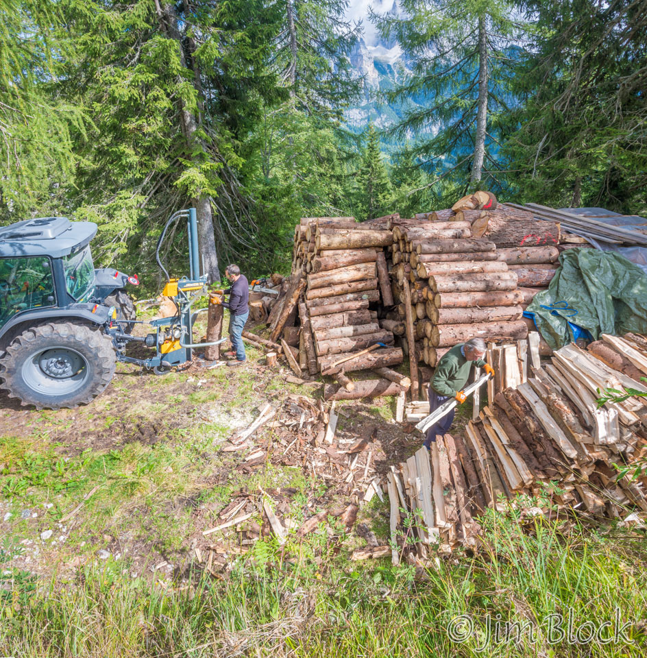
As we headed down the track below Rifugio Carestiato, we could see some serious firewood being split.
We passed what appeared to be an abandoned farm and a trough where we could fill our water bottles. We saw a number of these, especially along the second half of our Alta Via 1 trek.


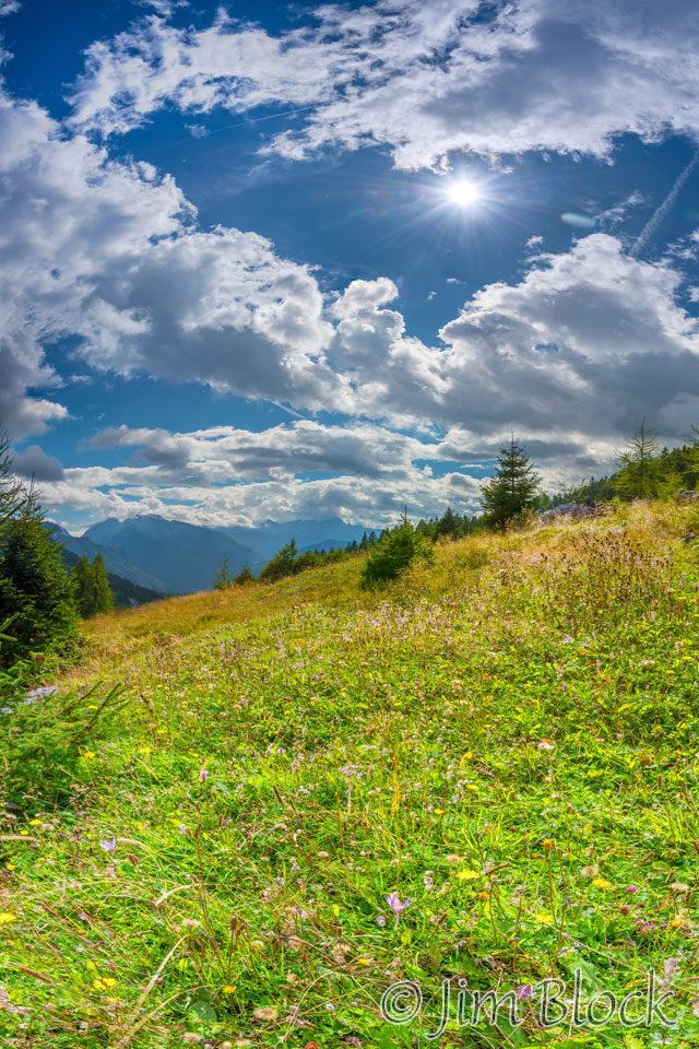
There were some wildflowers along the path.


They filled the field seen below.
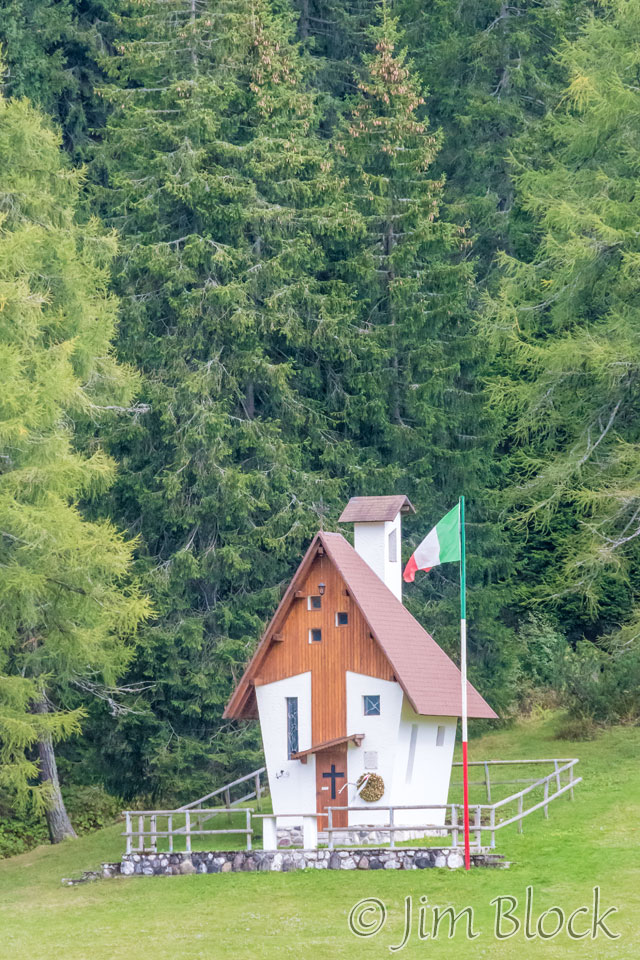
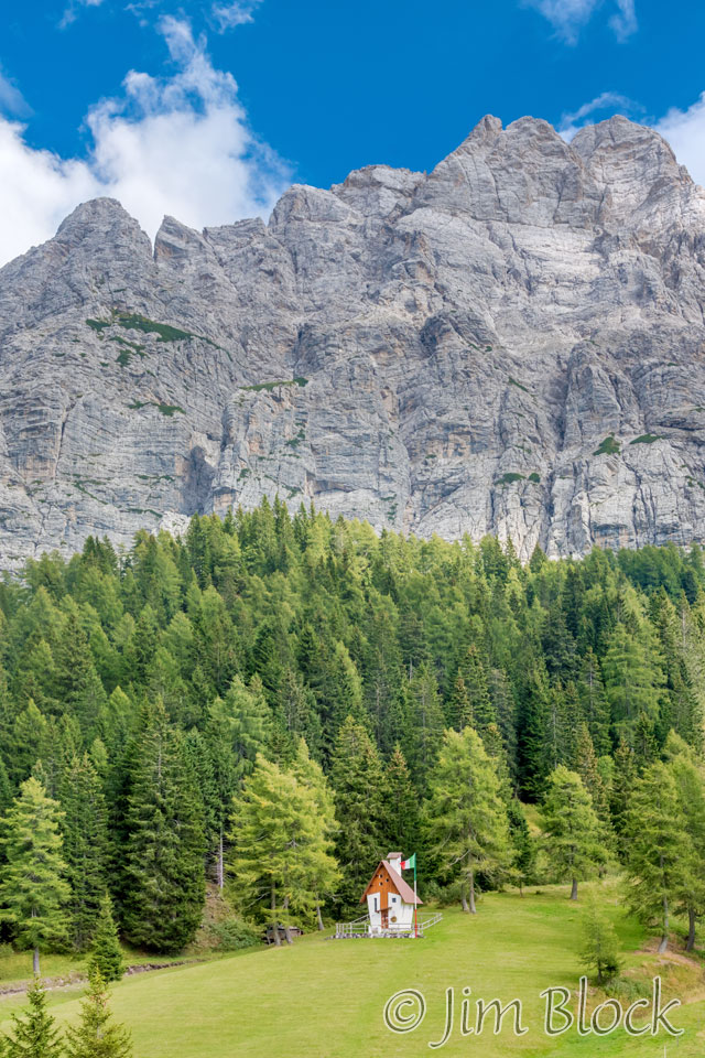
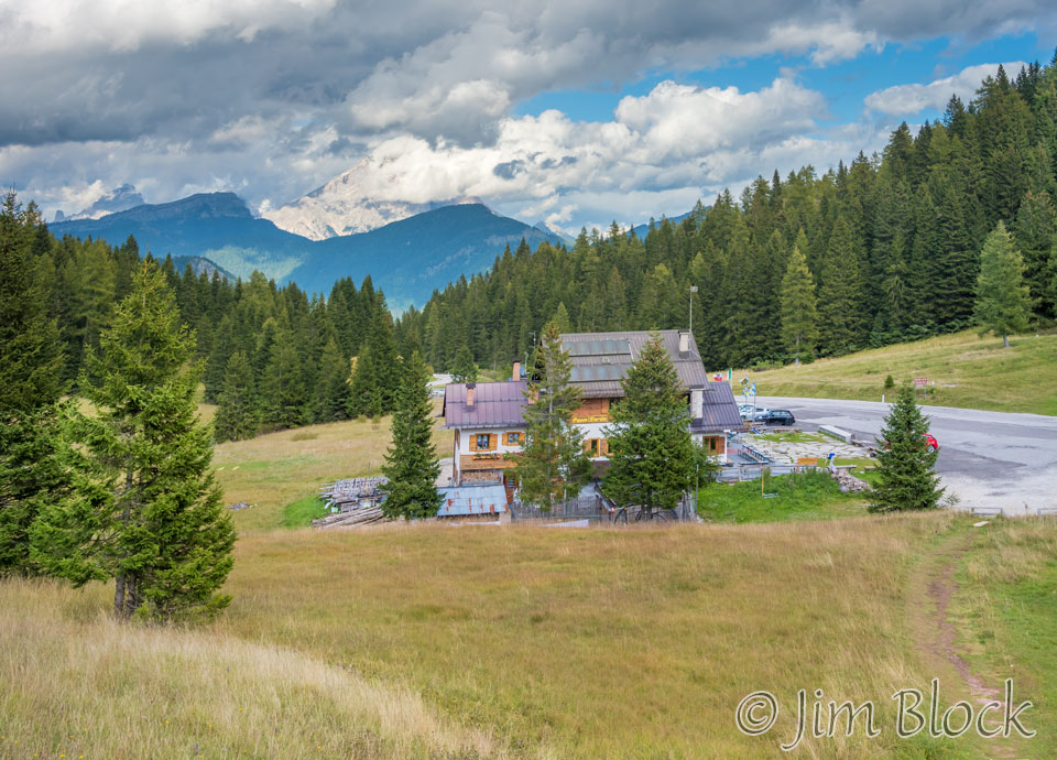
As we dropped down toward Rifugio San Sebastiano we could see a tiny chapel across the road from it.
 Rifugio San Sebastiano is along the road at Passo Duran.
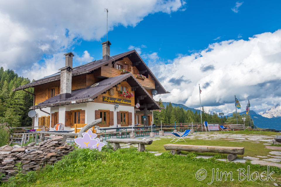
We had a nice private room with a balcony overlooking the front area of the rifugio. We hung some clothes out there, but they didn’t dry. The sun had moved too far to the west. In the morning they were still wet.
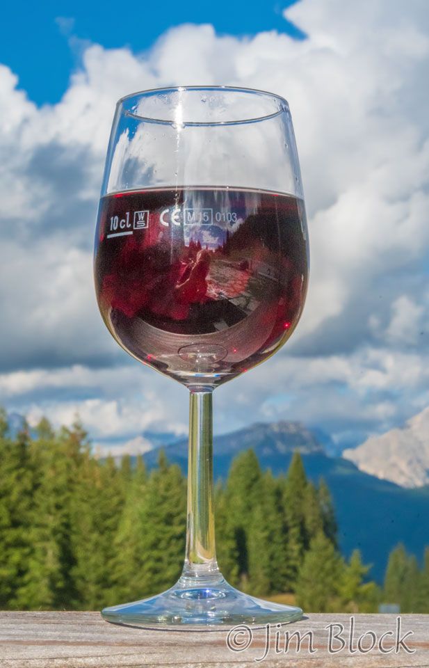
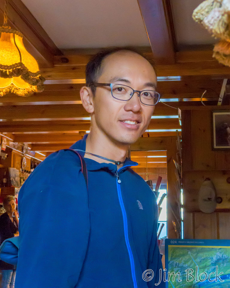
Rifugio San Sebastiano is a nice place, but it lacked internet. So Stephen and Jim walked to the nearby rifugio to use their WiFi and have a drink. I relaxed with a glass of wine and took a photo of Carman with my iPhone just before dinner.
Although we had a number of long climbs through scree slopes and hiked for eight and a half hours with an hour break for a late lunch, this was not a particularly challenging day.
Tomorrow would be much harder even though the hike was also rated only medium in difficulty.
![]()