This was a great day of trekking. The route card claimed it was “medium” in difficulty, but I found it challenging. I wound up walking most of the day alone.
It was a long uphill at the start, then a nice cruise to a rifugio for a great lunch. After that it was up and up over a col, and then up over another col, and then another col. We never seemed to get to the forcella where we could start downhill. Eventually a group of us stopped at a nice grassy spot just before below the forcella and took some photos. After that it was a very long downhill to our rifugio for the night.
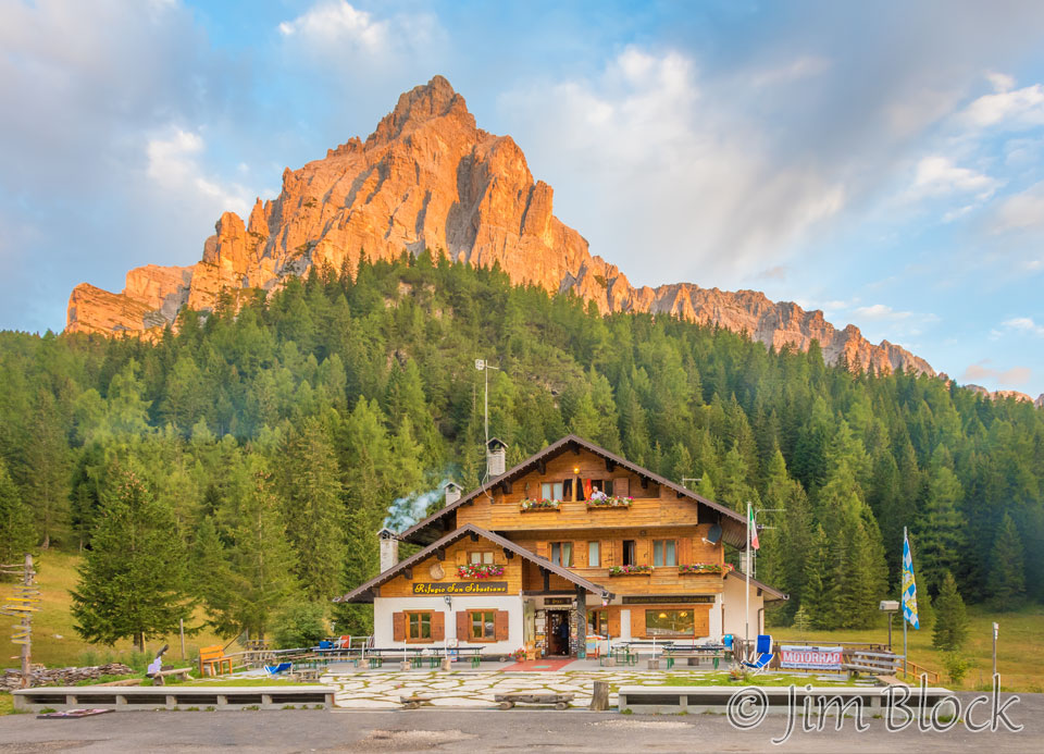
I was up well before 7 AM when I got this photo of Rifugio San Sebastiano with a piece of the Moiazza massif in the background.
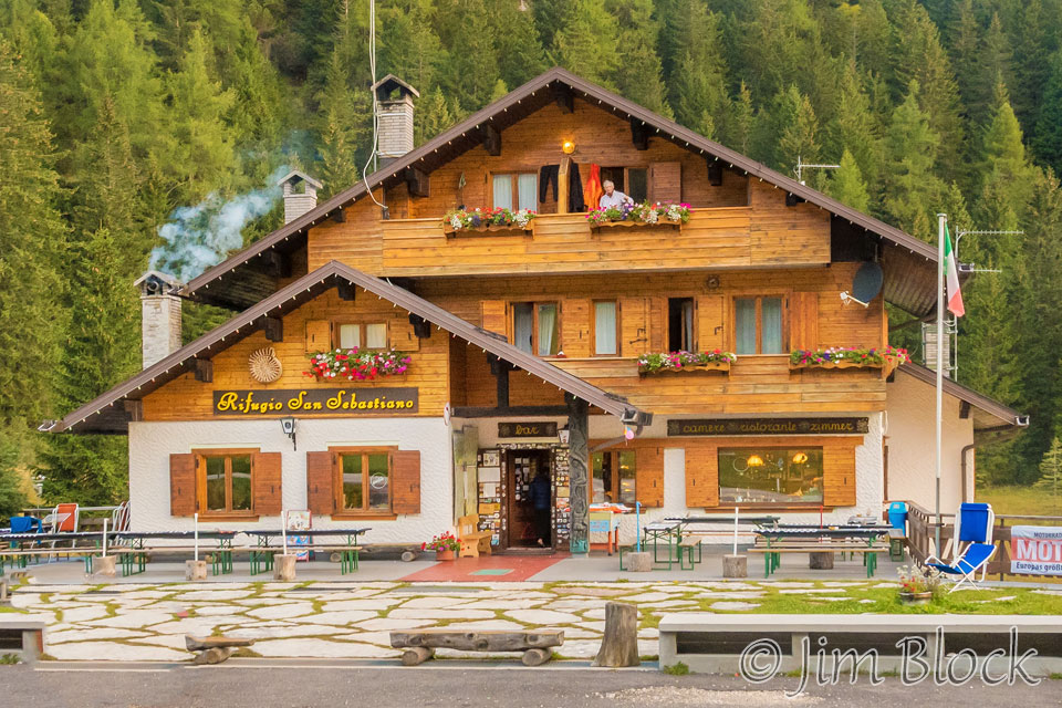
If you look carefully you can see Stephen looking out our room window. Here is a crop of the previous photo so you can see Stephen better.
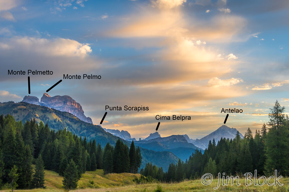
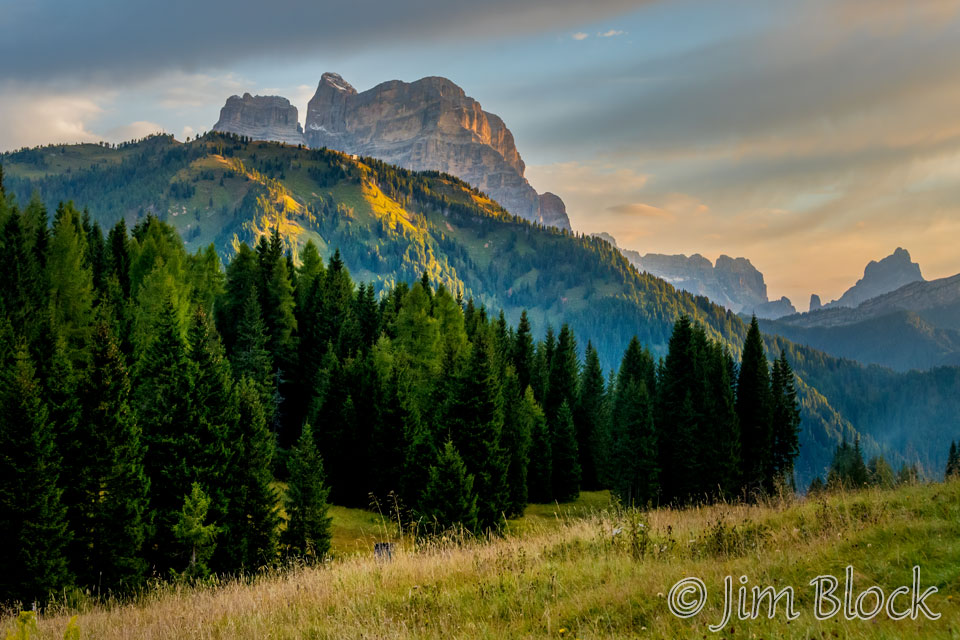
I walked across the road at Passo Duran and made some photos of the dawn. Here are two of them.
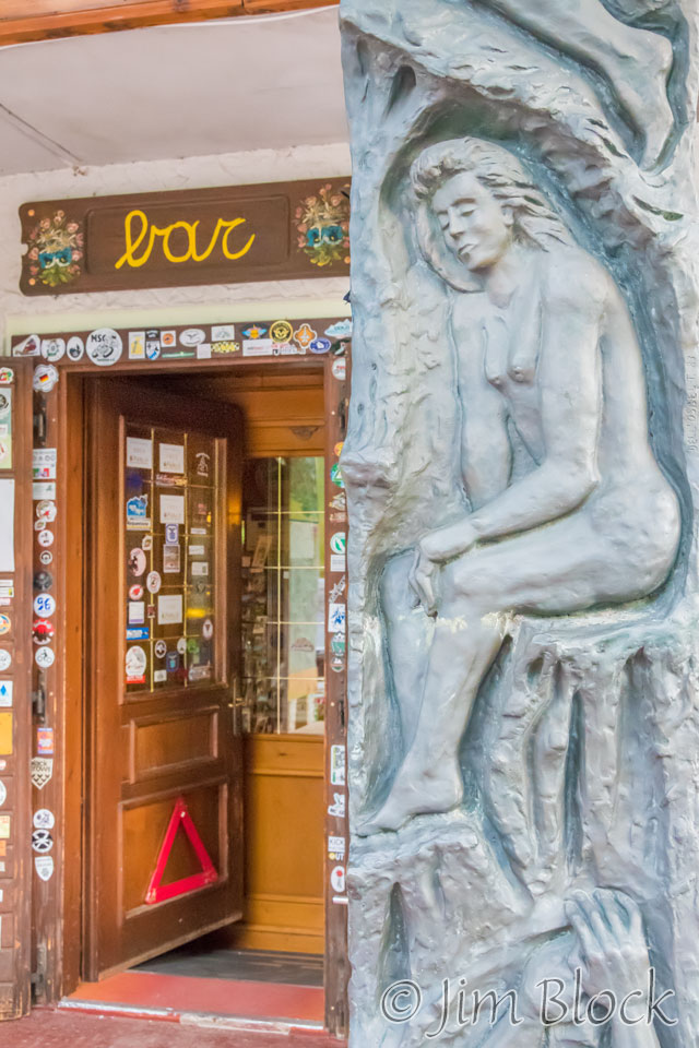
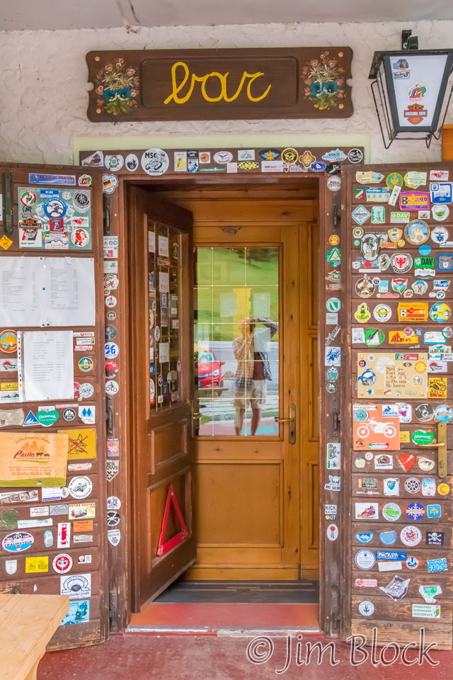
The entrance to this rifugio had some interesting sculptures and decals.
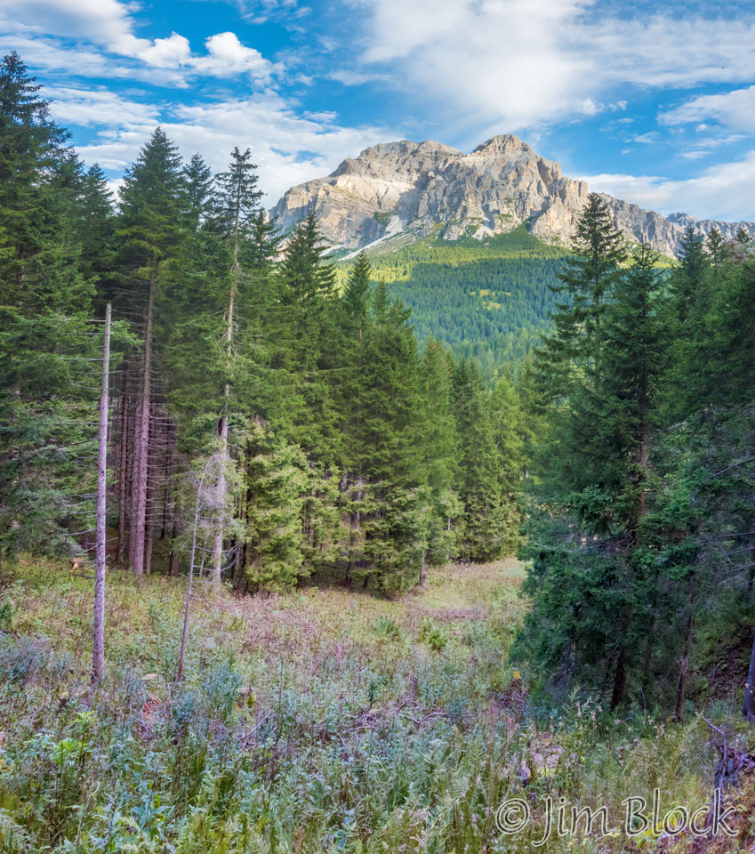
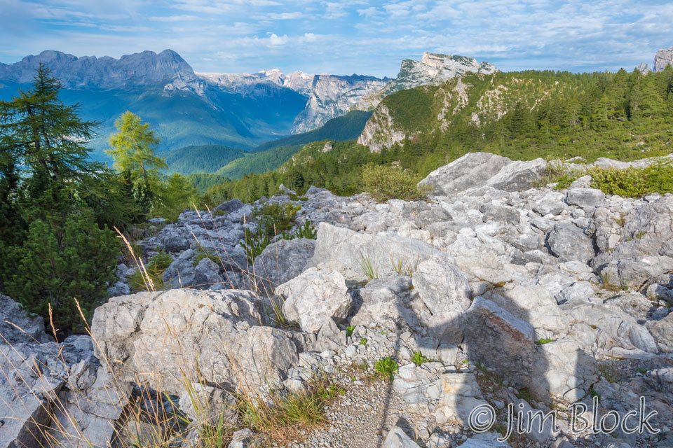
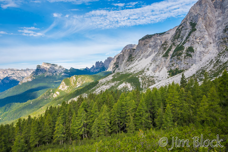
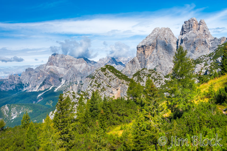
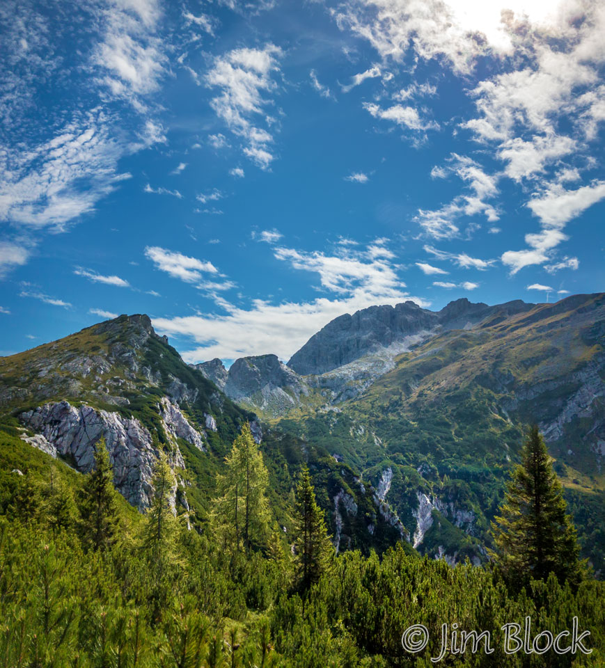
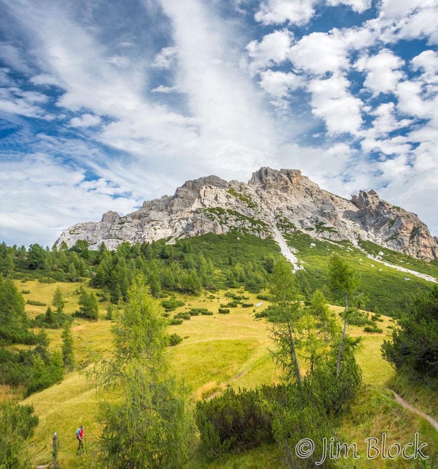
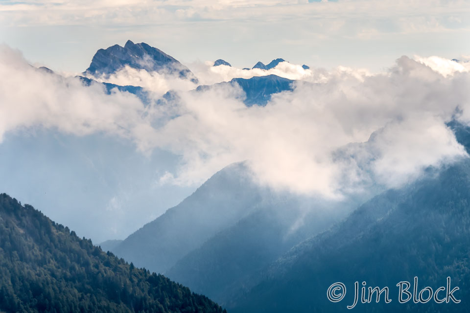
Our group of Stephen, Jim, and Young was somewhat slow getting started this morning. I saw Martin walking down the road so I wandered over to join him. We headed south for a bit less than 2 kilometers before turning into the woods and up a nice trail. Here is the view of the Moiazza massif from a short distance above the road.
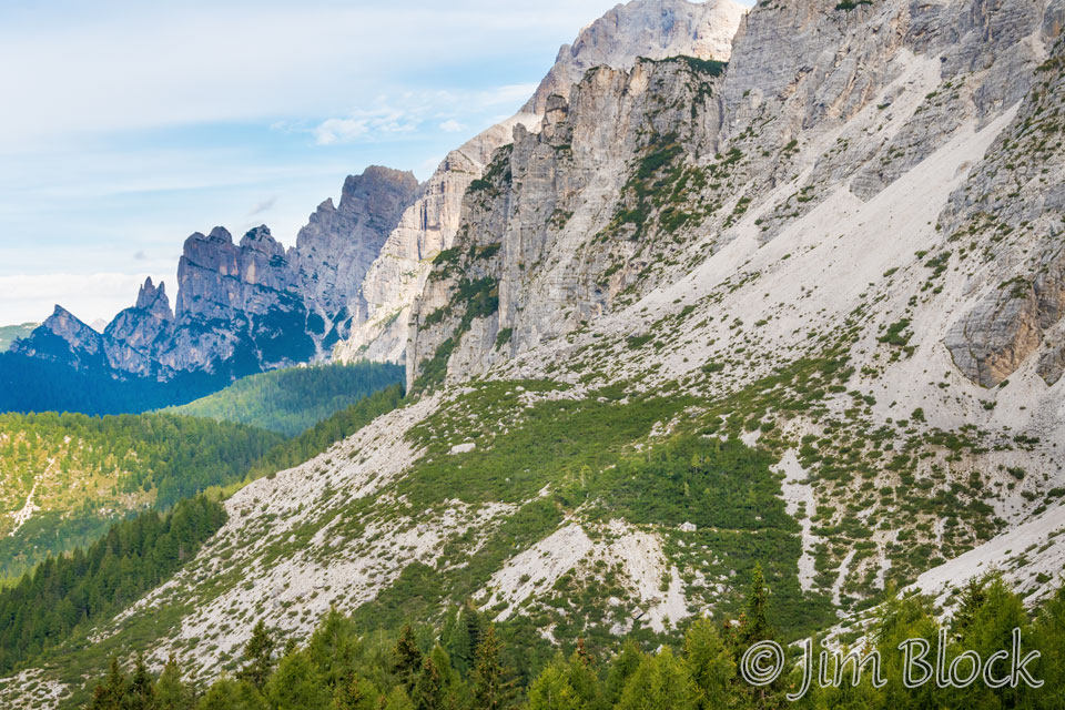
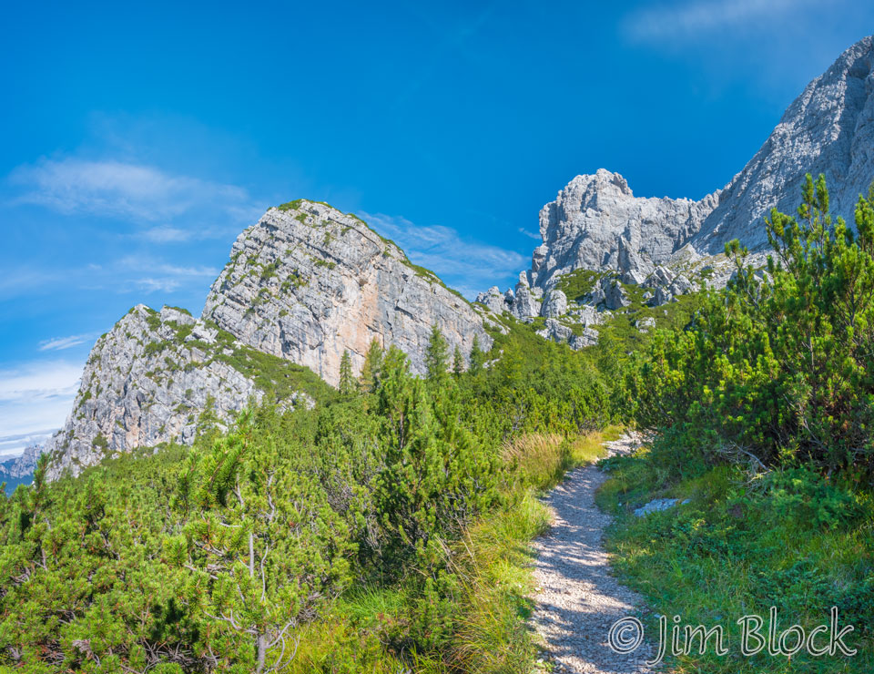
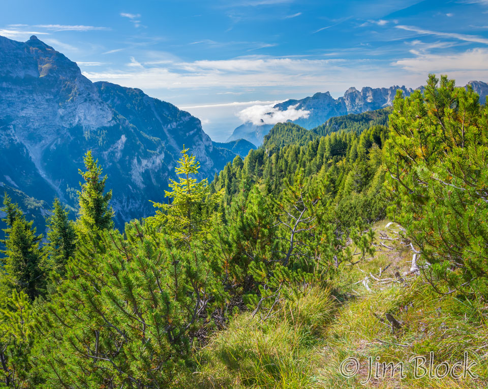
Martin is a faster hiker than I am, so I told him to go ahead without me. I didn’t want to hold him up, plus I knew I would be stopping often for photos. I figured that Stephen, Jim, and Young would catch up to me. At 9 AM I got this nice view along Path 543.
Soon after I took this photo.
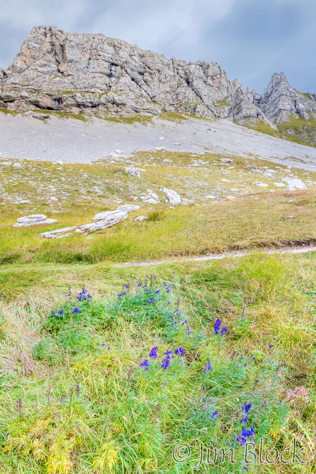
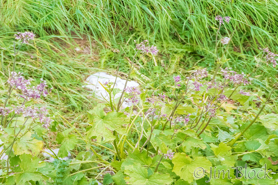
There were some nice wildflowers along the path. Here is a brief slideshow of three photos I took of them.


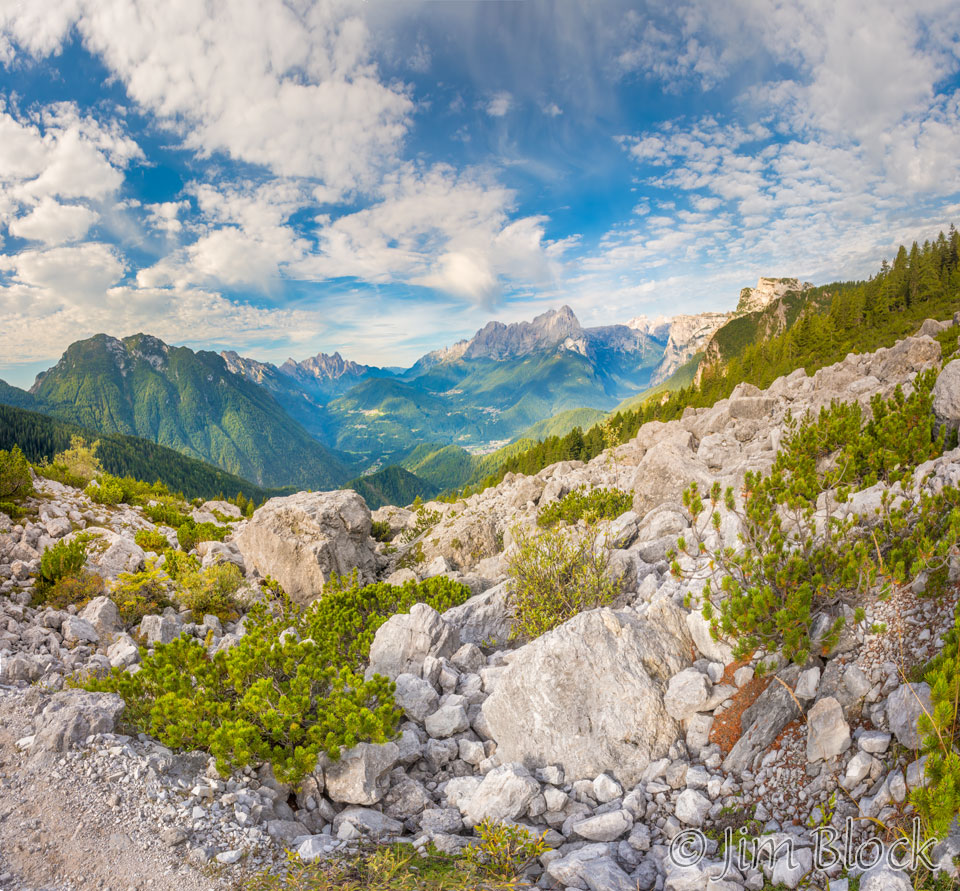
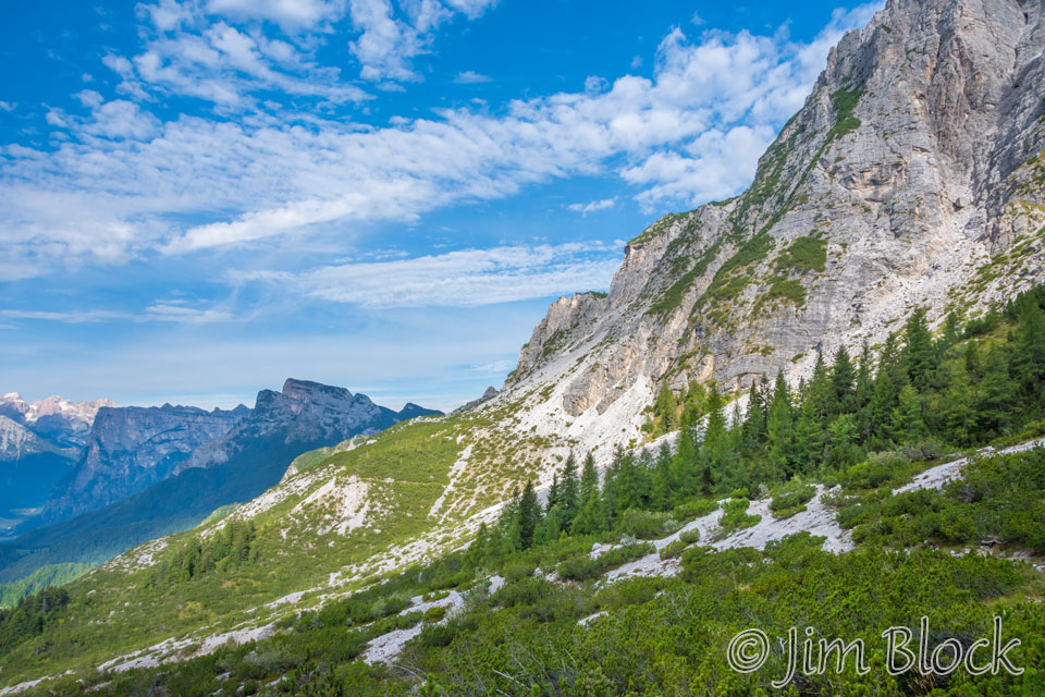
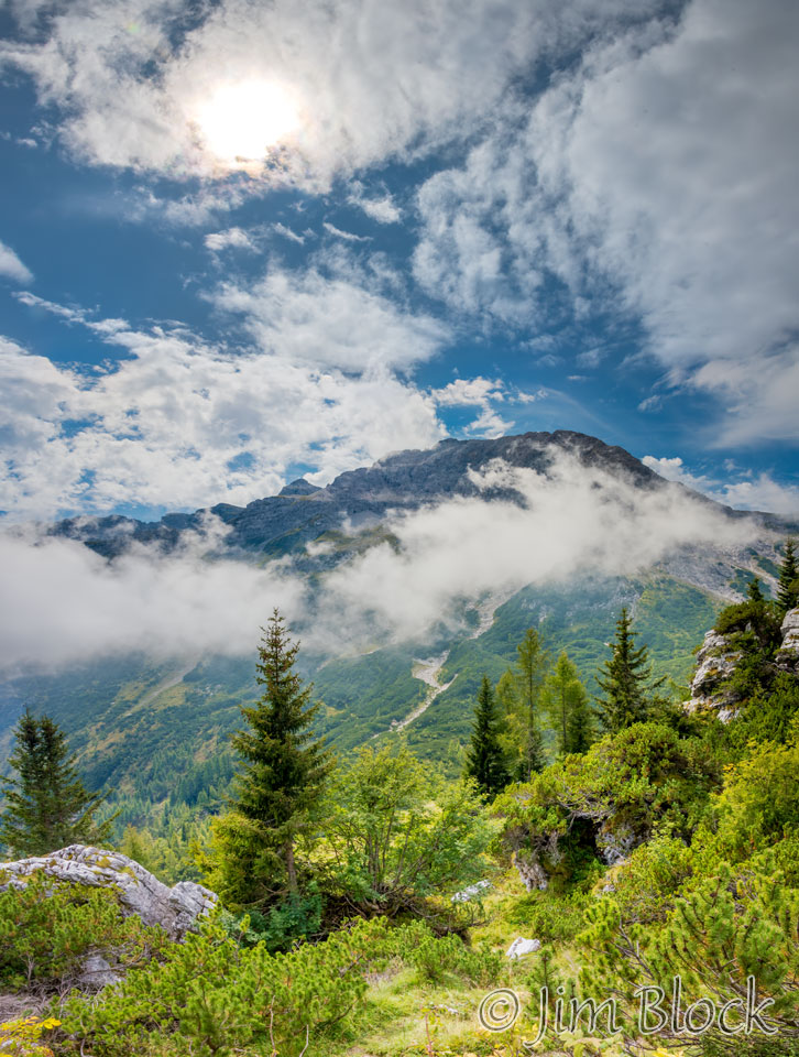
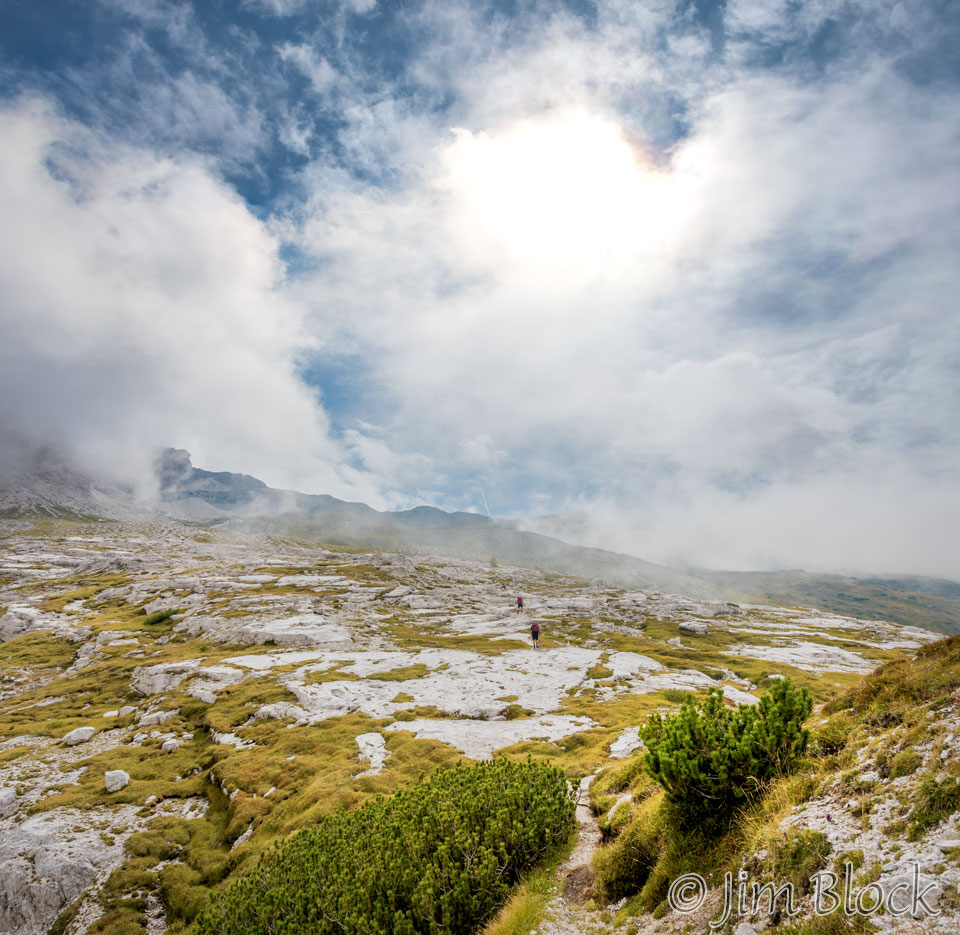
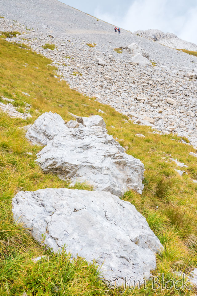
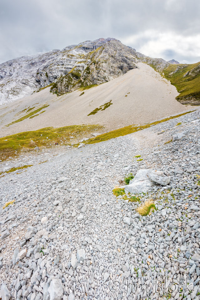
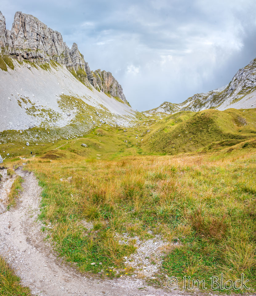
The scenery was breathtaking as I crossed a series of scree slopes while breathing heavily.


")
")
")
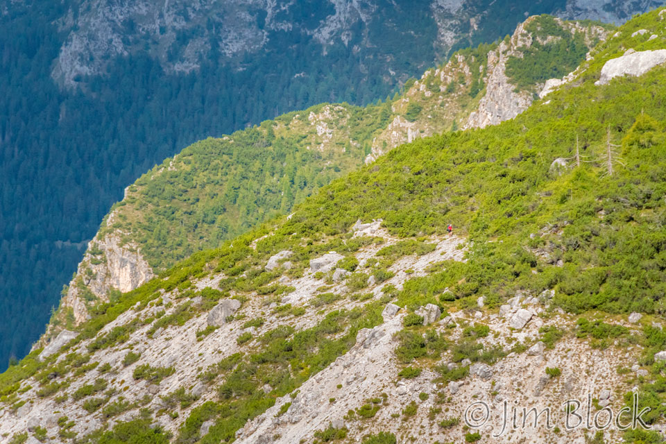
I kept looking back for the other three of our group. Here is photo of where I came from. You might be able to spot a path near the middle of this photo.
I took this photo from about the same spot as the photo above. I was hoping I would capture our group, but it was a different hiker.
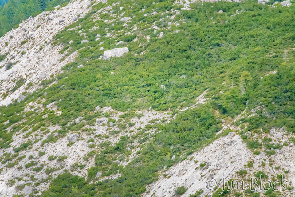
About 10 minutes later I got this photo which shows Stephen and Young heading up the same path. You might be able to find them near the center of the photo.
The views looking back were spectacular.
Here is another photo of basically the same scene where I zoomed in to the middle of it.
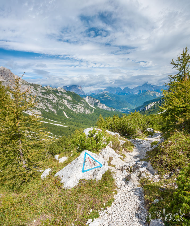
I got to a point where there was a trail marker painted on a rock. I took this photo looking back from whence I came.
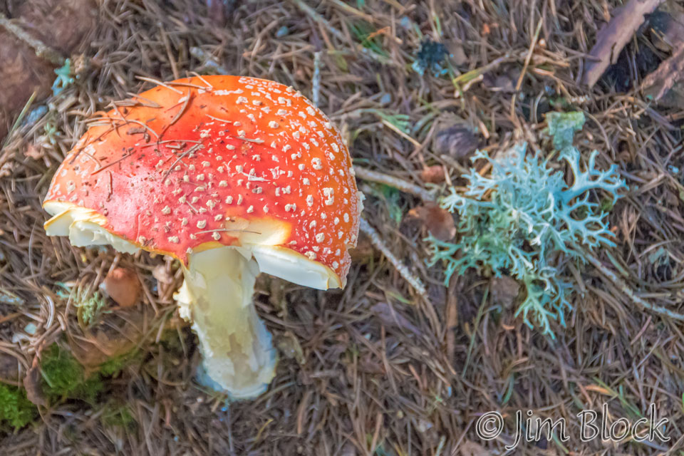
I found an amanita mushroom partially eaten. I certainly hope it wasn’t a human that devoured part of it. They can be deadly.
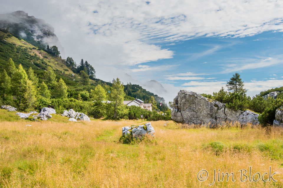
I reached Malga Moschesin, an interesting area with a few emergency huts and a water trough for refilling water bottles. This is where I first saw two woman from Germany, Marketa and Karin, who would hike before and after me for most of the day.

")
")
I continued along the path and saw some interesting formations before me.
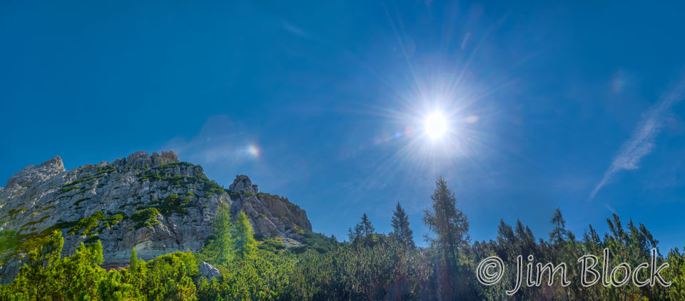
I spotted a sun dog in the sky. Here is a panorama that includes the sun and the sun dog.
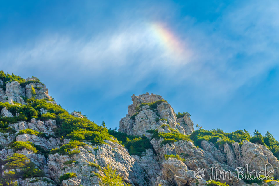
Here’s a close-up of the sun dog. This was the second one I saw in three consecutive days. If you want to learn more about sun dogs and a lot of other very interesting and colorful things in the sky, please CLICK HERE.
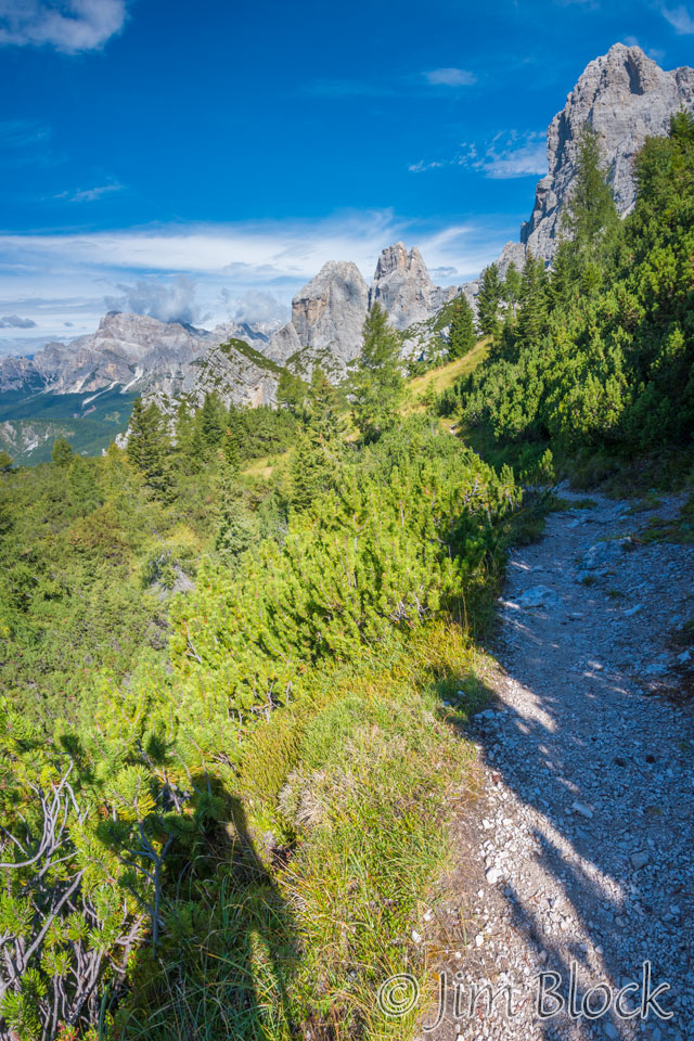
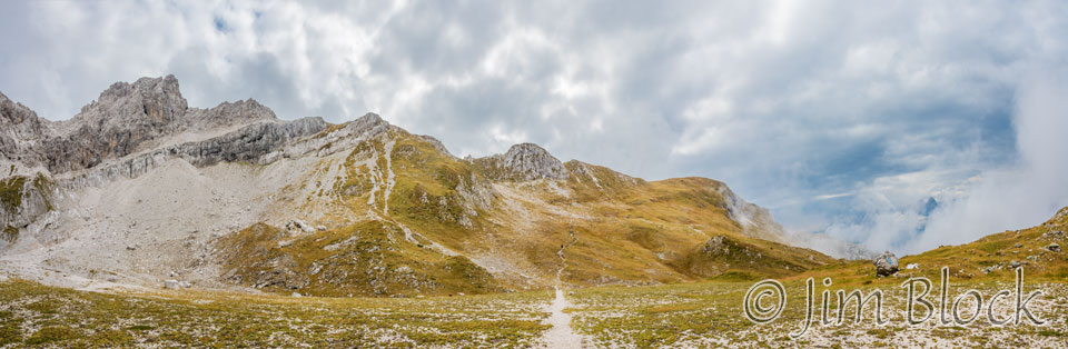
I continued forward along the path, stopping often to take photos. The landscape was marvelous.
Forcella del Moschesin was somewhere ahead. Before I reached it I got this vista.
Here is a close-up of a piece of that scene.
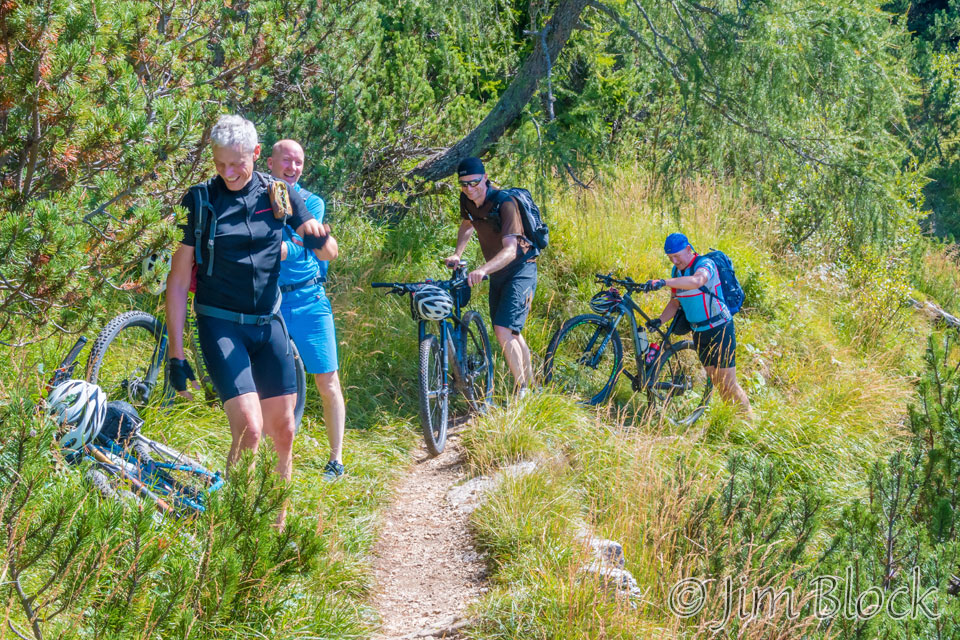
Amazingly I met a group of mountain bikers coming up the trail. They must be slightly crazy to do this, but anything seems to go in Italy.
I followed Marketa and Karin for a while. In the distance we got our first view of Cime di Zita, the mountain we would climb later in the day.


I made a 2-photo panorama of Cime di Zita with my iPhone. It is the peak on the right side of the image below. Looks like a challenging climb.
The ruins of a First World War barrack are seen in the photo below.
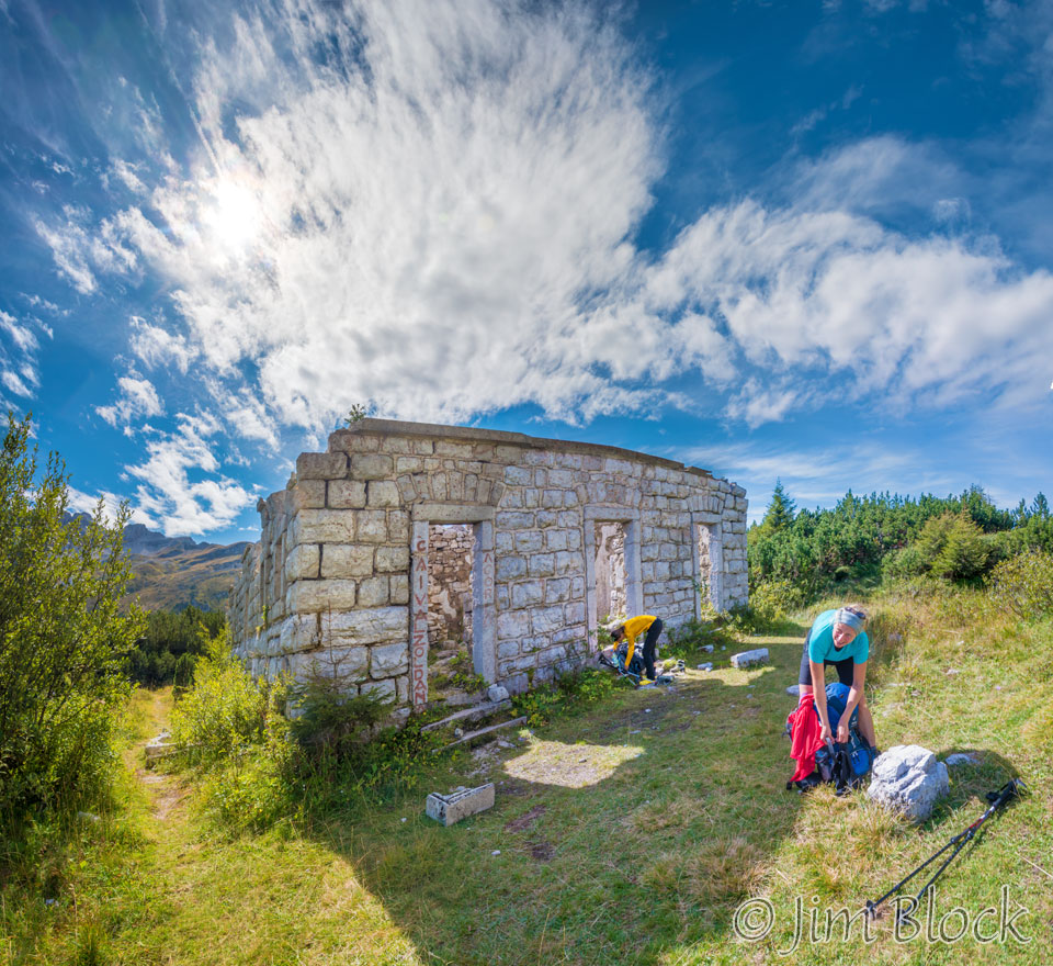
I made a wrong turn at this point but only walked about 100 meters before I realized my error. I was heading down into the valley of Forno di Zoldo. I looped back on a different path which came out a bit above the ruins.

I consulted my route card to figure out what I hoped was the correct path. It was not marked, but the description of entering a “curious small valley in the hillside” matched what I was seeing ahead. At this point Marketa and Karen we’re no longer in sight. The jagged peaks you see here are part of Castello di Moschesin.
")
")
I crossed the valley, climbed a bit, and turned around to get these views back from where I had travelled.


That evening at Rifugio Pian de Fontana, Jim told me that he took a 45 minute accidental detour during the day. It was possibly near the barracks where I almost went wrong or a short distance before Rifugio Pramperet where the paths head in several directions and are somewhat confusing.
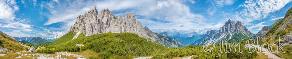
As I neared Forcella del Moschesin I made a 270° panorama. At the center is Castello di Moschesin and at the right we see Cima di Pramper.
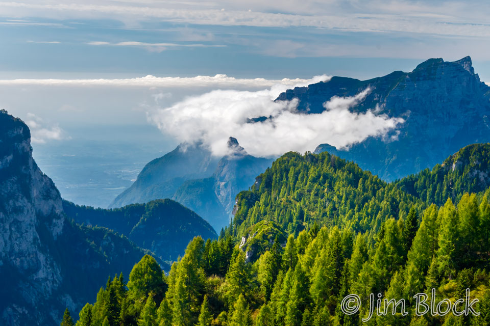
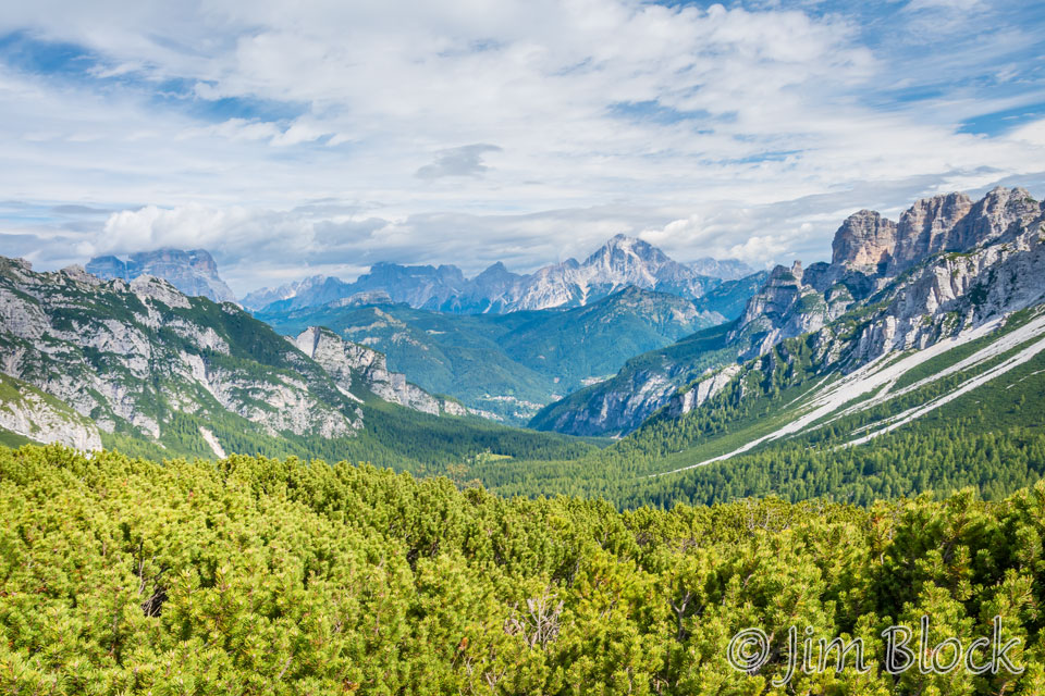
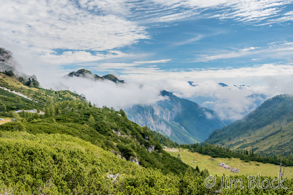
From this area there were great views down to the Val Balanzola valley toward Zoldo and the mountains behind it.
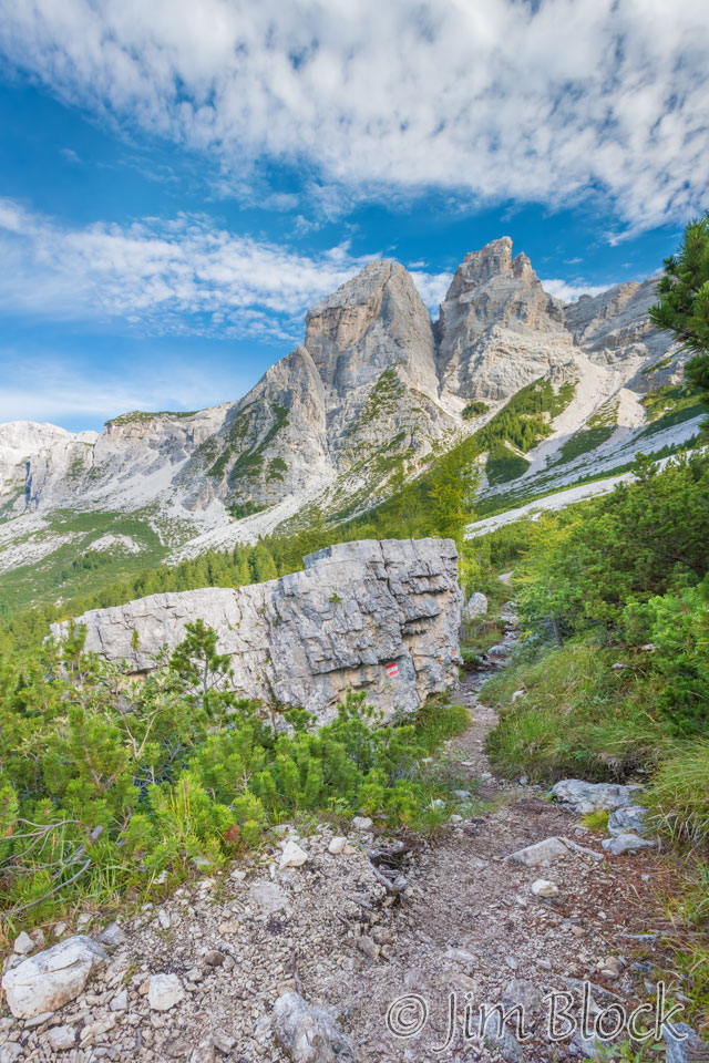
I reached a boulder painted with the Alta Via 1 symbol. Finally a confirmation that I was on the right path, although I was pretty sure I was.
Below is a wide view showing the path I came from on the left, the path that is ahead on the right, and the Val Balanzola valley in the center. This 12-photo panorama shows more than 180°.
")
")
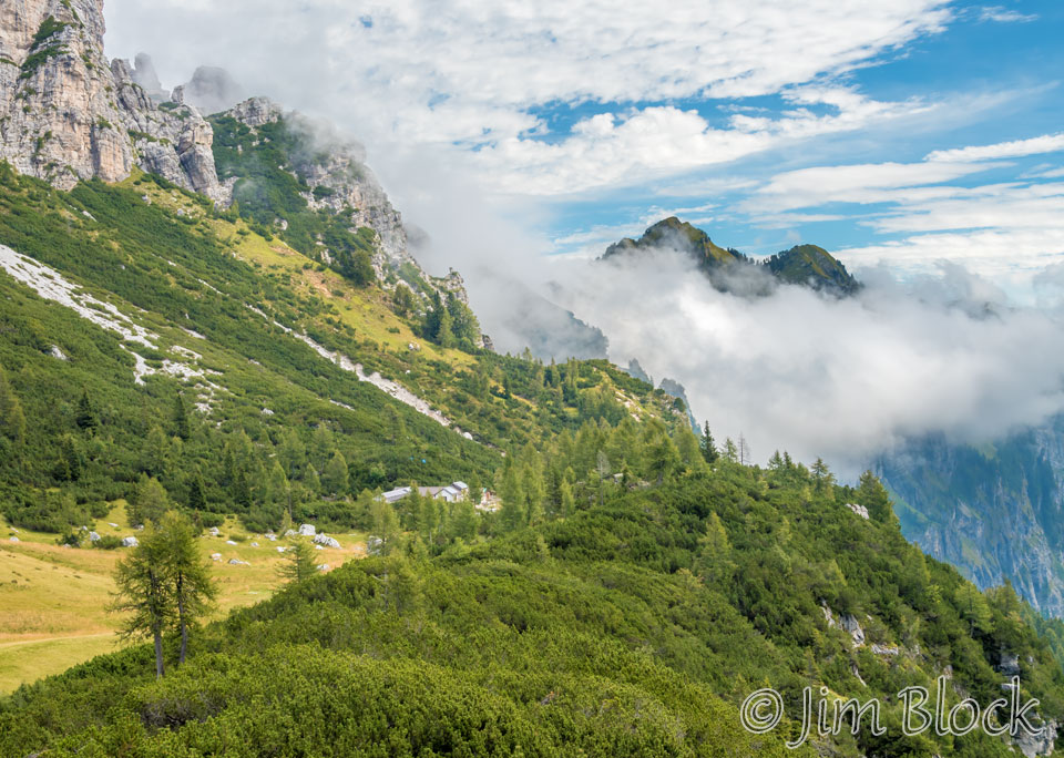
A short time later I got a view of Rifugio Pramperet on the hillside in the distance and the deep valley beyond it. The photo below was taken with my iPhone. You can see Rifugio Pramperet at the bottom left corner.
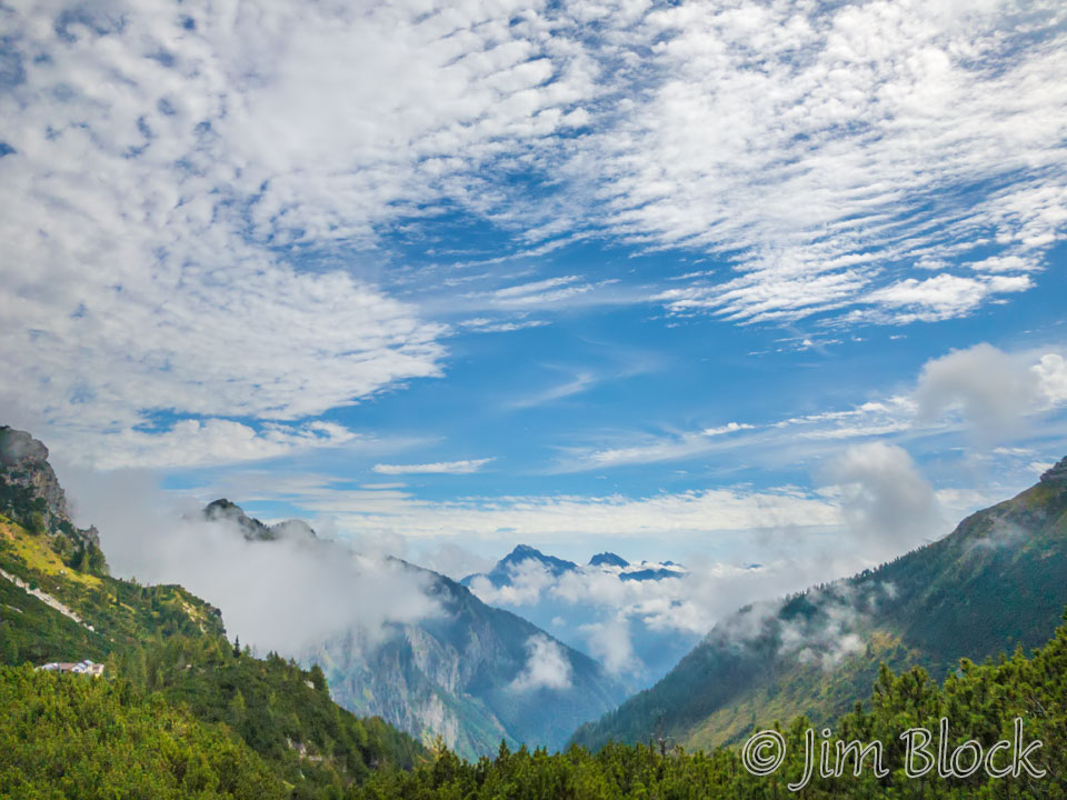
As I drew near Rifugio Pramperet I took some photos of the clouds that were building in the valley below it. I’m glad I got there when I did because soon it clouded over quite a bit.


In the photo below, Rifugio Pramperet is at the left edge. In the valley below we can see the remains of some old farm buildings.
Rifugio Pramperet can be better seen in the photo below.
To the left of the rifugio in the photo above you can see the end of a valley. Below is a view of that valley which is the crossroads of several trails. In the background is Cima de Pramper.
From the valley Rifugio Pramperet can be seen ahead.
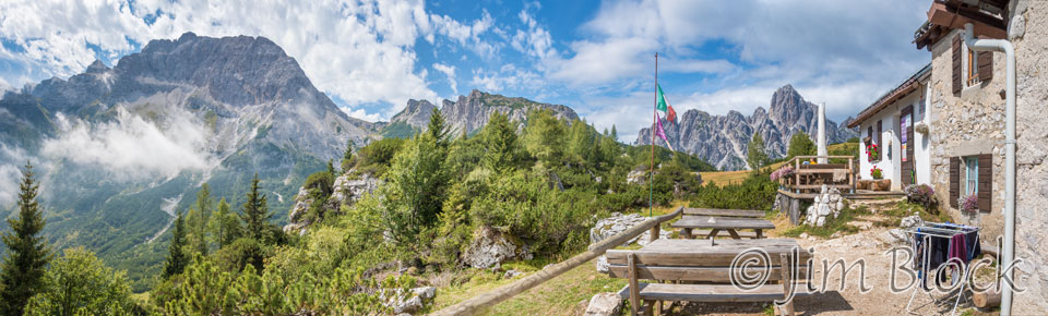
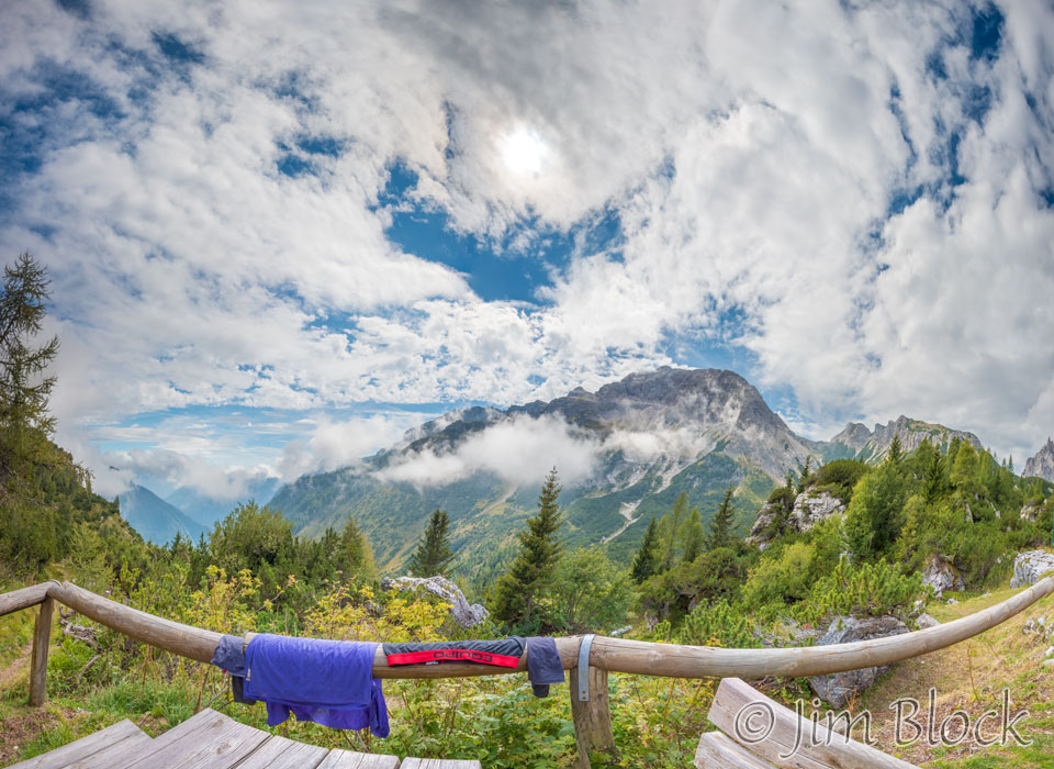
I arrived at Rifugio Pramperet a bit after noon and ordered lunch. I had normally been skipping lunch, but I wanted to have another plate of spaghetti with oil, garlic, and peppers which I had enjoyed earlier at Rifugio Vazzoler. In the five photo panorama below, Cime de Zita, the mountain I would climb after lunch is seen at the far left.
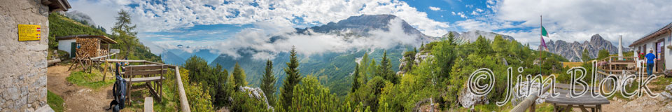
I made a 10-photo panorama showing about 180° from the patio of Rifugio Pramperet. At the far left is the table I chose. You might be able to see my backpack near it. In the center is Cime de Zita waiting to challenge me in the afternoon, and at the right you can see the rest of the patio with the host heading into the rifugio.
While waiting for lunch I made another photo of the building clouds in the valley below.
I also took another photo of Cime de Zita, though I did not know at the time that this was what awaited me.
Since the clothes I washed the night before at Rifugio San Sebastiano did not dry overnight, I pulled them out of a plastic bag and hung them on the railing near my table. Nobody was near me in this section of the patio so I felt it was OK to do. Below is a crazy 29-photo panorama showing Cime de Zita in the background.
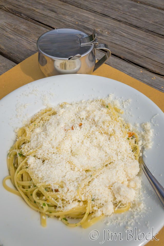
Lunch arrived and I dug into another great meal of spaghetti with oil, garlic, and peppers, but not before I added a healthy (unhealthy?) dose of grated cheese. I’m glad I stopped for lunch this day because the climb and then dissent in the afternoon were long, steep, and challenging.
After a great lunch, I started the grueling climb up to Forcella de Zita Sud, photographing some wildflowers along the way.


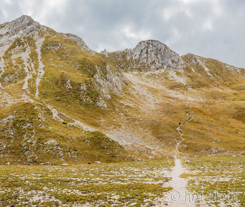
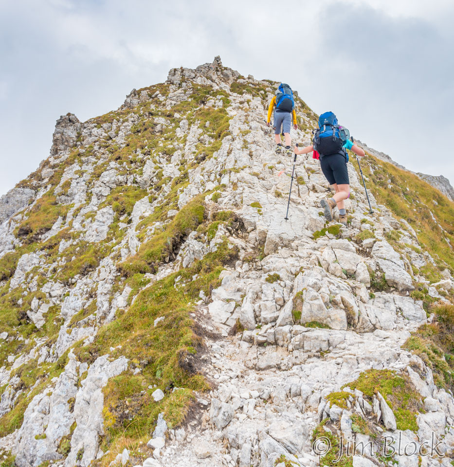
During the slog up to the forcella, Marketa and Karin would pass me and then stop to rest. I would pass them and later they would catch up and pass me again. This happened quite few times as we leapfrogged to the forcella, eventually reaching it at about the same time. During the whole climb there were two men ahead of me. They remained ahead of me the whole way. You can perhaps see them near the center of the photo below.
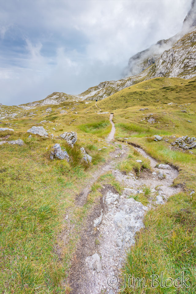
This was a long, tiring, and somewhat frustrating climb. I could see what looked like the col ahead, but it was just a false col. And then there was another false col, and another one, and another one. It seemed like the real forcella would never be reached. Here are some photos I took during the long climb uphill.


")
The 6-photo panorama below shows another false col near the center.
Below is a cropped version of that panorama where the trail, hikers, and false col can be better seen. If you look closely you can see one hiker about halfway up the path and a second one at the point where the path takes a sharp left turn. We are heading up toward that small peak in the center of the photo.
The valley below was filling with clouds. Here is a look back at where I came from. You can perhaps see a bit of the path at the center right of this 3-photo panorama.
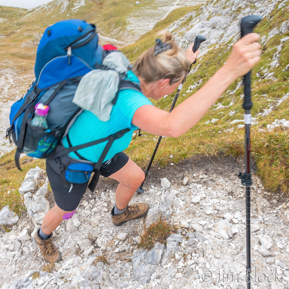
We were approaching a very steep part of the climb. I stepped aside to let Marketa pass. Here she is heading uphill quickly and with purpose.
As crazy as this 22-photo panorama seems, this is what we encountered as we climbed toward Forcella de Zita Sud. We came up the valley in the center of this photo and then climbed to the peak on the right.
Marketa and Karen were a bit ahead of me during this really steep climb. The climb is actually steeper than the photo below shows.
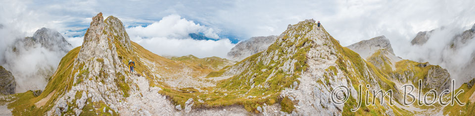
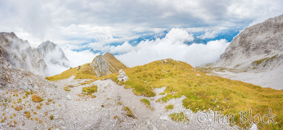
At the top of this steep climb was a beautiful, flat, grassy area still somewhat short of the actual forcella. Below is a 27-photo 360° panorama from this area. The valley we hiked up is near the center of this Image.
The five of us relaxed at this grassy area and took photos.
")
")


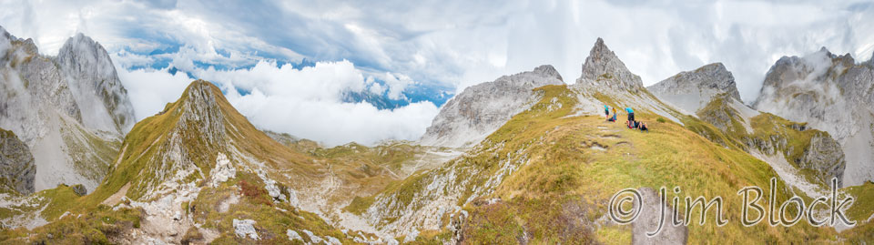
I climbed up toward the forcella and made a 12-photo panorama looking back at the grassy area. On the right side of this image is where we climbed, and on the left side is the beginning of the very steep Val de Erbandoi.
Below are two large panoramas from near Forcella de Zita Sud. You can see low clouds beginning to move in. You can perhaps make out the group at the grassy area in the background of these images.
")
")
As I climbed to the forcella I made other photos looking back at the group on the grassy area. You can see that clouds are moving in fast.


")
From the forcella there was a wonderful view down into the dramatic Val de Erbandoi.
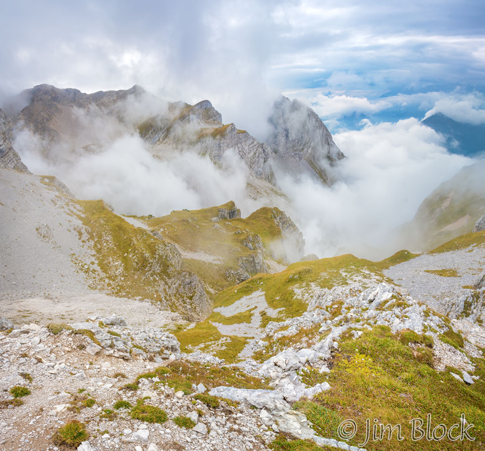
Once over the forcella, the views changed as I dropped down into the Val de Zita de Fora. This valley was scooped out by ancient glaciers. You can see the characteristic U-shape of the valley.
-copy")
-copy")
")
")
")
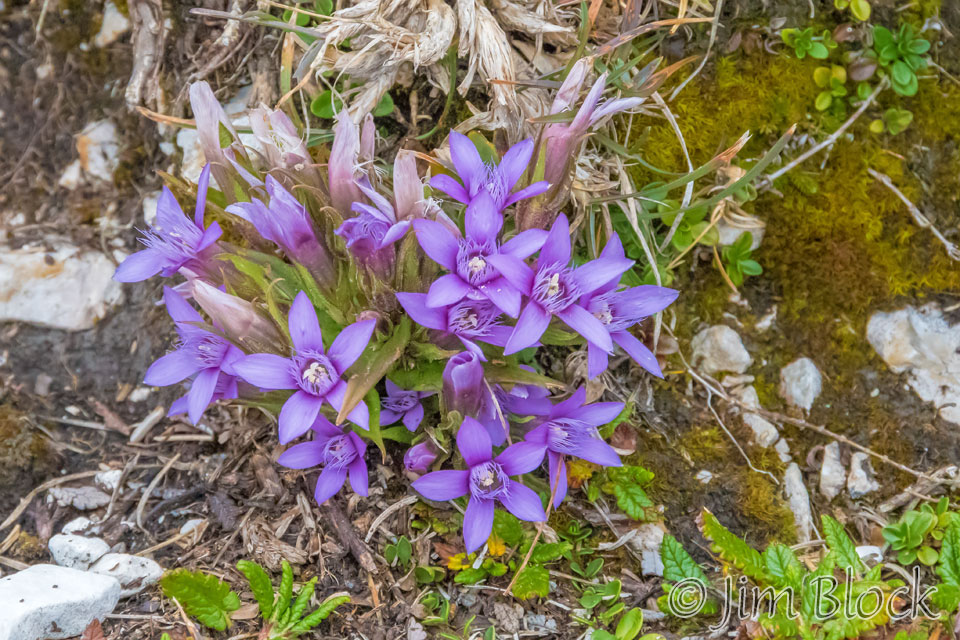
Along the way there were still some wildflowers blooming this early September day.
But it was mostly pebbles, rocks, and boulders as we worked our way down.
The 10-photo panorama below left shows the view back toward Forcella de Zita Sud. But why did I take the crazy 8-photo panorama on the right. Can you figure it out?
Below is a cropped version of the bottom portion of the tall skinny panorama above. Big deal, it shows some wildflowers that are not gorgeous. I believe they are saxifrage.
Below is a crop of the top portion of that tall thin panorama. Now you see why I made it. That’s a marmot sitting on a pile of rocks it excavated for its home.
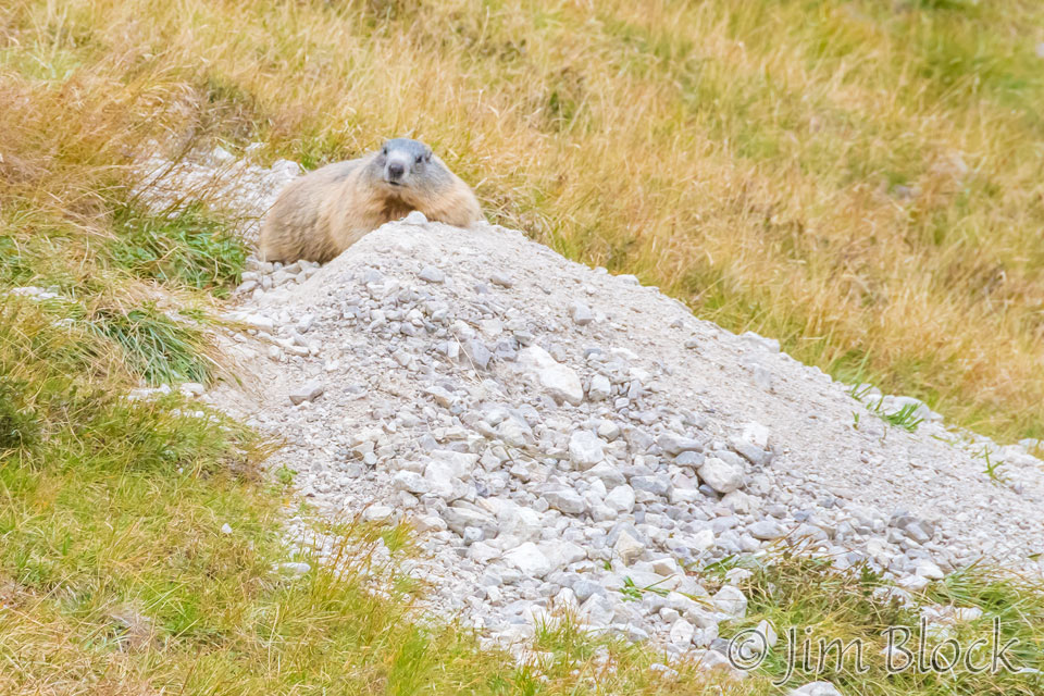
Below are two more photos I took of the marmot before it eventually scrambled down into its hole.


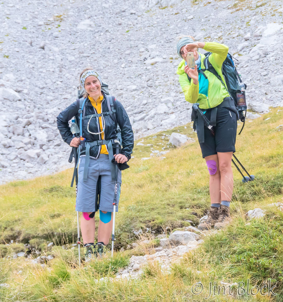
Marketa and Karin were with me when we when we saw the marmot. I believe they spotted it first. Here they are either taking a phone photo of me or more likely the marmot.
The trail down was long and in places quite steep. At this place I fell. This was a bad place to fall, but fortunately my camera was not damaged (I tend to protect it by instinct), and I did not get injured. This was the only time during the whole trek that I fell.
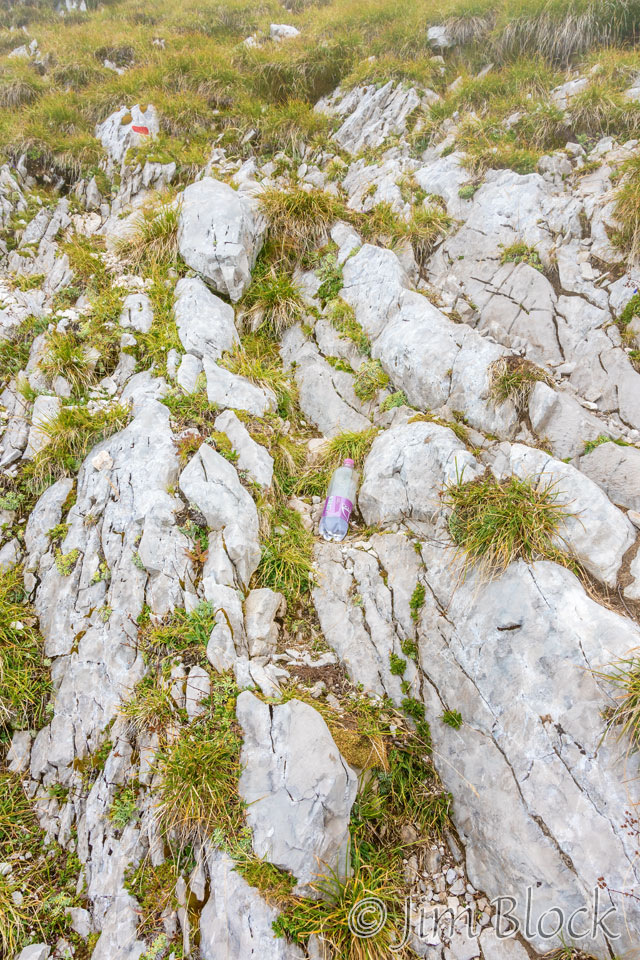
My water bottles flew out of my pack when I fell, and I retrieved one of them. However, I did not notice that the small one in my shoulder strap was missing. No matter, I had a spare.
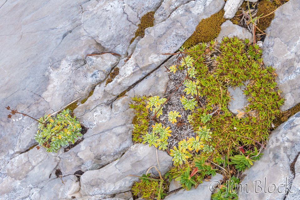
While standing after the fall I tried to convince myself that I would be more careful in the future, I made a photo of some plants growing in the rocks.
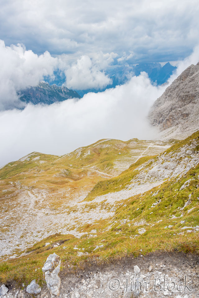
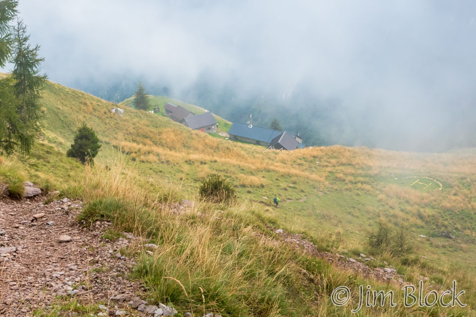
There was fog in the valley ahead.
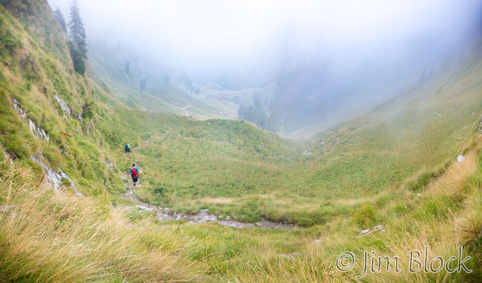
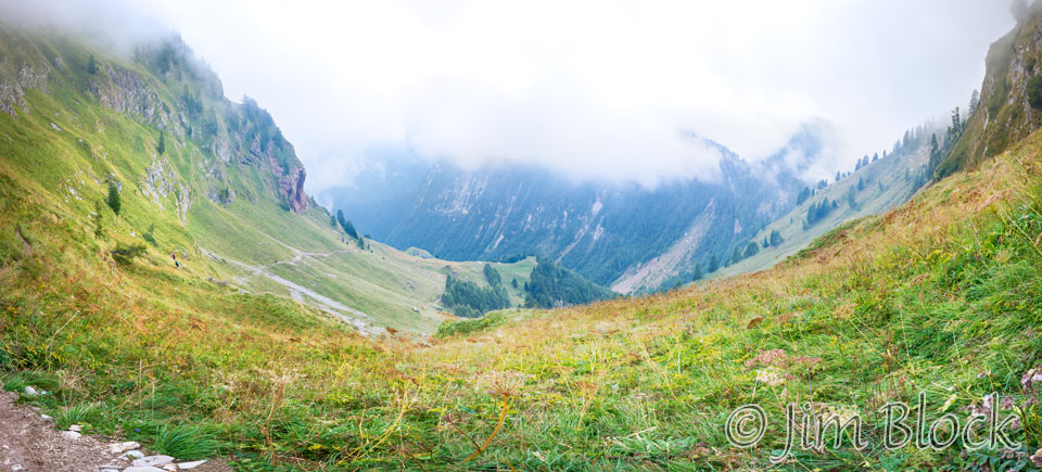
Rifugio Pian de Fontana came into view down a rather steep slope. Note the helipad at the right.
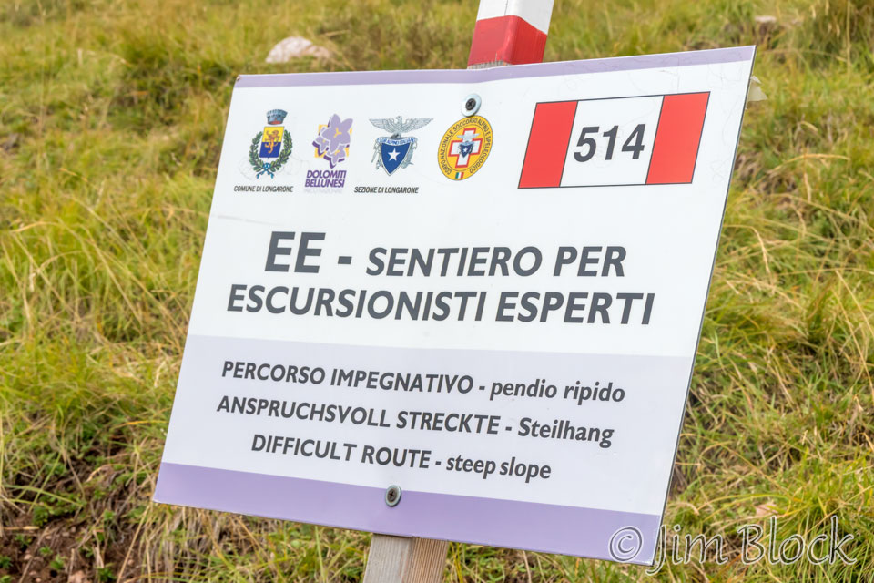
There was a sign that told me what I already knew.
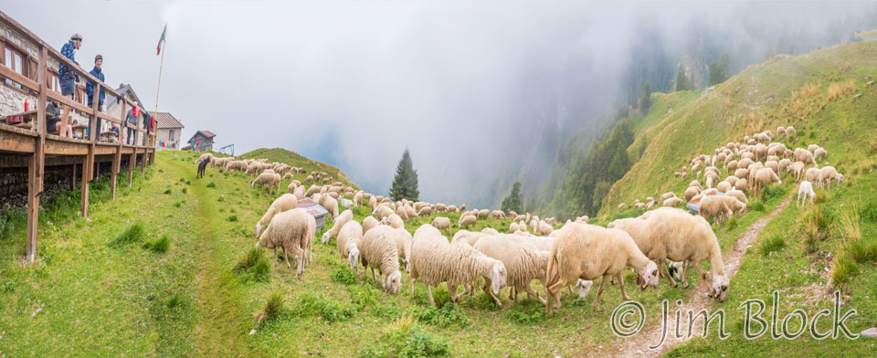
There were sheep and sheepherders above the rifugio. Here are some of the photos I took of them as they were herded downhill.


I made some multi-photo panoramas of the sheep being herded.
")
")
")
Eventually they wound up grazing in front of the rifugio.
But then the sheepherders decided to have their dog move the sheep farther away to a lower pasture.
")


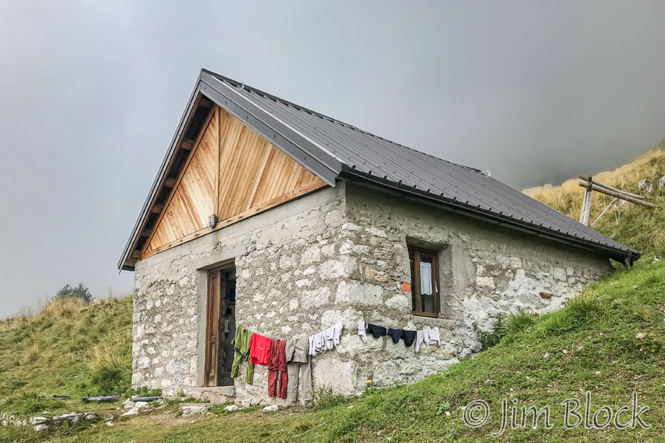
Rifugio Pian de Fontana had four stone buildings. The main dining room was flanked by three dormitory buildings. Below is my dormitory. Believe it or not, there were 13 beds and a single toilet and shower in this building.
The other two dormitories are seen below.
The photo below shows the main dining building on the far left. Behind it is the dormitory where we slept. I arrived first, so I staked out lower bunks for Jim and Stephen.
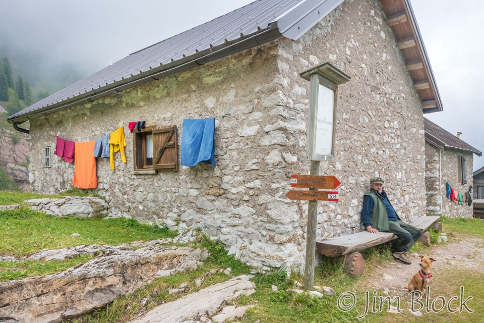
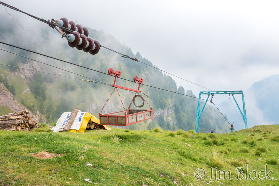
The clothes in the photo above are hanging on the line for a cable car up the mountain. Below is the support for the cable car. Inside the wooden building is a gasoline-powered engine which pulls the cable car up and down.
You can see the cable car is not for people but only for supplies.
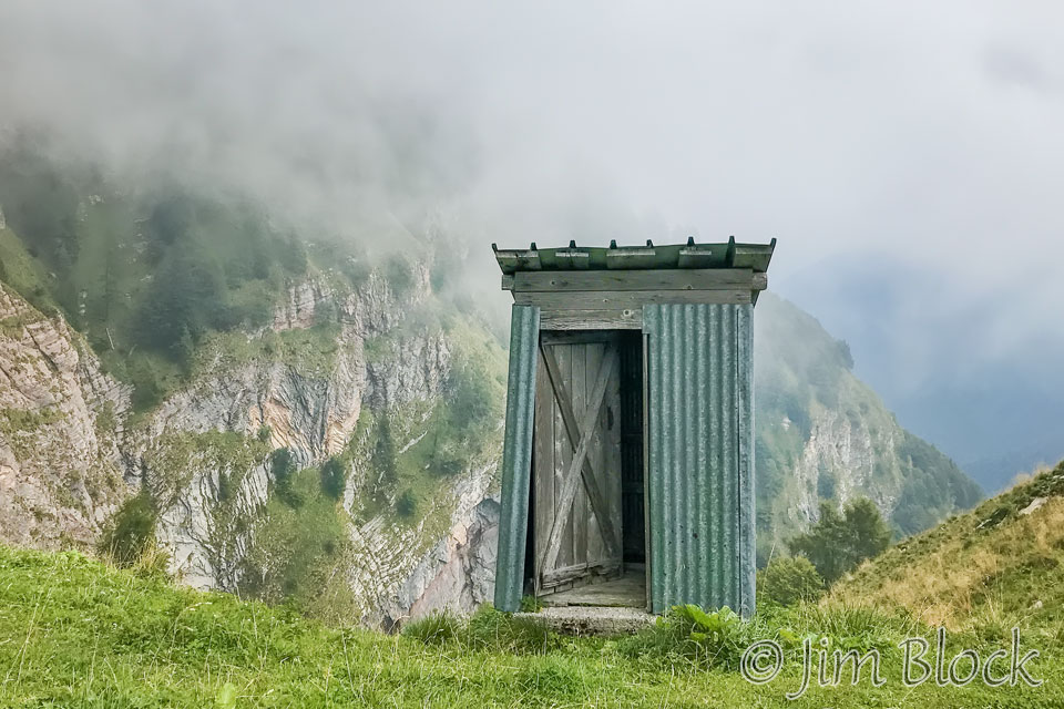
There was an old outhouse near the top of a cliff that I photographed with my iPhone.
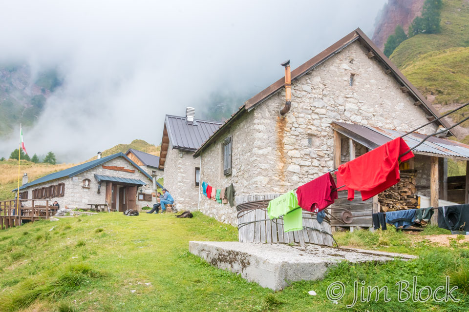
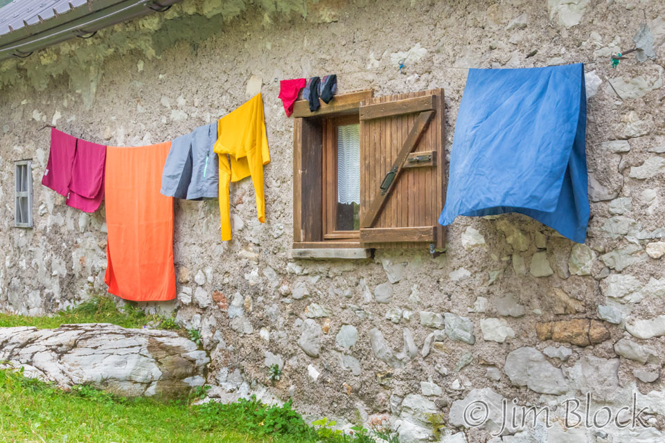
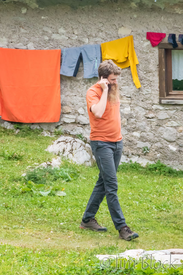
The manager of the rifugio used his phone while strolling around in front of the wash hanging on a wall of one of the dormitories.
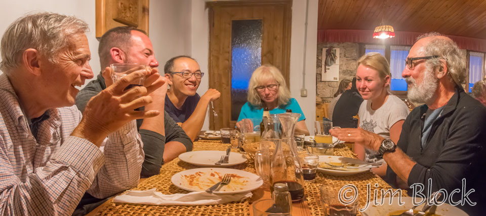
The dinner tables at this rifugio we’re not assigned, so we could gather together the friends we had made during the trip: Martin, Carman, Young, and two woman from Germany whose names did not make it to my notebook.


In the photo below, Stephen and Jim are on the left and right sides of this image respectively. Young was sitting to my right between Jim and me.
This dinner was a great last night of a fantastic trek. Tomorrow would be a long downhill to a bus to Belluno.
![]()