I finally hiked to Smith Pond from Route 4A. It was a completely unplanned hike on an overcast day, which was perfect for photographing the streams and waterfalls. I’d been meaning to do it for several years but never seem to make it happen. This is an excellent, fairly easy hike up to a beautiful, unspoiled pond, through the Smith Pond Shaker Forest, which is owned and protected by the Upper Valley Land Trust (UVLT).
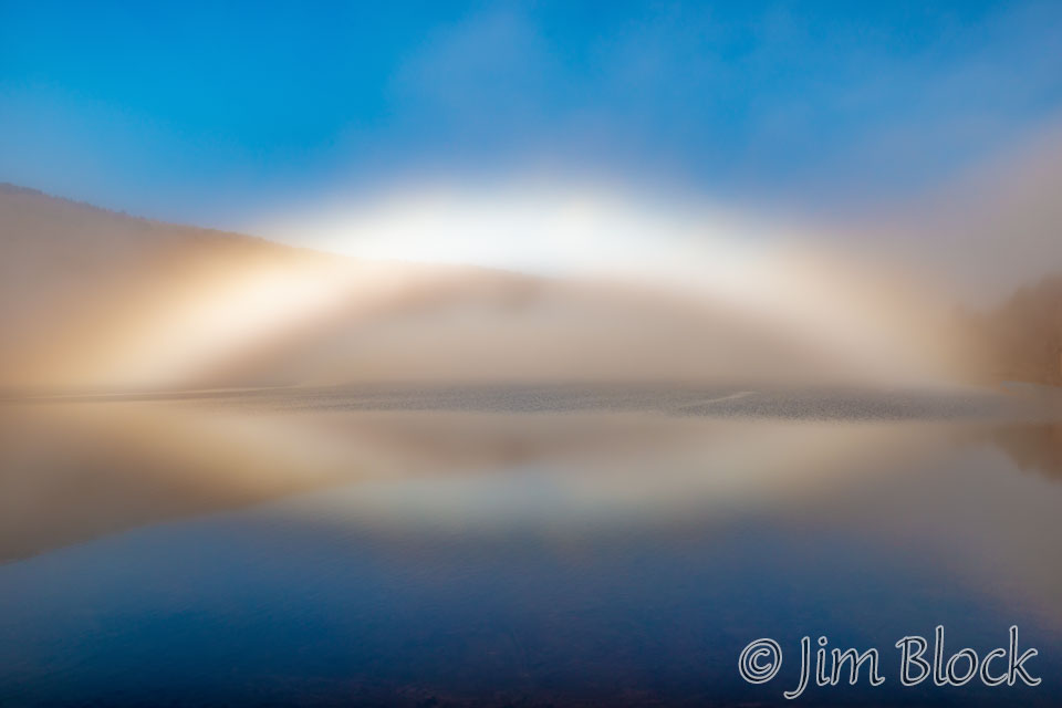
The day before I did this hike, I got a photo of an amazing fogbow from the nearby Shaker Bridge over Lake Mascoma.
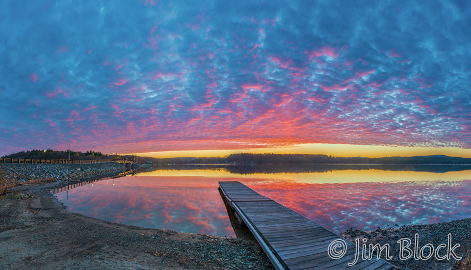
Two days after the hike I got a nice sunrise with the Shaker Bridge on the left side of the photo below.
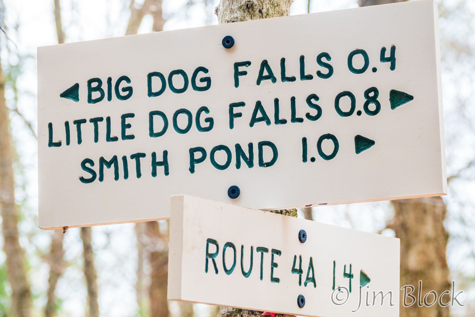
Since I made no preparations for this hike, I didn’t quite know what to expect. I reached this sign somewhat before 7 AM.
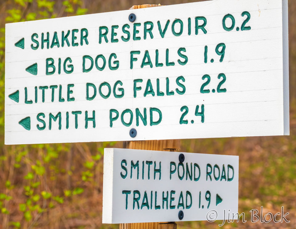
The sign is accurate but a bit misleading. I took it to mean that if I hiked 1.9 miles I would reach Big Dog Falls and then after another 0.3 miles I would reach Little Dog Falls. That seemed very doable. But all is not what meets the eye.
In the 1830s, the Shakers dammed several lily ponds up top, creating “Shaker Mountain Pond”, and developed a system of canals to deliver water to their community near Lake Mascoma.
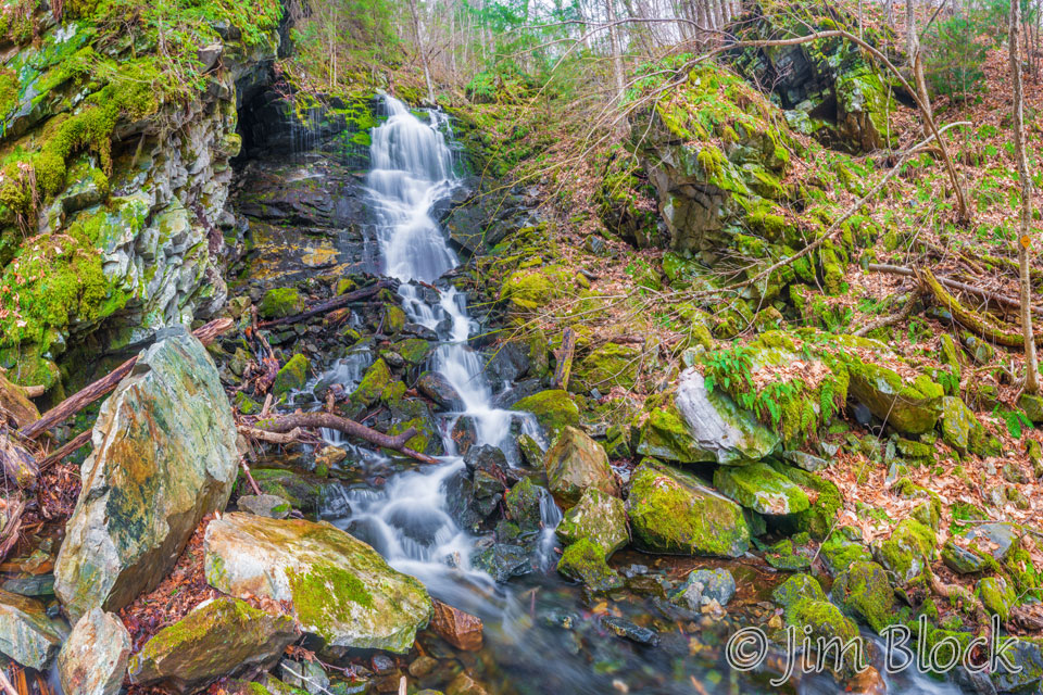
A short distance up the trail was a side path to the Shaker Spillway. Here is a seven-photo panorama of the spillway.
After photographing the spillway, I hiked above it and got this photo looking back. The spillway is behind the clump of green at the top middle of the photo. I believe this photo shows the spot where there was a reservoir constructed by the Shakers.
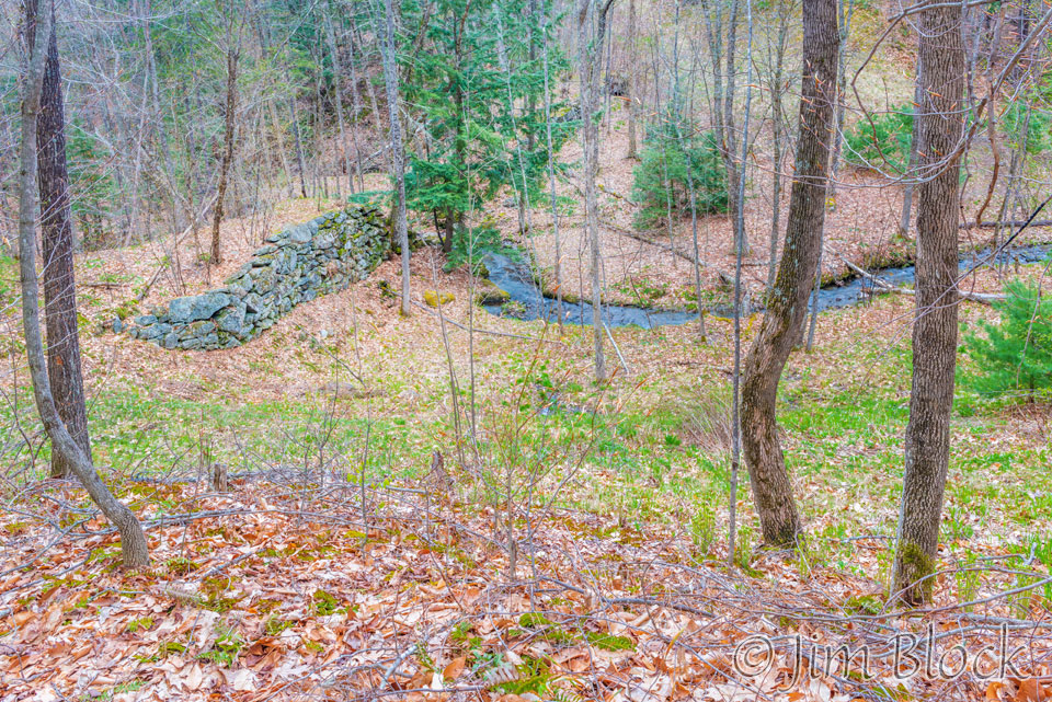
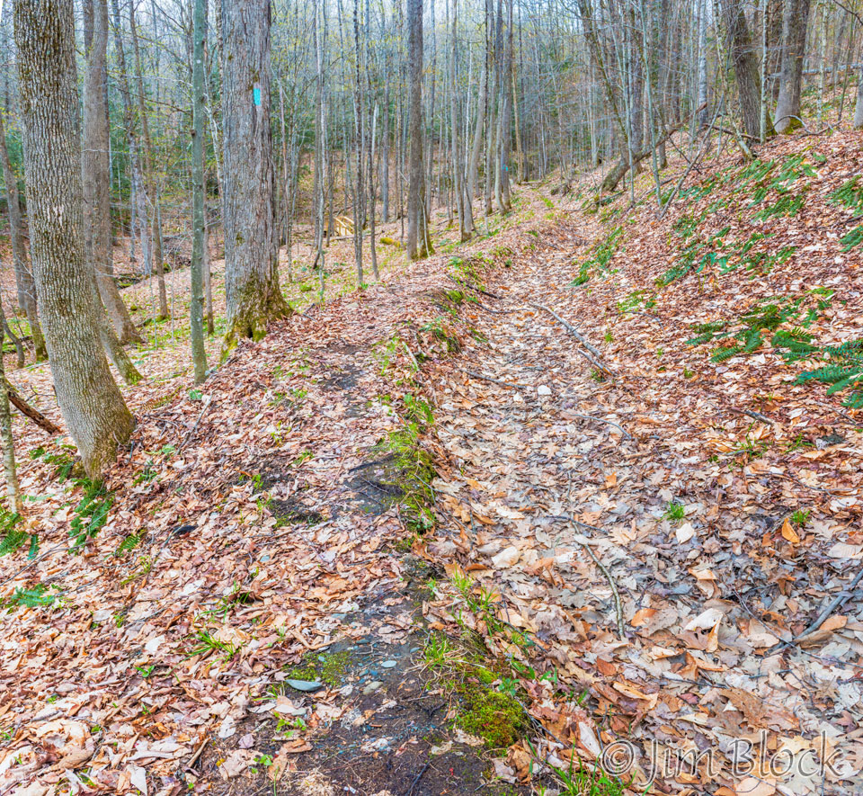
The Shakers created miles of hand and horse dug canals to feed water from Smith Pond and the several streams in this area to power their gristmills and their shops and irrigate their fields. I believe this photo shows one of those canals to the right of the path.
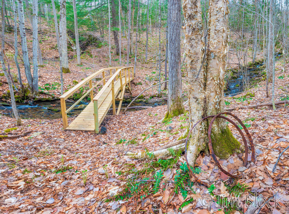
A little farther up the trail is a nicely constructed bridge over Shaker Brook.
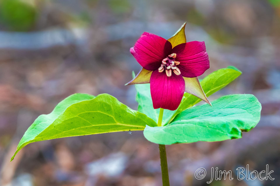
And I couldn’t resist photographing this Purple Trillium during this early May hike.
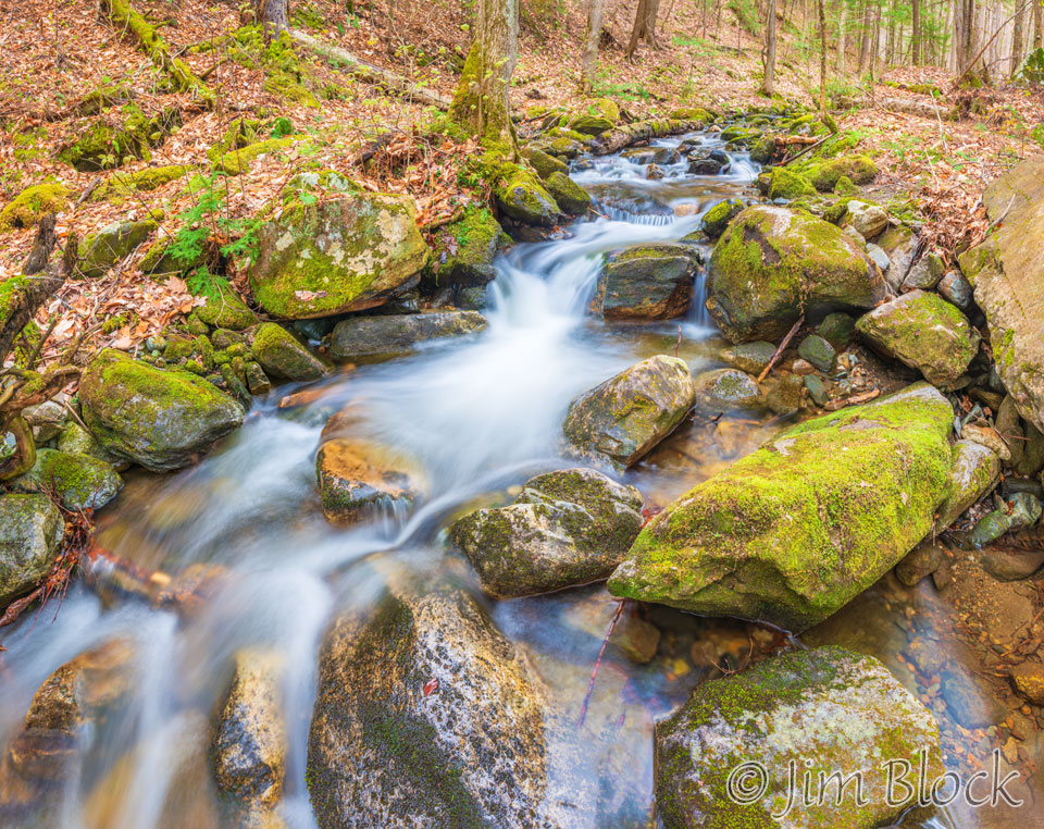
A while later I reached Smith Pond Brook and took this photo.
A bit beyond that spot I found another sign at an intersection. Now, it was revealed that it is actually 1.2 miles between Big Dog Falls and Little Dog Falls, not 0.3 miles as I had assumed from the previous sign. It seems that Big Dog Falls is off a side trail.
I decided to head up toward Little Dog Falls and Smith Pond, and about 20 minutes later I got a nice view of Lake Mascoma. In the photo on the left one can see Lakeview Cemetery near the center and above it the Moose Mountain Ridge. In the photo on the right, the building near the center left is the Shaker’s Stone Machine Shop, also seen in the photo below from ground level taken two days after the hike.
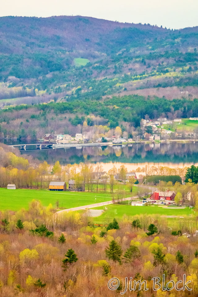
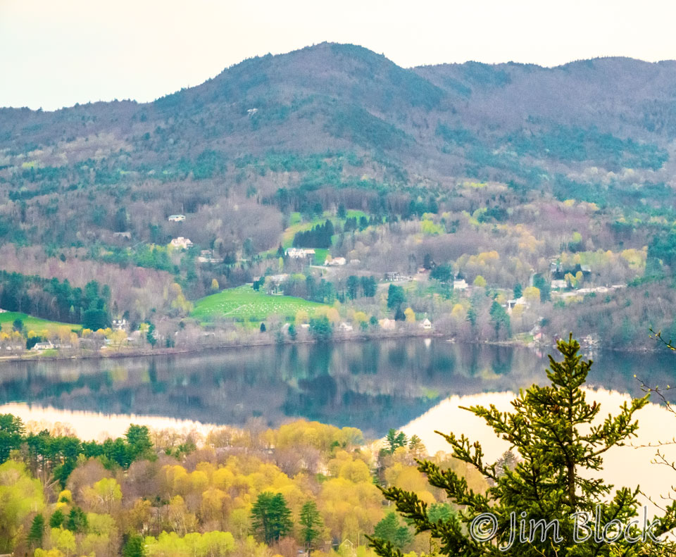
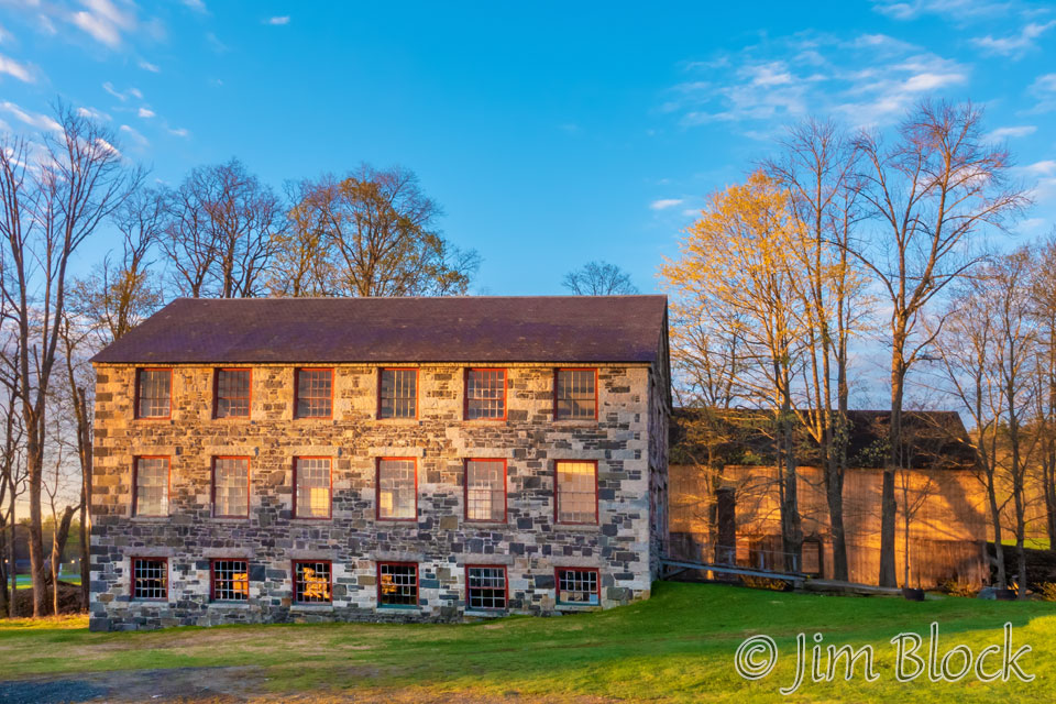
This Stone Machine Shop was constructed in 1849. It housed three stories of water power machinery. The Stone Machine Shop was built with stone brought from locations as far as five miles away.
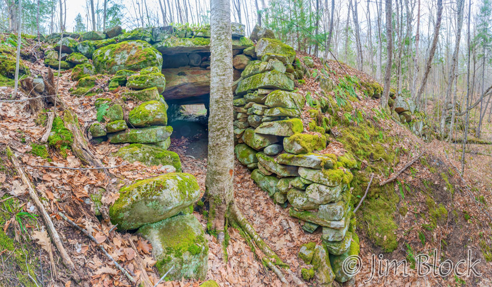
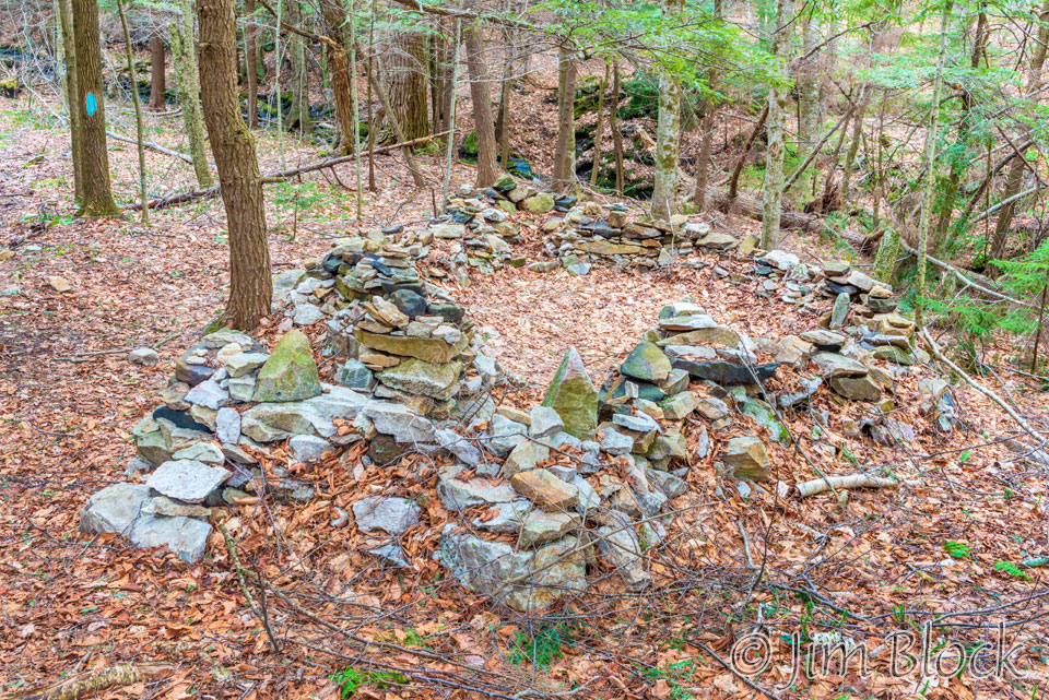
Fifteen minutes up the trail from the view spot, I found this interesting stone structure. I have no idea what its history is or purpose was.
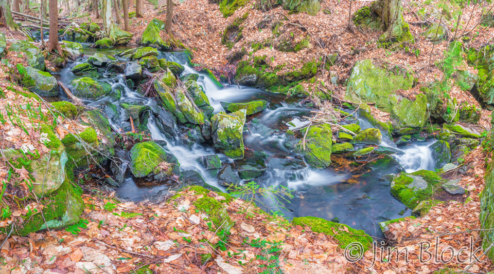
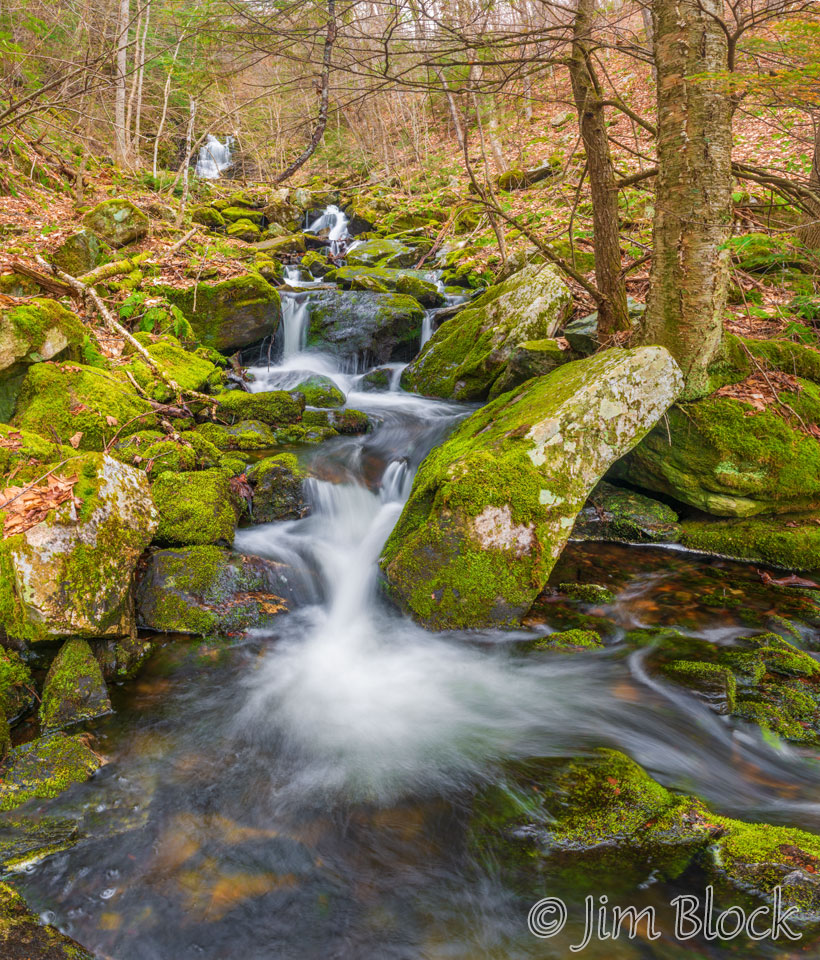
Just beyond that stone creation I made a four-photo panorama of Smith Pond Brook.
A very interesting bridge crosses Smith Pond Brook just below Little Dog Falls. I don’t ever recall seeing another one of this design. The image below is a nine-photo panorama shot with a wide angle lens. Consequently, the shape of the bridge is a bit distorted.
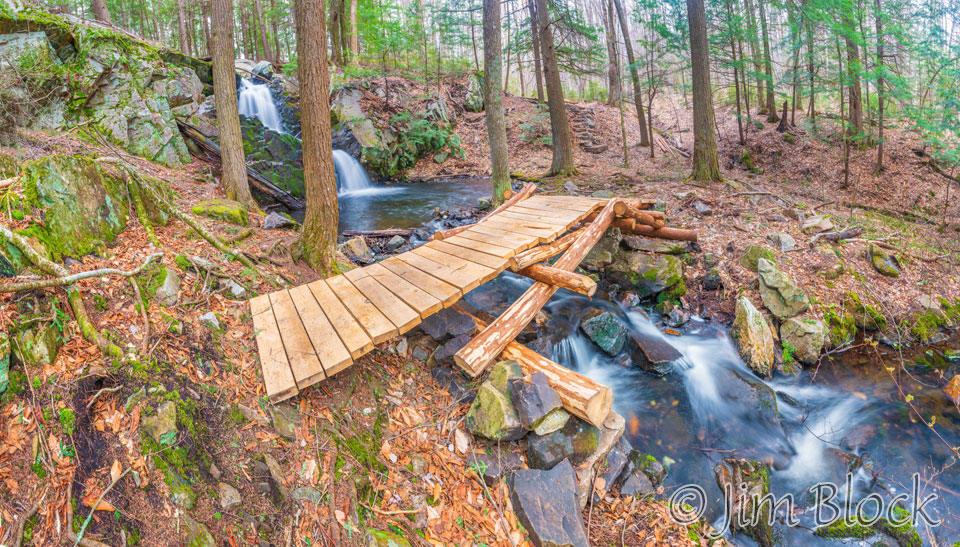
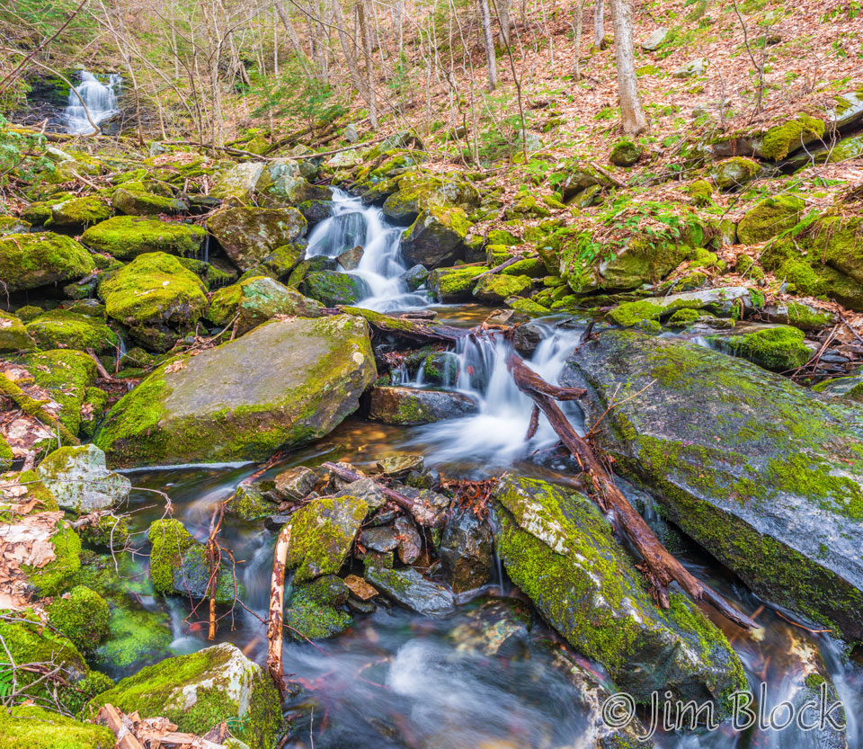
I’ve seen photos of Little Dog Falls when it was running very full. However, I much prefer it with less water like the day I was there. It had a nice S-curve to it with the lower flow rate.


I paid a brief visit to Smith Pond. There I found a bench with a beautiful view and also the remains of a refrigerator.


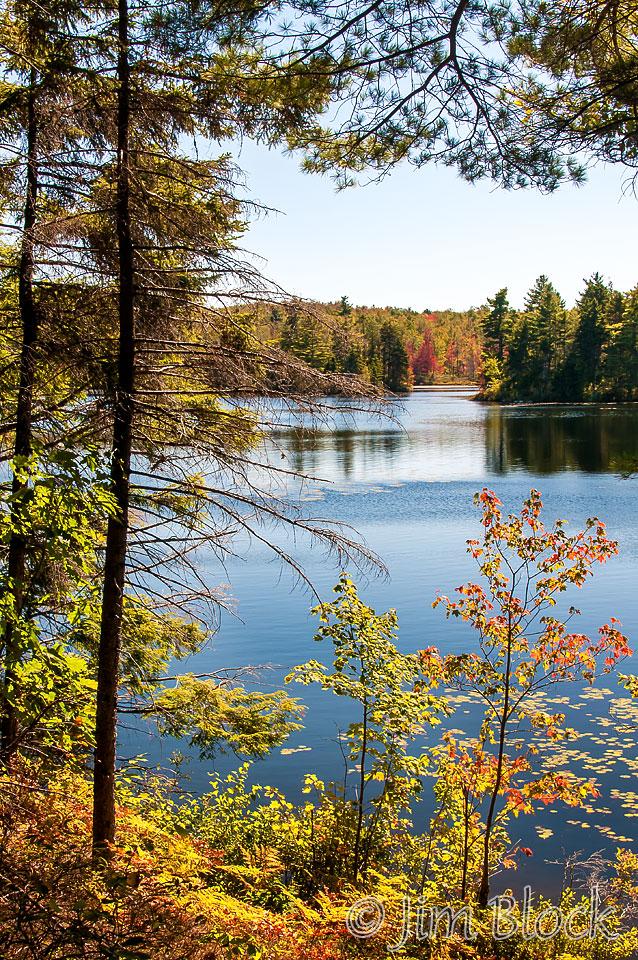
To the right is a photo of Smith Pond taken a number of years before the UVLT purchased the Smith Pond Shaker Forest.
That time I hiked from Smith Pond Road, a shorter and easier way to get to Smith Pond. I suspect that the trail through what is now the Smith Pond Shaker Forest did not exist.
I hiked back down to the trail junction and took the side trail to Big Dog Falls. It can be seen in the distance in the two photos below of Smith Pond Brook.
Here are two views of Big Dog Falls from closer up.
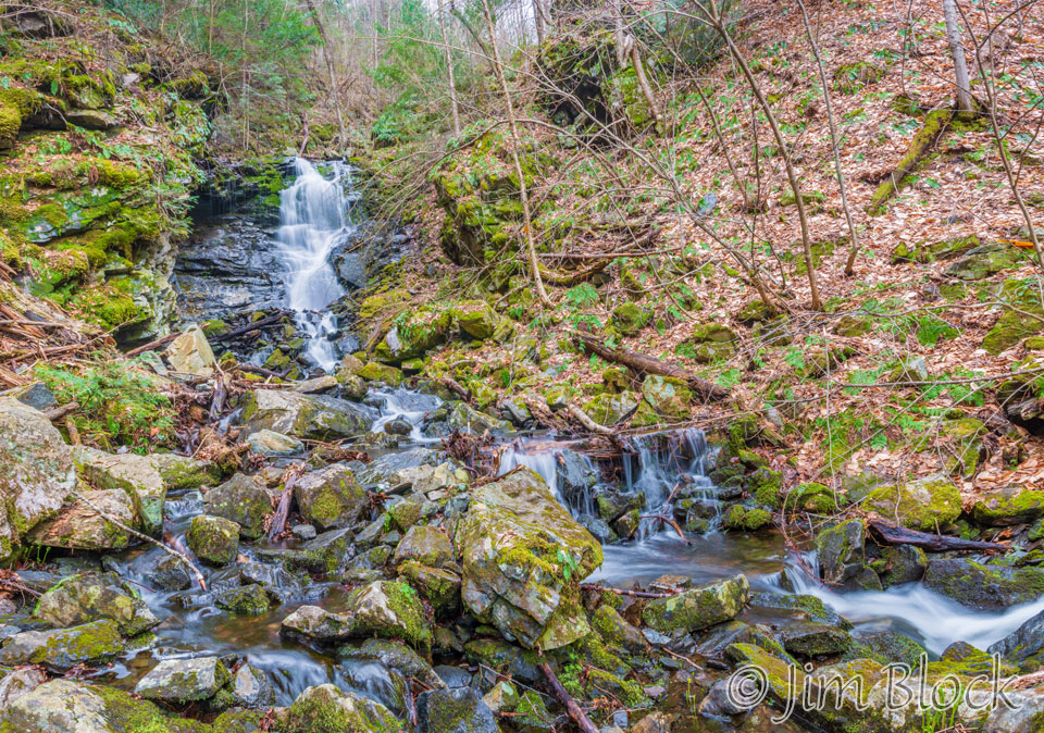
I did not find Big Dog Falls as attractive as Little Dog Falls.
When I studied my GPS track after the hike, I noticed how close Big Dog Falls is to the main trail to Little Dog Falls and Smith Pond. I did not study the terrain carefully when I was at Big Dog Falls, but I’m now wondering if a shortcut could be created to reduce the distance to hike from one falls to the other. This would be especially useful for folks visiting from Smith Pond Road, the other access to the area.
Heading down I took a few more photos of Smith Pond Brook.


My total hiking distance this day was just under 6 miles with 1,142 feet of elevation gain (and loss).
This is a beautiful, unspoiled area. If you would like to see photos from a winter trip on snowshoes, please CLICK HERE.
You can CLICK HERE for a map of the area from the UVLT.