If you would like to see the features in the image below labeled, you can click this image to get to a site where you can zoom way in then pan around. When you get there, click the double arrow above the image on the right to see it full frame. Please wait for the resolution to download. You can use the + and – keys to zoom and the arrow keys to scroll. Or use the scroll wheel to zoom and the left mouse to drag.

 We are truly blessed—one of the best hiking trails in the world passes right through the middle of the Upper Valley. Better yet, you don’t have to be a long-distance hiker to enjoy it. There are many great short hikes along parts of the Appalachian Trail in this area: from Three Mile Road in Etna to Moose Mountain, the trail up Mount Cube in Orford, and the Glencliff Trail up Moosilauke. The hike up Smarts Mountain ranks right up there with these three.
A hockey-stick hike—a long gradual walk then a short, steep uphill. That describes both routes up Smarts Mountain from Lyme. Since there are two trails, this is almost a loop hike, with only a relatively short section, the steep part, that needs to be retraced. The reward for making the steeper section is a great view from the abandoned but restored fire tower and a wonderful boreal forest.
From the parking lot on the Dorchester Road you have a choice: the Ranger Trail which starts more gradually or the Lambert Ridge Trail, the present Appalachian Trail route, which begins the assent more steeply. Both get to the same spot in 3 to 3.5 miles and then climb together the last 0.6 miles to the summit. The favored route up is the Lambert Ridge Trail, which is blazed in white since it is the AT. This is the one to take if you are unsure of your resolve to make it to the summit or if you just want a short hike to a great picnic spot.
The path up less taken, the Ranger Trail, has its own rewards. This blue-blazed trail follows a woods road up a brook with occasional ups and downs and switchbacks across rock slabs. This brook is one of the tributaries of Grant Brook which empties into the Connecticut River with a beautiful wide mouth along River Road in Lyme. At about 1.5 miles the trail crosses the small brook at a spot where an old fire warden’s garage stands. The fire rangers used to park their jeeps here. After this spot the Ranger Trail is a narrower path that ascend more steeply past rock cairns that at one time supported telephone poles linking the fire tower with the valley below. Look for them off to the side of the trail. About three miles up the Ranger Trail meets the Lambert Ridge Trail which joins it from the left.
")

After the two trails join forming the Upper Ranger Trail, the remaining hike to the summit is short but steeper. The lower elevation forest gives way to boreal species. Eventually branch trails appear to head in multiple directions. One to the left takes you a few paces to the former fire tower. This tower is definitely worth the climb—the views from it into the Upper Valley and out to the White Mountains are stunning.
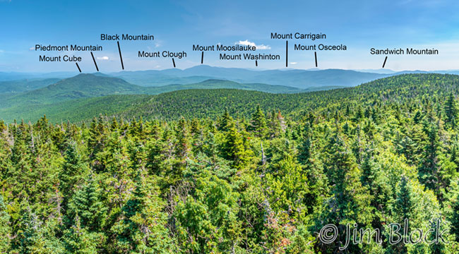
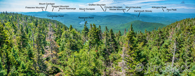
You can see Reservoir Pond and a piece of Cummins Pond below along the Dorchester Road. Holtz Ledge and the Dartmouth skiway are to the right of these ponds, and above Holtz in the distance is Mount Ascutney with Moose Mountain closer in. Above Cummins Pond you can see (left to right) Mounts Cardigan, Ragged, and Kearsarge. Beyond Reservoir Pond in the far distance is Mount Sunapee. With binoculars you might be able to identify DHMC in white and some of the mountains of Vermont on a clear day. The first photo above shows this view, but for a photo with labels on some of the features that you can zoom in and pan around to see these please click HERE.
There is an old ranger cabin, Mike Murphy Spring, and a tent platform you can explore along the various side trails in this area. If you were to continue on the AT heading east and then north you would reach Mount Cube in 7 miles. When you have finally had enough and decide to descend, be careful to take the correct trail down.

Whether you visit Lambert Ridge on the way up or down or just hike to it for lunch in the sun, this is truly a beautiful spot. The view to Smarts Mountain is superb and the pinkish-gray lichen-patterned rocks are a special treat. These rocks are quartzite which was beach sand roughly 400 million years ago when this part of New England stood at the edge of a chain of volcanic islands. Quartzite is unusually hard so it remains as high ridges long after surrounding rock has worn away. The ridge that forms the eastern edge of the Connecticut River valley, from Moose Mountain, up Smarts, and on to Mount Cube, is comprised in part of the same type of quartzite that you see on Lambert Ridge.
There are many viewpoints along Lambert Ridge but the best is about 1.7 miles up the Lambert Ridge Trail from the parking lot. Here you can bask in the sun on the beautiful quartzite while pondering Smarts across a small col.
To get to the trail heads from Lyme follow the signs for the Dartmouth Skiway to the east. Just before the skiway take the left branch which is the Dorchester Road. In 1.8 miles just before the iron bridge over Grant Brook, a small parking lot is reached on the left. Orange signs mark the trailheads.
Here is a slide show of a wonderful fall hike up Smarts Mountain with my good friend Stephen.


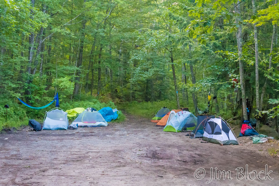
The hike described above took place in 2009 when Stephen and I were “training” for a long trek in Nepal. I also hiked Smarts in 2017 with Bruce. When we arrived the parking lot was full of tents. Boy Scouts if I recall correctly.
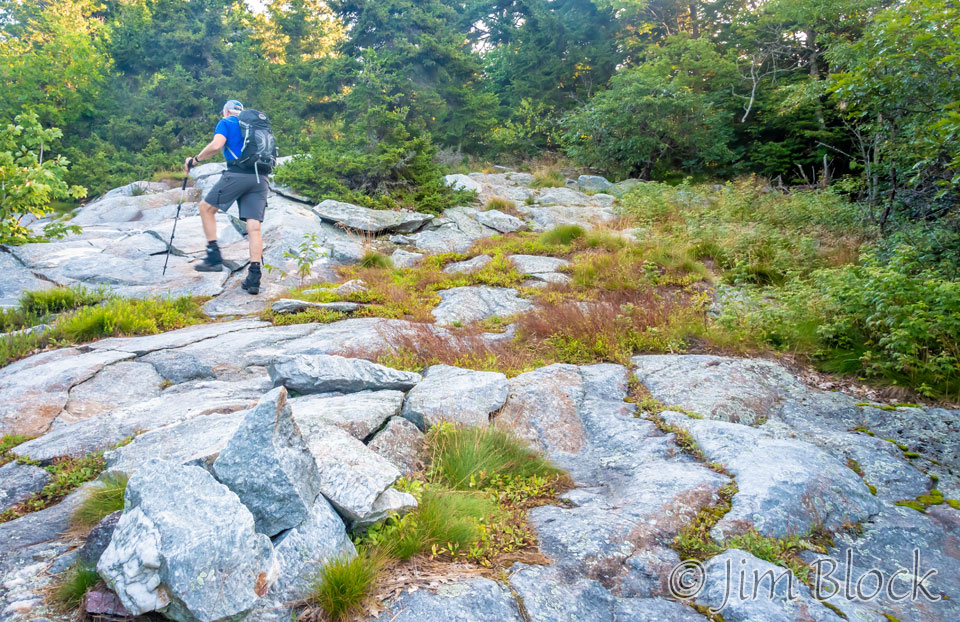
We ascended the Lambert Ridge Trail and returned along the Ranger Trail, which was not in great shape that day.
I took a photo of Mount Cube from the fire tower.
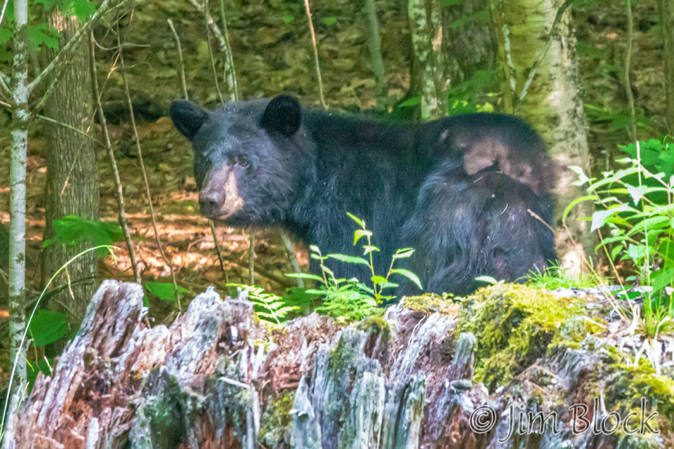
In 2019, three friends and I dropped one car at the trailhead along Dorchester Road and then drove around to the Orford side of Smarts to do an end-to-end hike across the summit. On the way to the north side we saw a bear. It had a cub that quickly climbed a tree.
From the fire tower I made a panorama looking NE toward Mounts Cube and Moosilauke.
And another one looking south that is similar to the top image on this page.
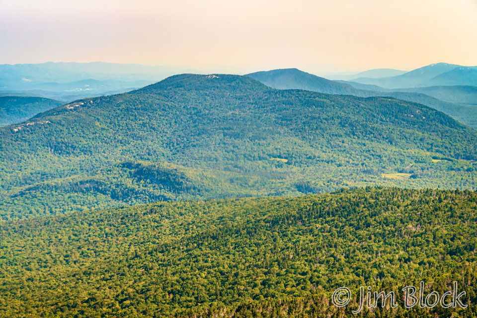
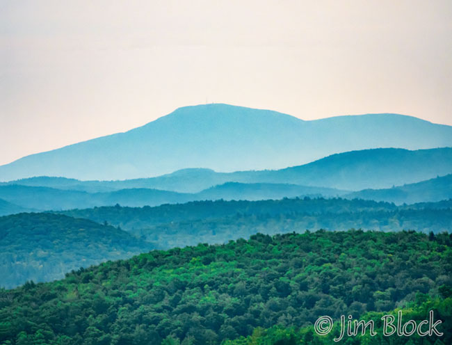
I zoomed in to get the photo below of Mount Kearsarge, with Black Mountain on the right side of the photo.
Smarts makes a great climb in any season, although I have not yet done it in the middle of winter.