The Zealand Trail, which starts at the end of the Zealand Road off Route 302 a bit east of Twin Mountain, is an easy trail with only a short steep section of less than 1/4 mile just before the Zealand Falls Hut. A friend and I hiked it one late October day after three days of heavy rain in the area. Areas normally dry were quite wet, and streams and falls that have often just trickles of water were near record levels. Nearby Mount Washington had the following rainfalls (inches) the preceding three days: Tuesday 1.9, Wednesday 2.0, and Thursday 2.7.
Above the Zealand Falls Hut one can follow the AT/Twinway Trail up to Zeacliff Outlook and Zeacliff Pond. We planned to hike there but found crossing Whitewall Creek above the hut too risky to attempt this day. Normally it is a trivial step-across.
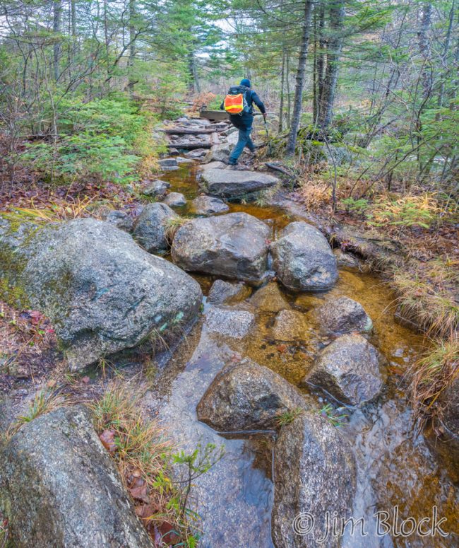
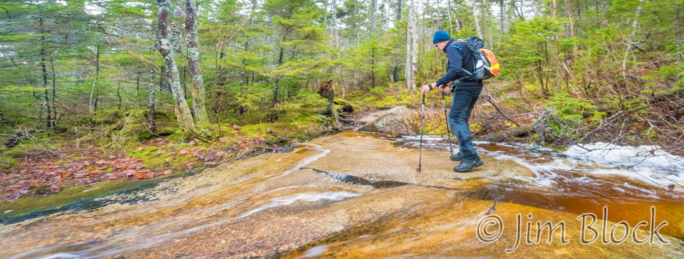
We crossed several small streams that were made a bit tricky by the fact that they actually had some water flowing.
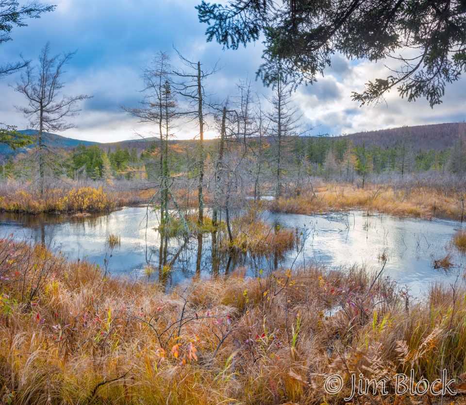
Most of the trail was dry, easy, and beautiful. We saw a number of bogs/ponds/wetlands along the way.
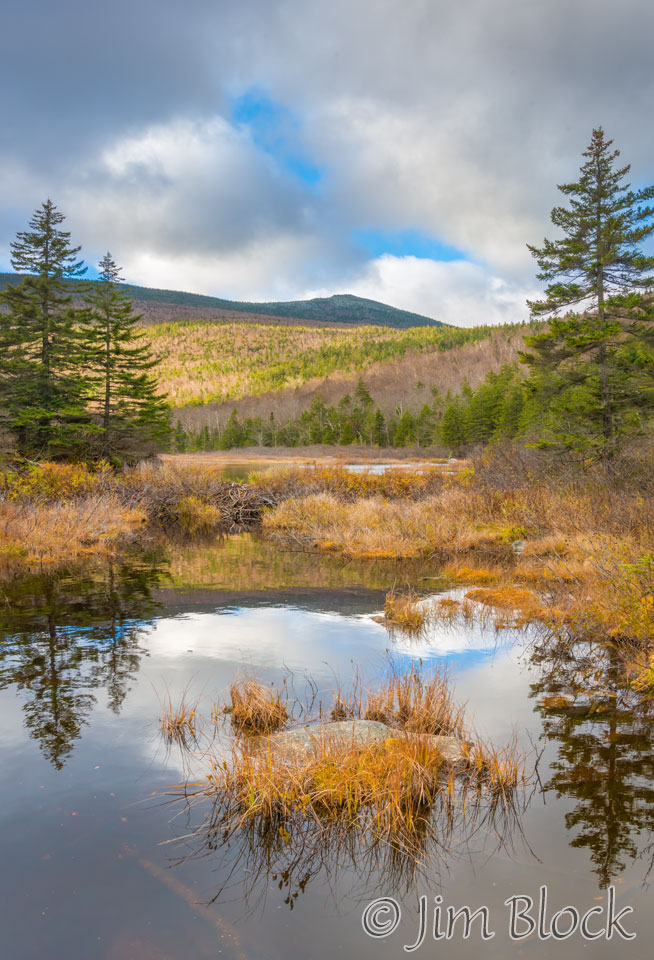
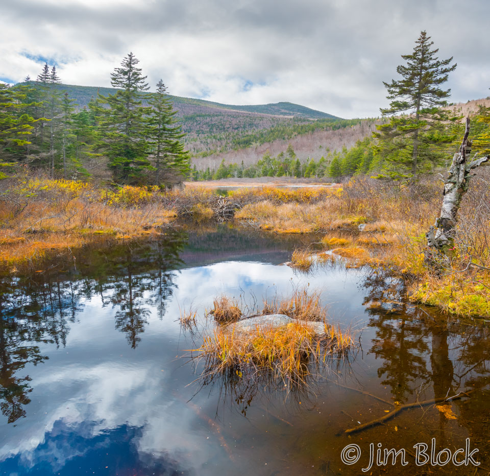
The photo above right was taken at the north end of Zealand Pond. You can see the main pond in the background. Below is another view from the same location 3 hours and 20 minutes later.
The pond has no visible inlet but has two small outlets, one on either end. The northern end of the lake drains into a broad swampy area, seen in the photo earlier, that gradually narrows to a small stream forming the headwaters of the Zealand River. At the southern end a small stream flows from the lake into Whitewall Brook.
The Whitewall Brook reaches the North Fork of the Pemigewasset River at the south end of the notch. It travels from there to the main stem of the Pemigewasset to the Merrimack River and ultimately into the Gulf of Maine. North of the Zealand Falls Hut, the Zealand River flows north to the Ammonoosuc River near the village of Twin Mountain, with the stream flow eventually reaching the Connecticut River and turning south again to ultimately reach Long Island Sound. Thus water in the Zealand Pond might flow to either the Gulf of Maine or Long Island Sound. Where would rather wind up?
We reached the junction of Zealand, Ethan Pond, and Twinway trails. The hut is a short, steep climb above this junction. I’ve never stayed there, but it looked very inviting.
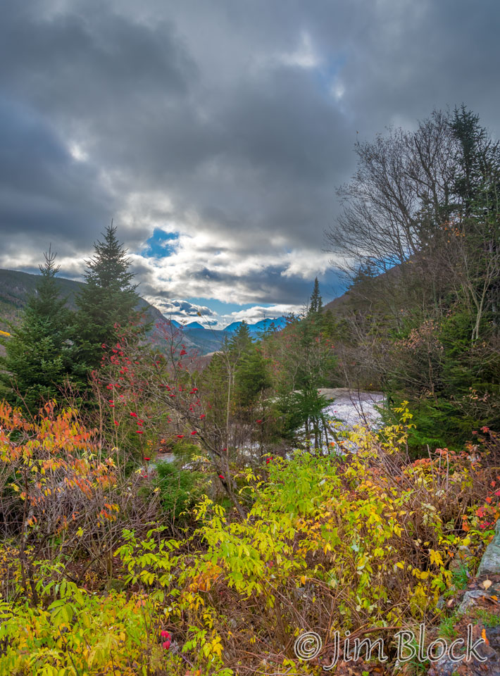
At the right is the view from the front porch looking a bit east of due south. The Whitewall Brook flows through that notch. Whitewall Mountain is to the left and Zeacliff is to the right. The AT/Ethan Pond Trail heads down this valley.
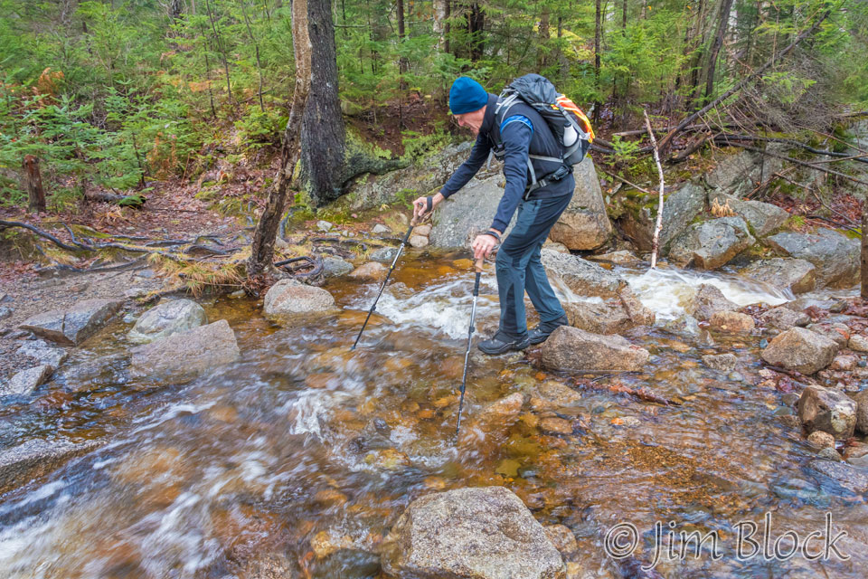
Above the hut we had to cross a stream that is normally dry. This wasn’t too bad — the rocks were flat and the water wasn’t deep — but I could not avoid getting my shoes wet. Starting this year I abandoned my heavy hiking boots and converted to trail runners. They are great — about half the weight, no break-in needed, and they dry very quickly. But they are definitely not waterproof. One quickly gets used to that minor trade-off, at least during three seasons. I had managed to keep they dry up to this point but lost the battle here and didn’t really mind.
We got to a spot where the normally tame Whitewall Brook had turning into a beautiful waterfall. I took off my pack, hiked down below the falls, and set up my tripod.
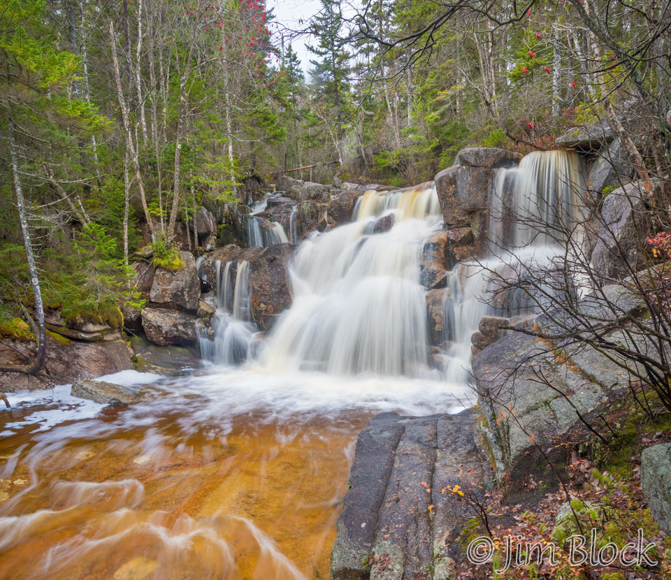
We hiked a bit farther uphill only to find further progress was too risky. The brook crossing was very wide, deep, and the water was flowing rapidly. A slip would have likely washed us over the falls in the photo above. We might have been able to make it but decided that prudence was the best course. Plus we were not sure if the water was rising during the day or falling. This spot is normally a trivial step-across. The photo below is looking upstream from where the trail crosses Whitewall Brook.
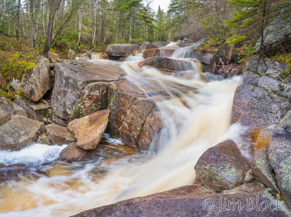
I zoomed into the stream from this spot and took some photos at various shutter speeds. I liked this one at 1/2 second best.
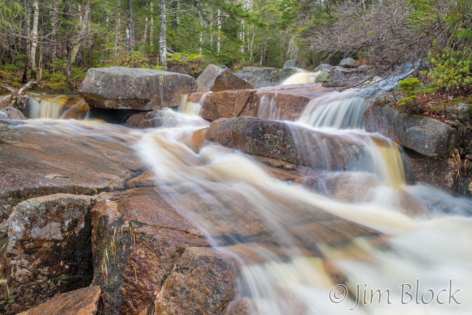
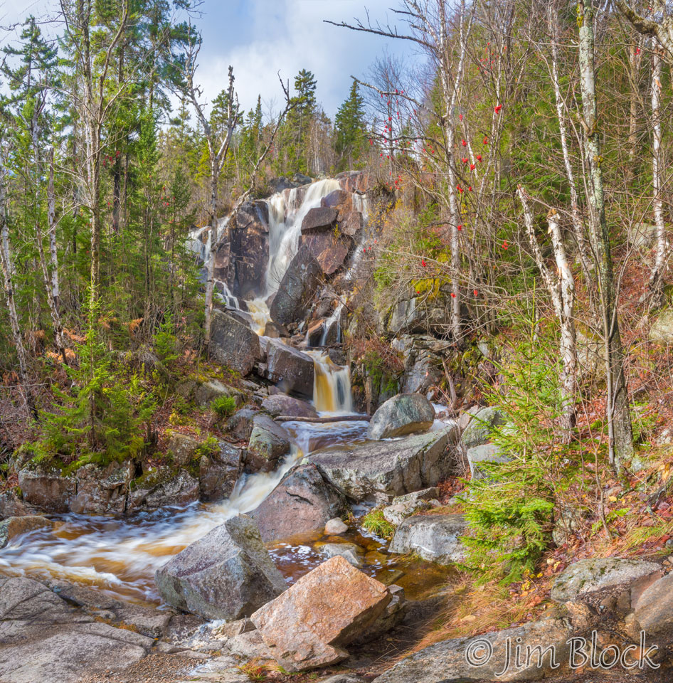
We headed back, but I decided to make one more photo of the falls from a spot closer to it. This image below is a 6-shot “panorama”. The main challenge with this image was keeping my lens dry. Although the wind was not strong, there was some spray in the air.
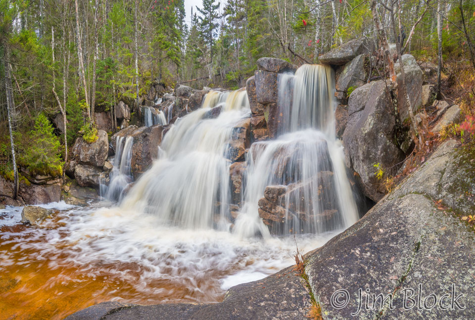
We had skipped visiting Zealand Falls on the way up. The falls are just a short obvious path east of the trail between the hut and the Zealand Trail, Ethan Pond Trail, and Twinway/Appalachian Trail junction. What is normally a trickle was running quite full. Here the photographic challenge was the sun. I waited quite a few minutes for a cloud to briefly cover the sun and then quickly made the photos that resulted in this 7-shot “panorama”.
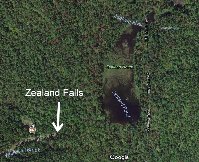
It is interesting, and for a while was confusing to me, that Google Maps has the incorrect location of Zealand Falls. The correct location is show at the right. Note in the top right of this screen shot from Google the incorrect label “Zealand Falls”.
The two photos earlier of Zealand Pond were taken from the location of the word “River” in the image on the right.
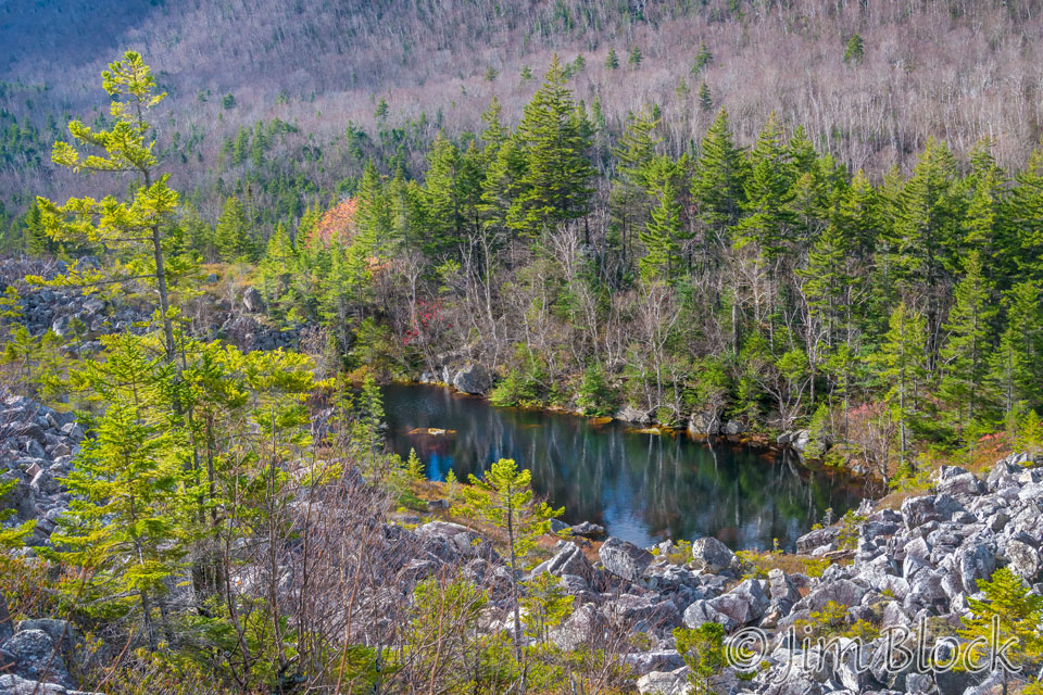
We hiked the Ethan Pond Trail south to a spot where several landslides of huge boulders had occurred. One to the left of the pond in the photo below had created a dam that contributed to the formation of this pond, likely filled only by runoff from Whitewall. Zeacliff, in the background, is on the other side of Whitewall Brook.

Below is a photo of the pond from the Ethan Pond Trail. I decided not to scramble down the boulder field for a closer look.
The bare white birch along the slope up to Zeacliff made interesting patterns, especially as they were partly shaded by clouds. Here are three of the photos I made of them.


")
We headed back to the Zealand Trail and stopped for lunch along the way back down to our car. There were a number of stream crossings again, but it appeared that the water had slightly receded during the day. I photographed a wetland and one very long bridge.

")

Our hike was 8.5 miles. We did it in a leisurely 6 hours, stopping at the hut, for a snack, for lunch, and for photos.
The track for the hike is shown below. You can zoom in and pan around. If you zoom way into the hut along the west-most track you will see a short south-heading spike just east of the hut. This was the short excursion to Zealand Falls. The long south track out and back was the trip along the Ethan Pond Trail to the spot where several landslides of huge boulders had occurred. This is a location where the northbound AT heads south for quite a distance. You can also zoom in and see Zealand Pond and the wetlands north of it that feed the Zealand River that we crossed several times out and back.