This hike is either a fairly easy out-and-back covering a total distance of 3 miles or a moderately difficult 5 mile loop. Either way I suggest starting up the Bemis Brook Trail which parallels the Arethusa Falls Trail for about a half mile. This gives a view of several nice falls before you reach the highest falls in NH, the beautiful Arethusa Falls. The only downside of the Bemis Brook option is the short steep section climbing from the brook to the Arethusa Falls Trail.
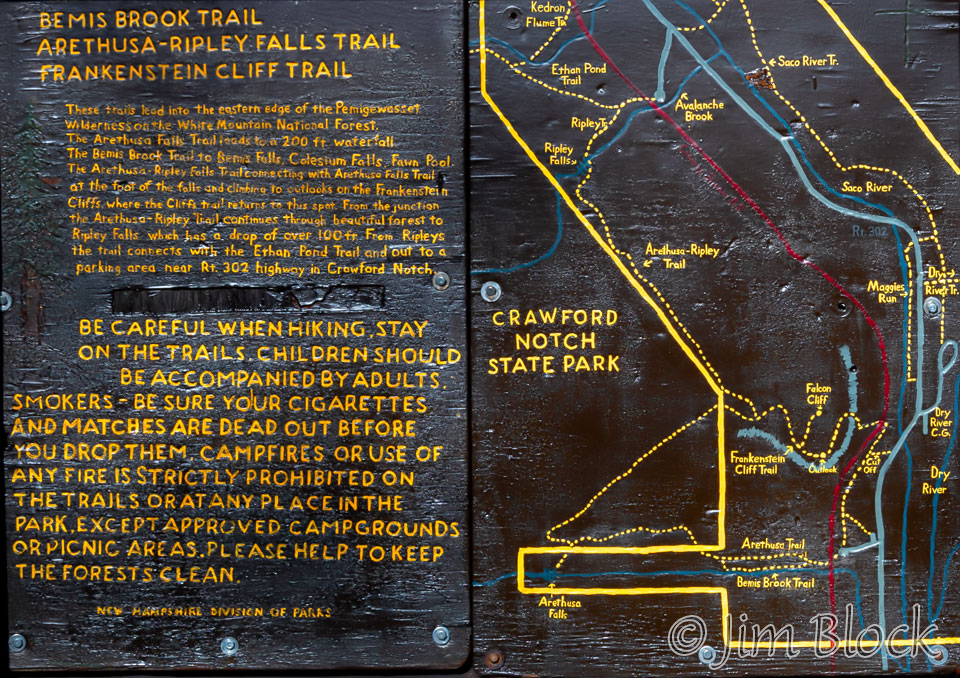
Here is an overview of the loop from a sign near the start. You can also see the loop we did on our GPS Track. The track has information on vertical gain and other potentially useful details.
Head up the Arethusa Trail for 0.2 miles and take the left branch onto the Bemis Brook Trail. Very soon you will reach the Bemis Brook Falls with a drop of 8 feet.
We did the hike on a clear, sunny early spring day. Full sun is the worst light for photographing moving water or forest scenes, so the photography was challenging. If I was shooting slide film I would have likely tossed all the slides away, if I even bothered to take any photos. But with a digital camera and careful editing, I had some hope of getting usable images.
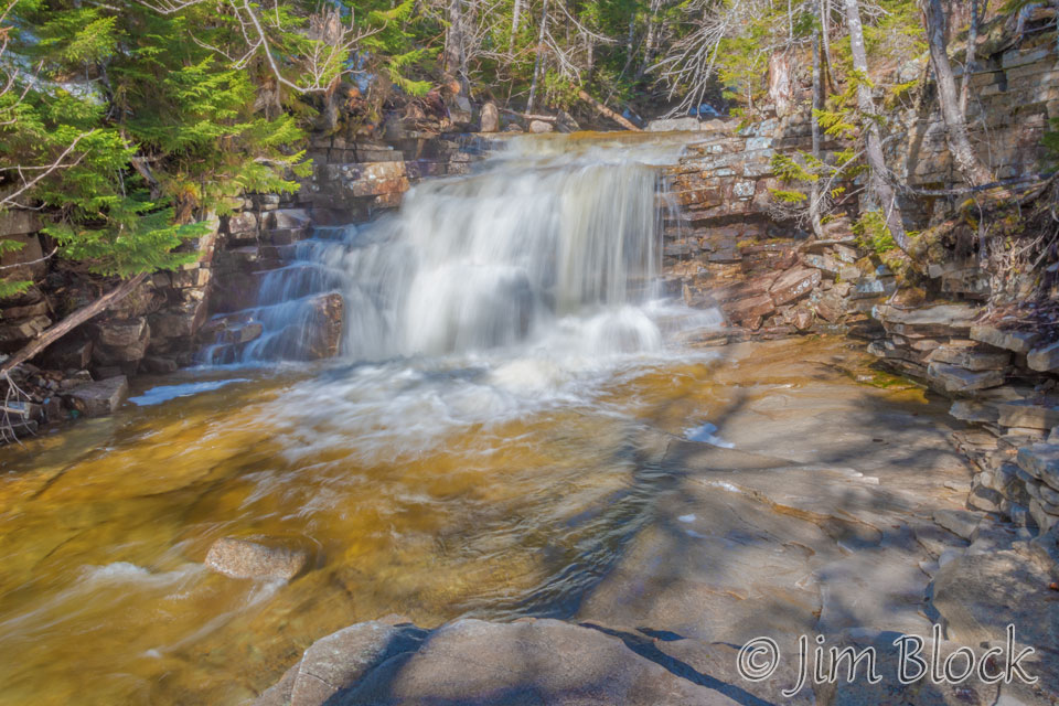
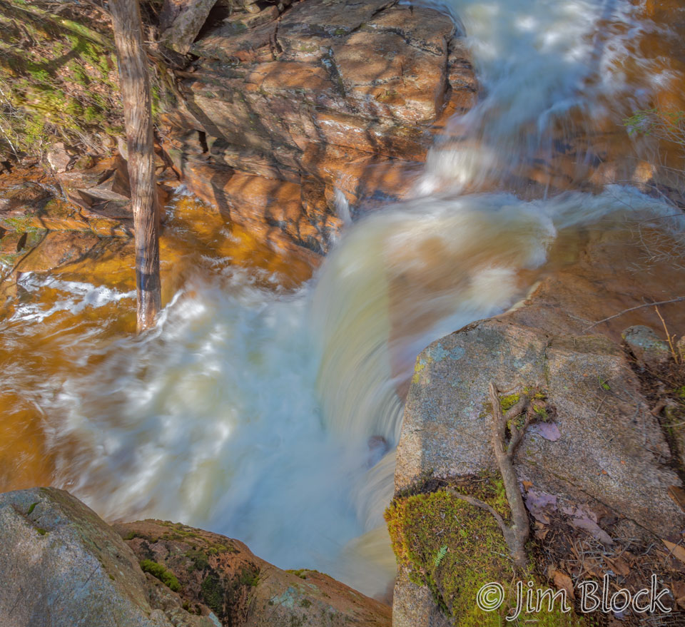
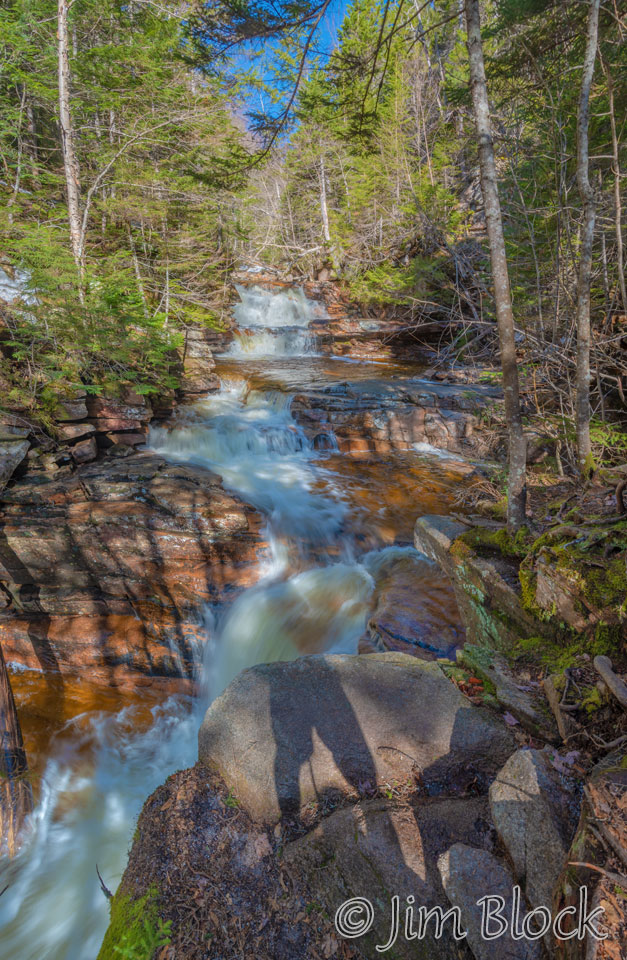
A short distance beyond Bemis Falls are the Coliseum Falls with a total drop of 20 feet. An overview of the falls is on the left, and an image looking down at the lower portion of the falls is on the right.
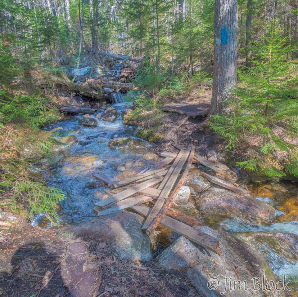
Continuing up the Bemis Brook Trail, we found a missing bridge and a pretty marginal replacement.
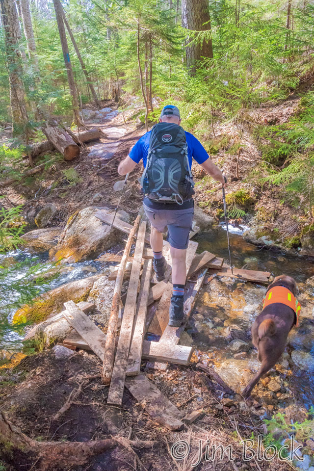
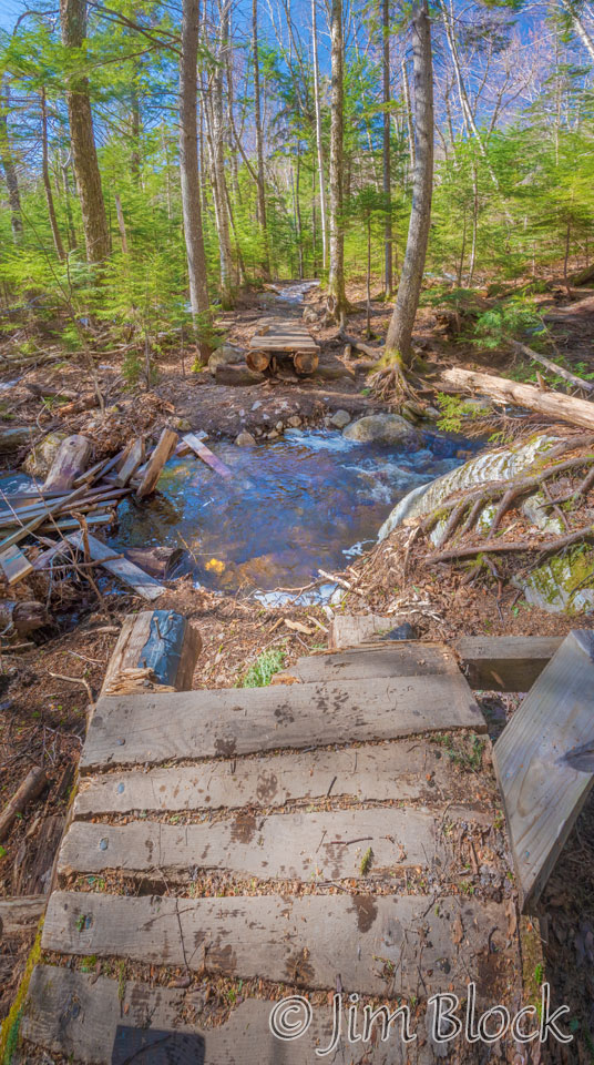
Here is another view of the makeshift “bridge”. It looks like it would have been easy to cross on the rocks if all that lumber was not there.
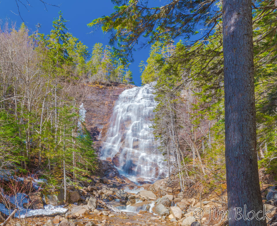
We rejoined the Arethusa Falls Trail after a steep uphill and, after walking over sections of the trail still covered with snow, soon reached Arethusa Falls. The falls are likely around 160 feet high, though some sources, including the park poster above, lists them as 200 feet. In any case, they are very impressive. I wish there were people in the photo for scale.
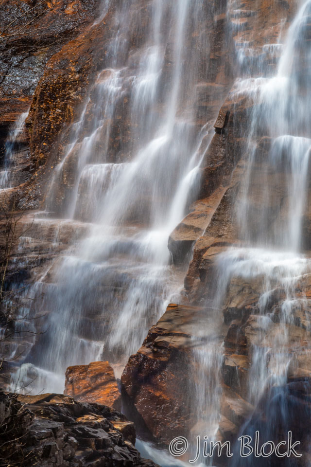
Arethusa was a nymph in Greek mythology who gave her name to a spring on the island of Ortygia, near Syracuse. Here is a painting of her done by Benjamin West in 1802. On the right is a detail of the falls. Maybe you can see the similarity in lines and tonal patterns.
![]()
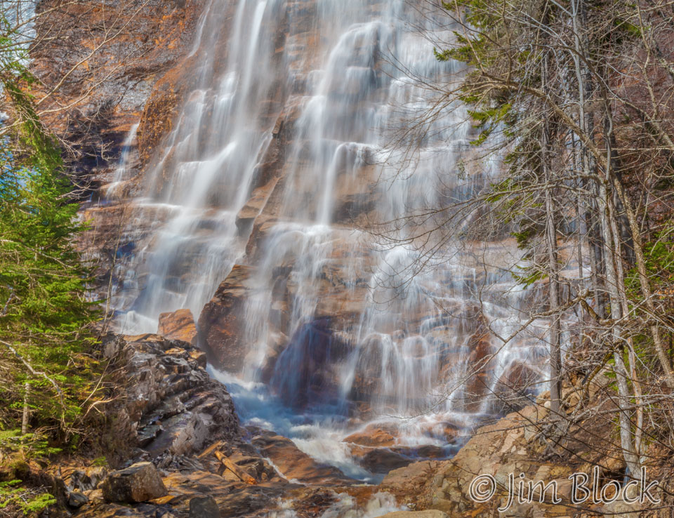
The lower part of the falls are seen below.
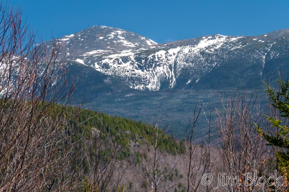
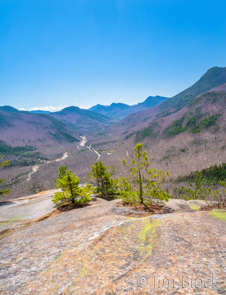
We retreated back the 0.2 mile spur that led to the falls and headed to the Frankenstein Cliff. There was still elevation to be gained, but the trail was not steep. We stopped for a snack at Falcon Cliff which provided a view of Mount Washington and the, anything but dry, Dry River Wilderness.
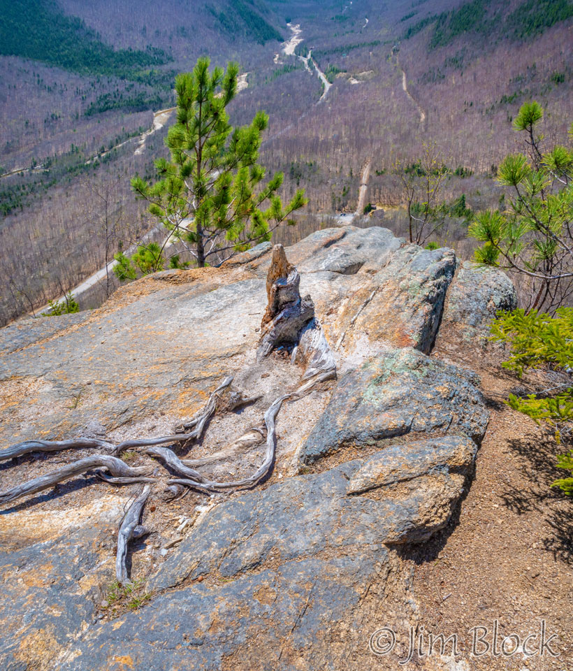
We paused to take some photos at Frankenstein Cliff. In the photo on the right you might be able to make out our car far below.
Frankenstein Cliff was named after an early 19th century landscape painter. Many such painters were promoters of the early tourism in the White Mountains, especially Crawford Notch and Mt. Washington with their colorful images before photography. Hotel owners actually paid them or gave them free lodging to show their paintings to depict the aesthetic beauty of the mountains.
The trail below the cliff was a long downhill. Parts of it were a bit challenging, partly because a lot of trail work was needed to clear away trees that had apparently fallen during the winter.
The trail took us under the Frankenstein Trestle for the Notch Train run by the Conway Scenic Railroad.
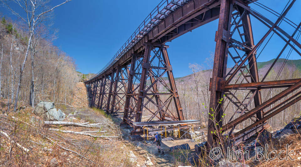
The trail back, east of the railroad tracks, was the least enjoyable part of the hike. We reached a sign that claimed we only had 0.1 miles to go and then trudged along what seemed to be a half mile. I think the next time I take this hike I will bushwhack as soon as I spot the trestle and hike the tracks the rest of the way.
The entrance to this area is approximately 12 miles north of Bartlett, NH on US 302 in Crawford Notch State Park.