The Nulhegan Basin in the Northeast Kingdom of Vermont is a very unique area. Part of the Silvio O. Conte National Fish and Wildlife Refuge, it is a relatively flat, low-lying circular area, roughly 10 miles in diameter, surrounded by hills. The predominance of boreal habitats is typical of forest found further to the north. It is Vermont’s largest IBA (Important Bird Area) and is comprised of forest and wetland habitat types.
The basin supports a number of bird species rarely found in Vermont including the state endangered Spruce Grouse seen at the left. Also found here are many species are usually found further to the north including the Gray Jay, Boreal Chickadee, Black-backed Woodpecker, and Cape May, Wilson’s, Bay-breasted, Palm and Tennessee warblers.
The basin contains several lakes and bogs including the wheelchair-accessible Mollie Beattie Bog. Below is a mass of pitcher plant “traps” in this bog.

The numerous rivers and streams in the basin drain into the Nulhegan River. Below is a stylized photo of this river.

One of the largest body of water in the basin is Lewis Pond. Below is a photo of a branch reflected in the pond and a dead tree serving as a nursery for another not far from the pond.


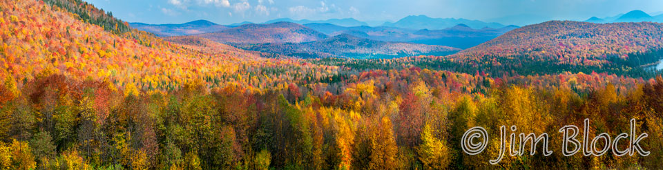
Below is a 15-shot panoramic image made October 2012 from the Lewis Pond Overlook looking roughly southeast. If you click the image you will trigger a page where you can zoom in, pan around, and explore the scene in detail. But don’t forget to see the slide show that follows this photo.