This page mainly covers the time we spent in the Westfjords.
We had planned to take the ferry across the Breiðafjörður the next morning, but Martha discovered much earlier that it was not running these days. Something about needing it elsewhere, I believe. However, when we checked Google Maps for various times and directions to Patreksfjörður in the Westfjords, it turned out that taking the ferry was almost exactly the same amount of time as driving. So we drove. Not that we had a choice.
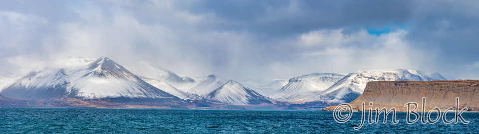
From Stykkishólmur, we took the coastal Route 54 east, then picked up Route 60 heading north paralleling the Svinadaluf river before entering the Westfjords. Here are some photos along that route starting with views across the Hvammsfjörður, then a beautiful Golden Plover, three photos of the Svinadaluf River, a shot of the back of our bright blue Citroen, and a view as we entered the Westfjords.


Traveling Route 60 west through the southern Westfjords, one mostly goes north and south as the road snakes around the various fjords on the fingers of land separating them. Here is an impressive waterfall we found along the way. I labeled this six-photo panorama “Upper Falls at Vesturbyggð” but I’m not sure where I got that name.
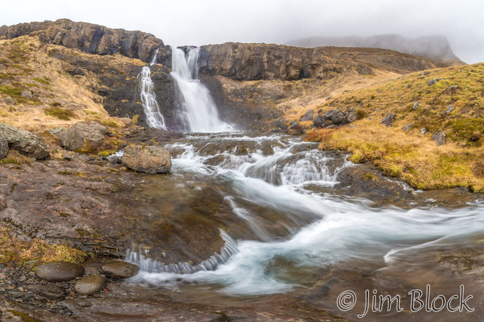
If you would like to see a 12-photo panorama for the lower falls at this site, please CLICK HERE. If you do you will be taken to a site where you can zoom way in then pan around. When you get there, click the double arrow above the image on the right to see it full frame. Please wait for the resolution to download. You can use the + and – keys to zoom and the arrow keys to scroll. Or use the scroll wheel to zoom and the left mouse to drag.
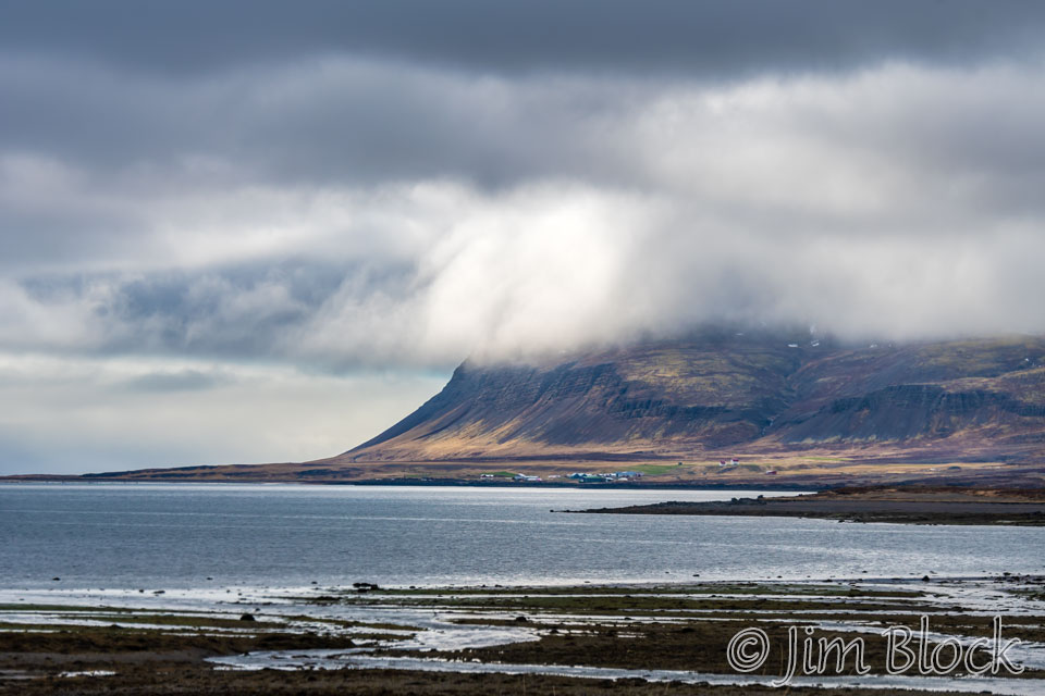
The clouds hung low as we looked across the water to the tiny village of Brjánslækur, which is the terminus of the ferry from Stykkishólmur. When it is running, that is.
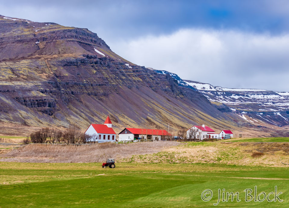
Now along Route 62, in Brjánslækur was this church and farm scene. It was interesting to us how many of the farms in Iceland also seem to have a small church attached.
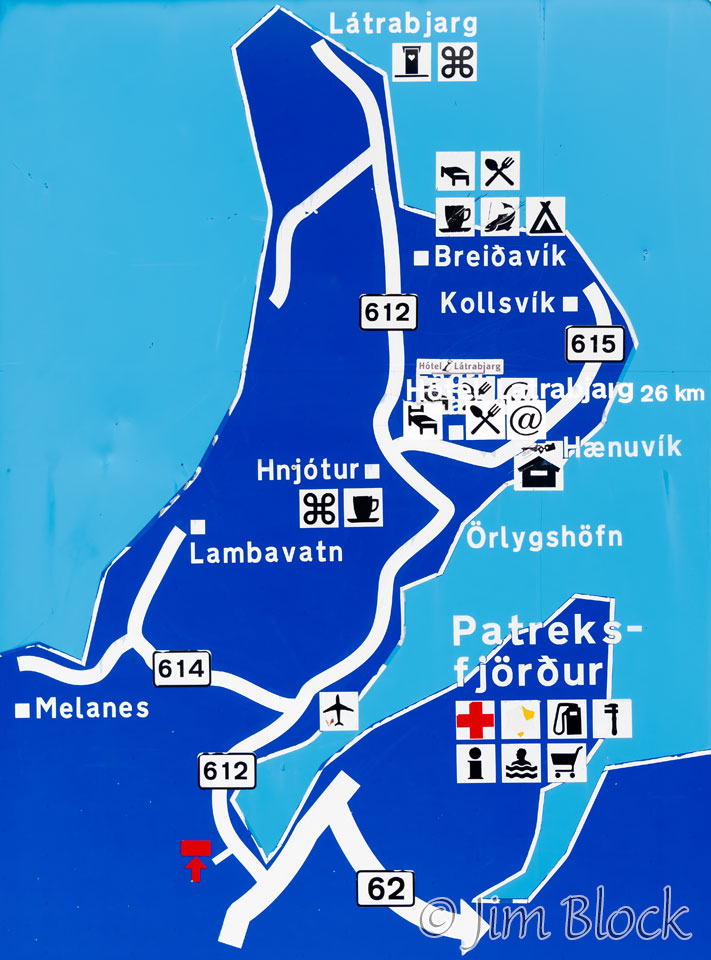
We reached the junction of Routes 62 and 612 around 1:30 PM. We were only a few miles from Patreksfjörður (“Patrick’s fjord”), and it was too early to check into our Airbnb.
We used our phones with GPS for navigation during our entire trip in Iceland. This worked great. We consulted our phones and a poster, shown at the right, near this intersection and determined we were less than 30 miles from the famous Latrabjarg Bird Cliffs.
So, it seemed like an easy decision. We would head to the bird cliffs, since it was a somewhat decent day, and we were unsure what the future would hold weather-wise. That was a great decision because much of the time we were in the Westfjords the weather was quite cold and extremely windy. In fact, for several days some of the roads were closed because of a combination of ice and high wind.
What we did not know was that Route 612 is one of the worst roads in Iceland and certainly one of the worst roads we have ever driven. Potholes were everywhere. It took us 90 minutes to travel less than 30 miles, an average speed of less than 20 mph.
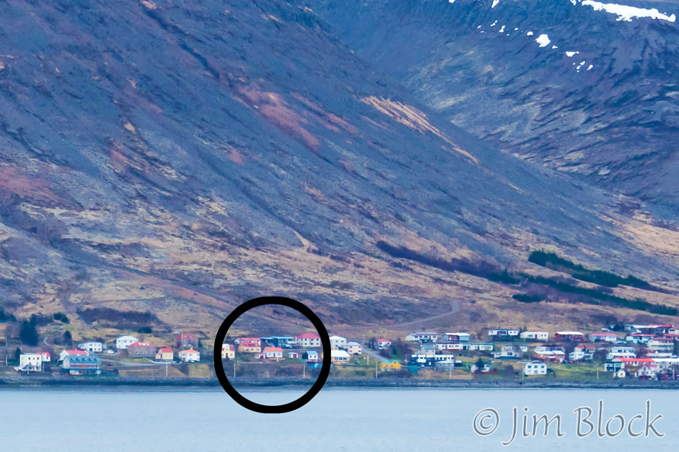
Partway up the road we got a view across the fjord at Patreksfjörður. In the center of the circle is the house we rented.
Just short of the parking area for the bird cliffs, we spotted an arctic fox. Here are a few of the photos I managed to take of the fox as it curiously approached me but not very close. The last photo in this slideshow, with the water and large rock in the background, is a second arctic fox in the same general area who was much more cautious about our presence.


Marc’s wife had told him not to come home unless he brought photos of puffins. So that was his mission for the afternoon. There were only perhaps one or two dozen puffins present, but I managed to photograph some of them as well as a squabbling pair of Northern Fulmars, and some Common Murres as seen in the slideshow below.


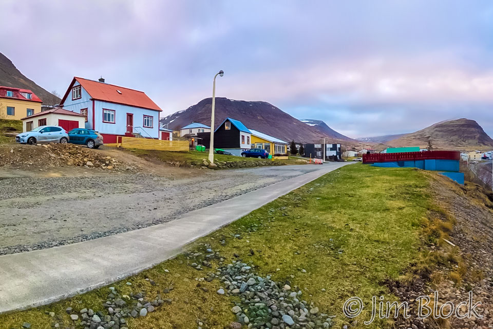
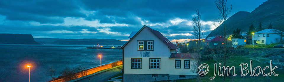
The photo below shows the light blue with red roof Airbnb house we rented on the left with our two cars parked in front. This photo was taken just before 10 PM with my iPhone.
Our first full day in the Westfjords was cool and overcast but with a little wind. We had a little mist but no rain. The rain and very high winds were still a day away.
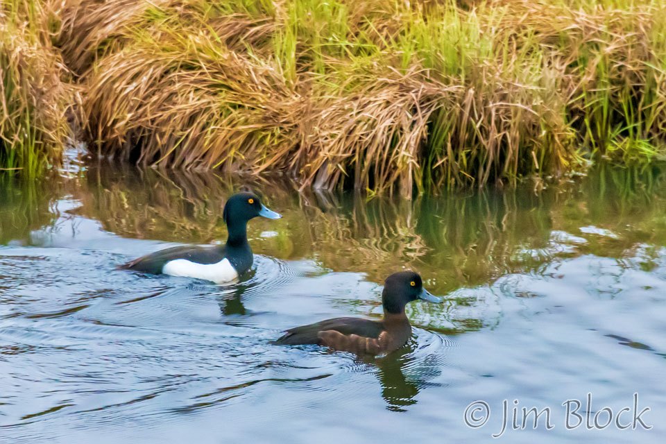
We were off just after 6 AM and around 7:30 I got the photo below of a pair of Tufted Ducks in the small village of Tálknafjörður along Route 63.
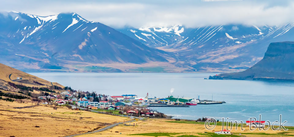
We stayed only a short time before heading on to Bíldudalur, a charming fishing village set in a beautiful bay with mountains all around, as can be seen in the photo below. We would explore this area several times during the trip.
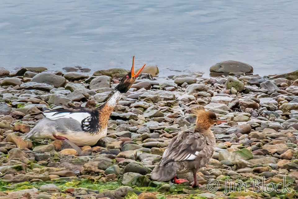
This day we stopped only briefly. I got a photo of Red-breasted Mergansers.
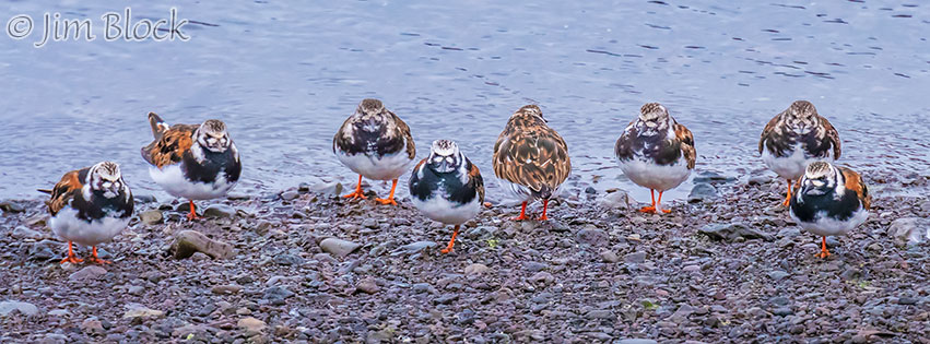
Nearby was a line of Ruddy Turnstones that posed for me except for one obstinate bird who refused to turn around.
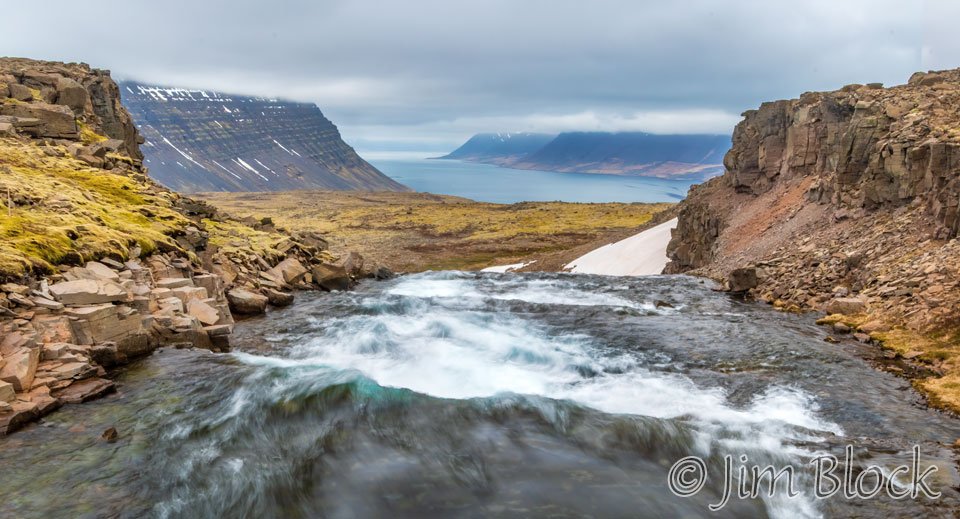
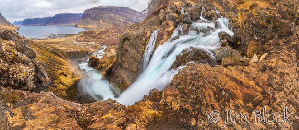
Our goal for the day was the falls at Dynjandi, so we kept moving along Route 63. But we couldn’t resist stopping at a dramatic waterfall at the head of Fossfjörður. Here are five photos of this beautiful waterfall.


We headed north on Route 60 and stopped for a bit of lunch near this flowing stream. We didn’t realize it at the time, but what we were photographing was the river a short distance upstream of the series of falls that is Dynjandi.
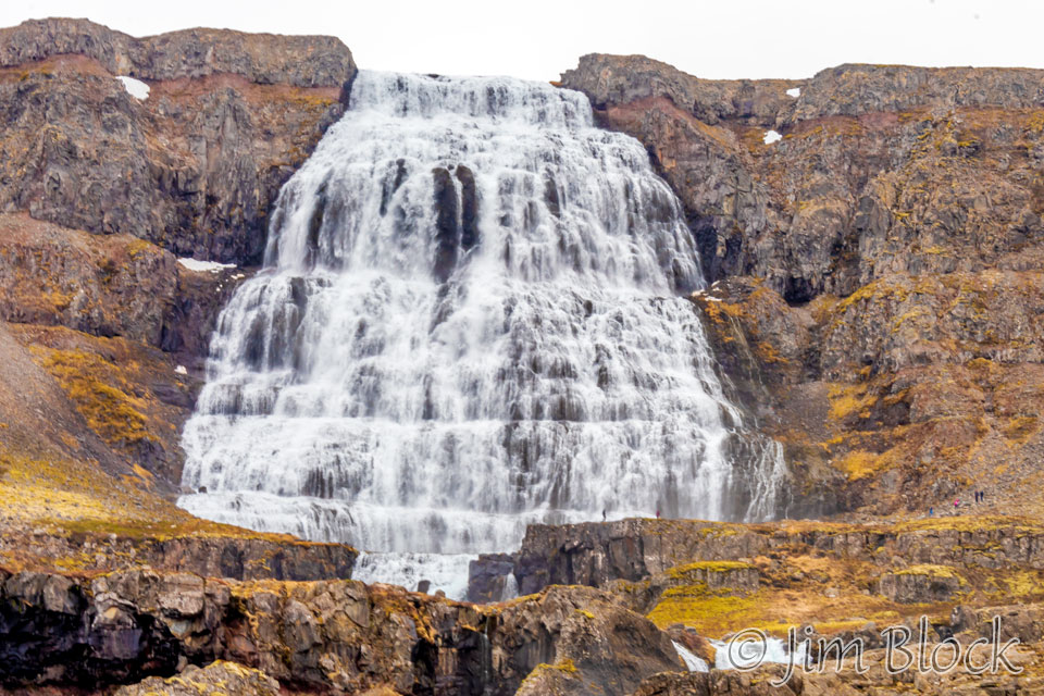
The main falls at Dynjandi are not surprisingly named Dynjandi and are shown at the top part of the photo below. This cascade is 30 meters wide at the top, 60 m wide at the bottom, and falls 100 meters. When we reached the level of the base of the main falls, the spray was so intense that we could not capture a photo without having our lens filter covered with water drops.
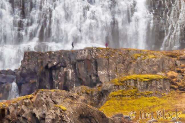 Above is about as close as we could get without a lot of spray. If you look carefully you might see 6 people in this photo. Two are in front of the falls on the right side and four are off to the side on the right. The extreme crop here show the people in front of the falls.
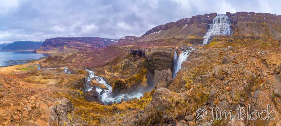
Below the main falls are a series of half a dozen named falls. Here are some photos of them.


Below are 13-photo and 20-photo panoramas of the series of falls.
You can click either image to get to a site where you can zoom way in then pan around. When you get there, click the double arrow above the image on the right to see it full frame. Please wait for the resolution to download. You can use the + and – keys to zoom and the arrow keys to scroll. Or use the scroll wheel to zoom and the left mouse to drag.
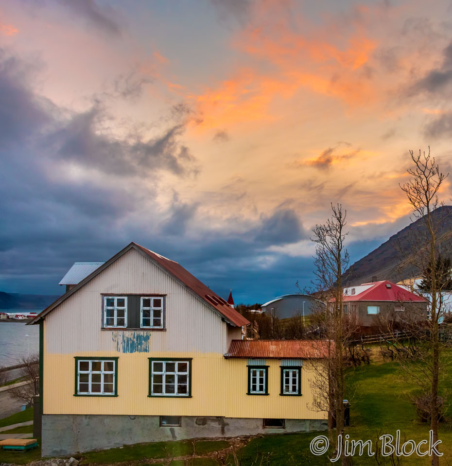
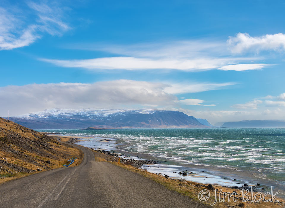
We looped south along Route 60 before heading west again on Route 62 to Patreksfjörður. Below is a photo taken from my bedroom at 10:30 PM.
May 10th was extremely windy. It was so windy that photography was nearly impossible. We drove east on Route 62 to Route 60 and then turned around. The winds were very high and gusty, and we had some rain and snow. Here are four photos I managed to take along Route 62 that give some hints of the wind.


When we got back to our Airbnb, we learned that the Ring Road (Route 1) from Reykjavík to the Glacier Lagoon, which we had visited the first several days, was closed due to the high winds and blowing lava dust.
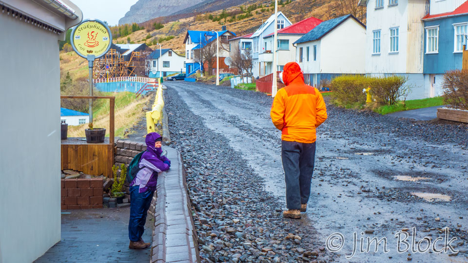
While Marc stayed in our rented home and worked on his images, Martha, Stephen, and I took a walk through Patreksfjörður. It was too rainy for my DSLR, so I used my Lumix LX7, which is much smaller and easier to shelter from the blowing mist.
After lunch Martha, Stephen, and I braved the 10 miles to Tálknafjörður. A web site tells the conditions of all the roads in Iceland from open and fine, to icy and marginal, to closed. The road we took was somewhere in the sketchy middle. Stephen drove carefully, and we made it fine. In Tálknafjörður, I photographed some Common Eiders and Black-headed Gulls. You might be able to spot some blowing snow in these photos.


Then it was back to Patreksfjörður where Martha, Stephen, and I took a late afternoon walk in the hills above town. Here are ten photos taken between 5 PM and midnight from, in, or near our Airbnb.


It was still very windy on May 11, and it was also very cold. In the morning we explored a bit more of the Latrabjarg Peninsula going partway on very bumpy 612 and also venturing on equally rugged 614.
Here is the view looking northwest up the peninsula with Patreksfjörður on our right.
From a little farther up 612 we got this view across the fjord of Patreksfjörður village with a Northern Fulmar flying by.
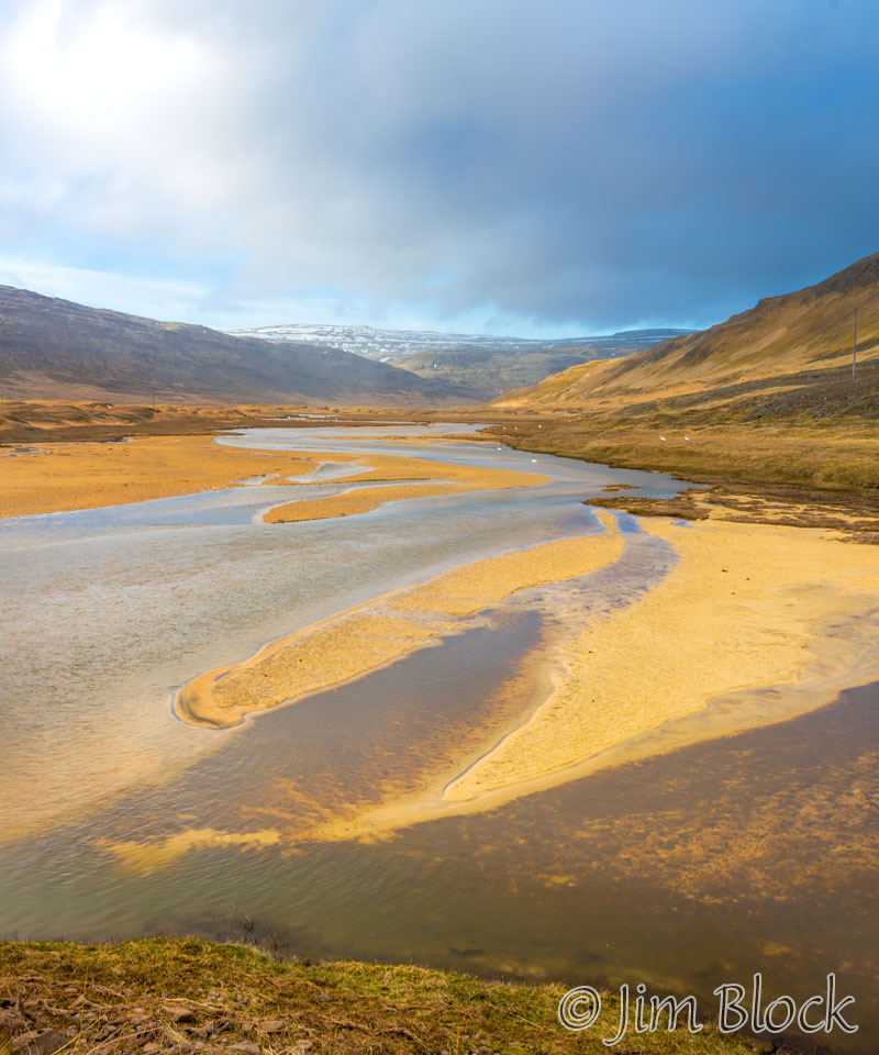
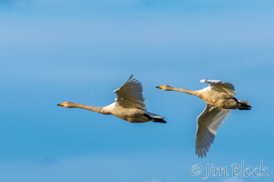
We stopped at a wide, sandy river mouth that was filled with Whooper Swans. But we were not going to go much farther along this terrible road. So we headed back Route 612 and then down Route 614 toward the southern beaches. There we found some more Whooper Swans, this time in flight.
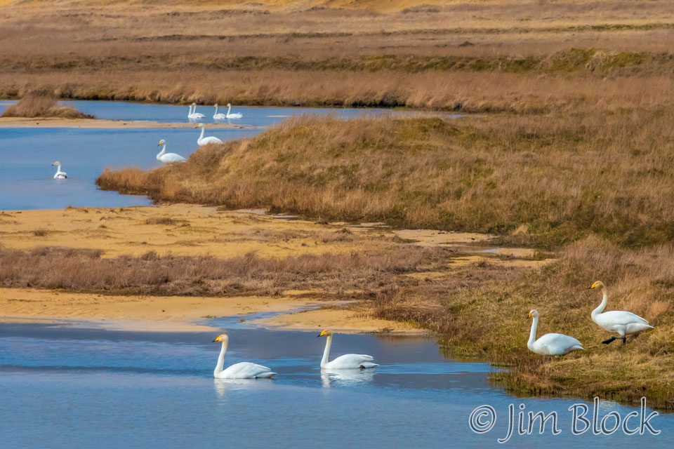
The water and sand were beautiful, even in the high wind.
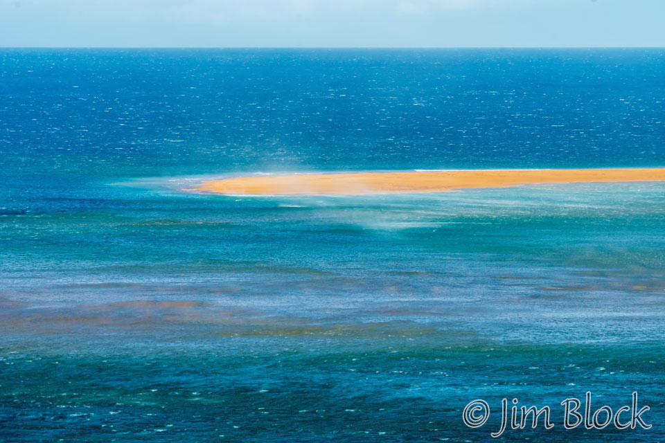
Speaking of high wind, here is the view on this windy day of the water along Route 62 later in the morning. Our photographic opportunities along Route 1 east of Reykjavik were limited by rain and mist, and the ones in the Westfjords were limited by the high winds we experienced three of our days there.
But the atmospherics were not all bad. There were some iridescent clouds and also some wonderfully shaped clouds in the sky this morning. You can read more about iridescent clouds, if you CLICK HERE.


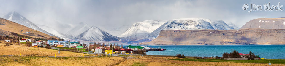
Mid-afternoon, Marc and I drove back to the charming village of Bíldudalur. Below is a six-photo panorama of the village, its harbor, and the surrounding mountains.
You can click this image to get to a site where you can zoom way in then pan around. When you get there, click the double arrow above the image on the right to see it full frame. Please wait for the resolution to download. You can use the + and – keys to zoom and the arrow keys to scroll. Or use the scroll wheel to zoom and the left mouse to drag. If you CLICK HERE you will get to an even wider image of this scene.
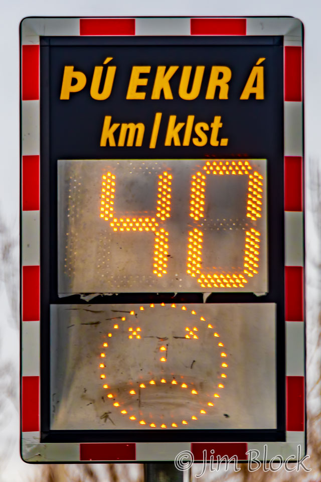
We intentionally entered the town at a slightly too-high speed hoping to trigger a frowny face in the speed sign. We were successful.
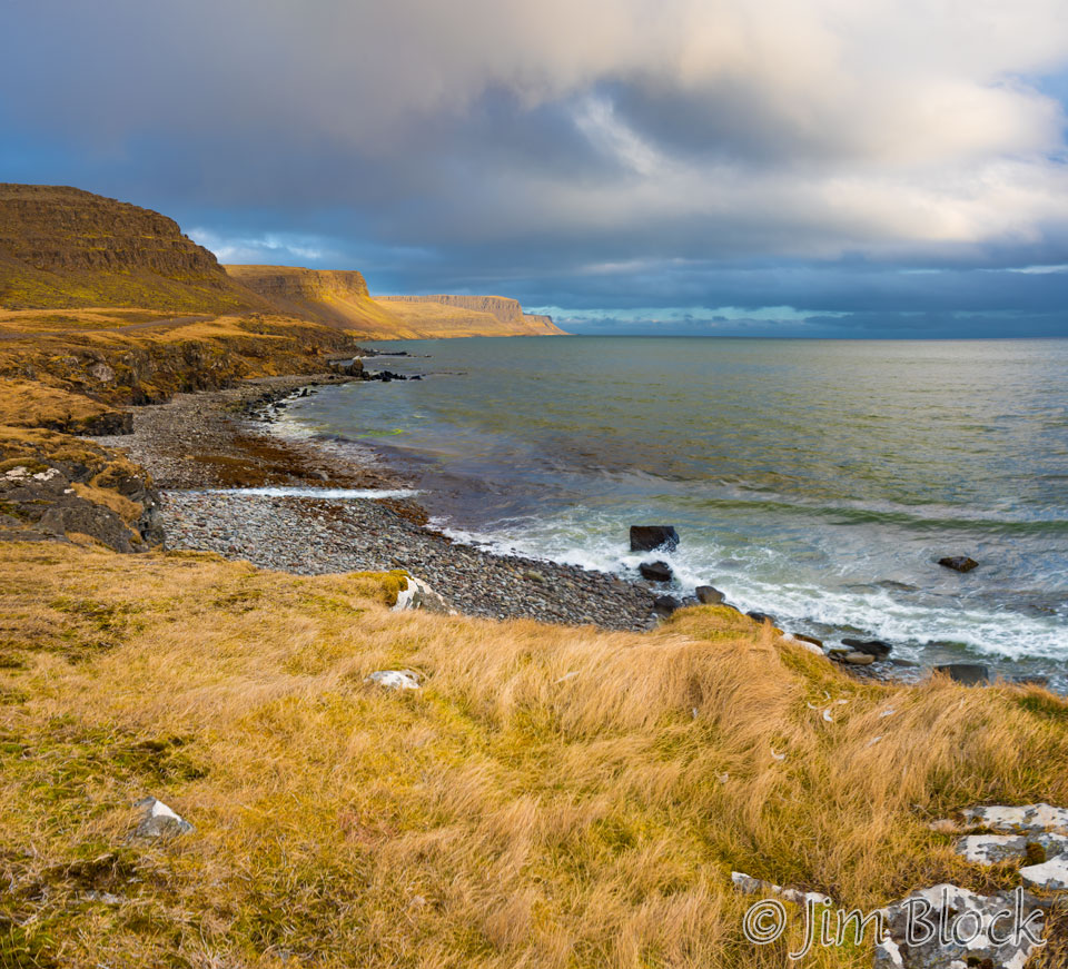
From Bíldudalur we drove the entire length of Route 619 along the southwest coast of Arnarfjörður. It was a beautiful drive.
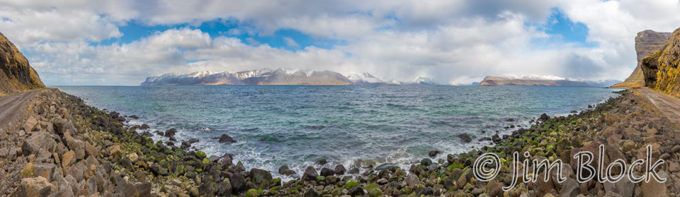
Below is a 20-photo, 180-degree panorama of Arnarfjörður that you can click on to get to a site where you can zoom way in then pan around. When you get there, click the double arrow above the image on the right to see it full frame. Please wait for the resolution to download. You can use the + and – keys to zoom and the arrow keys to scroll. Or use the scroll wheel to zoom and the left mouse to drag.
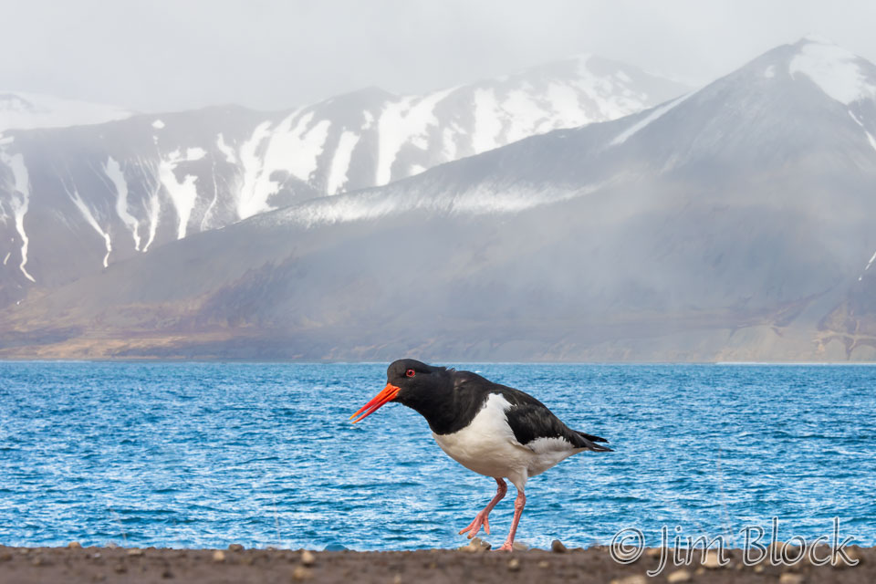
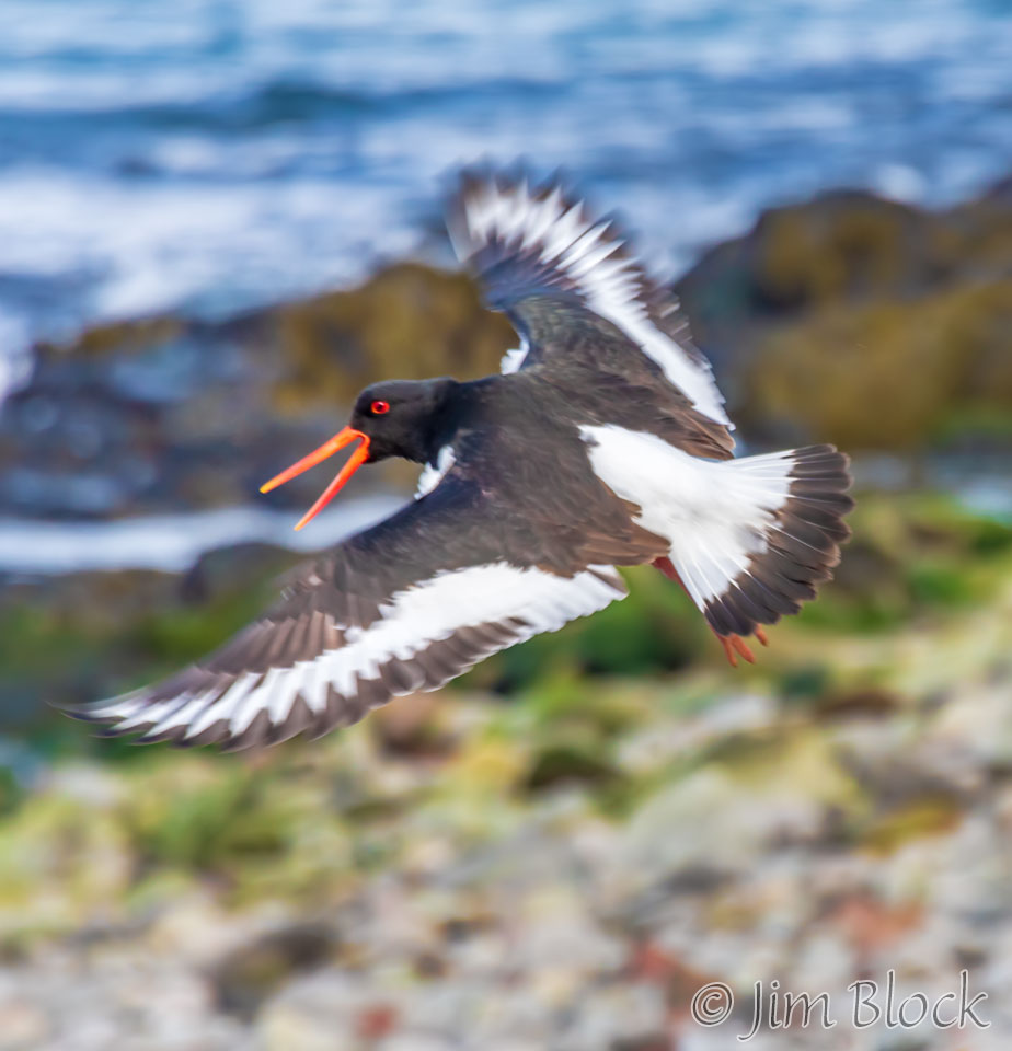
Along the way we photographed many American Oystercatchers.
Tomorrow, we would we would head to Reykjavík. I got the photo below from my bedroom window at 12:30 AM which was already tomorrow.
![]()