Keld to Reeth
Day eight, the last day of the hike for Stephen and me. Jim will continue and do the last third of the Coast-to-Coast Walk, as he has done three times previously. But scheduling problems for Stephen and me caused us to plan to head home after Reeth.
Today we would see the remains of numerous lead minds. Lead has been mined in this area since at least the Roman times. With the onset of the industrial revolution, mining developed very strongly in this region from the end of the 17th century. Apparently the conditions in the mines were horrible, and the mining wreaked havoc on the landscape that we walked across this day.
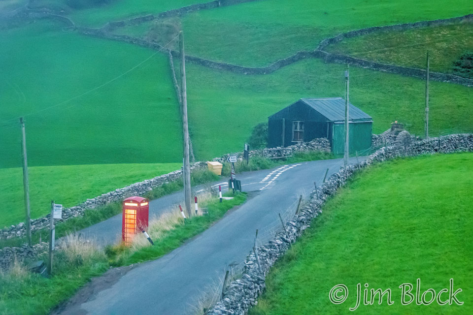
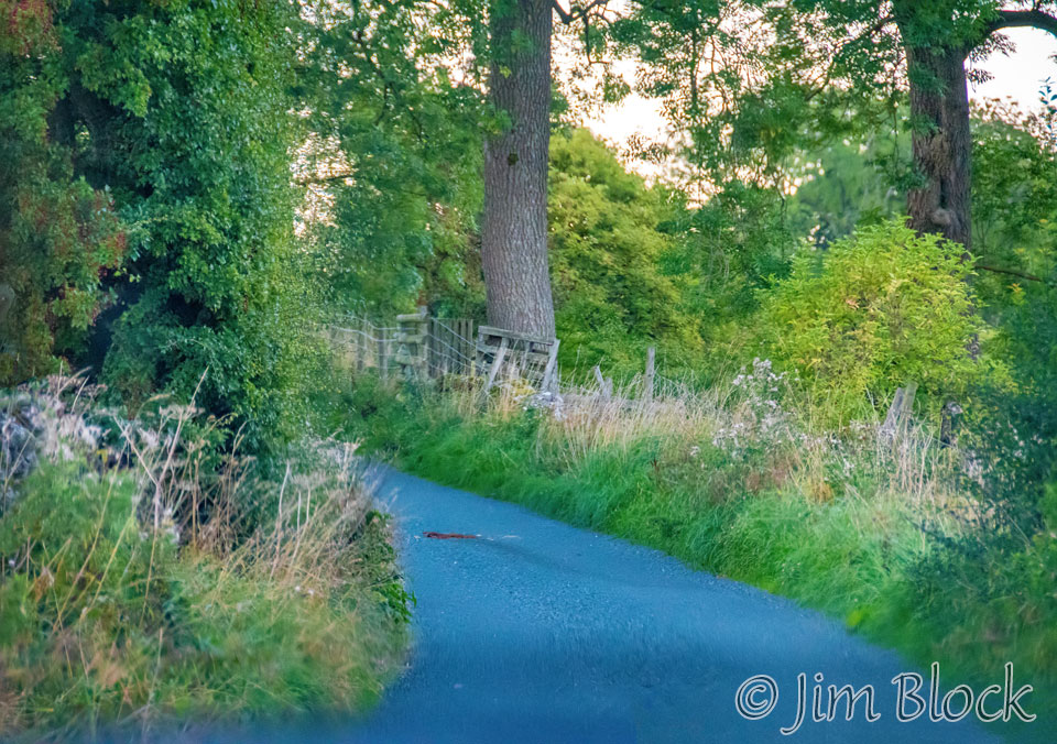
As I did the night before at 8 PM, I took a photo from my room of the lite phone booth at 6 AM. A sharp left turn here leads to the village of Reeth and the C2C Path.
I headed out early and took a few photos before breakfast.


")


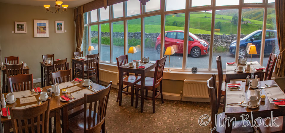
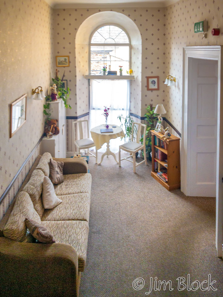
We had dinner and breakfast in this room.
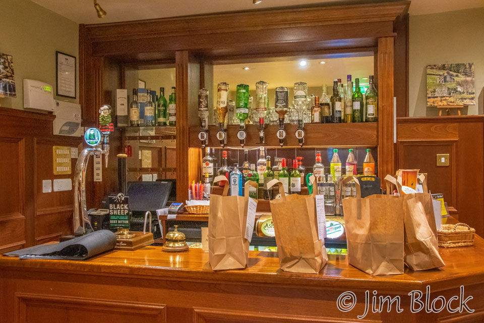
In the morning the pub had paper bags filled with lunches that some of the hikers had ordered. I had purchased some cheese in Kirkby Stephen that would be my lunch for this day. I don’t believe I ate any of it in the rain the day before.
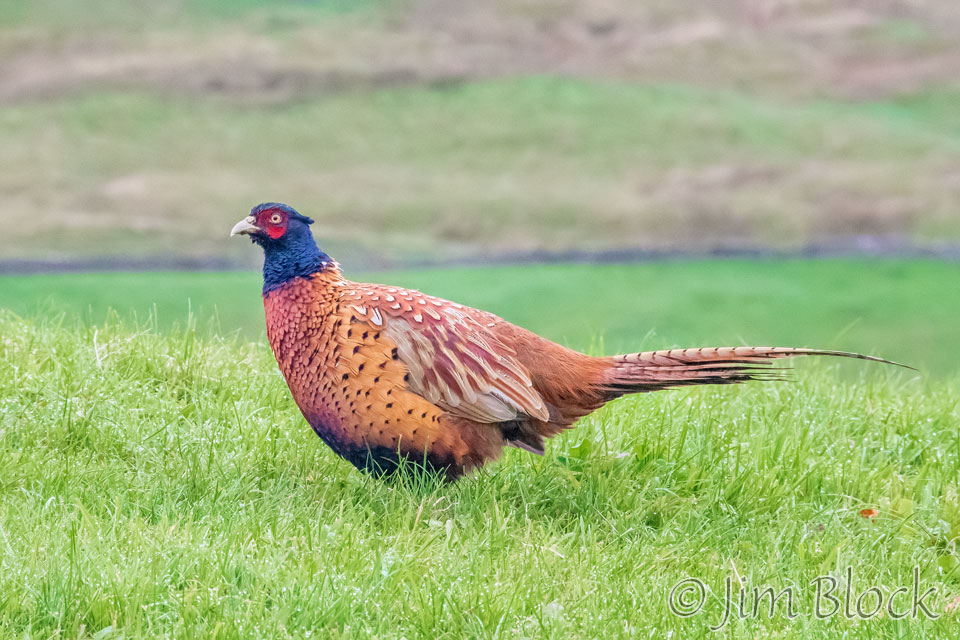
Stedman, in his book “Coast to Coast Path”, suggests starting off as early as possible this day to increase the chances of encountering pheasants and deer. Early wasn’t possible because, as with many of the lodges along the way, breakfast was much later than I would’ve liked.
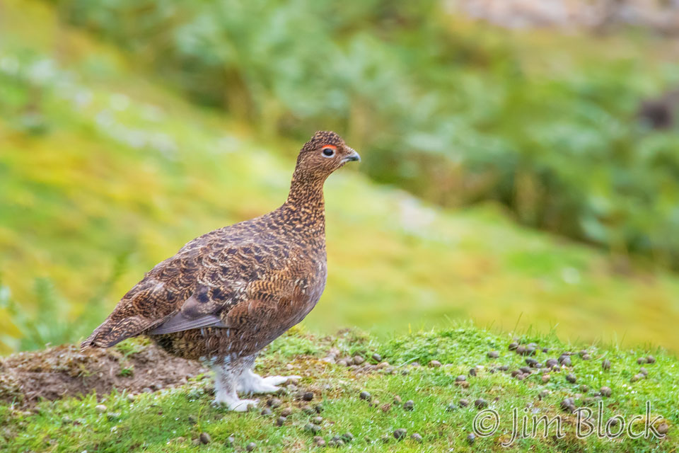
However, I was able to get a photo of a pheasant near our lodge before we started hiking. And, later in the day, I got a number of photos of red grouse. But no deer the whole trip, and no wildlife except for those two birds, a feral dove the first day, some birds nesting in the cliffs near St Bees, a few hares, and a few cormorants (shag for the British readers). I certainly cannot count sheep and a pet ferret as wildlife.
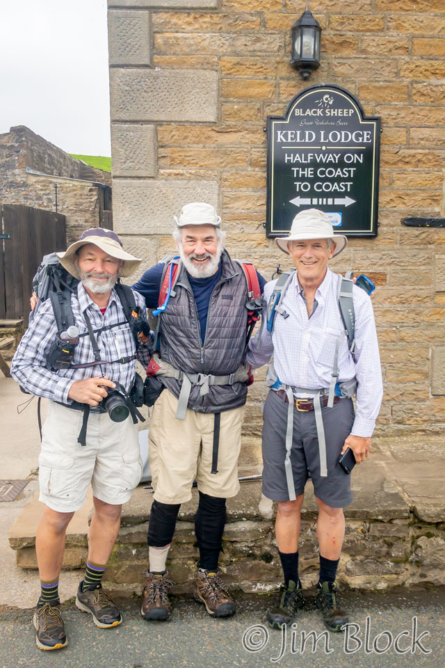
I handed my iPhone to Jim‘s friend, David, who took the photo here of the “three white hats”. That was the nickname given to us by a hiker when we traveled through the Dolomites the previous year. I am the guy with the camera, Jim is in the middle, and Stephen is on the right side of this photo.
Stephen and I were wearing trail runners instead of heavy hiking boots, as I did in the Dolomites. Jim was sticking to boots, which theoretically provide more ankle support. I have done a lot of hiking with trail runners over the last three years. I think they are great and highly recommend them. No problem with breaking them in, no blisters, no twisted ankles. They are much lighter than hiking boots — something one appreciates every step.
Finally we were off. We walked down through the village of Keld.
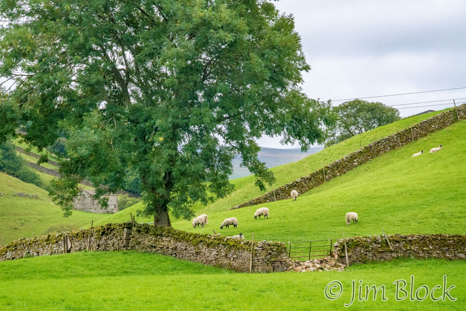
We passed more stonewalls and sheep and headed down a path that was constructed so that vehicles could navigate it.
At the bottom of that path were some nice waterfalls in East Gill. The red berries are on a mountain ash tree, also called rowan in the UK.


We passed some interesting trees as we climbed out of Keld.


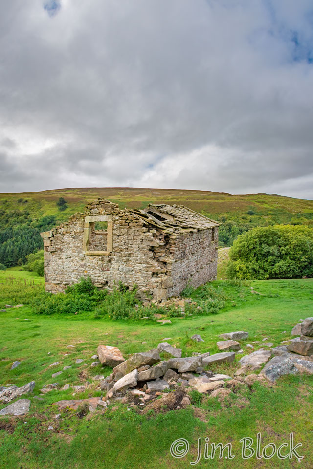
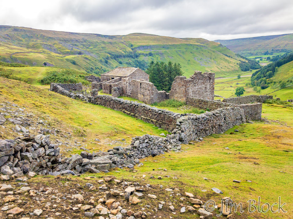
We saw the ruins of Stony Hill Farm.
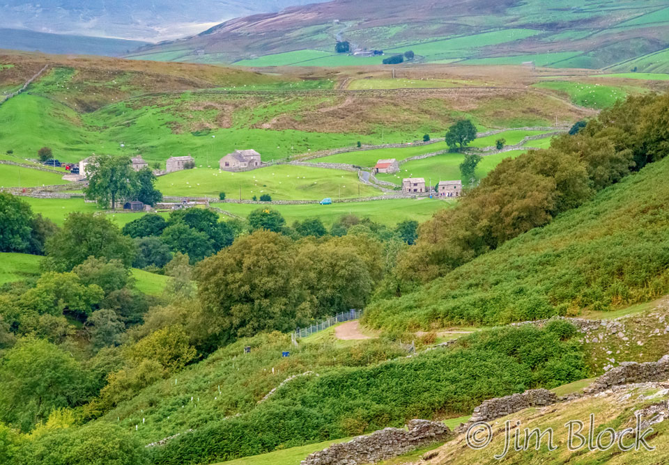
As we climbed, we got a nice view back toward Keld. The Keld Lodge is mostly hidden behind the trees on the left side of the photo. The main village is to the right and partly hidden by the nearby hill.
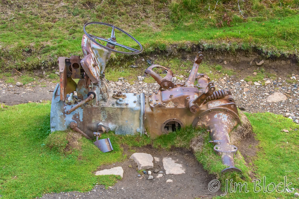
We walked by the carcass of an old tractor.
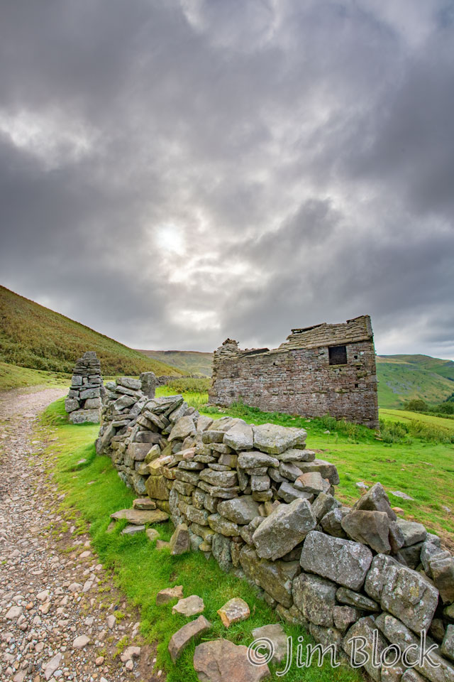
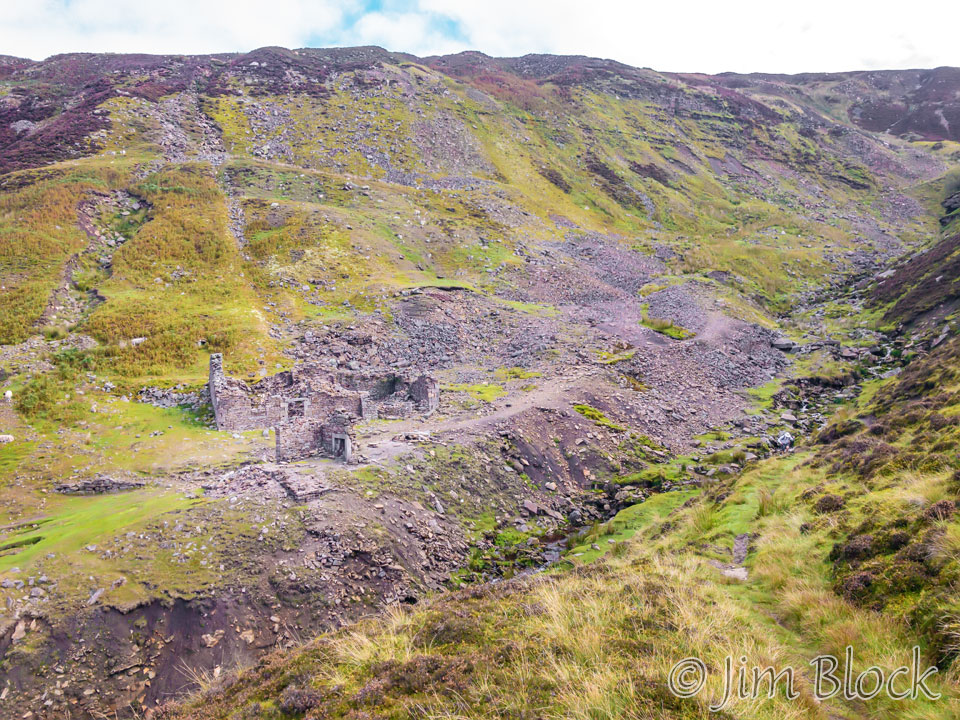
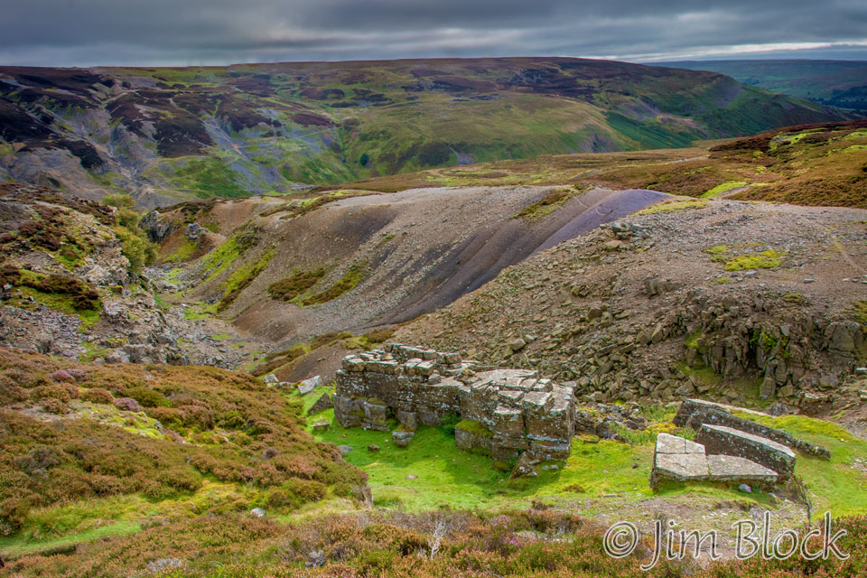
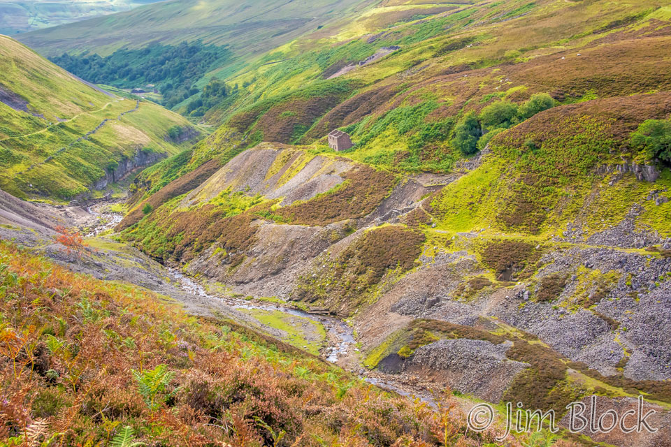
We passed Crackpot Hall shown below. These ruins are from the 18th century. The farm house was once owned by one of the managers of the local mine. You can see he had a nice view. According to Stedman, “Crackpot, by the way, means “deep hole or chasm that is the haunt of crows“, and is not a comment on the value of the endeavors of the former residents.”
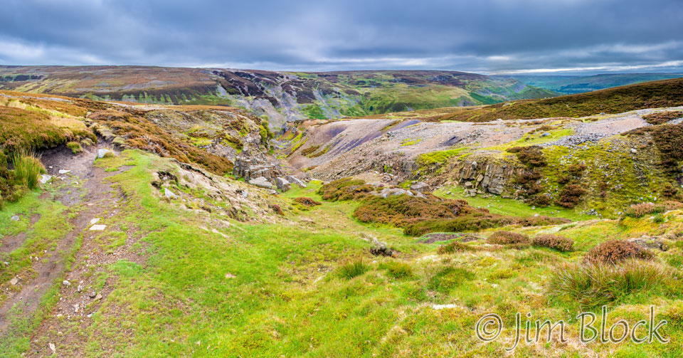
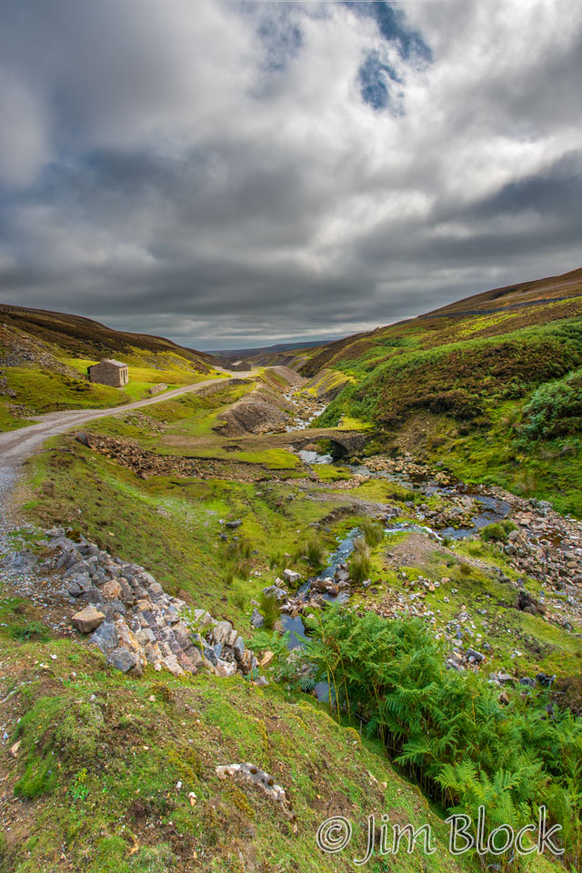
Next stop on this day’s tour of mining ruins was the Swinner Gill Smelting Mill, seen at the top above the heather and waterfall in the left photo below.
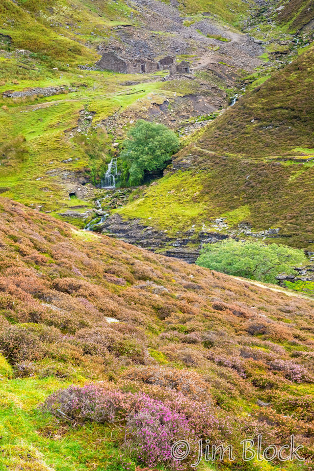
We crossed Swinner Gill and began to climb. You can see the remains of the smelting mill in the photo below.
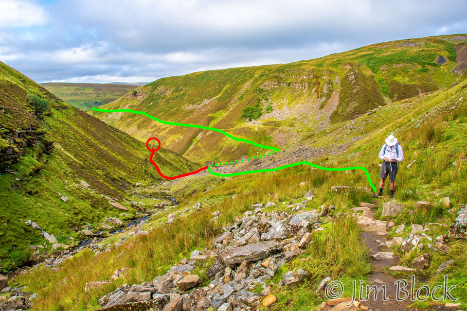
As we climbed up from the smelting mill, Jim and David were well ahead of Stephen and me. I followed them, taking the “obvious” path across the stream and headed up the trail along the hillside. I didn’t get far before my phone started beeping to indicate that I was on the wrong path.
At this point Jim and David were out of sight around the corner, so I continued uphill until I could see them in the distance. I yelled at them and waved for them to come back. Fortunately they heard and turned around.
I backtracked and met Stephen who had stopped short of taking the wrong route. He and I continued uphill along the correct path. In the photo below you can see the green track we took leading down to the Swinner Gill Smelting Mill, which is out of sight in this photo. The incorrect path is shown in red. In this photo, Jim and David are in the middle of the circle and are returning to the C2C Path.
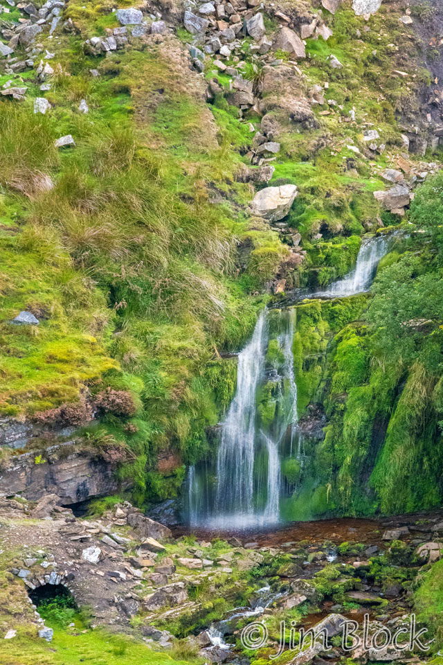
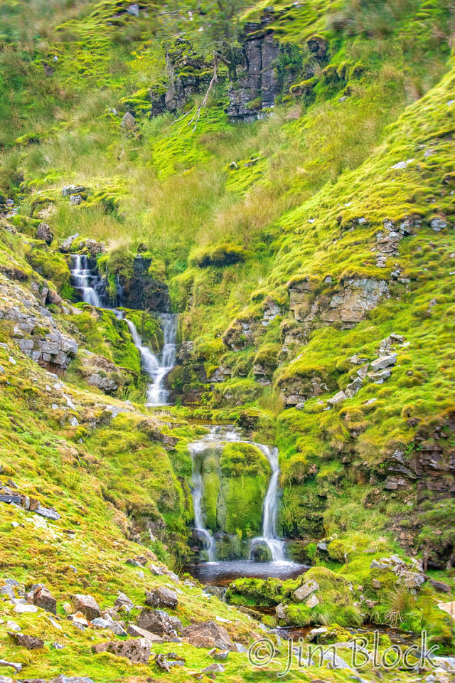
The stream that Jim and David crossed prematurely is named East Grain Beck. We passed a waterfall as we hiked up alongside it.
We climbed up to Gunnerside Moor. Here is Stephen, and behind him somewhere in those distance hills is Nine Standards Rigg and the moors we crossed the previous day.
I saw and photographed my first red grouse. Notice how well camouflaged it is in the heather, but more obvious when it perches on a fence post. Red grouse are found only in heather moorlands. They are resident throughout the year and native to Britain.


There was a strange structure in a deep gully along the moor. I couldn’t figure out what it was and still do not know.
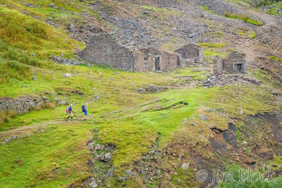
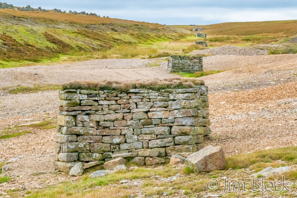
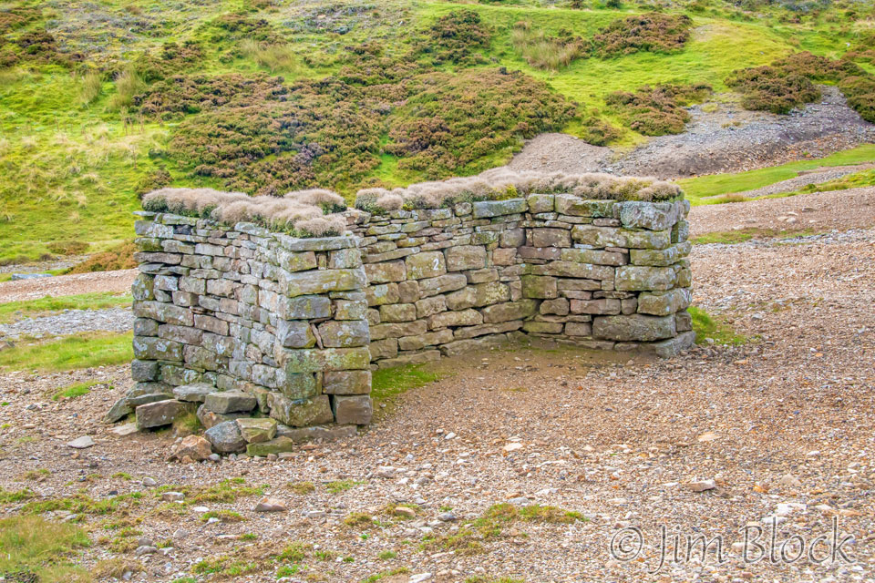
We reached the Blakethwaite Ruins in the valley of the Gunnerside Beck.
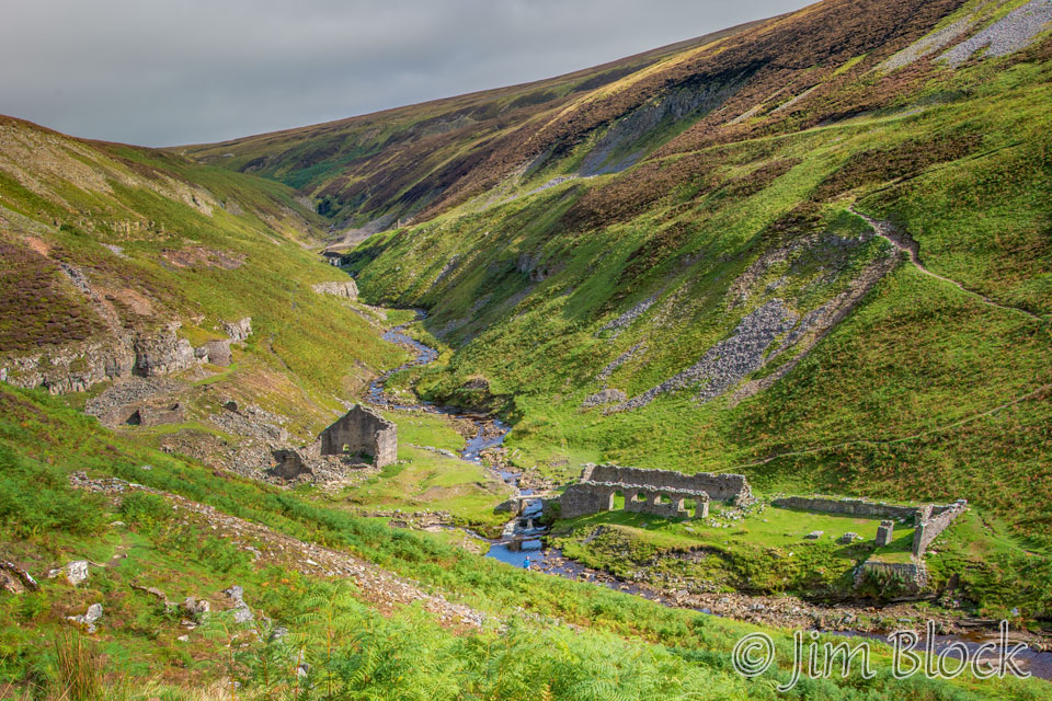
The ruins were photographically interesting. Here are photos I took as we wandered through the ruins and crossed Gunnerside Beck on a huge stone slab.
")


")


")
")
")

")
As we climbed above the Gunnerside Beck valley, we could see our trail to the Blakethwaite Ruins across the valley.
The photo below shows a look back as we climbed out of the Gunnerside Beck valley.
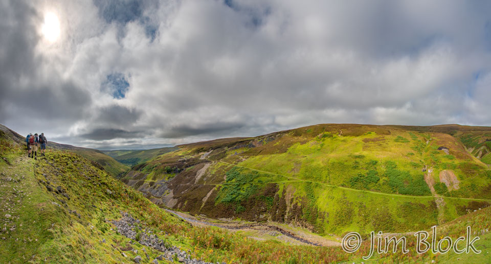
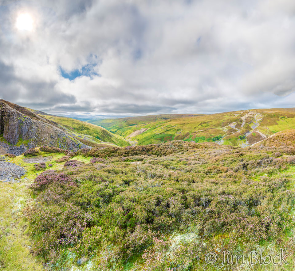
Here is a ridiculously large 41-photo panorama. We are entering the heather moor of the Melbecks Moor. The plants you see in the foreground are heather.
I looked at my Wikiloc map on my phone and noticed there was a shortcut up to Melbecks Moor. I decided to take it. Stephen, Jim, and David took the apparently more standard path. The photo on the left below shows the top of the shortcut I took, looking back at the Gunnerside Beck valley. The photo on the right shows the path the other three took. You might be able to see them in the lower third of the photo.
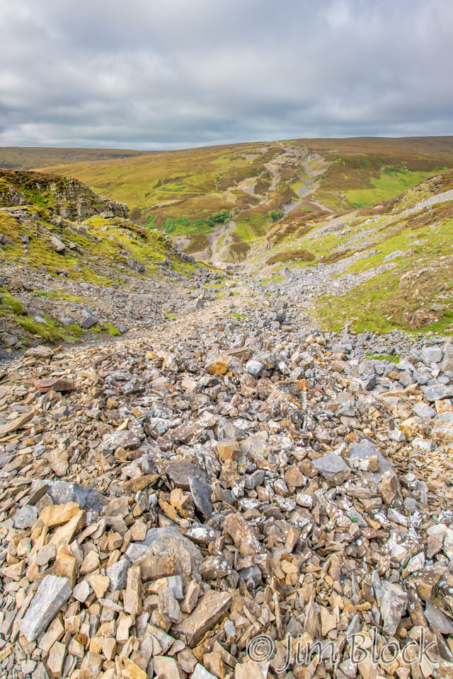
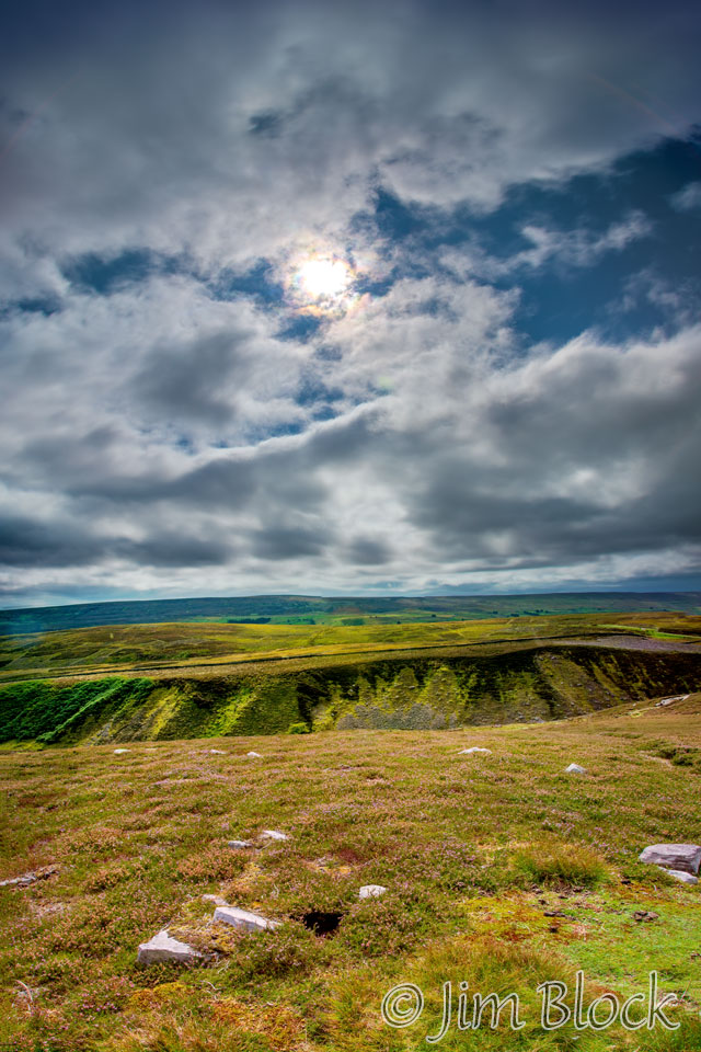
Melbecks Moor is a bland, desolate landscape. Quoting Stedman again, “Up here the landscape can be a bit of a shock. The mining relics encountered thus far have been rather quaint, but you are now faced with an eerie desolation stripped of topsoil by artificially channeled water to expose the minerals underneath.”
I spotted a line of strange structures. I could not figure them out. Here is the view of the line and a close-up of one of them.
Later research led me to identify these as grouse butts. No, they are certainly not the butts of red grouse. Rather, they are hunting blinds for the sport of “driven grouse shooting“. A party of perhaps eight people with guns stand behind these blinds while others drive the grouse toward the hunters.
In the UK there are many people trying to bring about an end to this horrible practice. It is not clear whether they have succeeded or are succeeding, but at least I didn’t see any hunters as I walked through the area. I am not anti-hunting in general, but when a species is declining, unlike the over-abundant deer in our area, they should not be hunted like the passenger pigeons were in the US.
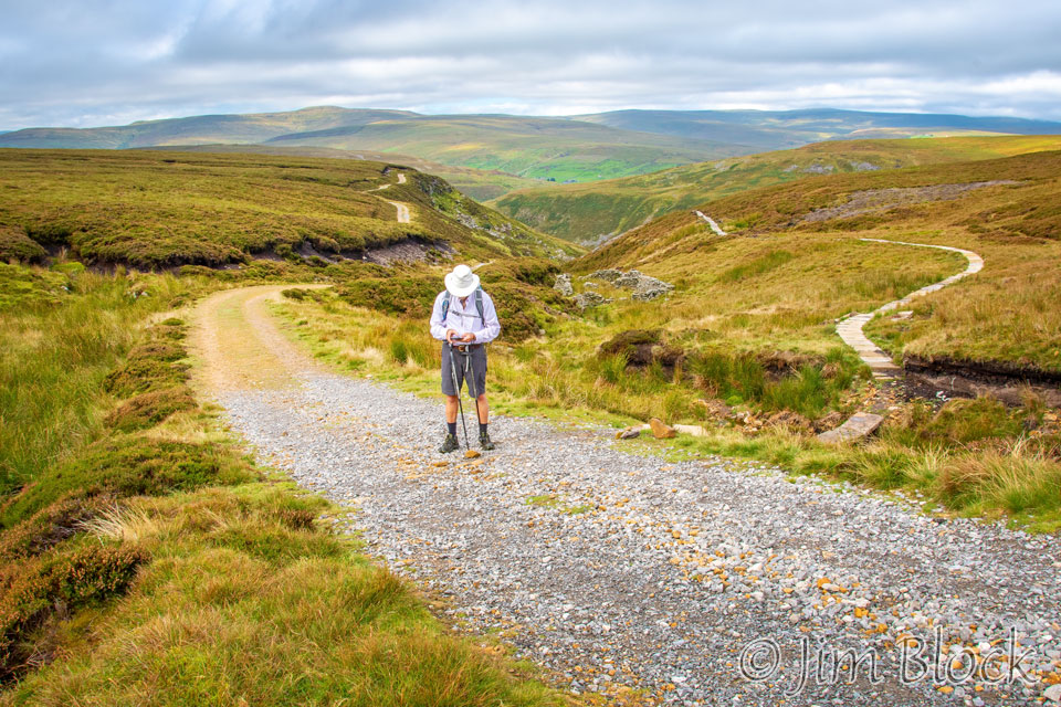
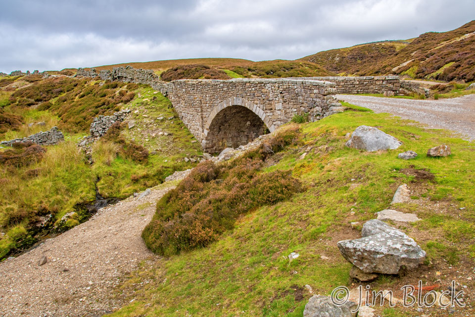
At this point I was ahead of the others and decided to keep walking, rather than wait for them. This gave me the opportunity to stop often at my leisure and photograph whatever interested me. Here is the Level House Bridge — another great stone arch bridge.
Somewhat after the bridge, I got another photo of a red grouse.
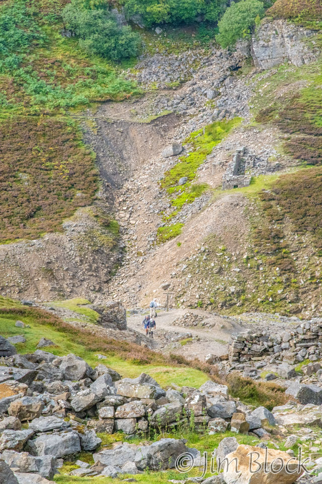
I was approaching the Old Gang Smelting Mill, seen in the distance in the photo.
When I got to the remains of the mill, there was a sign saying “please do not clamor on the walls“. Stedman said it differently. He claims there are warning notices suggesting you not “ruin the ruins”. In any case, these ruins seemed to be the best preserved of the day’s walk. Here are photos I took of them.
")
")


")
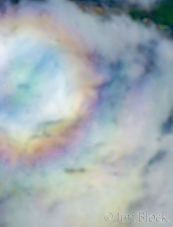
The heather moors were certainly an interesting landscape. Parts of it were dramatically beautiful, even though the mining here had savaged the landscape. As I walked down toward Reeth from the Old Gang Mill, I got this photo looking across the fields of heather at some faint cloud iridescence. The gully in the lower part of the photo is the valley carved by the Hard Level Gill.
I came upon another beautiful red grouse. It obligingly flew for me in a manner and direction that allowed me to get some nice flight shots, rather than butt shots, and not “grouse butt” shots. It is a shame that people are still shooting this beautiful bird.


I approached some areas that clearly were more devoted to farming. As I neared the end of my Coast-to-Coast Walk I took these photos.


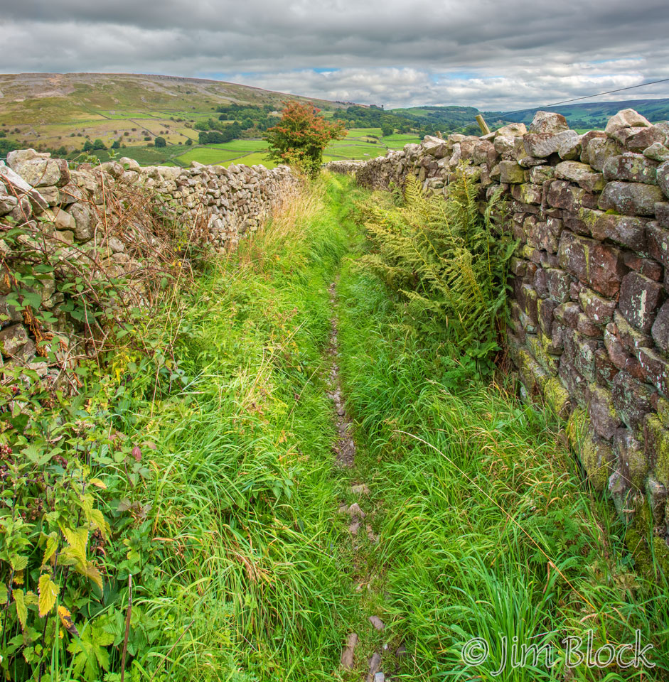
The last half mile of the hike was one of the most uncomfortable stretches during the entire trip. It was through a narrow path between two stone walls. The footing was very uneven with ankle-twisting rocks. Stinging nettles were all along the path. You can see some of them in the bottom left of the photo below.
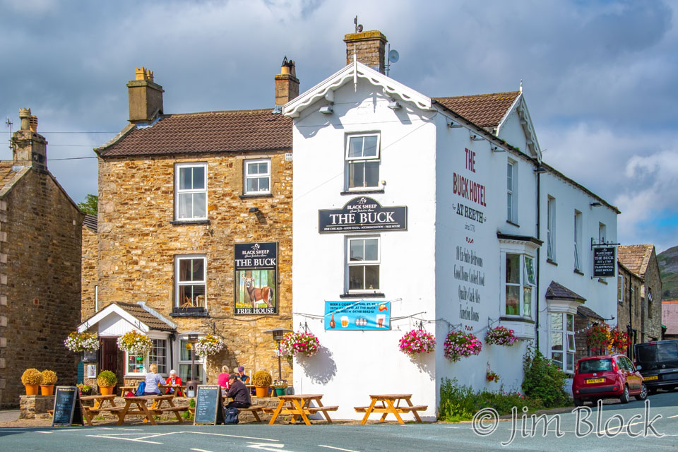
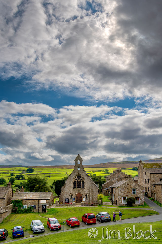
Reeth is a pleasant village. Stedman says it is an archetypal Yorkshire dales village. It originally grew from profits of the 19th century mining boom. After the mines closed, tourism gave Reeth a new vitality, a number of B&Bs and hotels, as well as gift shops.
We stayed at The Buck Hotel. Like four other hotels on the trip, my room was right in the front of the building allowing me a great look at the action in front of the hotel. My room was directly above The Buck sign in the white portion of the hotel.
This page started with another hotel sign that, like this one, said “Black Sheep” above the hotel name. Black Sheep is a bitter (beer). Bitters are ales; the English term bitter is generally equivalent to pale ale. Pale ales are made from pale malt and many types are heavily hopped. The term bitter refers to the bitterness inherent in their hoppy character when compared to other beers, like stouts and porters.
My room was tiny. I literally had to turn sideways to get around the end of the bed to the other side of the bed and to my window.
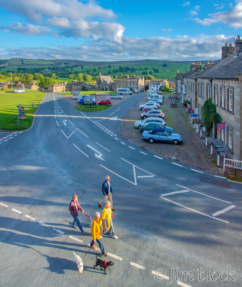
Once I made it around the bed, I took the photo on the left below out my front window. The photo on the right is a four-shot panorama taken from the green in the center of the village that can be seen in the photo on the left.
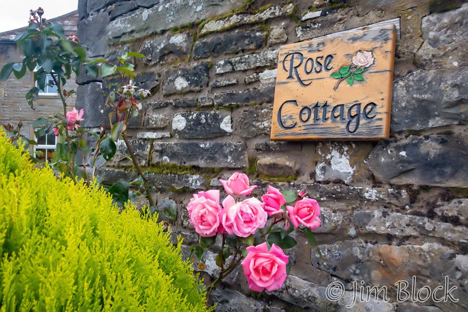
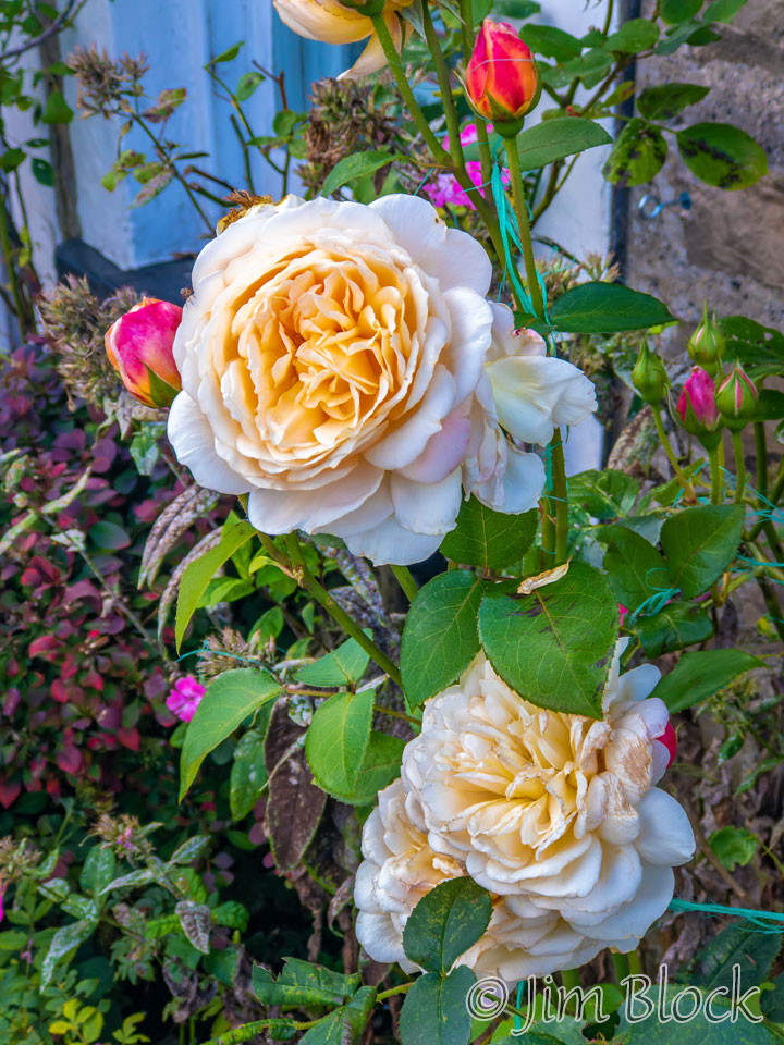
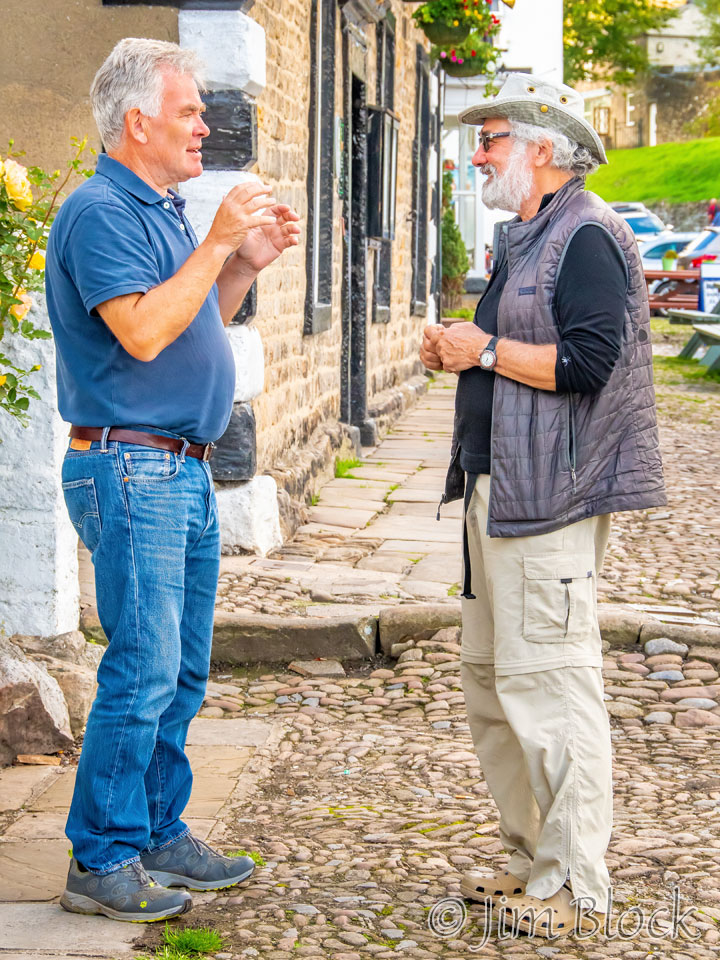
‘During a stroll around the village, I got a photo of David and Jim and another of some roses blooming. The roses were photographed with my iPhone, which for some reason I seemed to use a lot that afternoon.
Here is the hallway in the hotel that leads to some of the upstairs rooms. I had to sit on this couch in order to get a Wi-Fi signal. Below right is an artificial rose with two cutesy vases that were on my windowsill.

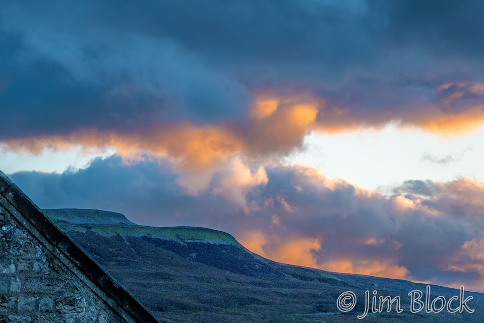
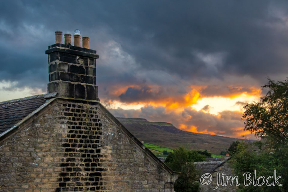
That evening we had a bit of sunset, the only one I can remember during the whole trip.
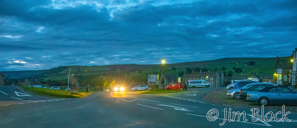
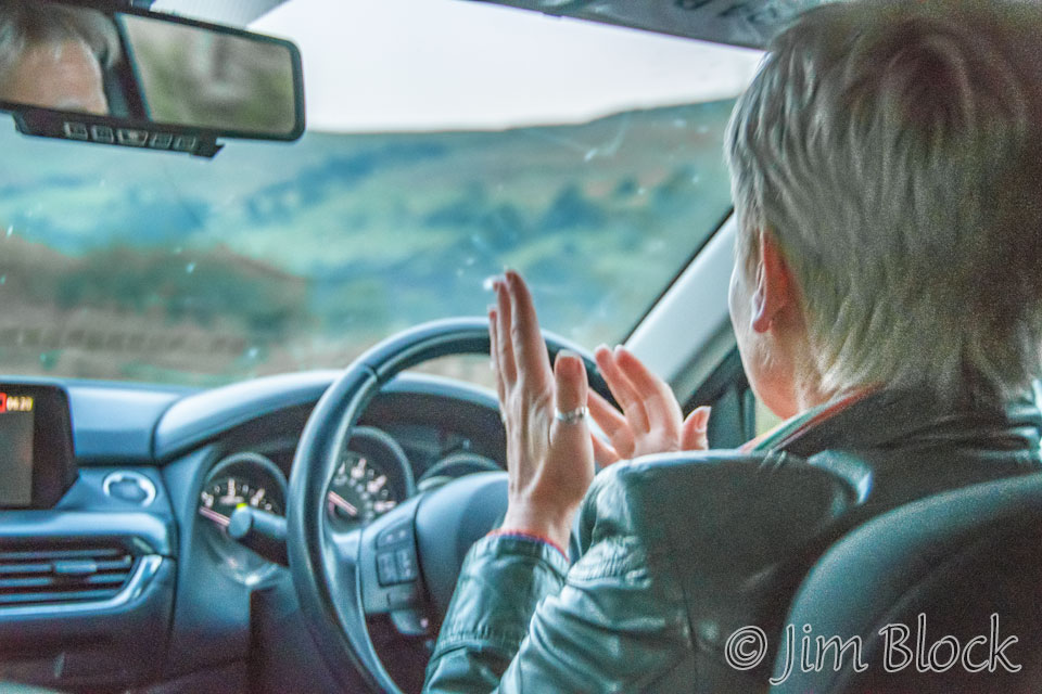
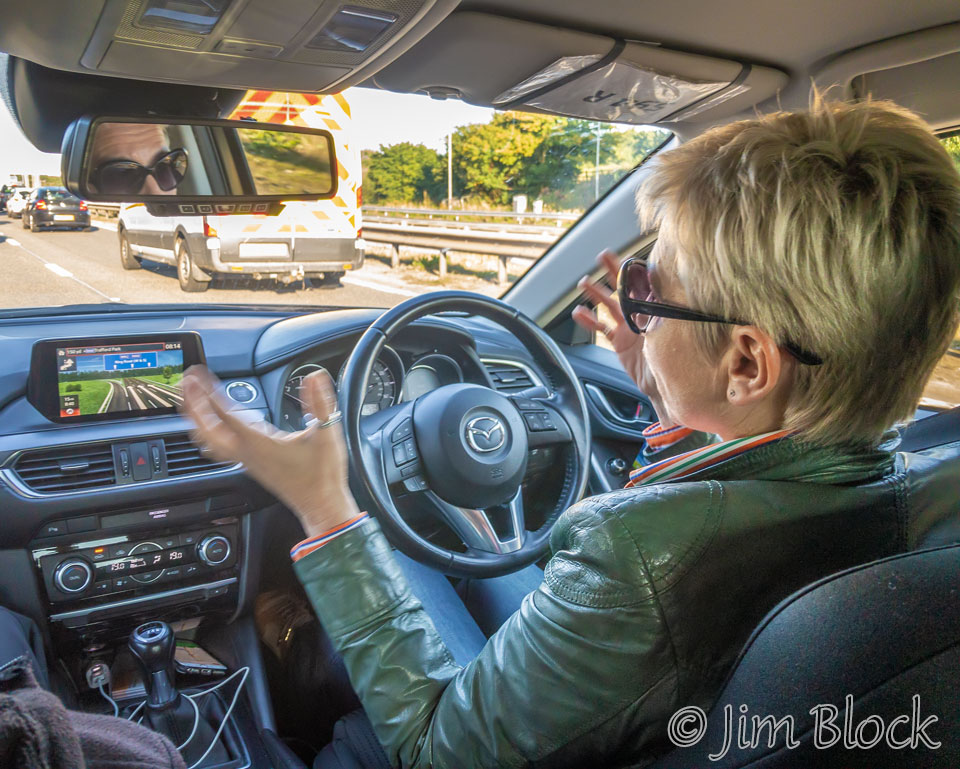
Tanya of Ladies Way Taxis was scheduled to pick us up at 6 AM. Here she is arriving at 5:50 AM.
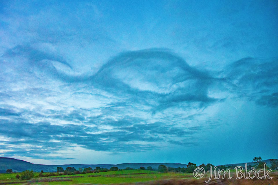
I took a number of photos during our 2 1/2 hour drive to the Manchester airport. However, most of them understandably were poor being taken out of a fast moving car. Here is one I got of some interesting clouds.
Tanya sped along the narrow lanes outside of Reeth occasionally breaking for hares or grouse on the road. I felt very confident of her ability to get us to the airport safely.
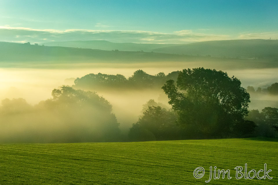
I got this shot of the fog shortly after the sun rose.
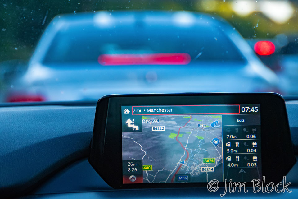
When we got near Manchester, we hit a lot of traffic. It was very slow going the last 10 or 15 miles. Stephen described Manchester as a slow-moving parking lot.
At the Manchester airport, I experienced the roughest, most invasive search of my carry-on bag I ever had. The woman almost dropped my cameras on the floor. I was trying to be very polite and certainly had nothing to hide.
The photo below is a three-shot panorama taken with my iPhone as we left the UK. The only camera I used on the plane flights was my phone.
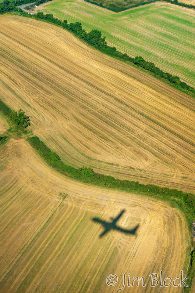
In route, I managed to capture a piece of a glory in the clouds below us. As we were landing in Dublin the plane shadow was interesting in the patterned fields below.
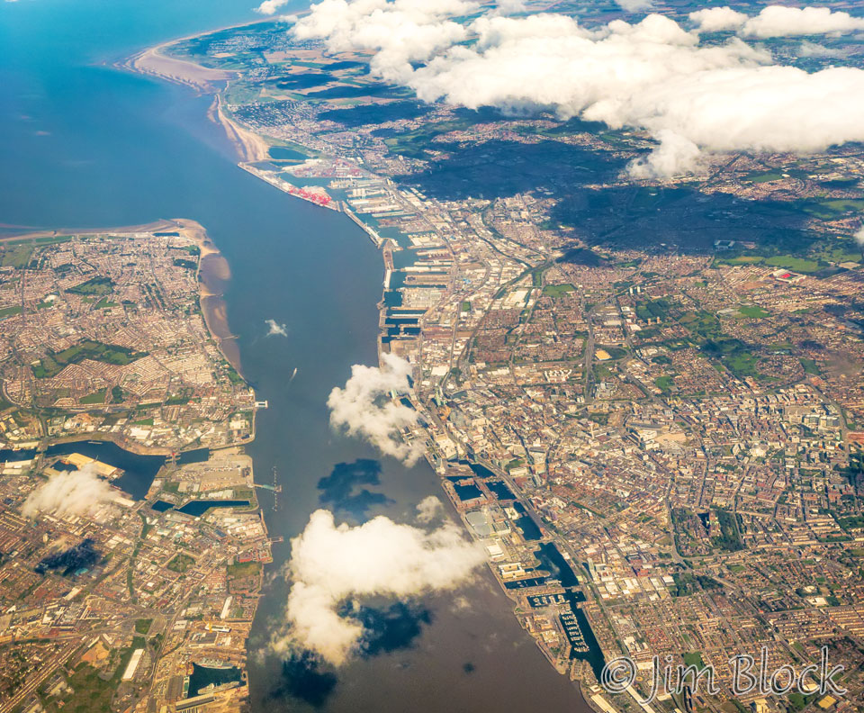
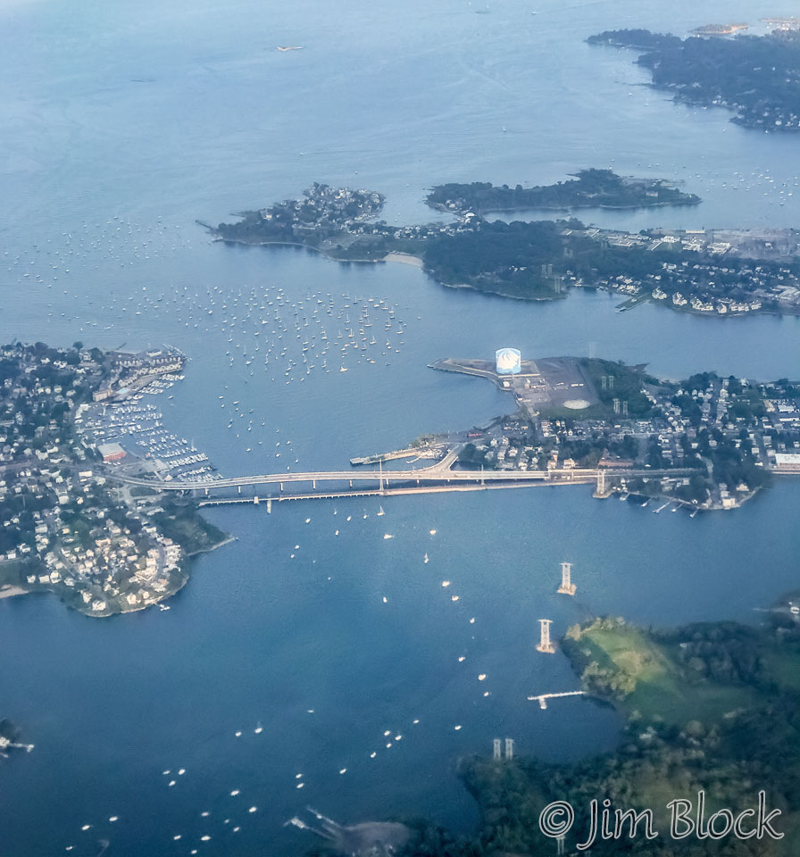
That evening we arrived back in Boston. The photo below shows the bridge over the Danvers River connecting Beverly on the left with Salem on the right.
What is there left to say? It was a great eight-day hike with two good friends. We had adventures and memorable experiences. We met some interesting people along the way. And I came back with lots of photos that will help me relive the trip through these pages for many years in the future.
![]()